Ben Earb

Hill, Mountain in Perthshire

Scotland

Ben Earb

View from the Upper Lunch Hut A grey, wet, stormy morning in the Upper Lunch Hut on the track from Enochdhu to Spittal of Glenshee. This is the view from the frontdoor. The hill on the other side is Uchd nan Carn. The simple wooden hut, open for hillwalkers, has been refurbished on the outside in 2019, but the inside is pretty much as shown in <a href="https://www.geograph.org.uk/photo/2857163">NO0867 : Inside the Lunch Hut</a>. Long may that hut survive.
View from the Upper Lunch Hut Credit: Aleks Scholz

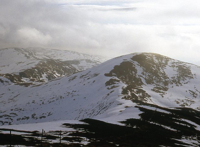
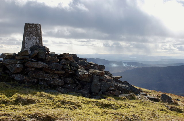
Ben Earb is a prominent hill located in Perthshire, Scotland. It is part of the Grampian Mountains and stands at an elevation of approximately 742 meters (2,434 feet). The hill is situated about 10 kilometers northeast of Dunkeld, a small town in the heart of Perthshire.

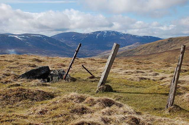
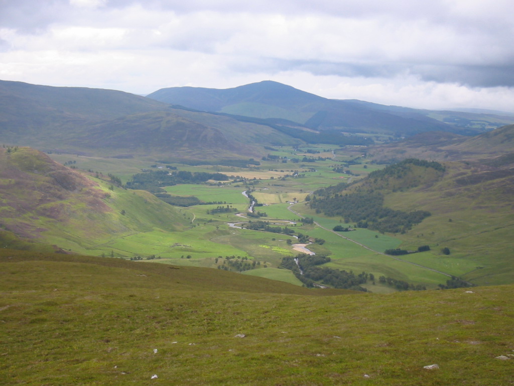
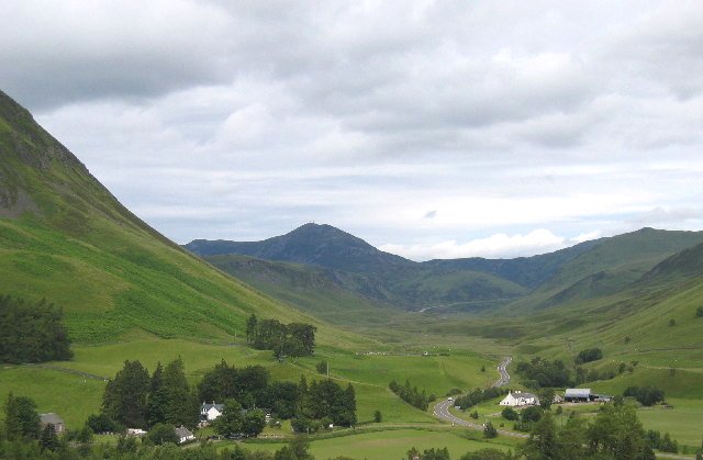
Ben Earb is renowned for its stunning natural beauty and is a popular destination for outdoor enthusiasts and nature lovers. The hill offers breathtaking panoramic views of the surrounding landscape, including the picturesque Tay Valley and the rolling hills of Perthshire. On a clear day, it is even possible to see as far as the Cairngorms National Park.

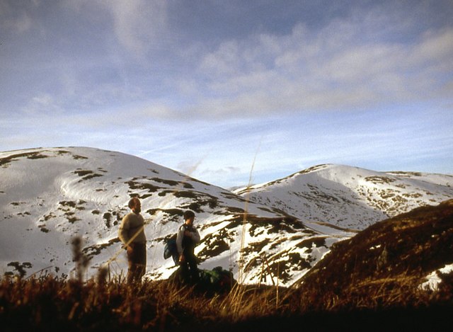
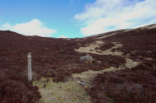
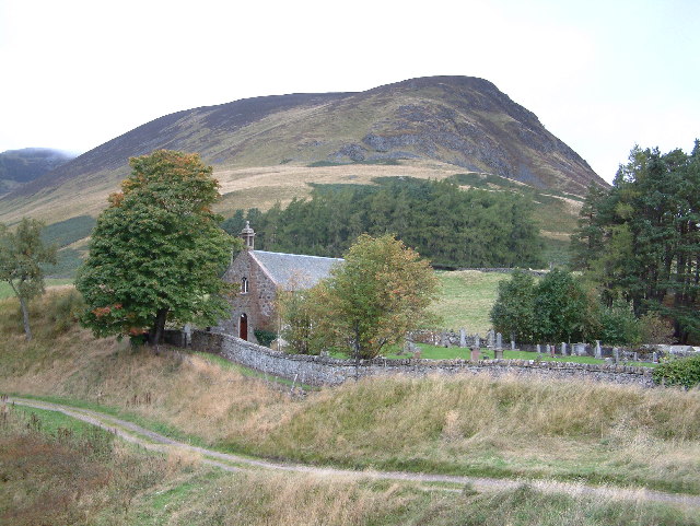
The ascent to the summit of Ben Earb is relatively moderate, making it accessible to hikers of various skill levels. There are several well-marked trails that lead up the hill, offering a variety of routes to suit different preferences. Along the way, visitors can enjoy the diverse flora and fauna that inhabit the area, including heather, wildflowers, and various bird species.

At the summit, visitors are rewarded with unparalleled vistas and a sense of tranquility. The hill provides a serene and peaceful environment, allowing visitors to immerse themselves in the beauty of the Scottish countryside.

Overall, Ben Earb is a captivating hill in Perthshire, offering a memorable outdoor experience for those seeking stunning views and a connection with nature.

If you have any feedback on the listing, please let us know in the comments section below.

Ben Earb Images

Images are sourced within 2km of 56.804905/-3.5096166 or Grid Reference NO0769. Thanks to Geograph Open Source API. All images are credited.

View from the Upper Lunch Hut A grey, wet, stormy morning in the Upper Lunch Hut on the track from Enochdhu to Spittal of Glenshee. This is the view from the frontdoor. The hill on the other side is Uchd nan Carn. The simple wooden hut, open for hillwalkers, has been refurbished on the outside in 2019, but the inside is pretty much as shown in <a href="https://www.geograph.org.uk/photo/2857163">NO0867 : Inside the Lunch Hut</a>. Long may that hut survive.
View from the Upper Lunch Hut
A grey, wet, stormy morning in the Upper Lunch Hut on the track from Enochdhu to Spittal of Glenshee. This is the view from the frontdoor. The hill on the other side is Uchd nan Carn. The simple wooden hut, open for hillwalkers, has been refurbished on the outside in 2019, but the inside is pretty much as shown in NO0867 : Inside the Lunch Hut. Long may that hut survive.
Ben Earb
Ben Earb
East side of Ben Earb
An Lairig Just below An Lairig looking in the direction of The Spittal of Glenshee.
An Lairig
Just below An Lairig looking in the direction of The Spittal of Glenshee.
Track junction near Upper Lunch Hut The track shown here is a loop out to the E which rejoins the Cateran Trail S of Calamanach Wood.
Track junction near Upper Lunch Hut
The track shown here is a loop out to the E which rejoins the Cateran Trail S of Calamanach Wood.
Upper Lunch Hut below Creag Bhreac The notice on the door reads 'Footpath walkers are welcome to take shelter' - an enlightened attitude by the Dirnanean Estate. The Visitors' Book has entries from far and wide including Mexico and New Zealand.
Upper Lunch Hut below Creag Bhreac
The notice on the door reads 'Footpath walkers are welcome to take shelter' - an enlightened attitude by the Dirnanean Estate. The Visitors' Book has entries from far and wide including Mexico and New Zealand.
Inside the Lunch Hut In the Visitors' Book is an extract from Queen Victoria's Scottish Diaries describing her journey by pony from Enochdhu to Spittal of Glenshee on Friday 13th October 1863. Let's hope the modern day visitors repay the trust of the estate in keeping the hut open by leaving it as they find it.
Inside the Lunch Hut
In the Visitors' Book is an extract from Queen Victoria's Scottish Diaries describing her journey by pony from Enochdhu to Spittal of Glenshee on Friday 13th October 1863. Let's hope the modern day visitors repay the trust of the estate in keeping the hut open by leaving it as they find it.
Looking southwards along the Cateran Trail The roof of the Lunch Hut can be seen above centre with the summit of Elrig beyond.
Looking southwards along the Cateran Trail
The roof of the Lunch Hut can be seen above centre with the summit of Elrig beyond.
The Cateran Trail below Creag an Dubh Shluic The path climbs the heathery slopes to the pass of An Lairig.
The Cateran Trail below Creag an Dubh Shluic
The path climbs the heathery slopes to the pass of An Lairig.
View back to the Cateran Trail The path stands out clearly as it comes up the glen below Elrig and the slopes of Creag Bhreac.
View back to the Cateran Trail
The path stands out clearly as it comes up the glen below Elrig and the slopes of Creag Bhreac.
The pass of An Lairig The highest point (648m) of the route on the Cateran Trail from Enochdhu to Glenshee. The steep heather slope L of centre is Ben Gulabin, a Corbett above Spittal of Glenshee. The Cairnwell summit is in view beyond.
The pass of An Lairig
The highest point (648m) of the route on the Cateran Trail from Enochdhu to Glenshee. The steep heather slope L of centre is Ben Gulabin, a Corbett above Spittal of Glenshee. The Cairnwell summit is in view beyond.
South ridge of Creag an Dubh Shluic The ridge dips down to the pass of An Lairig and continues E towards Meall Uaine.
South ridge of Creag an Dubh Shluic
The ridge dips down to the pass of An Lairig and continues E towards Meall Uaine.
Summit of Creag an Dubh Shluic The W top appears slightly higher than the E top from which this photo was taken. Ben Earb is the next summit with the ridge rising higher to Meall a' Choire Bhuidhe beyond.
Summit of Creag an Dubh Shluic
The W top appears slightly higher than the E top from which this photo was taken. Ben Earb is the next summit with the ridge rising higher to Meall a' Choire Bhuidhe beyond.
Cairn on Creag an Dubh Shluic The cairn appears slightly lower than the W top from which this photo was taken.
Cairn on Creag an Dubh Shluic
The cairn appears slightly lower than the W top from which this photo was taken.
Honest toil ahead, Ben Earb The 150m ascent of the E side of Ben Earb from the bumpy ridge en route from Creag an Dubh Shluic.
Honest toil ahead, Ben Earb
The 150m ascent of the E side of Ben Earb from the bumpy ridge en route from Creag an Dubh Shluic.
Ben Earb trig point The hill is given two heights: 801m for the base of the trig pillar and 802m for the highest natural point, from which this photo was taken. A light shower can be seen falling to the south, but passed by.
Ben Earb trig point
The hill is given two heights: 801m for the base of the trig pillar and 802m for the highest natural point, from which this photo was taken. A light shower can be seen falling to the south, but passed by.
Fence at Ben Earb summit The bulky ridge of Bheinn a' Ghlo is off to the W seen here from the angle in the fence, with the Corbett Ben Vuirich to the L.
Fence at Ben Earb summit
The bulky ridge of Bheinn a' Ghlo is off to the W seen here from the angle in the fence, with the Corbett Ben Vuirich to the L.
Distant muirburn from Ben Earb summit Heather burning was in progress in several places, and I could smell burning from a site several km upwind to the west.
Distant muirburn from Ben Earb summit
Heather burning was in progress in several places, and I could smell burning from a site several km upwind to the west.
Show me another place!

Ben Earb is located at Grid Ref: NO0769 (Lat: 56.804905, Lng: -3.5096166)

Unitary Authority: Perth and Kinross

Police Authority: Tayside

What 3 Words

///midwinter.boat.system. Near Pitlochry, Perth & Kinross

Nearby Locations

Ben Earb Sròn na Lairige

Related Wikis

Shee Water

The Shee Water (Scottish Gaelic: Sìdh / Uisge Sìdh) is a river in the highland portion of eastern Perth and Kinross, Scotland. The Allt a' Ghlinne Bhig...

Spittal of Glenshee

The Spittal of Glenshee (Scottish Gaelic: Spideal Ghlinn Sìdh, pronounced [ˈspitʲəl̪ˠ ʝliːɲ ˈʃiːʝ]) lies at the head of Glenshee in the highlands of eastern...

Ben Gulabin

Ben Gulabin (806 m) is a mountain in the Mounth area of the Grampian Mountains in Scotland. It is located on the eastern side of the main A93 road between...

Glen Shee

Glen Shee (Scottish Gaelic: Gleann Sith) is a glen in eastern Perthshire, Scotland. Shee Water flows through the glen. The head of the glen, where Gleann...

Dirnanean House

Dirnanean House is part of a private, traditional Highland estate located near Enochdhu in Moulin parish, Blairgowrie, Perth and Kinross, Scotland, 10...

Kindrogan House

Kindrogan House is located near Enochdhu, Blairgowrie, Perth and Kinross in Moulin parish, at the head of Strath Ardle, 7 miles (11 km) ENE of Pitlochry...

Finegand

Finegand is a farming hamlet located in eastern Perth and Kinross, Scotland and also refers historically to the portion of lands surrounding the hamlet...

Balvarran

Balvarran is an old laird's house and estate in Strathardle, Perth and Kinross. It is situated to the east of the River Ardle, a mile east of Enochdhu...

Nearby Amenities

Located within 500m of 56.804905,-3.5096166
Ben Earb
Ele: 795
Natural: peak
Lat/Long: 56.8059097/-3.5093821
The data included in this document is from www.openstreetmap.org. The data is made available under ODbL.

Have you been to Ben Earb?

Leave your review of Ben Earb below (or comments, questions and feedback).