Geldies Knowe

Hill, Mountain in Peeblesshire

Scotland

Geldies Knowe

Gallow Law Looking northwest from the A72 east of Skirling.
Gallow Law Credit: M J Richardson

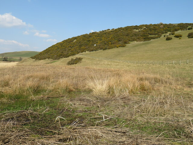
Geldies Knowe, located in Peeblesshire, Scotland, is a prominent hill that offers breathtaking views and a sense of tranquility to visitors. Situated in the beautiful Scottish Borders region, the hill stands at an elevation of approximately 1,073 feet (327 meters) above sea level. Its distinct shape and prominent position make it a popular destination for hikers, nature enthusiasts, and photographers.

The hill is covered in lush green vegetation, with a variety of trees and wildflowers adorning its slopes. The landscape surrounding Geldies Knowe is characterized by rolling hills, picturesque valleys, and meandering streams, adding to its natural charm. The higher you ascend, the more panoramic the views become, allowing visitors to appreciate the stunning vistas of the surrounding countryside, including the nearby Tweed Valley.

Geldies Knowe offers several walking trails that cater to different skill levels, making it accessible to both experienced hikers and casual walkers. The paths wind their way through the hill's undulating terrain, leading visitors through enchanting woodlands and open meadows. The hilltop rewards explorers with a commanding view of the surrounding landscape, providing an ideal spot for a picnic or a moment of reflection.

Aside from its natural beauty, Geldies Knowe is known for its historical significance. The area has traces of ancient settlements, including prehistoric cairns and stone circles, indicating human activity in the region dating back thousands of years.

Overall, Geldies Knowe, with its stunning vistas, diverse flora, and serene atmosphere, offers a captivating experience for those seeking to immerse themselves in the natural wonders of Peeblesshire.

If you have any feedback on the listing, please let us know in the comments section below.

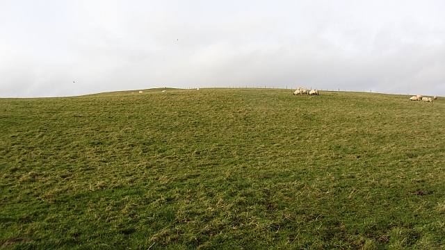
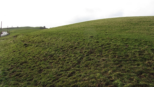
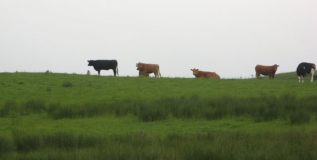
Geldies Knowe Images

Images are sourced within 2km of 55.640233/-3.4698209 or Grid Reference NT0739. Thanks to Geograph Open Source API. All images are credited.

Gallow Law Looking northwest from the A72 east of Skirling.
Gallow Law
Looking northwest from the A72 east of Skirling.
Candy Burn ford and footbridge The boundary between the Scottish Borders [this side] and South Lanarkshire [across the burn]. On the road from Skirling and Cambwell to the main A702 Biggar to Edinburgh road.
Candy Burn ford and footbridge
The boundary between the Scottish Borders [this side] and South Lanarkshire [across the burn]. On the road from Skirling and Cambwell to the main A702 Biggar to Edinburgh road.
Hillside Gorse at Cambwell The hill slopes down to Candy Burn.
Hillside Gorse at Cambwell
The hill slopes down to Candy Burn.
Castle Hill Sheep graze on a small hill north of Biggar. There is a hill fort at the summit.
Castle Hill
Sheep graze on a small hill north of Biggar. There is a hill fort at the summit.
Slopes of Castle Hill Grassland beside the A702.
Slopes of Castle Hill
Grassland beside the A702.
The Site of Castle Hill Fort Viewed westward from the Triangulation Pillar.
The Site of Castle Hill Fort
Viewed westward from the Triangulation Pillar.
Road through Candybank Looking northward.
Road through Candybank
Looking northward.
The Romans Were Here This stretch of the A702 near Biggar follows the course of a Roman Road.
The Romans Were Here
This stretch of the A702 near Biggar follows the course of a Roman Road.
Ford and footbridge near Cambwell
Road junction SW of Candy Mill
A702 near Candy Mill View towards Broomy Law
A702 near Candy Mill
View towards Broomy Law
Ford, Cambwell Looking westwards
Ford, Cambwell
Looking westwards
Cow pasture, Candy Mill Grazing land and a hay/silage meadow above Candy Mill. View down to the Drove Road, marked as a track on the maps, but there is barely a path visible today.
Cow pasture, Candy Mill
Grazing land and a hay/silage meadow above Candy Mill. View down to the Drove Road, marked as a track on the maps, but there is barely a path visible today.
The Old Drove Road The maps show an enclosed lane here, however what looks to have been a dyke has been removed. There is little trace of a track now, but it is still a good waymarked walking route. Gallows Law in the background.
The Old Drove Road
The maps show an enclosed lane here, however what looks to have been a dyke has been removed. There is little trace of a track now, but it is still a good waymarked walking route. Gallows Law in the background.
The Old Drove Road Track, now little used between Skirling and Candy Mill. No doubt used to connect with the Coldstane Slap over the Pentland Hills. Now waymarked.
The Old Drove Road
Track, now little used between Skirling and Candy Mill. No doubt used to connect with the Coldstane Slap over the Pentland Hills. Now waymarked.
Above Candy Mill View across the headwaters of the Candy Burn towards Broomy Law. The flowery foreground is an ungrazed area beside a strip wood.
Above Candy Mill
View across the headwaters of the Candy Burn towards Broomy Law. The flowery foreground is an ungrazed area beside a strip wood.
Gallow Law Prominent hill above Skirling, not quite as imposing from this angle. The slopes were being grazed by cattle.
Gallow Law
Prominent hill above Skirling, not quite as imposing from this angle. The slopes were being grazed by cattle.
Cattle, Gallow Law
Cattle, Gallow Law
Show me another place!

Geldies Knowe is located at Grid Ref: NT0739 (Lat: 55.640233, Lng: -3.4698209)

Unitary Authority: The Scottish Borders

Police Authority: The Lothians and Scottish Borders

What 3 Words

///mentioned.kettles.hockey. Near Biggar, South Lanarkshire

Nearby Locations

Skirling Geldies Knowe

Related Wikis

Skirling

Skirling is a parish, community council area and village in Peeblesshire in the Scottish Borders situated 2+1⁄2 miles east of Biggar in Lanarkshire. Biggar...

Brownsbank

Brownsbank (Brounsbank in Scots) is a cottage close to the small settlement of Candymill to the north of Biggar in Scotland. It is best known as the former...

Biggar, South Lanarkshire

Biggar (Scottish Gaelic: Bigear [ˈpikʲəɾ]) is a town and former burgh in South Lanarkshire, Scotland, in the Southern Uplands near the River Clyde on...

Biggar Corn Exchange

Biggar Corn Exchange is a commercial building in the High Street, Biggar, South Lanarkshire, Scotland. The structure, which is now used as a theatre, is...

Nearby Amenities

Located within 500m of 55.640233,-3.4698209
Skirling
Name Sco: Skerlin
Place: village
Population: 194
Wikidata: Q28448202
Wikipedia: en:Skirling
Lat/Long: 55.6364108/-3.4685044
Bus Stop
Village Green
Bus: yes
Local Ref: AT
Naptan AtcoCode: 69001064
Naptan Bearing: S
Naptan CommonName: Village Green
Naptan Indicator: at
Naptan Landmark: Village Green
Naptan NaptanCode: 72726852
Naptan Street: A72
Operator: Scottish Borders Council
Public Transport: platform
Ref: 69001064
Shelter: yes
Source: NaPTAN
Lat/Long: 55.6366082/-3.4687685
Bus Stop
Goatfoot
Bus: yes
Local Ref: AT
Naptan AtcoCode: 6900770
Naptan Bearing: E
Naptan CommonName: Goatfoot
Naptan Indicator: at
Naptan Landmark: Skirling
Naptan NaptanCode: 72724659
Naptan Notes: reposition
Naptan Street: A72
Operator: Scottish Borders Council
Public Transport: platform
Ref: 6900770
Source: NaPTAN
Lat/Long: 55.6410574/-3.4658269
Post Box
Ref: ML12 19
Source: survey
Lat/Long: 55.6366456/-3.4687282
Historic: memorial
Memorial: war_memorial
Wikidata: Q17847403
Lat/Long: 55.6385967/-3.4690075
Goatfoot
Place: hamlet
Lat/Long: 55.6410893/-3.4658301
Power: pole
Lat/Long: 55.6364755/-3.4659247
Power: pole
Lat/Long: 55.6433716/-3.4734195
Power: pole
Lat/Long: 55.6430525/-3.4725995
Power: pole
Lat/Long: 55.6426621/-3.4715589
Power: pole
Lat/Long: 55.6421911/-3.4706317
Power: pole
Lat/Long: 55.6417011/-3.4696331
Power: pole
Lat/Long: 55.6412146/-3.4686513
Power: pole
Lat/Long: 55.6407234/-3.4676652
Power: pole
Lat/Long: 55.6402855/-3.4667654
Power: pole
Lat/Long: 55.6398679/-3.4659245
Power: pole
Lat/Long: 55.640053/-3.4649174
Power: pole
Lat/Long: 55.6402642/-3.4637905
Power: pole
Lat/Long: 55.6396922/-3.4635782
Power: pole
Lat/Long: 55.6391096/-3.4633406
Power: pole
Lat/Long: 55.6383389/-3.4630274
Power: pole
Lat/Long: 55.6411576/-3.4667633
Power: pole
Lat/Long: 55.6413748/-3.4659644
Power: pole
Lat/Long: 55.6414341/-3.4652559
Power: pole
Lat/Long: 55.6415053/-3.4645852
Power: pole
Lat/Long: 55.6417734/-3.464211
Power: pole
Lat/Long: 55.6420819/-3.4638053
Power: pole
Lat/Long: 55.6423501/-3.4635509
Power: pole
Lat/Long: 55.6425969/-3.4632965
Power: pole
Lat/Long: 55.6403852/-3.4640344
The data included in this document is from www.openstreetmap.org. The data is made available under ODbL.

Have you been to Geldies Knowe?

Leave your review of Geldies Knowe below (or comments, questions and feedback).