Bryn Cwmyrhiwdre

Hill, Mountain in Montgomeryshire

Wales

Bryn Cwmyrhiwdre

The steep slope of Glog from the A483 The road makes a huge loop to traverse the hill and is just visible near the centre of the photo. To the left is the valley of Cwmyrhiwdre.
The steep slope of Glog from the A483 Credit: Eirian Evans

Bryn Cwmyrhiwdre is a prominent hill located in Montgomeryshire, a historic county in Wales, United Kingdom. Rising to an elevation of approximately 451 meters (1,480 feet), it is considered one of the notable peaks in the region.

Situated within the picturesque Cambrian Mountains, Bryn Cwmyrhiwdre offers breathtaking panoramic views of the surrounding landscape. The hill is characterized by its gentle slopes covered in lush green vegetation, dotted with patches of heather and grasses, creating a vibrant and picturesque setting.

The area surrounding Bryn Cwmyrhiwdre is rich in biodiversity and wildlife. It is home to various species of birds, such as kestrels, buzzards, and peregrine falcons, making it a popular spot for birdwatching enthusiasts. The hill is also known for its diverse plant life, including ferns, wildflowers, and mosses, contributing to its natural beauty.

Visitors to Bryn Cwmyrhiwdre can enjoy a range of outdoor activities in the surrounding area. Hiking and walking trails provide opportunities for exploration and adventure, allowing visitors to immerse themselves in the tranquil ambiance of the hill and its surroundings. The hill's location within the Cambrian Mountains also makes it a popular destination for mountain biking, providing thrilling routes and challenging terrains for enthusiasts.

Overall, Bryn Cwmyrhiwdre stands as a stunning natural landmark in Montgomeryshire, offering visitors a chance to reconnect with nature, enjoy breathtaking views, and engage in various outdoor activities.

If you have any feedback on the listing, please let us know in the comments section below.

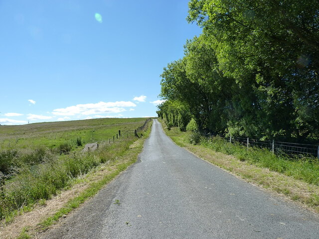
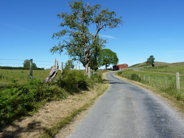
Bryn Cwmyrhiwdre Images

Images are sourced within 2km of 52.444082/-3.3615809 or Grid Reference SO0783. Thanks to Geograph Open Source API. All images are credited.

The steep slope of Glog from the A483 The road makes a huge loop to traverse the hill and is just visible near the centre of the photo. To the left is the valley of Cwmyrhiwdre.
The steep slope of Glog from the A483
The road makes a huge loop to traverse the hill and is just visible near the centre of the photo. To the left is the valley of Cwmyrhiwdre.
Pasture land on the lower slopes of Glog
Esgairdraenllwyn bridge over the River Ithon The view in <a href="https://www.geograph.org.uk/photo/3525115">SO0882 : River Ithon</a> was taken over the parapet of this bridge
Esgairdraenllwyn bridge over the River Ithon
The view in SO0882 : River Ithon was taken over the parapet of this bridge
OS benchmark - Esgairdraenllwyn bridge An OS cutmark on the southern parapet wall of <a href="https://www.geograph.org.uk/photo/7227376">SO0882 : Esgairdraenllwyn bridge over the River Ithon</a>, last levelled by the OS in 1977 at 334.293m above Ordnance Datum Newlyn.
OS benchmark - Esgairdraenllwyn bridge
An OS cutmark on the southern parapet wall of SO0882 : Esgairdraenllwyn bridge over the River Ithon, last levelled by the OS in 1977 at 334.293m above Ordnance Datum Newlyn.
On the A483 near Camnant
Bridleway crossing the A483 The track on the right comes down from Black Gate on the moor east of here, whilst the fingerpost on the left marks the line of the same bridleway which then ceases to exist at the old road which has now been re-aligned. To be fair, the bridleway probably once continued up onto the hills to the west as a cart track to Seven Wells and beyond, but has long been metalled.
Bridleway crossing the A483
The track on the right comes down from Black Gate on the moor east of here, whilst the fingerpost on the left marks the line of the same bridleway which then ceases to exist at the old road which has now been re-aligned. To be fair, the bridleway probably once continued up onto the hills to the west as a cart track to Seven Wells and beyond, but has long been metalled.
Straight road across Bryn Cwmyrhiwdre Almost the same viewpoint and subject as <a href="https://www.geograph.org.uk/photo/1438255">SO0784 : Road heading up Bryn Cwmyrhiwdre</a>, maybe taken 50 or 60 yards further back along the lane. The windturbines of the Penrhyddlan and Llidiarytwaun Wind Farm are just visible on the horizon.
Straight road across Bryn Cwmyrhiwdre
Almost the same viewpoint and subject as SO0784 : Road heading up Bryn Cwmyrhiwdre, maybe taken 50 or 60 yards further back along the lane. The windturbines of the Penrhyddlan and Llidiarytwaun Wind Farm are just visible on the horizon.
Approaching the bend at Seven Wells A bit of downhill, before the next rather stiff climb up towards the Penrhyddlan and Llidiarytwaun Wind Farm on the moor to the west of here.
Approaching the bend at Seven Wells
A bit of downhill, before the next rather stiff climb up towards the Penrhyddlan and Llidiarytwaun Wind Farm on the moor to the west of here.
Hawthorn and rusty barn beside the bend at Seven Wells
Road junction at Seven Wells A parting of the ways here - the lane we're on rather peters out behind us up in the hills near the windfarm, whilst the one running right to left at the T-junction finds its way back into Newtown through the valleys and fields around Mochdre.
Road junction at Seven Wells
A parting of the ways here - the lane we're on rather peters out behind us up in the hills near the windfarm, whilst the one running right to left at the T-junction finds its way back into Newtown through the valleys and fields around Mochdre.
Road at Esgairdraenllwyn Looking north-eastward.
Road at Esgairdraenllwyn
Looking north-eastward.
View west from the A483 near Camnant
Part of the A483 (T) above Cwmyrhiwdre near Newtown, Powys A well known section of this great trunk road, just south of the re-entrant switchback, with great views down the Cwm-y-rhiw-dre Brook valley towards the valley of the River Severn, where a temperature inversion fills the valley with 'low cloud'.
Part of the A483 (T) above Cwmyrhiwdre near Newtown, Powys
A well known section of this great trunk road, just south of the re-entrant switchback, with great views down the Cwm-y-rhiw-dre Brook valley towards the valley of the River Severn, where a temperature inversion fills the valley with 'low cloud'.
The valley of the Cwm-y-rhiwdre Brook valley in winter Cold air has sunk into the valley of the River Severn leaving the tributary brook valleys clear of fog, if not of frost. The A483 trunk road runs along the bracken line. A famous viewpoint in conditions like these.
The valley of the Cwm-y-rhiwdre Brook valley in winter
Cold air has sunk into the valley of the River Severn leaving the tributary brook valleys clear of fog, if not of frost. The A483 trunk road runs along the bracken line. A famous viewpoint in conditions like these.
Pen-I-Thon Baptist chapel A little chapel beside the busy A483 road. Dated 1908.
Pen-I-Thon Baptist chapel
A little chapel beside the busy A483 road. Dated 1908.
Pen-I-Thon Baptist chapel The frontage faces on to the busy A483 road so I assume it has been sound-proofed by having the windows sealed over.
Pen-I-Thon Baptist chapel
The frontage faces on to the busy A483 road so I assume it has been sound-proofed by having the windows sealed over.
Plaque on Pen-I-Thon Baptist chapel Dated April 1908.
Plaque on Pen-I-Thon Baptist chapel
Dated April 1908.
A483 near Camnant
A483 near Camnant
Show me another place!

Bryn Cwmyrhiwdre is located at Grid Ref: SO0783 (Lat: 52.444082, Lng: -3.3615809)

Unitary Authority: Powys

Police Authority: Dyfed Powys

What 3 Words

///rank.superhero.quieter. Near Mochdre, Powys

Nearby Locations

Bryn Cwmyrhiwdre

Related Wikis

Mid Wales

Mid Wales (Welsh: Canolbarth Cymru or simply Y Canolbarth, meaning "the midlands") or Central Wales is a region of Wales, encompassing its midlands, in...

Dolfor

Dolfor is a small hamlet in the north of Powys, Wales. It is located about three miles to the south of Newtown, at the junction of the B4355 and A483 roads...

Mochdre, Powys

Mochdre () is a small village in the community of Mochdre with Penstrowed, in Montgomeryshire, Powys, Wales. == Geography == About 3 miles (4.8 km) southwest...

Mochdre with Penstrowed

Mochdre with Penstrowed (Welsh: Mochdre gyda Phenystrywaid), or just Mochdre, is a community in Montgomeryshire, Powys, Wales. The community includes Mochdre...

Nearby Amenities

Located within 500m of 52.444082,-3.3615809
Cwm-Y-Rhiwdre Hill
Natural: peak
Lat/Long: 52.4441075/-3.3614815
Generator Method: wind_turbine
Generator Source: wind
Power: generator
Lat/Long: 52.444217/-3.3614574
The data included in this document is from www.openstreetmap.org. The data is made available under ODbL.

Have you been to Bryn Cwmyrhiwdre?

Leave your review of Bryn Cwmyrhiwdre below (or comments, questions and feedback).