Bank Top

Settlement in Northumberland

England

Bank Top

Hadrian's Wall east of Heddon on the Wall Taken on a sunny winter's morning in January 2004 with my first and low resolution digital camera (Canon Ixus). Only uploaded in 2021 as a photo for my 2022 Heddon on the Wall Geograph Calendar.

To the right (north) of the Wall the edge of the berm with the Northern ditch is marked by the shadow.

"In front of the Wall lay a berm, normally about 20 Roman feet (6m) wide. In places in the eastern 17.5km of the Wall pits have been found on the berm. In one area at least, where there were three rows of pits, each held two substantial posts, perhaps cut down tree trunks with the branches trimmed short and sharpened at their ends. In one sector the pits were recut. Beyond the berm lay a ditch. It ran along the whole length of the Wall, except where the crags or similar features rendered it unnecessary. It was probably planned to be 30 Roman feet (9m) wide. The material from its excavation was tipped out to the north to form a wide, low mound."
<span class="nowrap"><a title="https://hadrianswallcountry.co.uk/history/about-hadrians-wall/building-hadrians-wall" rel="nofollow ugc noopener" href="https://hadrianswallcountry.co.uk/history/about-hadrians-wall/building-hadrians-wall">Link</a><img style="margin-left:2px;" alt="External link" title="External link - shift click to open in new window" src="https://s1.geograph.org.uk/img/external.png" width="10" height="10"/></span> <span class="nowrap"><a title="https://web.archive.org/web/20210307055957/https://hadrianswallcountry.co.uk/history/about-hadrians-wall/building-hadrians-wall" rel="nofollow ugc noopener" href="https://web.archive.org/web/20210307055957/https://hadrianswallcountry.co.uk/history/about-hadrians-wall/building-hadrians-wall">Archive Link</a><img style="margin-left:2px;" alt="External link" title="External link - shift click to open in new window" src="https://s1.geograph.org.uk/img/external.png" width="10" height="10"/></span>

The presence of pits along this section of the berm was demonstrated by geophysics in 2018.
<span class="nowrap"><a title="http://heddonhistory.weebly.com/throckley--heddon-entanglements.html" rel="nofollow ugc noopener" href="http://heddonhistory.weebly.com/throckley--heddon-entanglements.html">Link</a><img style="margin-left:2px;" alt="External link" title="External link - shift click to open in new window" src="https://s1.geograph.org.uk/img/external.png" width="10" height="10"/></span> <span class="nowrap"><a title="https://web.archive.org/web/20210204213252/http://heddonhistory.weebly.com/throckley--heddon-entanglements.html" rel="nofollow ugc noopener" href="https://web.archive.org/web/20210204213252/http://heddonhistory.weebly.com/throckley--heddon-entanglements.html">Archive Link</a><img style="margin-left:2px;" alt="External link" title="External link - shift click to open in new window" src="https://s1.geograph.org.uk/img/external.png" width="10" height="10"/></span>
Hadrian's Wall east of Heddon on the Wall Credit: Andrew Curtis

Bank Top is a small village located in the county of Northumberland in England. Situated in the northern part of the county, it lies approximately 6 miles southwest of the town of Hexham. The village is nestled within a rural landscape, surrounded by rolling hills and picturesque countryside.

Bank Top is a close-knit community with a population of around 300 residents. The village is characterized by its quaint charm and traditional architecture, with many stone-built houses that reflect the area's rich history. The village's name is derived from the fact that it is situated at the top of a hill, providing scenic views of the surrounding area.

Despite its small size, Bank Top offers several amenities for its residents. These include a village hall, a local pub, and a small convenience store, providing essential services to the community. The village is also well-connected to nearby towns and cities, with regular bus services and good road links.

The surrounding area of Bank Top offers ample opportunities for outdoor activities and exploration. There are numerous walking trails and hiking routes that take advantage of the village's picturesque surroundings. Nearby attractions include the historic Hadrian's Wall, a UNESCO World Heritage Site, and the beautiful Northumberland National Park.

Bank Top is a peaceful and idyllic village, perfect for those seeking a tranquil rural lifestyle, away from the hustle and bustle of city living. Its natural beauty, sense of community, and convenient location make it a desirable place to live or visit for those seeking a slice of Northumberland's charming countryside.

If you have any feedback on the listing, please let us know in the comments section below.
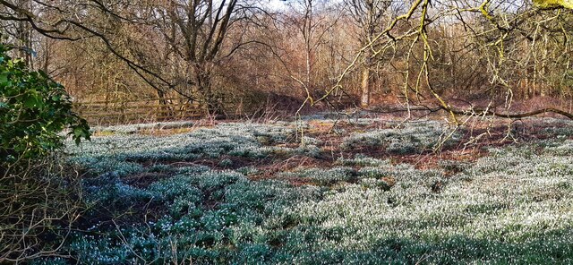
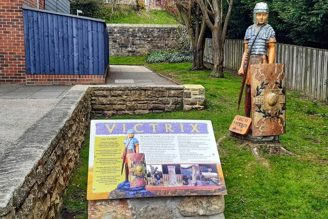
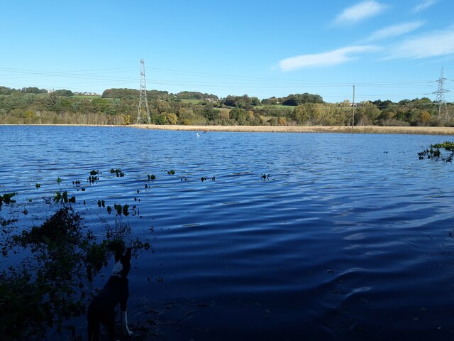
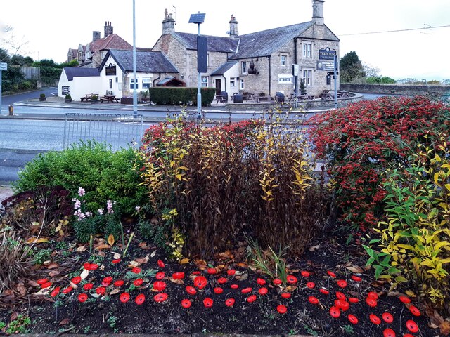
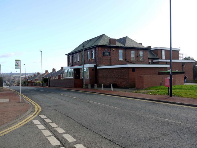
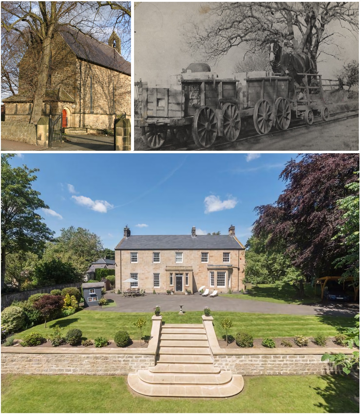
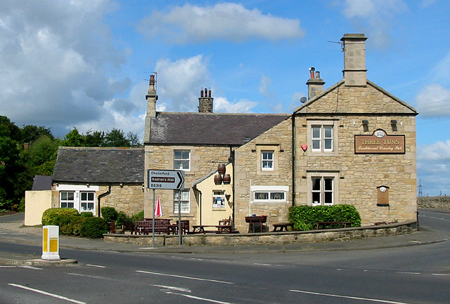
Bank Top Images

Images are sourced within 2km of 54.996115/-1.7669468 or Grid Reference NZ1566. Thanks to Geograph Open Source API. All images are credited.

Hadrian's Wall east of Heddon on the Wall Taken on a sunny winter's morning in January 2004 with my first and low resolution digital camera (Canon Ixus). Only uploaded in 2021 as a photo for my 2022 Heddon on the Wall Geograph Calendar.

To the right (north) of the Wall the edge of the berm with the Northern ditch is marked by the shadow.

"In front of the Wall lay a berm, normally about 20 Roman feet (6m) wide. In places in the eastern 17.5km of the Wall pits have been found on the berm. In one area at least, where there were three rows of pits, each held two substantial posts, perhaps cut down tree trunks with the branches trimmed short and sharpened at their ends. In one sector the pits were recut. Beyond the berm lay a ditch. It ran along the whole length of the Wall, except where the crags or similar features rendered it unnecessary. It was probably planned to be 30 Roman feet (9m) wide. The material from its excavation was tipped out to the north to form a wide, low mound."
<span class="nowrap"><a title="https://hadrianswallcountry.co.uk/history/about-hadrians-wall/building-hadrians-wall" rel="nofollow ugc noopener" href="https://hadrianswallcountry.co.uk/history/about-hadrians-wall/building-hadrians-wall">Link</a><img style="margin-left:2px;" alt="External link" title="External link - shift click to open in new window" src="https://s1.geograph.org.uk/img/external.png" width="10" height="10"/></span> <span class="nowrap"><a title="https://web.archive.org/web/20210307055957/https://hadrianswallcountry.co.uk/history/about-hadrians-wall/building-hadrians-wall" rel="nofollow ugc noopener" href="https://web.archive.org/web/20210307055957/https://hadrianswallcountry.co.uk/history/about-hadrians-wall/building-hadrians-wall">Archive Link</a><img style="margin-left:2px;" alt="External link" title="External link - shift click to open in new window" src="https://s1.geograph.org.uk/img/external.png" width="10" height="10"/></span>

The presence of pits along this section of the berm was demonstrated by geophysics in 2018.
<span class="nowrap"><a title="http://heddonhistory.weebly.com/throckley--heddon-entanglements.html" rel="nofollow ugc noopener" href="http://heddonhistory.weebly.com/throckley--heddon-entanglements.html">Link</a><img style="margin-left:2px;" alt="External link" title="External link - shift click to open in new window" src="https://s1.geograph.org.uk/img/external.png" width="10" height="10"/></span> <span class="nowrap"><a title="https://web.archive.org/web/20210204213252/http://heddonhistory.weebly.com/throckley--heddon-entanglements.html" rel="nofollow ugc noopener" href="https://web.archive.org/web/20210204213252/http://heddonhistory.weebly.com/throckley--heddon-entanglements.html">Archive Link</a><img style="margin-left:2px;" alt="External link" title="External link - shift click to open in new window" src="https://s1.geograph.org.uk/img/external.png" width="10" height="10"/></span>
Hadrian's Wall east of Heddon on the Wall
Taken on a sunny winter's morning in January 2004 with my first and low resolution digital camera (Canon Ixus). Only uploaded in 2021 as a photo for my 2022 Heddon on the Wall Geograph Calendar. To the right (north) of the Wall the edge of the berm with the Northern ditch is marked by the shadow. "In front of the Wall lay a berm, normally about 20 Roman feet (6m) wide. In places in the eastern 17.5km of the Wall pits have been found on the berm. In one area at least, where there were three rows of pits, each held two substantial posts, perhaps cut down tree trunks with the branches trimmed short and sharpened at their ends. In one sector the pits were recut. Beyond the berm lay a ditch. It ran along the whole length of the Wall, except where the crags or similar features rendered it unnecessary. It was probably planned to be 30 Roman feet (9m) wide. The material from its excavation was tipped out to the north to form a wide, low mound." LinkExternal link Archive LinkExternal link The presence of pits along this section of the berm was demonstrated by geophysics in 2018. LinkExternal link Archive LinkExternal link
Rear of The Swan, Heddon on the Wall
The Swan, Towne Gate, Heddon on the Wall
Junction of Towne Gate & Marius Avenue, Heddon on the Wall
South entrance to St Andrew's Church, Heddon on the Wall
Garden House from Towne Gate, Heddon on the Wall See description and similar view here <a href="https://www.geograph.org.uk/photo/2104399">NZ1366 : Garden House, Heddon on the Wall</a>
Garden House from Towne Gate, Heddon on the Wall
See description and similar view here NZ1366 : Garden House, Heddon on the Wall
Village sign, Towne Gate, Heddon on the Wall
Towne Gate, Heddon on the Wall Flowers on the edge of the Memorial Park near junction with Hexham Road.
Towne Gate, Heddon on the Wall
Flowers on the edge of the Memorial Park near junction with Hexham Road.
Autumn in the Memorial Park, Heddon on the Wall
Chare Bank & Memorial Park, Heddon on the Wall
Towne Gate, Heddon on the Wall Near junction with Heddon Banks.
Towne Gate, Heddon on the Wall
Near junction with Heddon Banks.
Hadrian's Wall, Heddon on the Wall
Heddon Village Show in Knott Hall (2015)
Carpet of snowdrops on old colliery site off Station Road
Victrix, Taberna Close, Heddon on the Wall Photo taken in May 2021 after the installation of new information board.

See description here <a href="https://www.geograph.org.uk/photo/5970948">NZ1366 : 'Victrix', Taberna Close, Heddon on the Wall</a>
Victrix, Taberna Close, Heddon on the Wall
Photo taken in May 2021 after the installation of new information board. See description here NZ1366 : 'Victrix', Taberna Close, Heddon on the Wall
Flooded farmland east of Heddon Haughs
Memorial Park, Heddon on the Wall
The Three Tuns, Heddon on the Wall View from the Memorial Park.
The Three Tuns, Heddon on the Wall
View from the Memorial Park.
Show me another place!

Bank Top is located at Grid Ref: NZ1566 (Lat: 54.996115, Lng: -1.7669468)

Unitary Authority: Newcastle upon Tyne

Police Authority: Northumbria

What 3 Words

///galaxy.pure.active. Near Heddon on the Wall, Northumberland

Related Wikis

Milecastle 11

Milecastle 11 (Throckley Bank Top) was a milecastle of the Roman Hadrian's Wall. No remains exist, but the measured position is the middle of the old...

Bank Top, Northumberland

Bank Top is a neighbourhood on the west side of Throckley, in Tyne and Wear, England.

Throckley

Throckley is a village in the Newcastle upon Tyne district, in the county of Tyne and Wear, England, approximately 7 miles (11 km) west of Newcastle city...

Heddon-on-the-Wall railway station

Heddon-on-the-Wall railway station served the village of Heddon-on-the-Wall, Northumberland, England from 1881 to 1958. == History == The station opened...

Milecastle 12

Milecastle 12 (Heddon) was a milecastle of the Roman Hadrian's Wall. Its remains lay under Town Farm, Heddon-on-the-Wall, (just opposite the farm house...

Milecastle 10

Milecastle 10 (Walbottle Dene) was a milecastle of the Roman Hadrian's Wall. It is located near to the modern village of Throckley in Tyne and Wear, northern...

Heddon-on-the-Wall

Heddon-on-the-Wall is a village in Northumberland, England, located on Hadrian's Wall. Heddon-on-the-Wall is roughly 9 miles (14 km) west of the centre...

Walbottle Academy

Walbottle Academy, previously 'Walbottle Campus and Walbottle Campus Technology College', is a large secondary Academy in Newcastle upon Tyne, England...

Nearby Amenities

Located within 500m of 54.996115,-1.7669468
Bus Stop
Hexham Road
Bench: no
Bus: yes
Local Ref: W
Naptan AtcoCode: 410000006001
Naptan Bearing: W
Naptan Indicator: W-Bound
Naptan Landmark: 240m East Of Royal French Arms
Naptan NaptanCode: twragjtm
Naptan Street: Hexham Road
Naptan Verified: no
Passenger Information Display: no
Public Transport: platform
Shelter: no
Source: naptan_import
Lat/Long: 54.9961302/-1.7697215
Bus Stop
Hexham Road
Bus: yes
Departures Board: timetable
Local Ref: E
Naptan AtcoCode: 410000006002
Naptan Bearing: E
Naptan CommonName: HEXHAM ROAD-BANK TOP-E/B
Naptan Indicator: E
Naptan Landmark: EAST OF ROYAL FRENCHMANS ARMS
Naptan NaptanCode: twragjtp
Naptan Street: HEXHAM ROAD
Naptan Verified: no
Public Transport: platform
Shelter: no
Source: naptan_import
Lat/Long: 54.9962118/-1.7700649
Bus Stop
HEXHAM ROAD-MIDDLE SCHOOL-W/B
Local Ref: W
Naptan AtcoCode: 410000007013
Naptan Bearing: W
Naptan CommonName: HEXHAM ROAD-MIDDLE SCHOOL-W/B
Naptan Indicator: W
Naptan Landmark: OPPOSITE THROCKLEY MIDDLE SCHOOL
Naptan NaptanCode: twragmap
Naptan Street: HEXHAM ROAD
Naptan Verified: no
Source: naptan_import
Lat/Long: 54.9959787/-1.7610315
Bus Stop
Hexham Road-Drove Road
Bench: no
Bus: yes
Local Ref: W
Naptan AtcoCode: 410000007014
Naptan Bearing: W
Naptan Indicator: W-Bound
Naptan Landmark: Outside Throckley Bank Top Club / Institute
Naptan NaptanCode: twragmat
Naptan Street: Hexham Road
Naptan Verified: no
Public Transport: platform
Shelter: no
Source: naptan_import
Lat/Long: 54.9960775/-1.7667074
Bus Stop
Hexham Road
Bench: yes
Bus: yes
Local Ref: E
Naptan AtcoCode: 410000007015
Naptan Bearing: E
Naptan Indicator: E-Bound
Naptan Landmark: Opposite Throckley Bank Top Club/ Institute
Naptan NaptanCode: twragmaw
Naptan Street: Hexham Road
Naptan Verified: no
Public Transport: platform
Shelter: yes
Source: naptan_import
Lat/Long: 54.99622/-1.766537
Bus Stop
HEXHAM ROAD-MIDDLE SCHOOL-E/B
Bench: no
Bin: no
Bus: yes
Local Ref: E
Naptan AtcoCode: 410000007016
Naptan Bearing: E
Naptan CommonName: HEXHAM ROAD-MIDDLE SCHOOL-E/B
Naptan Indicator: E
Naptan Landmark: OUTSIDE THROCKLEY MIDDLE SCHOOL
Naptan NaptanCode: twragmda
Naptan Street: HEXHAM ROAD
Naptan Verified: no
Public Transport: platform
Shelter: no
Source: naptan_import
Lat/Long: 54.9960788/-1.7604162
Bus Stop
COACH ROAD-WOODLANDS-S/B
Bus: yes
Local Ref: S
Naptan AtcoCode: 410000007164
Naptan Bearing: S
Naptan CommonName: COACH ROAD-WOODLANDS-S/B
Naptan Indicator: S
Naptan Landmark: OUTSIDE VALLUM FIRST SCHOOL
Naptan NaptanCode: twragtjg
Naptan Street: COACH ROAD
Naptan Verified: no
Public Transport: platform
Source: naptan_import
Lat/Long: 54.9941527/-1.7615838
Bus Stop
COACH ROAD N/B
Bus: yes
Departures Board: timetable
Local Ref: N
Naptan AtcoCode: 410000007166
Naptan Bearing: N
Naptan CommonName: COACH ROAD-WELLFIELD CLOSE-N/B
Naptan Indicator: N
Naptan Landmark: SOUTH OF WELLFIELD CLOSE ENTRANCE
Naptan NaptanCode: twragtjp
Naptan Street: COACH ROAD
Naptan Verified: no
Network: X82, 22
Operator: Stagecoach
Public Transport: platform
Shelter: no
Source: naptan_import;local knowledge
Lat/Long: 54.9929176/-1.7617607
Bus Stop
COACH ROAD-WOODLANDS-N/B
Bus: yes
Departures Board: timetable
Local Ref: N
Naptan AtcoCode: 410000007167
Naptan Bearing: N
Naptan CommonName: COACH ROAD-WOODLANDS-N/B
Naptan Indicator: N
Naptan Landmark: OPPOSITE VALLUM FIRST SCHOOL
Naptan NaptanCode: twragtjt
Naptan Street: COACH ROAD
Naptan Verified: no
Network: X82, 22
Operator: Stagecoach
Public Transport: platform
Shelter: no
Source: naptan_import
Lat/Long: 54.9944073/-1.7617888
Generator Method: photovoltaic
Generator Output Electricity: yes
Generator Source: solar
Generator Type: solar_photovoltaic_panel
Location: roof
Power: generator
Lat/Long: 54.9954521/-1.765466
Generator Method: photovoltaic
Generator Output Electricity: yes
Generator Source: solar
Generator Type: solar_photovoltaic_panel
Location: roof
Power: generator
Lat/Long: 54.9954152/-1.7656162
Generator Method: photovoltaic
Generator Output Electricity: yes
Generator Source: solar
Generator Type: solar_photovoltaic_panel
Location: roof
Power: generator
Lat/Long: 54.9950521/-1.7641866
Generator Method: photovoltaic
Generator Output Electricity: yes
Generator Source: solar
Generator Type: solar_photovoltaic_panel
Location: roof
Power: generator
Lat/Long: 54.9950306/-1.7631942
Generator Method: photovoltaic
Generator Output Electricity: yes
Generator Source: solar
Generator Type: solar_photovoltaic_panel
Location: roof
Power: generator
Lat/Long: 54.9950275/-1.7630896
Generator Method: photovoltaic
Generator Output Electricity: yes
Generator Source: solar
Generator Type: solar_photovoltaic_panel
Location: roof
Power: generator
Lat/Long: 54.9950598/-1.7625102
Generator Method: photovoltaic
Generator Output Electricity: yes
Generator Source: solar
Generator Type: solar_photovoltaic_panel
Location: roof
Power: generator
Lat/Long: 54.9950029/-1.7676815
Generator Method: photovoltaic
Generator Output Electricity: yes
Generator Source: solar
Generator Type: solar_photovoltaic_panel
Location: roof
Power: generator
Lat/Long: 54.9946567/-1.7676574
Generator Method: photovoltaic
Generator Output Electricity: yes
Generator Source: solar
Generator Type: solar_photovoltaic_panel
Location: roof
Power: generator
Lat/Long: 54.9938335/-1.7633149
Generator Method: photovoltaic
Generator Output Electricity: yes
Generator Source: solar
Generator Type: solar_photovoltaic_panel
Location: roof
Power: generator
Lat/Long: 54.9918778/-1.7643905
Generator Method: photovoltaic
Generator Output Electricity: yes
Generator Source: solar
Generator Type: solar_photovoltaic_panel
Location: roof
Power: generator
Lat/Long: 54.991947/-1.7641678
Generator Method: photovoltaic
Generator Output Electricity: yes
Generator Source: solar
Generator Type: solar_photovoltaic_panel
Location: roof
Power: generator
Lat/Long: 54.9934765/-1.7618424
Generator Method: photovoltaic
Generator Output Electricity: yes
Generator Source: solar
Generator Type: solar_photovoltaic_panel
Location: roof
Power: generator
Lat/Long: 54.9934857/-1.7619067
Generator Method: photovoltaic
Generator Output Electricity: yes
Generator Source: solar
Generator Type: solar_photovoltaic_panel
Location: roof
Power: generator
Lat/Long: 54.9927118/-1.7633712
Generator Method: photovoltaic
Generator Output Electricity: yes
Generator Source: solar
Generator Type: solar_photovoltaic_panel
Location: roof
Power: generator
Lat/Long: 54.9926933/-1.7635214
Generator Method: photovoltaic
Generator Output Electricity: yes
Generator Source: solar
Generator Type: solar_photovoltaic_panel
Location: roof
Power: generator
Lat/Long: 54.9950209/-1.7604409
Generator Method: photovoltaic
Generator Output Electricity: yes
Generator Source: solar
Generator Type: solar_photovoltaic_panel
Location: roof
Power: generator
Lat/Long: 54.9949009/-1.7596041
Generator Method: photovoltaic
Generator Output Electricity: yes
Generator Source: solar
Generator Type: solar_photovoltaic_panel
Location: roof
Power: generator
Lat/Long: 54.9950132/-1.7594083
Generator Method: photovoltaic
Generator Output Electricity: yes
Generator Source: solar
Generator Type: solar_photovoltaic_panel
Location: roof
Power: generator
Lat/Long: 54.99617/-1.7597432
Crossing
Lat/Long: 54.9992271/-1.7650946
Traffic Calming: cushion
Lat/Long: 54.9960925/-1.7648904
Defibrillator
Emergency: defibrillator
Lat/Long: 54.9958477/-1.7602875
Traffic Calming: cushion
Lat/Long: 54.996115/-1.76622
Traffic Calming: cushion
Lat/Long: 54.9960574/-1.7629923
Crossing
Crossing: unmarked
Tactile Paving: yes
Lat/Long: 54.9983244/-1.7652753
Post Box
Operator: Royal Mail
Operator Wikidata: Q638098
Post Box Type: lamp
Royal Cypher: EIIR
Royal Cypher Wikidata: Q33102113
Lat/Long: 54.996322/-1.7745453
Crossing
Lat/Long: 54.9979471/-1.7651185
Bus Stop
Bench: no
Bus: yes
Naptan AtcoCode: 3100Z144669
Naptan NaptanCode: nldagmdm
Public Transport: platform
Shelter: no
Lat/Long: 54.9963008/-1.7739963
Bus Stop
Bench: no
Bus: yes
Naptan AtcoCode: 3100Z145668
Naptan NaptanCode: nldgjagp
Public Transport: platform
Shelter: no
Lat/Long: 54.9961983/-1.7736622
Noexit: yes
Lat/Long: 54.9964027/-1.7593668
Post Box
Brand: Royal Mail
Brand Wikidata: Q638098
Operator: Royal Mail
Operator Wikidata: Q638098
Post Box Type: lamp
Lat/Long: 54.9964548/-1.7672601
Throckley Service Station
Addr City: Newcastle upon Tyne
Addr Postcode: NE15 9DX
Addr Street: Hexham Road
Contact Facebook: https://www.facebook.com/ThrockleyServiceStation/
Service Vehicle Car Repair: yes
Service Vehicle Inspection: yes
Service Vehicle Tyres: yes
Shop: car_repair
Lat/Long: 54.9958464/-1.7596645
Crossing
Crossing: uncontrolled
Lat/Long: 54.9960367/-1.7618515
Addr Housenumber: 27
Addr Street: Juniper Lane
Lat/Long: 54.9998482/-1.7635873
The data included in this document is from www.openstreetmap.org. The data is made available under ODbL.

Have you been to Bank Top?

Leave your review of Bank Top below (or comments, questions and feedback).