Fauch Hill
Hill, Mountain in Midlothian
Scotland
Fauch Hill
![Post boxes at Crosswood Redundant postboxes put to use for delivery rather than despatch. At the start of the track to Crosswood and Crosswoodburn. The A70 [Lang Whang] heads off into the distance on the left, with the sign for the left turn [B7oo8] to West Calder.](https://s1.geograph.org.uk/geophotos/02/70/52/2705225_8e2ff54e.jpg)
The requested URL returned error: 429 Too Many Requests
If you have any feedback on the listing, please let us know in the comments section below.
Fauch Hill Images
Images are sourced within 2km of 55.807814/-3.4842051 or Grid Reference NT0758. Thanks to Geograph Open Source API. All images are credited.
![Aberlyn and Crosswoodburn Looking south east from the A70 [Lang Whang]. Rough grassland in the foothills of the Pentland Hills.](https://s0.geograph.org.uk/geophotos/02/70/52/2705236_91129d9b.jpg)

![Crosswood Bridge Taking the A70 [Lang Whang] over the Crosswood Burn.](https://s1.geograph.org.uk/geophotos/02/70/52/2705253_c95ac985.jpg)


Fauch Hill is located at Grid Ref: NT0758 (Lat: 55.807814, Lng: -3.4842051)
Unitary Authority: West Lothian
Police Authority: The Lothians and Scottish Borders
What 3 Words
///pens.lies.vaulting. Near West Calder, West Lothian
Nearby Locations
Related Wikis
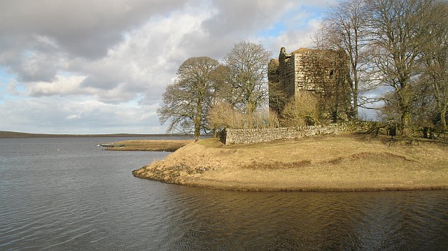
Cairns Castle
Cairns Castle is a ruined keep, dating from the 15th century. It is located on the northern slope of the Pentland Hills, around 6.5 miles (10.5 km) south...

West Cairn Hill
West Cairn Hill is a hill in the Pentland Hills range of Scotland. With a height of 562 m (1,844 ft), it is the fifth highest elevation and lies on the...

Harperrig Reservoir
Harperrig Reservoir is a reservoir in West Lothian, Scotland, to the north of the Pentland Hills, four miles (6.4 km) south of Mid Calder. The Water of...
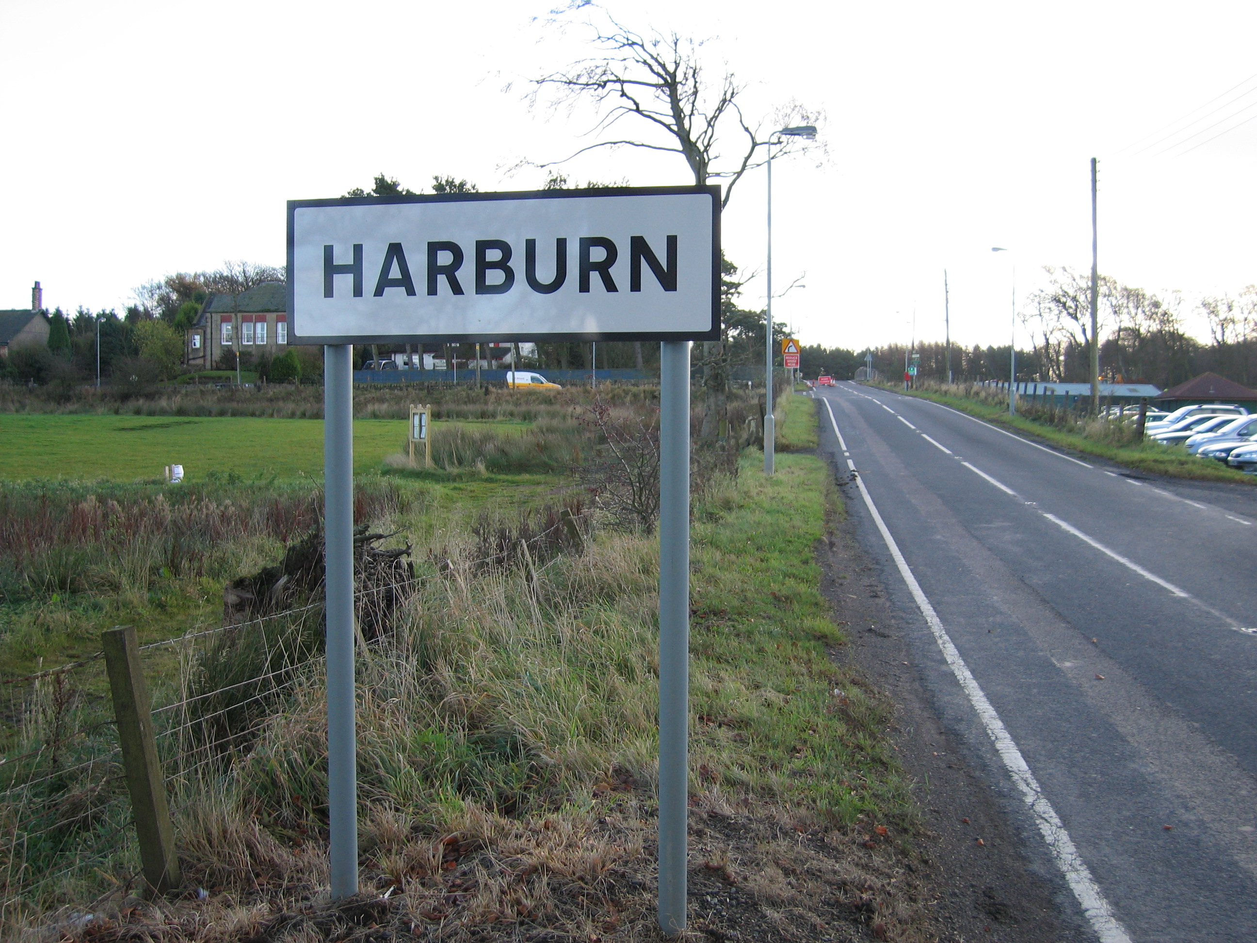
Harburn, West Lothian
Harburn is a small village and estate in West Lothian, Scotland. It lies approximately 2 miles south-east of West Calder and just to the north of the Pentland...
Have you been to Fauch Hill?
Leave your review of Fauch Hill below (or comments, questions and feedback).