Benachally

Hill, Mountain in Perthshire

Scotland

Benachally

Loch Benachally Fishermen on an loch enlarged as a reservoir.
Loch Benachally Credit: Richard Webb

Benachally is a prominent hill located in the region of Perthshire, Scotland. Standing at an elevation of 998 meters (3,274 feet), it is classified as a Corbett, a term used to describe a Scottish mountain between 2,500 and 3,000 feet (762 and 914 meters) in height.

Situated in the southern part of the Grampian Mountains range, Benachally offers breathtaking panoramic views of the surrounding area. From its summit, one can admire the stunning landscapes of Perthshire, including the picturesque Loch Tay and the rolling hills that stretch out towards the horizon. On clear days, it is even possible to catch a glimpse of the iconic Ben Lawers, another prominent mountain in the area.

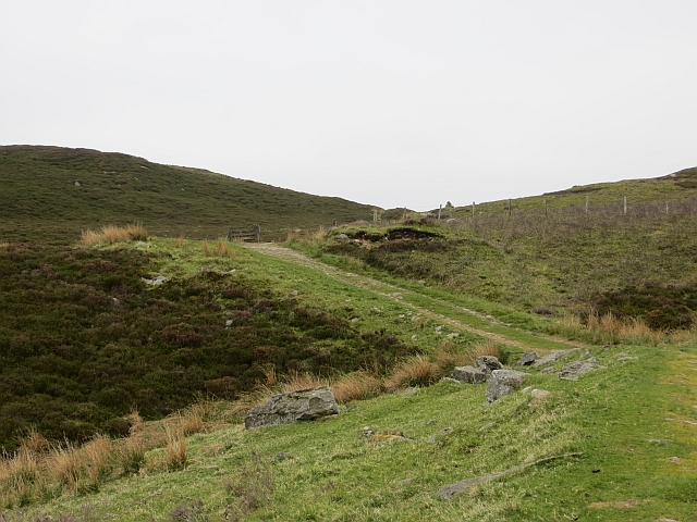
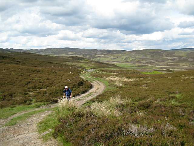
Accessing Benachally can be achieved by following well-marked paths that wind through the scenic countryside. The ascent can be challenging in parts, with steep sections and uneven terrain, but the rewarding vistas make it all worthwhile. The hike typically takes around three to four hours to complete, depending on one's fitness level and the weather conditions.

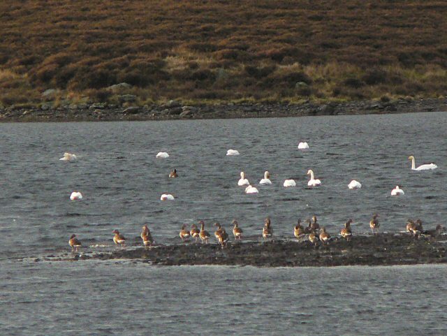
Nature enthusiasts visiting Benachally may have the chance to spot various wildlife species, including red deer, mountain hares, and golden eagles. The hill is also home to diverse plant life, with heather, mosses, and wildflowers covering its slopes during the summer months.

Overall, Benachally offers an unforgettable experience for outdoor enthusiasts and nature lovers, allowing them to immerse themselves in Scotland's stunning natural beauty.

If you have any feedback on the listing, please let us know in the comments section below.

Benachally Images

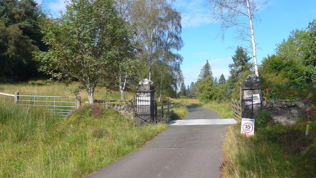
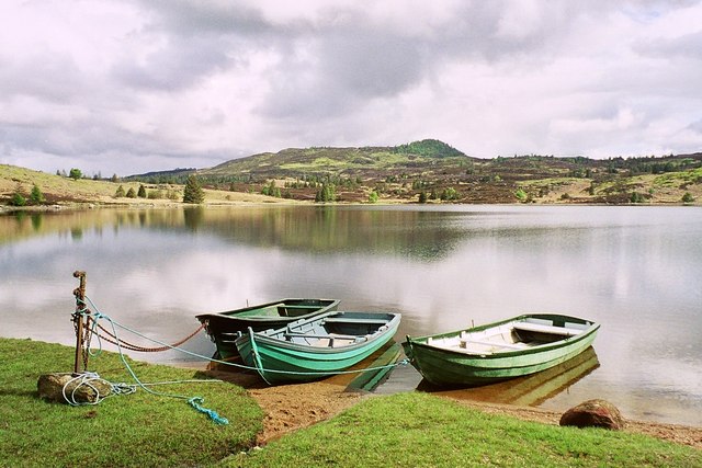
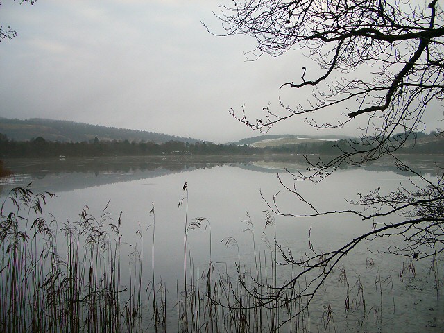
Images are sourced within 2km of 56.624951/-3.5240203 or Grid Reference NO0649. Thanks to Geograph Open Source API. All images are credited.

Loch Benachally Fishermen on an loch enlarged as a reservoir.
Loch Benachally
Fishermen on an loch enlarged as a reservoir.
Track over Rieman Hill A track to the grazings and moorlands at the head of the Baden Burn and Craigsheal Burn.
Track over Rieman Hill
A track to the grazings and moorlands at the head of the Baden Burn and Craigsheal Burn.
Stormont moorland Ewe and lamb on a burnt strip near Loch Benachally.
Stormont moorland
Ewe and lamb on a burnt strip near Loch Benachally.
Pass on Riemore Hill A road crosses Riemore Hill between Riemore Lodge and the grazing at the head of Loch Benachally.
Pass on Riemore Hill
A road crosses Riemore Hill between Riemore Lodge and the grazing at the head of Loch Benachally.
Pass on Riemore Hill Track between Riemore and Craigsheal over Stormont.
Pass on Riemore Hill
Track between Riemore and Craigsheal over Stormont.
Boundary wall Our descent from Benachally required a few detours to find gates in fences and walls. The northern tip of Loch Benachally can be seen below, with more hills rising beyond.
Boundary wall
Our descent from Benachally required a few detours to find gates in fences and walls. The northern tip of Loch Benachally can be seen below, with more hills rising beyond.
Eastern shore, Loch Benachally Walking along this side of the loch there is a choice between the rocky shoreline and the bog. The loch is enclosed by a semi circle of hills to the west.
Eastern shore, Loch Benachally
Walking along this side of the loch there is a choice between the rocky shoreline and the bog. The loch is enclosed by a semi circle of hills to the west.
Hillside above Loch Benachally The slope of Benachally is covered in heather and bracken.
Hillside above Loch Benachally
The slope of Benachally is covered in heather and bracken.
Track near Riemore Hill This track runs from Riemore Lodge northeast to the hills north of Loch Benachally.
Track near Riemore Hill
This track runs from Riemore Lodge northeast to the hills north of Loch Benachally.
Whooper swans and geese on Loch Benachally The geese are too far away to identify, but the swans were obvious from the noise.
Whooper swans and geese on Loch Benachally
The geese are too far away to identify, but the swans were obvious from the noise.
Riemore Hill Looking down Riemore Hill in the direction of the Laird's House ruins.
Riemore Hill
Looking down Riemore Hill in the direction of the Laird's House ruins.
Riemore Lodge Riemore Lodge viewed from near the entrance track to the south-west.
Riemore Lodge
Riemore Lodge viewed from near the entrance track to the south-west.
Over the fields to Riechip The glen of the Buckny Burn in between.
Over the fields to Riechip
The glen of the Buckny Burn in between.
Entrance to the Riemore Estate A good tarmac surface on this estate road.
Entrance to the Riemore Estate
A good tarmac surface on this estate road.
Hydro scheme intake on the Buckny Burn This is a "run of river" scheme;  that is, there is no storage dam but power is generated according to the flow of the burn. Water is abstracted via the weir here then enters a pipeline before being passed through a 500 kilowatt capacity turbine which is housed near Butterstone village.  For the technically minded, this scheme utilises a  twin-jet vertical pelton turbine rated at 500 kW.
Hydro scheme intake on the Buckny Burn
This is a "run of river" scheme; that is, there is no storage dam but power is generated according to the flow of the burn. Water is abstracted via the weir here then enters a pipeline before being passed through a 500 kilowatt capacity turbine which is housed near Butterstone village. For the technically minded, this scheme utilises a twin-jet vertical pelton turbine rated at 500 kW.
The Dubh Loch, Riemore
View to the Children's Loch Taken from the start of the Garlet ridge.
View to the Children's Loch
Taken from the start of the Garlet ridge.
Confusing signs! The sign on the right indicates either right or left track leads to Loch Ordie;  the sign on the left track says "No route to Loch Ordie"!  The sign on the left appears to be accurate as OS indicates that track is a dead end.
Confusing signs!
The sign on the right indicates either right or left track leads to Loch Ordie; the sign on the left track says "No route to Loch Ordie"! The sign on the left appears to be accurate as OS indicates that track is a dead end.
Show me another place!

Benachally is located at Grid Ref: NO0649 (Lat: 56.624951, Lng: -3.5240203)

Unitary Authority: Perth and Kinross

Police Authority: Tayside

What 3 Words

///eating.suitably.scales. Near Blairgowrie, Perth & Kinross

Nearby Locations

Benachally

Related Wikis

Loch Benachally

Loch Benachally is a large shallow freshwater reservoir that is located close to the Forest of Clunie in Perth and Kinross, Scotland.The reservoir is operated...

Loch Ordie

Loch Ordie is a classic freshwater hill loch east of the River Tay, and surrounded by wooded hills, in the Forest of Clunie. == Fly Fishing == Loch Ordie...

Loch of Butterstone

Loch of Butterstone is a small freshwater loch, almost circular in shape, located within the nature reserve of the Cardney Estate, near Dunkeld in Perth...

Loch of Craiglush

Loch of Craiglush is a freshwater loch, located around 1+1⁄2 miles (2.4 km) north-east of Dunkeld in Perth and Kinross, Scotland. The loch is a designated...

Loch of the Lowes

Loch of the Lowes is a loch near Dunkeld in Perth and Kinross, Scotland. The loch and the surrounding area are designated as a wildlife reserve, run by...

Lady's Tree

Lady's Tree is a Scots pine on the banks of the Loch of the Lowes, Scotland. It was the roost of famous osprey 'Lady' for 24 years. In 2014, Lady's Tree...

Blackcraig Castle

Blackcraig Castle is a Baronial mansion house dating from 1856 in Perthshire, Scotland, close to the towns of Ballintuim and Blairgowrie on the banks of...

Dowally

Dowally is a village and parish in Perth and Kinross, Scotland. It lies 3+1⁄2 miles (5.6 km) north of Dunkeld on the A9 road.The village has a parish church...

Have you been to Benachally?

Leave your review of Benachally below (or comments, questions and feedback).