Glenwhappen Rig

Hill, Mountain in Peeblesshire

Scotland

Glenwhappen Rig

River Tweed at Hawkshaw
River Tweed at Hawkshaw Credit: Anthony Parkes

Glenwhappen Rig is a prominent hill located in Peeblesshire, Scotland. Situated near the border with Dumfries and Galloway, it forms part of the stunning rolling landscape of the Southern Uplands. With an elevation of approximately 473 meters (1,552 feet), Glenwhappen Rig offers breathtaking panoramic views of the surrounding countryside.

This hill is a favorite destination for outdoor enthusiasts, including hikers, walkers, and nature lovers. Its rugged terrain and diverse flora and fauna make it an ideal spot for exploring and observing wildlife. Visitors can expect to encounter a variety of bird species, such as buzzards and kestrels, as well as native wildlife like red deer and mountain hares.

Glenwhappen Rig is characterized by its undulating slopes covered in heather and grasses, interspersed with rocky outcrops. The hill is also home to a number of small streams and cascading waterfalls, adding to its natural beauty. The ascent to the summit is moderately challenging, but the reward is well worth the effort, offering magnificent views of the surrounding valleys and neighboring hills.

In addition to its natural beauty, Glenwhappen Rig also holds historical significance. The hill is believed to have been the site of ancient settlements, with traces of prehistoric structures and artifacts discovered in the area.

Overall, Glenwhappen Rig is a captivating hill in Peeblesshire, offering a memorable outdoor experience for those seeking to explore Scotland's stunning landscape and rich history.

If you have any feedback on the listing, please let us know in the comments section below.

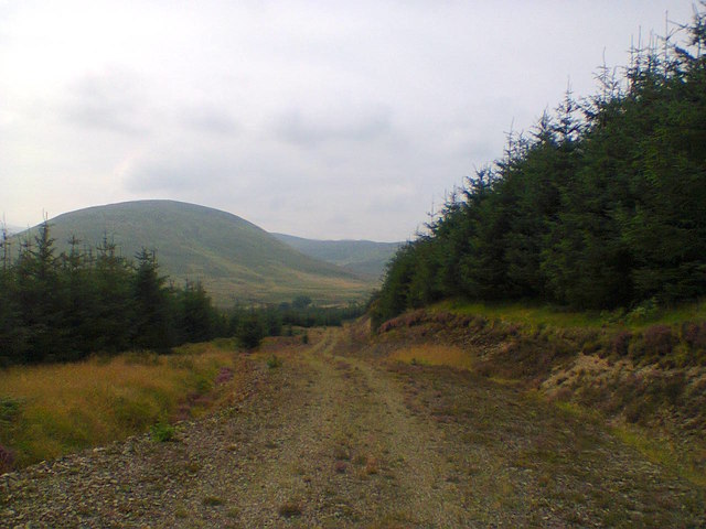
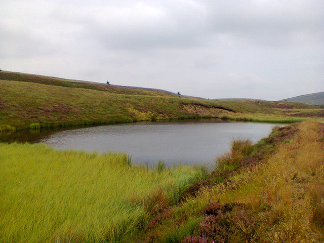
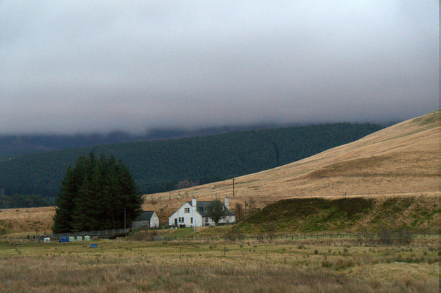
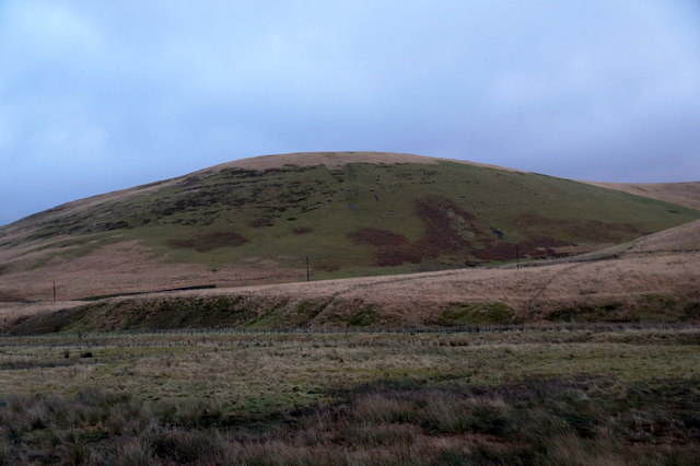
Glenwhappen Rig Images

Images are sourced within 2km of 55.489612/-3.4825498 or Grid Reference NT0622. Thanks to Geograph Open Source API. All images are credited.

River Tweed at Hawkshaw
Scottish Borders : The A701 Heading along the A701 through the Scottish Borders.
Scottish Borders : The A701
Heading along the A701 through the Scottish Borders.
Scottish Borders : The A701 Heading along the A701 through the Scottish Borders.
Scottish Borders : The A701
Heading along the A701 through the Scottish Borders.
Scottish Borders : The A701 The A701 and the surrounding hillside.
Scottish Borders : The A701
The A701 and the surrounding hillside.
Scottish Borders : The A701 Looking along the A701 as it heads through the Scottish Borders.
Scottish Borders : The A701
Looking along the A701 as it heads through the Scottish Borders.
Forest track near Tweedsmuir Whiteside Hill can be seen in the distance.
Forest track near Tweedsmuir
Whiteside Hill can be seen in the distance.
Pond near Weird Law Small pond just below the northern slopes of Weird Law.
Pond near Weird Law
Small pond just below the northern slopes of Weird Law.
Hawkshaw, Tweedsmuir
Nether Dod, near Tweedsmuir
Old Milestone by the A701, near Hawkshaw, Tweed Valley Milestone by the A701, in parish of Tweedsmuir (Peebles District), Tweed Valley, just North of bridge over river to Hawkshaw.

Inscription reads:-
38
(To Edinburgh)

Surveyed

Milestone Society National ID: BD_EDMF38
Old Milestone by the A701, near Hawkshaw, Tweed Valley
Milestone by the A701, in parish of Tweedsmuir (Peebles District), Tweed Valley, just North of bridge over river to Hawkshaw. Inscription reads:- 38 (To Edinburgh) Surveyed Milestone Society National ID: BD_EDMF38
River Tweed near to Glenbreck The River Tweed is 97 miles long and flows generally west to east through the Scottish borders. It rises at Tweedsmuir and passes through small towns like Peebles, Selkirk, Melrose, Galashields and Kelso, before entering the North Sea at Berwick on Tweed.
River Tweed near to Glenbreck
The River Tweed is 97 miles long and flows generally west to east through the Scottish borders. It rises at Tweedsmuir and passes through small towns like Peebles, Selkirk, Melrose, Galashields and Kelso, before entering the North Sea at Berwick on Tweed.
River Tweed at Hawkshaw
Southbound A701 near Glenbreck At one time, the A701 was the major road between Edinburgh and Dumfries. The southern section between Dumfries and Beattock is still a trunk road, forming the primary route link between Dumfries and the A74(M) for northbound Glasgow/Edinburgh traffic. The northern section has now been largely downgraded in favour of the A74M/A702 route to Edinburgh but is popular with some (particularly motorcyclists) as an alternative to the A7 or A702 routes and it is signposted as a scenic route to Edinburgh from the motorway.
Southbound A701 near Glenbreck
At one time, the A701 was the major road between Edinburgh and Dumfries. The southern section between Dumfries and Beattock is still a trunk road, forming the primary route link between Dumfries and the A74(M) for northbound Glasgow/Edinburgh traffic. The northern section has now been largely downgraded in favour of the A74M/A702 route to Edinburgh but is popular with some (particularly motorcyclists) as an alternative to the A7 or A702 routes and it is signposted as a scenic route to Edinburgh from the motorway.
Layby on the Southbound A701 At one time, the A701 was the major road between Edinburgh and Dumfries. The southern section between Dumfries and Beattock is still a trunk road, forming the primary route link between Dumfries and the A74(M) for northbound Glasgow/Edinburgh traffic. The northern section has now been largely downgraded in favour of the A74M/A702 route to Edinburgh but is popular with some (particularly motorcyclists) as an alternative to the A7 or A702 routes and it is signposted as a scenic route to Edinburgh from the motorway.
Layby on the Southbound A701
At one time, the A701 was the major road between Edinburgh and Dumfries. The southern section between Dumfries and Beattock is still a trunk road, forming the primary route link between Dumfries and the A74(M) for northbound Glasgow/Edinburgh traffic. The northern section has now been largely downgraded in favour of the A74M/A702 route to Edinburgh but is popular with some (particularly motorcyclists) as an alternative to the A7 or A702 routes and it is signposted as a scenic route to Edinburgh from the motorway.
Scottish Borders, A701 At one time, the A701 was the major road between Edinburgh and Dumfries. The southern section between Dumfries and Beattock is still a trunk road, forming the primary route link between Dumfries and the A74(M) for northbound Glasgow/Edinburgh traffic. The northern section has now been largely downgraded in favour of the A74M/A702 route to Edinburgh but is popular with some (particularly motorcyclists) as an alternative to the A7 or A702 routes and it is signposted as a scenic route to Edinburgh from the motorway.
Scottish Borders, A701
At one time, the A701 was the major road between Edinburgh and Dumfries. The southern section between Dumfries and Beattock is still a trunk road, forming the primary route link between Dumfries and the A74(M) for northbound Glasgow/Edinburgh traffic. The northern section has now been largely downgraded in favour of the A74M/A702 route to Edinburgh but is popular with some (particularly motorcyclists) as an alternative to the A7 or A702 routes and it is signposted as a scenic route to Edinburgh from the motorway.
A701 at Glenbreck At one time, the A701 was the major road between Edinburgh and Dumfries. The southern section between Dumfries and Beattock is still a trunk road, forming the primary route link between Dumfries and the A74(M) for northbound Glasgow/Edinburgh traffic. The northern section has now been largely downgraded in favour of the A74M/A702 route to Edinburgh but is popular with some (particularly motorcyclists) as an alternative to the A7 or A702 routes and it is signposted as a scenic route to Edinburgh from the motorway.
A701 at Glenbreck
At one time, the A701 was the major road between Edinburgh and Dumfries. The southern section between Dumfries and Beattock is still a trunk road, forming the primary route link between Dumfries and the A74(M) for northbound Glasgow/Edinburgh traffic. The northern section has now been largely downgraded in favour of the A74M/A702 route to Edinburgh but is popular with some (particularly motorcyclists) as an alternative to the A7 or A702 routes and it is signposted as a scenic route to Edinburgh from the motorway.
A701, Bridge over Rigs Burn At one time, the A701 was the major road between Edinburgh and Dumfries. The southern section between Dumfries and Beattock is still a trunk road, forming the primary route link between Dumfries and the A74(M) for northbound Glasgow/Edinburgh traffic. The northern section has now been largely downgraded in favour of the A74M/A702 route to Edinburgh but is popular with some (particularly motorcyclists) as an alternative to the A7 or A702 routes and it is signposted as a scenic route to Edinburgh from the motorway.
A701, Bridge over Rigs Burn
At one time, the A701 was the major road between Edinburgh and Dumfries. The southern section between Dumfries and Beattock is still a trunk road, forming the primary route link between Dumfries and the A74(M) for northbound Glasgow/Edinburgh traffic. The northern section has now been largely downgraded in favour of the A74M/A702 route to Edinburgh but is popular with some (particularly motorcyclists) as an alternative to the A7 or A702 routes and it is signposted as a scenic route to Edinburgh from the motorway.
A701, South of Tweedsmuir At one time, the A701 was the major road between Edinburgh and Dumfries. The southern section between Dumfries and Beattock is still a trunk road, forming the primary route link between Dumfries and the A74(M) for northbound Glasgow/Edinburgh traffic. The northern section has now been largely downgraded in favour of the A74M/A702 route to Edinburgh but is popular with some (particularly motorcyclists) as an alternative to the A7 or A702 routes and it is signposted as a scenic route to Edinburgh from the motorway.
A701, South of Tweedsmuir
At one time, the A701 was the major road between Edinburgh and Dumfries. The southern section between Dumfries and Beattock is still a trunk road, forming the primary route link between Dumfries and the A74(M) for northbound Glasgow/Edinburgh traffic. The northern section has now been largely downgraded in favour of the A74M/A702 route to Edinburgh but is popular with some (particularly motorcyclists) as an alternative to the A7 or A702 routes and it is signposted as a scenic route to Edinburgh from the motorway.
Show me another place!

Glenwhappen Rig is located at Grid Ref: NT0622 (Lat: 55.489612, Lng: -3.4825498)

Unitary Authority: The Scottish Borders

Police Authority: The Lothians and Scottish Borders

What 3 Words

///campus.howler.breeding. Near Biggar, South Lanarkshire

Nearby Locations

Glenwhappen Rig

Related Wikis

Hawkshaw, Scottish Borders

Hawkshaw is a pair of semi-detached houses on the River Tweed, two miles southwest of Tweedsmuir in the Scottish Borders. Historically part of Peeblesshire...

Fruid Water

Fruid Water is a river in the Scottish Borders area of Scotland. The valley it occupies has been dammed to form the Fruid Reservoir. The river is a tributary...

Menzion

Menzion, sometimes Minzion is a small settlement in southern Scotland near Tweedsmuir in the Scottish Borders, in the valley of the River Tweed. ��2...

Gathersnow Hill

Gathersnow Hill is a hill in the Culter Hills range, part of the Southern Uplands of Scotland. It lies west of the village of Tweedsmuir on the border...

Have you been to Glenwhappen Rig?

Leave your review of Glenwhappen Rig below (or comments, questions and feedback).