Cnoc Allt a' Chait

Hill, Mountain in Caithness

Scotland

Cnoc Allt a' Chait

Moorland near Innis nam Mult Blanket bog in the Caithness peatlands.
Moorland near Innis nam Mult Credit: david glass

Cnoc Allt a' Chait, also known as the Hill of the Burn of the Cat, is a prominent hill located in Caithness, a historic county in the northernmost part of mainland Scotland. Situated in the far north-eastern corner of the country, Caithness is renowned for its rugged and picturesque landscapes, and Cnoc Allt a' Chait is no exception.

With an elevation of approximately 466 meters (1,529 feet), Cnoc Allt a' Chait offers breathtaking panoramic views of the surrounding countryside. The hill is characterized by its distinctive cone-shaped summit, which is covered in heather and grasses. Its name, which translates to "Hill of the Burn of the Cat," is derived from the nearby burn (stream) and the presence of wildcats in the area in the past.

Cnoc Allt a' Chait is a popular destination for outdoor enthusiasts, including hikers and nature lovers. The hill features several well-defined paths and trails, making it accessible to individuals of various fitness levels. The ascent to the summit offers a rewarding challenge, with stunning vistas of the surrounding Caithness countryside and the North Sea in the distance.

In addition to its natural beauty, Cnoc Allt a' Chait is also of historical significance. The area is known to have been inhabited since ancient times, with nearby archaeological sites providing evidence of human activity dating back thousands of years.

Overall, Cnoc Allt a' Chait is a captivating hill in Caithness, offering a blend of natural splendor, recreational opportunities, and historical interest to visitors and locals alike.

If you have any feedback on the listing, please let us know in the comments section below.

Cnoc Allt a' Chait Images

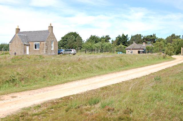
Images are sourced within 2km of 58.344891/-3.6151456 or Grid Reference ND0540. Thanks to Geograph Open Source API. All images are credited.

Moorland near Innis nam Mult Blanket bog in the Caithness peatlands.
Moorland near Innis nam Mult
Blanket bog in the Caithness peatlands.
Innis-nam-Mult The remains of two longhouses at the old settlement of Innis-nam-Mult.
Innis-nam-Mult
The remains of two longhouses at the old settlement of Innis-nam-Mult.
Kiln at Innis-nam-Mult The remains of a corn-drying kiln at the old settlement of Innis-nam-Mult.
Kiln at Innis-nam-Mult
The remains of a corn-drying kiln at the old settlement of Innis-nam-Mult.
The lonesome road to Dalwillan Lodge This is one of the longest private roads in Caithness, leading from Loch More past the derelict lodge of Dalwillan to the hunting lodge at The Glutt (behind the low hills on the horizon, to the left of centre). The vegetation on both sides of the R Thurso consists of the most monotonous wet heath
The lonesome road to Dalwillan Lodge
This is one of the longest private roads in Caithness, leading from Loch More past the derelict lodge of Dalwillan to the hunting lodge at The Glutt (behind the low hills on the horizon, to the left of centre). The vegetation on both sides of the R Thurso consists of the most monotonous wet heath
See the Adder? This picture demonstrates the ease in which an Adder can hide in grass, making it all too easy to step on when out in the hills.  The adder is in the centre of the picture.  It was taken on the flanks of Ben Alisky in the Caithness Flow Country.
See the Adder?
This picture demonstrates the ease in which an Adder can hide in grass, making it all too easy to step on when out in the hills. The adder is in the centre of the picture. It was taken on the flanks of Ben Alisky in the Caithness Flow Country.
Stalker's path from Dalnawillann to Ben Alisky On the stalking path heading from Dalnawillan towards Ben Alisky
Stalker's path from Dalnawillann to Ben Alisky
On the stalking path heading from Dalnawillan towards Ben Alisky
Sheepfold at the foot of Ben Alisky A sheepfold at the foot of the northern slopes of Ben Alisky
Sheepfold at the foot of Ben Alisky
A sheepfold at the foot of the northern slopes of Ben Alisky
Ford on the stalker's path to Ben Alisky A ford across the Allt Bad na Capuill burn (Note the ancient tree root eroding out of the peat in the middle distance).
Ford on the stalker's path to Ben Alisky
A ford across the Allt Bad na Capuill burn (Note the ancient tree root eroding out of the peat in the middle distance).
Stalker's path up the NE ridge of Ben Alisky Looking up the stalker's path on the NE ridge of Ben Alisky
Stalker's path up the NE ridge of Ben Alisky
Looking up the stalker's path on the NE ridge of Ben Alisky
Junction of stalker's paths Junction of the Ben Alisky and Sithean Corr-meille stalker's paths.  With apologies for the quality.
Junction of stalker's paths
Junction of the Ben Alisky and Sithean Corr-meille stalker's paths. With apologies for the quality.
Peat moorland on the NE flank of Ben Alisky Looking over the unbroken peat moorland from Ben Alisky
Peat moorland on the NE flank of Ben Alisky
Looking over the unbroken peat moorland from Ben Alisky
By Dalnawillan From near Dalnawillan looking down the Thurso river towards Loch More
By Dalnawillan
From near Dalnawillan looking down the Thurso river towards Loch More
Thurso river towards Loch More From near Dalnawillan looking down the Thurso river towards Loch More
Thurso river towards Loch More
From near Dalnawillan looking down the Thurso river towards Loch More
By Dalnaglaton Once sheep grazing now going back to moorland
By Dalnaglaton
Once sheep grazing now going back to moorland
By Dalnaglaton Looking down the Thurso river
By Dalnaglaton
Looking down the Thurso river
Dalnawillan Dalnawillan. In the foreground is what I think is defunct mill pond and dam, the top of which still carries the Glutt road. The track beyond leads into the high moor between Dalnawhillan and Dunbeath with a fork off to the top of Ben Alisky 348mts which is visible on the right and is about 3kms away.
Dalnawillan
Dalnawillan. In the foreground is what I think is defunct mill pond and dam, the top of which still carries the Glutt road. The track beyond leads into the high moor between Dalnawhillan and Dunbeath with a fork off to the top of Ben Alisky 348mts which is visible on the right and is about 3kms away.
Track near Dalnaglaton One of a few buildings alongside the long track from Loch More to The Glutt and beyond to Braemore Lodge.
Track near Dalnaglaton
One of a few buildings alongside the long track from Loch More to The Glutt and beyond to Braemore Lodge.
Fenceline on the moor The fenceline that encloses Dalnawillan Lodge; broken at this point to allow peat vehicles through for stalking purposes.
Fenceline on the moor
The fenceline that encloses Dalnawillan Lodge; broken at this point to allow peat vehicles through for stalking purposes.
Show me another place!

Cnoc Allt a' Chait is located at Grid Ref: ND0540 (Lat: 58.344891, Lng: -3.6151456)

Unitary Authority: Highland

Police Authority: Highlands and Islands

What 3 Words

///defected.pounds.gladiator. Near Dunbeath, Highland

Nearby Locations

Cnoc Allt a' Chait

Related Wikis

Altnabreac

Altnabreac ( ALT-nə-BREK, from Scottish Gaelic Allt nam Breac) is a tiny settlement within the county of Caithness, in the north of Scotland, and now...

Altnabreac railway station

Altnabreac railway station () is a rural railway station in the Highland council area of Scotland. It serves the area of Altnabreac – a settlement in which...

Flow Country

The Flow Country is a large, rolling expanse of peatland and wetland area of Caithness and Sutherland in the North of Scotland. It is the largest expanse...

Have you been to Cnoc Allt a' Chait?

Leave your review of Cnoc Allt a' Chait below (or comments, questions and feedback).