Glenwhappen Dod

Hill, Mountain in Peeblesshire

Scotland

Glenwhappen Dod

Scottish Borders : The A701 Heading along the A701 through the Scottish Borders.
Scottish Borders : The A701 Credit: Lewis Clarke

Glenwhappen Dod is a prominent hill located in Peeblesshire, Scotland. Situated within the scenic Scottish Borders region, this hill stands tall at an elevation of approximately 455 meters (1,492 feet). It is nestled within the stunning landscape of the Tweed Valley, offering breathtaking panoramic views of the surrounding countryside.

Characterized by its rolling green slopes and rugged terrain, Glenwhappen Dod attracts hikers, walkers, and outdoor enthusiasts seeking a challenging and rewarding experience. The hill is accessible via various well-marked trails that wind their way through the picturesque countryside.

The summit of Glenwhappen Dod offers a vantage point from which visitors can admire the stunning vistas of the surrounding valleys, hills, and rivers. On clear days, one can even catch glimpses of the nearby towns and villages, including Peebles and Innerleithen.

The hill is home to a diverse range of flora and fauna, with heather, grasses, and wildflowers dotting the landscape. Wildlife enthusiasts may be fortunate enough to spot native species such as red deer, hares, and various bird species as they explore the area.

Glenwhappen Dod provides a peaceful and tranquil setting for those who wish to escape the hustle and bustle of daily life. Its natural beauty and serene atmosphere make it a popular destination for nature lovers and those seeking a peaceful retreat in the heart of the Scottish Borders.

If you have any feedback on the listing, please let us know in the comments section below.

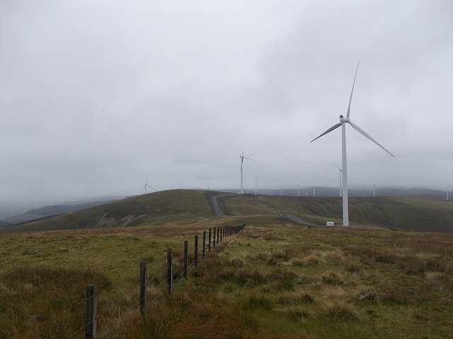
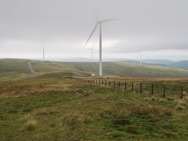
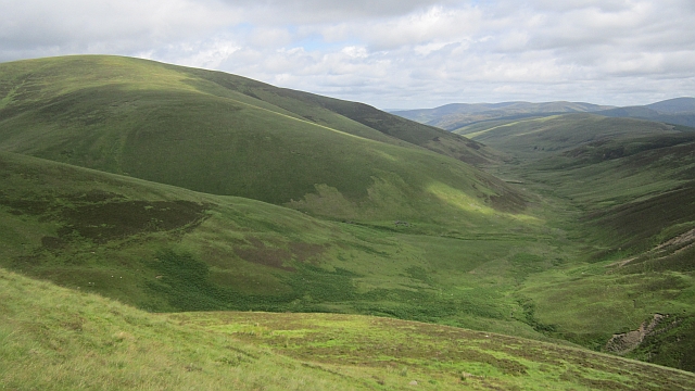
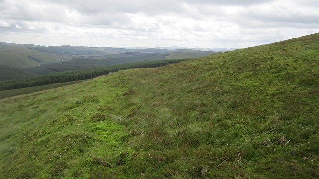
Glenwhappen Dod Images

Images are sourced within 2km of 55.495414/-3.4975686 or Grid Reference NT0523. Thanks to Geograph Open Source API. All images are credited.

Scottish Borders : The A701 Heading along the A701 through the Scottish Borders.
Scottish Borders : The A701
Heading along the A701 through the Scottish Borders.
Scottish Borders : The A701 The A701 and the surrounding hillside.
Scottish Borders : The A701
The A701 and the surrounding hillside.
Scottish Borders : The A701 Looking along the A701 as it heads through the Scottish Borders.
Scottish Borders : The A701
Looking along the A701 as it heads through the Scottish Borders.
Summit of Hillshaw Head This is the spot marked as a 'cairn' on the Ordnance Survey map.
Summit of Hillshaw Head
This is the spot marked as a 'cairn' on the Ordnance Survey map.
Hillshaw Head A wind turbine is under construction on Hillshaw Head, one of 54 new turbines being added to the 152 which are already in operation on nearby hills as part of the Clyde Wind Farm.
Hillshaw Head
A wind turbine is under construction on Hillshaw Head, one of 54 new turbines being added to the 152 which are already in operation on nearby hills as part of the Clyde Wind Farm.
Summit area of Hillshaw Head The hill in the distance among the wind turbines is Coomb Dod.
Summit area of Hillshaw Head
The hill in the distance among the wind turbines is Coomb Dod.
Layby on the Southbound A701 At one time, the A701 was the major road between Edinburgh and Dumfries. The southern section between Dumfries and Beattock is still a trunk road, forming the primary route link between Dumfries and the A74(M) for northbound Glasgow/Edinburgh traffic. The northern section has now been largely downgraded in favour of the A74M/A702 route to Edinburgh but is popular with some (particularly motorcyclists) as an alternative to the A7 or A702 routes and it is signposted as a scenic route to Edinburgh from the motorway.
Layby on the Southbound A701
At one time, the A701 was the major road between Edinburgh and Dumfries. The southern section between Dumfries and Beattock is still a trunk road, forming the primary route link between Dumfries and the A74(M) for northbound Glasgow/Edinburgh traffic. The northern section has now been largely downgraded in favour of the A74M/A702 route to Edinburgh but is popular with some (particularly motorcyclists) as an alternative to the A7 or A702 routes and it is signposted as a scenic route to Edinburgh from the motorway.
Scottish Borders, A701 At one time, the A701 was the major road between Edinburgh and Dumfries. The southern section between Dumfries and Beattock is still a trunk road, forming the primary route link between Dumfries and the A74(M) for northbound Glasgow/Edinburgh traffic. The northern section has now been largely downgraded in favour of the A74M/A702 route to Edinburgh but is popular with some (particularly motorcyclists) as an alternative to the A7 or A702 routes and it is signposted as a scenic route to Edinburgh from the motorway.
Scottish Borders, A701
At one time, the A701 was the major road between Edinburgh and Dumfries. The southern section between Dumfries and Beattock is still a trunk road, forming the primary route link between Dumfries and the A74(M) for northbound Glasgow/Edinburgh traffic. The northern section has now been largely downgraded in favour of the A74M/A702 route to Edinburgh but is popular with some (particularly motorcyclists) as an alternative to the A7 or A702 routes and it is signposted as a scenic route to Edinburgh from the motorway.
Fence and Wind Turbines on Hillshaw Head
View to the west from Coomb Dod A view of moorland and wind turbines
View to the west from Coomb Dod
A view of moorland and wind turbines
Kingledoors Burn A track runs up to the end of the hope, under Coomb Dod.
Kingledoors Burn
A track runs up to the end of the hope, under Coomb Dod.
Fingland Burn Under Hillshaw Head at the head of the Kingledoors glen.
Fingland Burn
Under Hillshaw Head at the head of the Kingledoors glen.
Coomb Dod A fence at the head of the Kingledoors glen under Coomb Dod.
Coomb Dod
A fence at the head of the Kingledoors glen under Coomb Dod.
Glenwhappen Dod The not forested side of Glenwhappen Dod at the head of the Kingledoors Glen.
Glenwhappen Dod
The not forested side of Glenwhappen Dod at the head of the Kingledoors Glen.
Kingledoors Looking down the glen from the slopes of Coomb Dod. The hill is Gathersnow Hill.
Kingledoors
Looking down the glen from the slopes of Coomb Dod. The hill is Gathersnow Hill.
Hillshaw Head Hillshaw Head at the head of the Kingledoors glen.
Hillshaw Head
Hillshaw Head at the head of the Kingledoors glen.
Lost road on Coomb Dod Feelings of disgust at the horrid roads built on the hill can be softened. This probably dates to the forestry around 1980 and was never used. It is now reclaimed by the moorland vegetation: there is hope! It continues to the col between Coomb Dod and Hillshaw Head.

I would hazard a guess it was intended for a greater forested area than was actually planted.
Lost road on Coomb Dod
Feelings of disgust at the horrid roads built on the hill can be softened. This probably dates to the forestry around 1980 and was never used. It is now reclaimed by the moorland vegetation: there is hope! It continues to the col between Coomb Dod and Hillshaw Head. I would hazard a guess it was intended for a greater forested area than was actually planted.
Coomb Dod triangulation pillar Many pillars near Lanark have fared badly. The theory goes that the builders did not have the best batch of concrete.
Coomb Dod triangulation pillar
Many pillars near Lanark have fared badly. The theory goes that the builders did not have the best batch of concrete.
Show me another place!

Glenwhappen Dod is located at Grid Ref: NT0523 (Lat: 55.495414, Lng: -3.4975686)

Unitary Authority: The Scottish Borders

Police Authority: The Lothians and Scottish Borders

What 3 Words

///dozens.giggle.pickup. Near Biggar, South Lanarkshire

Nearby Locations

Glenwhappen Dod

Related Wikis

Hawkshaw, Scottish Borders

Hawkshaw is a pair of semi-detached houses on the River Tweed, two miles southwest of Tweedsmuir in the Scottish Borders. Historically part of Peeblesshire...

Gathersnow Hill

Gathersnow Hill is a hill in the Culter Hills range, part of the Southern Uplands of Scotland. It lies west of the village of Tweedsmuir on the border...

Fruid Water

Fruid Water is a river in the Scottish Borders area of Scotland. The valley it occupies has been dammed to form the Fruid Reservoir. The river is a tributary...

Menzion

Menzion, sometimes Minzion is a small settlement in southern Scotland near Tweedsmuir in the Scottish Borders, in the valley of the River Tweed. ��2...

Nearby Amenities

Located within 500m of 55.495414,-3.4975686
Glenwhappen Dod
Ele: 536
Ele Ft: 1760
Natural: peak
Lat/Long: 55.4956345/-3.4971771
The data included in this document is from www.openstreetmap.org. The data is made available under ODbL.

Have you been to Glenwhappen Dod?

Leave your review of Glenwhappen Dod below (or comments, questions and feedback).