Bank Newton

Settlement in Yorkshire Craven

England

Bank Newton

Ordnance Survey Cut Mark This mark can be found on a field entrance gatepost at Hawber Hill.
The benchmark has a recorded height of 153.412 metres above sea level.
For more detail see : <span class="nowrap"><a title="https://www.bench-marks.org.uk/bm112478" rel="nofollow ugc noopener" href="https://www.bench-marks.org.uk/bm112478">Link</a><img style="margin-left:2px;" alt="External link" title="External link - shift click to open in new window" src="https://s1.geograph.org.uk/img/external.png" width="10" height="10"/></span>
Ordnance Survey Cut Mark Credit: Peter Wood

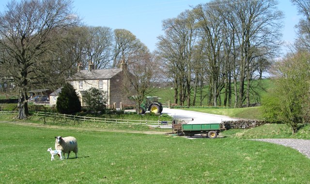
Bank Newton is a small village located in the Craven district of North Yorkshire, England. Situated near the A65 road, it lies approximately 4 miles west of Skipton and 6 miles east of Gargrave. The village is nestled in the picturesque countryside of the Yorkshire Dales National Park, offering residents and visitors stunning views of the surrounding hills and valleys.

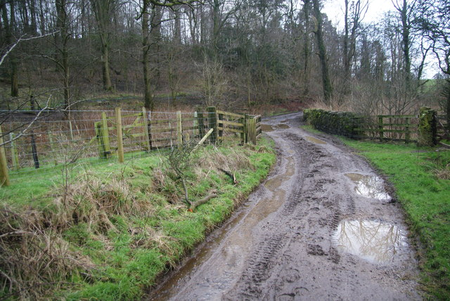
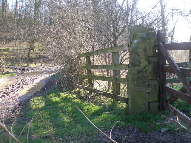
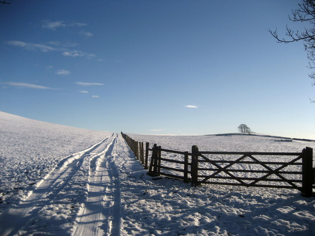
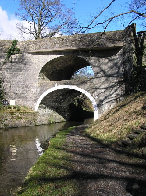
Historically, Bank Newton was a significant location due to its proximity to the Leeds-Liverpool Canal. The village was once home to a busy wharf, serving as a hub for the transportation of goods between Yorkshire and Lancashire. Today, the canal remains a notable feature of the area, attracting tourists with its peaceful towpath walks and opportunities for boating and fishing.

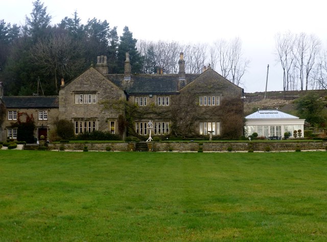
The village itself is characterized by a collection of attractive stone-built houses, many of which date back to the 18th and 19th centuries. These buildings contribute to the village's charming and traditional appearance. Although small in size, Bank Newton is a close-knit community with a strong sense of community spirit.

For amenities, the nearby towns of Skipton and Gargrave offer a range of services, including schools, shops, and healthcare facilities. Additionally, the village benefits from excellent transport links, with regular bus services connecting it to surrounding areas.

Bank Newton's idyllic location makes it a popular destination for outdoor enthusiasts, with numerous hiking and cycling trails in the vicinity. The village provides a peaceful and picturesque setting for those seeking a rural retreat in the heart of Yorkshire's stunning countryside.

If you have any feedback on the listing, please let us know in the comments section below.
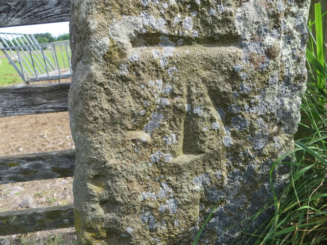
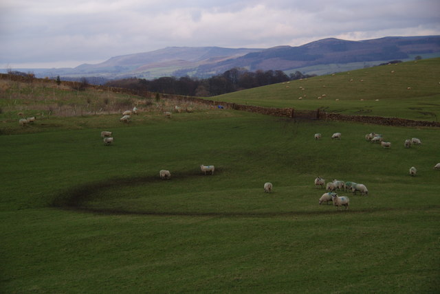
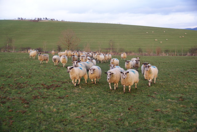
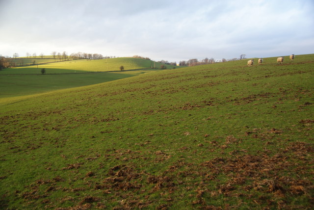
Bank Newton Images

Images are sourced within 2km of 53.973592/-2.138902 or Grid Reference SD9053. Thanks to Geograph Open Source API. All images are credited.

Ordnance Survey Cut Mark This mark can be found on a field entrance gatepost at Hawber Hill.
The benchmark has a recorded height of 153.412 metres above sea level.
For more detail see : <span class="nowrap"><a title="https://www.bench-marks.org.uk/bm112478" rel="nofollow ugc noopener" href="https://www.bench-marks.org.uk/bm112478">Link</a><img style="margin-left:2px;" alt="External link" title="External link - shift click to open in new window" src="https://s1.geograph.org.uk/img/external.png" width="10" height="10"/></span>
Ordnance Survey Cut Mark
This mark can be found on a field entrance gatepost at Hawber Hill. The benchmark has a recorded height of 153.412 metres above sea level. For more detail see : LinkExternal link
Sheep on Great Pasture Hill With views towards the southern Yorkshire Dales. This was taken as the light was beginning to fade.
Sheep on Great Pasture Hill
With views towards the southern Yorkshire Dales. This was taken as the light was beginning to fade.
Sheep following me They must have thought I was bringing food.
Sheep following me
They must have thought I was bringing food.
Evening sun near Ingthorpe Grange The sun finally broke out at the end of a consistently grey day. This view is seen from the undefined path which goes in the direction of Bank Newton.
Evening sun near Ingthorpe Grange
The sun finally broke out at the end of a consistently grey day. This view is seen from the undefined path which goes in the direction of Bank Newton.
Ingthorpe Lane nearing Brows Plantation The bridge ahead crosses Fleet Syke.
Ingthorpe Lane nearing Brows Plantation
The bridge ahead crosses Fleet Syke.
Ingthorpe Lane It links Ingthorpe Grange with East Marton.
Ingthorpe Lane
It links Ingthorpe Grange with East Marton.
Benchmark beside Ingthorpe Lane at Brows Plantation
Ingthorpe Grange Historic farmhouse with outbuildings near East & West Marton. A date over the porch reads 1672, whilst the name would suggest an association with a former monastic site.
Ingthorpe Grange
Historic farmhouse with outbuildings near East & West Marton. A date over the porch reads 1672, whilst the name would suggest an association with a former monastic site.
Stainton Cotes One of the post houses at the hamlet of Stainton Cotes accessed via a track from Coniston Cold.
Stainton Cotes
One of the post houses at the hamlet of Stainton Cotes accessed via a track from Coniston Cold.
Rural scene at Pot Haw Farm Sheep pastures at Pot Haw Farm near Coniston Cold.
Rural scene at Pot Haw Farm
Sheep pastures at Pot Haw Farm near Coniston Cold.
Stainton Cotes Stainton Cotes has several grand up-market residences in this pretty corner of the Dales.  This is one of them, but what a shame about the white plastic thing on the right.  It's not as if they were short of space.
Stainton Cotes
Stainton Cotes has several grand up-market residences in this pretty corner of the Dales. This is one of them, but what a shame about the white plastic thing on the right. It's not as if they were short of space.
Moorber Lane Unmetalled lane that swings under a green hill of the same name, en route from Stainton Cotes to Coniston Cold
Moorber Lane
Unmetalled lane that swings under a green hill of the same name, en route from Stainton Cotes to Coniston Cold
Ingthorpe Grange
Ingthorpe Grange
Ingthorpe Grange Farm Farmyard next to Ingthorpe Grange
Ingthorpe Grange Farm
Farmyard next to Ingthorpe Grange
Pasture near Ingthorpe Grange
Looking North East from near Ingthorpe Grange
Fields adjacent to Stainton Cotes
Snowbound fields below Moorber Hill A winter scene looking east from Moorber Lane.
Snowbound fields below Moorber Hill
A winter scene looking east from Moorber Lane.
Show me another place!

Bank Newton is located at Grid Ref: SD9053 (Lat: 53.973592, Lng: -2.138902)

Division: West Riding

Administrative County: North Yorkshire

District: Craven

Police Authority: North Yorkshire

What 3 Words

///unsecured.terms.ironclad. Near Gargrave, North Yorkshire

Related Wikis

Bank Newton

Bank Newton is a small settlement and civil parish in the Craven district of North Yorkshire, England. According to the 2001 census the parish had a population...

Newton Grange, Skipton

Newton Grange in Bank Newton, Skipton, in Yorkshire is a Georgian house of historical significance and is Grade II listed on the English Heritage Register...

Coniston Cold

Coniston Cold is a village and civil parish in the Craven district of North Yorkshire, England. Historically part of the Staincliffe Wapentake of the West...

East Marton

East Marton is a village in the Craven District of North Yorkshire, England. It is situated approximately 5 miles (8 km) west of the market town of Skipton...

Gargrave railway station

Gargrave is a railway station on the Bentham Line, which runs between Leeds and Morecambe via Skipton. The station, situated 30 miles (48 km) north-west...

Gargrave

Gargrave is a large village and civil parish in the Craven district located along the A65, 4 miles (6 km) north-west of Skipton in North Yorkshire, England...

A65 road

The A65 is a major road in England. It runs north west from Leeds in West Yorkshire via Kirkstall, Horsforth, Yeadon, Guiseley, Ilkley and Skipton, west...

Eshton

Eshton is a small village and civil parish in the Craven district of North Yorkshire, England. At the 2011 Census the population was less than 100 and...

Nearby Amenities

Located within 500m of 53.973592,-2.138902
Seamark Type: gate
Waterway: lock_gate
Lat/Long: 53.9752538/-2.1352066
Seamark Type: gate
Waterway: lock_gate
Lat/Long: 53.9757718/-2.1337101
Ref: 41
Seamark Type: gate
Waterway: lock_gate
Lat/Long: 53.9722585/-2.1366559
Bank Newton
Is In: Airedale, Craven, North Yorkshire, Yorkshire, England, UK
Is In Country Code: GB
Is In County: North Yorkshire
Is In Valley: Airedale
Place: hamlet
Population: 47
Wikidata: Q4855951
Wikipedia: en:Bank Newton
Lat/Long: 53.9738474/-2.13752
Seamark Type: gate
Waterway: lock_gate
Lat/Long: 53.9746806/-2.1358262
Ref: 40
Seamark Type: gate
Waterway: lock_gate
Lat/Long: 53.9736463/-2.1367723
Seamark Type: gate
Waterway: lock_gate
Lat/Long: 53.9744908/-2.1358265
Banks Hill
Natural: peak
Source: OS 1:25k
Lat/Long: 53.9692975/-2.1403095
Bank Newton Locks
Place: locality
Lat/Long: 53.9747471/-2.1354996
Seamark Type: gate
Waterway: lock_gate
Lat/Long: 53.9753471/-2.1349353
Ref: 41
Seamark Type: gate
Waterway: lock_gate
Lat/Long: 53.9724148/-2.1368531
Ref: 40
Seamark Type: gate
Waterway: lock_gate
Lat/Long: 53.9737582/-2.1365469
Ref: 37
Seamark Type: gate
Waterway: lock_gate
Lat/Long: 53.975668/-2.1339366
Barrier: cattle_grid
Lat/Long: 53.9751516/-2.1416119
Barrier: cattle_grid
Source: GPS Survey
Lat/Long: 53.9746915/-2.140599
Post Box
Brand: Royal Mail
Brand Wikidata: Q638098
Brand Wikipedia: en:Royal Mail
Operator: Royal Mail
Operator Wikidata: Q638098
Post Box Type: wall
Ref: BD23 19
Royal Cypher: GR
Royal Cypher Wikidata: Q33102273
Source: survey
Lat/Long: 53.9736208/-2.1389599
Grit Bin
Lat/Long: 53.9714144/-2.135434
Bench
Source: GPS Survey
Lat/Long: 53.9760769/-2.133472
Bench
Source: GPS Survey
Lat/Long: 53.9760469/-2.1335042
Bench
Source: GPS Survey
Lat/Long: 53.9751237/-2.1358303
Historic: milestone
Source: GPS Survey
Lat/Long: 53.9739693/-2.1363996
The data included in this document is from www.openstreetmap.org. The data is made available under ODbL.

Have you been to Bank Newton?

Leave your review of Bank Newton below (or comments, questions and feedback).