Castley Hill

Hill, Mountain in Cumberland Copeland

England

Castley Hill

Monks Bridge Crossing the River Calder, Cold Fell, Cumbria The oldest packhorse bridge in Cumbria. Wainwright described it as "The most charming of Lakeland's packhorse bridges" and My Cousin told me we were going to see a "Wonder". Both were correct! As to a build date I would think it's Late 1600's maybe using stone from the nearby Abbey (closed 1536) But if it was built by the Monks then this would give a lot earlier date.  

It's also listed as Matty Benn's Bridge. Martha "Matty" Benn (1831-1888), who used the bridge to get to and from market on horseback. She was known to return in a state of inebriation but still managed to cross the bridge!
Monks Bridge Crossing the River Calder, Cold Fell, Cumbria Credit: Brian Deegan

Castley Hill is a prominent natural landmark located in Cumberland, a county in the northwestern part of England. It is classified as a hill or mountain, standing at an elevation of approximately 2,126 feet (648 meters) above sea level. The hill is situated within the boundaries of the Lake District National Park, a renowned protected area known for its stunning landscapes and rich biodiversity.

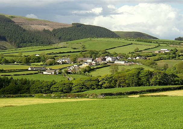
Castley Hill is part of the Caldbeck Fells, a range of hills characterized by rugged terrain and picturesque valleys. It is composed mainly of volcanic rock, with distinctive features such as crags and scree slopes. The hill offers panoramic views of the surrounding countryside, including the nearby Skiddaw Mountain, which is the fourth highest peak in England.

The area surrounding Castley Hill is abundant in flora and fauna, with various species of plants and animals calling it home. The hill itself is covered in heather, grasses, and moss, while the lower slopes are adorned with woodlands and meadows. It provides a habitat for several bird species, including peregrine falcons and golden eagles, as well as mammals like red deer and red squirrels.

Due to its natural beauty and ecological importance, Castley Hill attracts a significant number of visitors each year. Outdoor enthusiasts and nature lovers are drawn to the hill for activities such as hiking, climbing, and birdwatching. Additionally, the surrounding area offers opportunities for exploring other nearby attractions, including the charming village of Caldbeck and the picturesque Carrock Fell.

Overall, Castley Hill in Cumberland is a stunning natural feature that showcases the diverse and breathtaking landscapes of the Lake District National Park.

If you have any feedback on the listing, please let us know in the comments section below.
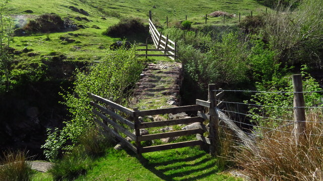
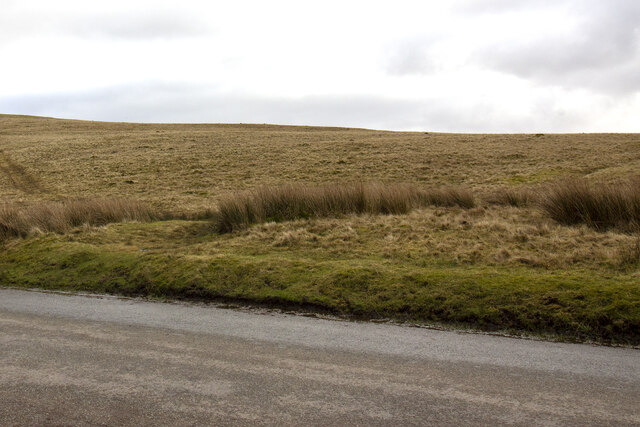
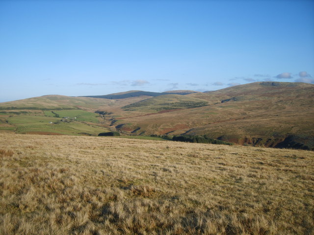
Castley Hill Images

Images are sourced within 2km of 54.479318/-3.4638709 or Grid Reference NY0510. Thanks to Geograph Open Source API. All images are credited.

Monks Bridge Crossing the River Calder, Cold Fell, Cumbria The oldest packhorse bridge in Cumbria. Wainwright described it as "The most charming of Lakeland's packhorse bridges" and My Cousin told me we were going to see a "Wonder". Both were correct! As to a build date I would think it's Late 1600's maybe using stone from the nearby Abbey (closed 1536) But if it was built by the Monks then this would give a lot earlier date.  

It's also listed as Matty Benn's Bridge. Martha "Matty" Benn (1831-1888), who used the bridge to get to and from market on horseback. She was known to return in a state of inebriation but still managed to cross the bridge!
Monks Bridge Crossing the River Calder, Cold Fell, Cumbria
The oldest packhorse bridge in Cumbria. Wainwright described it as "The most charming of Lakeland's packhorse bridges" and My Cousin told me we were going to see a "Wonder". Both were correct! As to a build date I would think it's Late 1600's maybe using stone from the nearby Abbey (closed 1536) But if it was built by the Monks then this would give a lot earlier date. It's also listed as Matty Benn's Bridge. Martha "Matty" Benn (1831-1888), who used the bridge to get to and from market on horseback. She was known to return in a state of inebriation but still managed to cross the bridge!
Bridge over River Calder below Monk's Bridge near Egremont
Monk's Bridge on the R Calder, E of Egremont Monk’s Bridge on Cold Fell is the oldest packhorse bridge in Cumbria, and crosses Friar Gill where it passes through a narrow deep chasm. It was built for the monks of Calder Abbey, who would have crossed it on their many journeys. Iron ore would have been carried over it from Ennerdale to smithies on the fells to be smelted. The bridge is also known as Matty Benn’s Bridge, after the family Benn who lived nearby.
Monk's Bridge on the R Calder, E of Egremont
Monk’s Bridge on Cold Fell is the oldest packhorse bridge in Cumbria, and crosses Friar Gill where it passes through a narrow deep chasm. It was built for the monks of Calder Abbey, who would have crossed it on their many journeys. Iron ore would have been carried over it from Ennerdale to smithies on the fells to be smelted. The bridge is also known as Matty Benn’s Bridge, after the family Benn who lived nearby.
Wilton Village Passing through Wilton Village towards Grange
Wilton Village
Passing through Wilton Village towards Grange
Dike Nook Road leaving Wilton village
Dike Nook
Road leaving Wilton village
Farm track Gateway to a farm track bordered by a hedgerow and post and wire fence
Farm track
Gateway to a farm track bordered by a hedgerow and post and wire fence
Cattle Grid
Cattle Grid
Swath Fell Swath Fell from Lowther Park car park
Swath Fell
Swath Fell from Lowther Park car park
Lowther Park
Lowther Park
Bridge over the Calder The footbridge doubles as a farm bridge over the Calder near Friar Gill and is close to the much more photogenic Monks Bridge See<a href="https://www.geograph.org.uk/photo/3027194">NY0610 : Monks Bridge</a>
Bridge over the Calder
The footbridge doubles as a farm bridge over the Calder near Friar Gill and is close to the much more photogenic Monks Bridge SeeNY0610 : Monks Bridge
Monks Bridge Wainwright called it the most charming of Lakeland's packhorse bridges. Also known as Matty Benn's Bridge it is the oldest packhorse bridge in Cumbria. 
It was built by the monks of Calder Abbey (dissolved in 1536)
See <a href="https://www.geograph.org.uk/photo/3027147">NY0610 : Bridge over the Calder</a>
Monks Bridge
Wainwright called it the most charming of Lakeland's packhorse bridges. Also known as Matty Benn's Bridge it is the oldest packhorse bridge in Cumbria. It was built by the monks of Calder Abbey (dissolved in 1536) See NY0610 : Bridge over the Calder
Coldfell Gate
Coldfell Gate
Lowther Park plantation The Sleven Beck runs down beside the trees.
Lowther Park plantation
The Sleven Beck runs down beside the trees.
The entrance to Lowther Park plantation
Heading north from Cold Fell
Coldfell gate. approaching the Coldfell road.
Coldfell gate.
approaching the Coldfell road.
The top of Cold Fell 10 minutes' walk from the road.
The top of Cold Fell
10 minutes' walk from the road.
Old Milestone near Castley Hill Carved stone post by the UC road, in parish of HAILE (COPELAND District), Cold Fell, Castley Hill, T-junction 50m West of cattle grid, on North East side of road. Egremont stone, erected by the Egremont to Salthouse turnpike trust in the 19th century. 

Inscription reads:-
: To / Haile / 1 / Mile : : To / Wilton / (1½) Miles / To Egremont / (3) Miles : 

Grade II Listed. List Entry Number: 1084320
<span class="nowrap"><a title="https://historicengland.org.uk/listing/the-list/list-entry/1084320" rel="nofollow ugc noopener" href="https://historicengland.org.uk/listing/the-list/list-entry/1084320">Link</a><img style="margin-left:2px;" alt="External link" title="External link - shift click to open in new window" src="https://s1.geograph.org.uk/img/external.png" width="10" height="10"/></span>

Milestone Society National ID: CU_HLEG01.
Old Milestone near Castley Hill
Carved stone post by the UC road, in parish of HAILE (COPELAND District), Cold Fell, Castley Hill, T-junction 50m West of cattle grid, on North East side of road. Egremont stone, erected by the Egremont to Salthouse turnpike trust in the 19th century. Inscription reads:- : To / Haile / 1 / Mile : : To / Wilton / (1½) Miles / To Egremont / (3) Miles : Grade II Listed. List Entry Number: 1084320 LinkExternal link Milestone Society National ID: CU_HLEG01.
Show me another place!

Castley Hill is located at Grid Ref: NY0510 (Lat: 54.479318, Lng: -3.4638709)

Administrative County: Cumbria

District: Copeland

Police Authority: Cumbria

What 3 Words

///lifted.hairspray.daffodils. Near Egremont, Cumbria

Nearby Locations

Friar Moor Castley Hill

Related Wikis

Wilton, Cumbria

Wilton is a hamlet in the Copeland district, in the county of Cumbria, England. It is near the small town of Egremont. In 1870-72 it had a population of...

Cold Fell (Calder Bridge)

Cold Fell is a hill in the west of the English Lake District. It is easily climbed from the road between Ennerdale Bridge and Calder Bridge. This road...

Haile, Cumbria

Haile is a small village and civil parish in Copeland district, in the county of Cumbria, England. It had a population of 617 at the 2011 Census.Nearby...

Haile Parish Church

Haile Parish Church is near Haile, Cumbria, England. It is an active Anglican parish church in the deanery of Calder, and the diocese of Carlisle. Its...

Nearby Amenities

Located within 500m of 54.479318,-3.4638709
Barrier: cattle_grid
Lat/Long: 54.4773169/-3.4592771
Friar Well
Natural: spring
Lat/Long: 54.4770264/-3.4581125
Castley Hill
Natural: peak
Lat/Long: 54.478715/-3.4635516
Power: pole
Lat/Long: 54.4805855/-3.4697459
Power: pole
Lat/Long: 54.4803718/-3.467564
Power: pole
Lat/Long: 54.4801603/-3.4654127
Power: pole
Lat/Long: 54.4800673/-3.4641912
The data included in this document is from www.openstreetmap.org. The data is made available under ODbL.

Have you been to Castley Hill?

Leave your review of Castley Hill below (or comments, questions and feedback).