Beacon Hill

Hill, Mountain in Somerset Somerset West and Taunton

England

Beacon Hill

Old Cleve : Road A small country lane.
Old Cleve : Road Credit: Lewis Clarke

Beacon Hill, Somerset, is located in the southwestern region of England, specifically in the county of Somerset. It is a prominent hill, also referred to as a mountain due to its significant elevation, and is part of the Mendip Hills range. The hill stands at an impressive height of 1,047 feet (319 meters) above sea level.

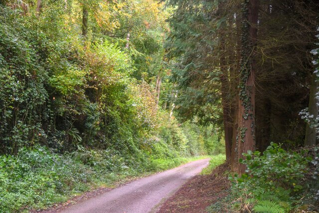
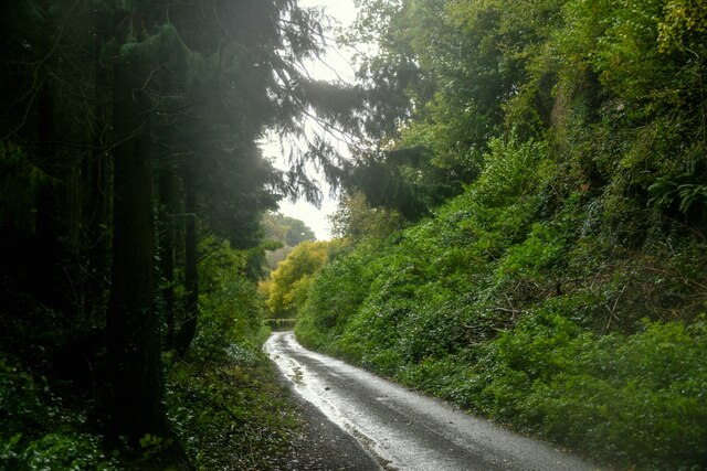
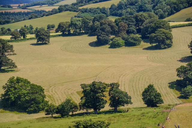
Beacon Hill is surrounded by breathtaking natural beauty, boasting stunning panoramic views of the surrounding countryside and nearby towns. It is known for its lush greenery, with rolling hills, meadows, and woodlands surrounding its slopes. The hill's diverse flora and fauna make it an ideal destination for nature enthusiasts and hikers.

Historically, Beacon Hill has played a significant role in the region. The name "Beacon" originates from its use as a signaling point during times of war. In the past, fires would be lit on the hill's summit to warn nearby communities of impending danger. Today, remnants of the beacon can still be seen, serving as a reminder of the hill's historical importance.

The hill also offers various recreational activities, including walking trails and cycling routes that cater to individuals of all fitness levels. These outdoor activities attract locals and tourists alike, providing opportunities for exercise and exploration.

Overall, Beacon Hill, Somerset, is a stunning natural landmark with historical significance. Its breathtaking views, diverse ecosystems, and recreational activities make it a must-visit destination for those seeking to immerse themselves in the beauty of the English countryside.

If you have any feedback on the listing, please let us know in the comments section below.
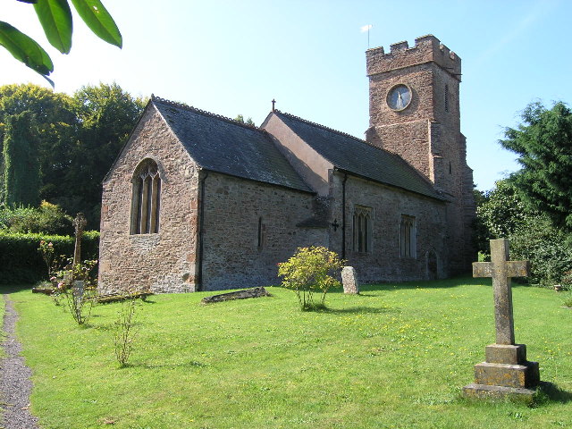
Beacon Hill Images

Images are sourced within 2km of 51.114015/-3.3598713 or Grid Reference ST0435. Thanks to Geograph Open Source API. All images are credited.

Old Cleve : Road A small country lane.
Old Cleve : Road
A small country lane.
Old Cleve : Road A road heads through the countryside.
Old Cleve : Road
A road heads through the countryside.
Leighland Chapel Ford There are warnings at either end of this narrow byway with photographs of stranded delivery vans. On the day of our visit the ford was muddy but 'dry' and passable in both directions.
Leighland Chapel Ford
There are warnings at either end of this narrow byway with photographs of stranded delivery vans. On the day of our visit the ford was muddy but 'dry' and passable in both directions.
SCC Fingerpost on B3224 at Galloping Bottom Lane SCC fingerpost.
SCC Fingerpost on B3224 at Galloping Bottom Lane
SCC fingerpost.
SCC Fingerpost on B3224 jnc to Beech Tree farm 3 fingered SCC Post.
SCC Fingerpost on B3224 jnc to Beech Tree farm
3 fingered SCC Post.
West Somerset : Countryside Scenery Looking out across from the Brendon Hills with the Bristol Channel and beyond, Cardiff Airport stands out on the Welsh landscape.
West Somerset : Countryside Scenery
Looking out across from the Brendon Hills with the Bristol Channel and beyond, Cardiff Airport stands out on the Welsh landscape.
West Somerset : Countryside Scenery Looking out across the fields and out beyond the Bristol Channel to the South Wales coastline.
West Somerset : Countryside Scenery
Looking out across the fields and out beyond the Bristol Channel to the South Wales coastline.
West Somerset : Countryside Scenery Looking out across the Bristol Channel with Steep Holm in view.
West Somerset : Countryside Scenery
Looking out across the Bristol Channel with Steep Holm in view.
West Somerset : Bristol Channel Looking out across the Bristol Channel with Flat Holm in view.
West Somerset : Bristol Channel
Looking out across the Bristol Channel with Flat Holm in view.
West Somerset : Bristol Channel In the very distance you can pick out the Severn Bridge.
West Somerset : Bristol Channel
In the very distance you can pick out the Severn Bridge.
West Somerset : Bristol Channel Looking across the Bristol Channel towards Wales.
West Somerset : Bristol Channel
Looking across the Bristol Channel towards Wales.
West Somerset : Bristol Channel Looking out across the Bristol Channel and Welsh coastline.
West Somerset : Bristol Channel
Looking out across the Bristol Channel and Welsh coastline.
Old Direction Sign - Signpost by the B3190, Ralegh's Cross Inn Pyramid finial - 4 arms; Somerset SCC pyramid by the B3190, in parish of Nettlecombe (West Somerset District), junction with the B3224 by "Ralegh's Cross Inn" PH.

Surveyed

Milestone Society National ID: SO_ST0334
Old Direction Sign - Signpost by the B3190, Ralegh's Cross Inn
Pyramid finial - 4 arms; Somerset SCC pyramid by the B3190, in parish of Nettlecombe (West Somerset District), junction with the B3224 by "Ralegh's Cross Inn" PH. Surveyed Milestone Society National ID: SO_ST0334
Old Milestone by the B3190, Sticklepath, Old Cleeve parish Metal plate attached to stone post by the B3190, in parish of Old Cleeve (West Somerset District), hamlet of Sticklepath, beside road on bank, on West side of road. Minehead iron plate, erected by the Minehead & Bampton Road turnpike trust in the 19th century. 

Inscription reads:- 
5
MILES
To
Watchet
Carved benchmark lower front.

Grade II listed.  List Entry Number: 1345598 <span class="nowrap"><a title="https://historicengland.org.uk/listing/the-list/list-entry/1345598" rel="nofollow ugc noopener" href="https://historicengland.org.uk/listing/the-list/list-entry/1345598">Link</a><img style="margin-left:2px;" alt="External link" title="External link - shift click to open in new window" src="https://s1.geograph.org.uk/img/external.png" width="10" height="10"/></span>

Milestone Society National ID: SO_WTTV05
Old Milestone by the B3190, Sticklepath, Old Cleeve parish
Metal plate attached to stone post by the B3190, in parish of Old Cleeve (West Somerset District), hamlet of Sticklepath, beside road on bank, on West side of road. Minehead iron plate, erected by the Minehead & Bampton Road turnpike trust in the 19th century. Inscription reads:- 5 MILES To Watchet Carved benchmark lower front. Grade II listed. List Entry Number: 1345598 LinkExternal link Milestone Society National ID: SO_WTTV05
West Somerset : The B3224 Heading along the B3224.
West Somerset : The B3224
Heading along the B3224.
Nettlecombe : The B3190 Heading along the B3190 in the Nettlecombe parish.
Nettlecombe : The B3190
Heading along the B3190 in the Nettlecombe parish.
Nettlecombe : Countryside Scenery Hills and fields in the Nettlecombe parish.
Nettlecombe : Countryside Scenery
Hills and fields in the Nettlecombe parish.
Nettlecombe : The B3190 Heading along the B3190 in the Nettlecombe parish.
Nettlecombe : The B3190
Heading along the B3190 in the Nettlecombe parish.
Show me another place!

Beacon Hill is located at Grid Ref: ST0435 (Lat: 51.114015, Lng: -3.3598713)

Administrative County: Somerset

District: Somerset West and Taunton

Police Authority: Avon and Somerset

What 3 Words

///decoding.shaver.scout. Near Williton, Somerset

Related Wikis

Nettlecombe Court

Nettlecombe Court and park is an old estate on the northern fringes of the Brendon Hills, within the Exmoor National Park. They are within the civil parish...

Comberow railway station

Comberow was an intermediate station on the West Somerset Mineral Railway (WSMR), which was built primarily to carry iron ore from mines to Watchet harbour...

Nettlecombe, Somerset

Nettlecombe is a civil parish in the English county of Somerset. The parish covers a rural area below the Brendon Hills, comprising the small hamlets of...

Roadwater railway station

The Roadwater railway station was an intermediate station on the West Somerset Mineral Railway (WSMR), which was built primarily to carry iron ore from...

Roadwater

Roadwater is a village 3 miles (5 km) south-west of Williton, on the northern edge of the Exmoor National Park, in Somerset, England. == History == The...
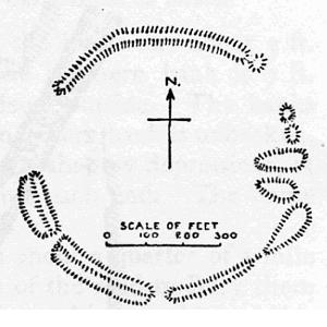
Elworthy Barrows

Elworthy Barrows is an unfinished Iron Age hill fort, rather than Bronze Age barrows, which is designated a scheduled ancient monument (No:188401). It...

Brendon Hill railway station

Brendon Hill (occasionally referred to as "Raleigh's Cross") was an intermediate station on the West Somerset Mineral Railway (WSMR), which was built primarily...

Monksilver

Monksilver is a village 3 miles (5 km) west of the town of Williton in Somerset, England, on the eastern flank of the Brendon Hills and the border of the...

Nearby Amenities

Located within 500m of 51.114015,-3.3598713
Stickle Path
Is In: Somerset, England, UK
Place: hamlet
Lat/Long: 51.1171391/-3.3632721
Wilhay Farm
Note Retag: CS #48756035
Place: isolated_dwelling
Lat/Long: 51.1164522/-3.3656666
Windwhistle Farm
Landuse: farm
Note Retag: CS #48756035
Lat/Long: 51.1132135/-3.3583154
The data included in this document is from www.openstreetmap.org. The data is made available under ODbL.

Have you been to Beacon Hill?

Leave your review of Beacon Hill below (or comments, questions and feedback).