Bryn Gwyn

Hill, Mountain in Montgomeryshire

Wales

Bryn Gwyn

View from the stone circle Looking down the valley of the Afon Disgynfa towards Pistyll Rhaeadr from the stone circle.
View from the stone circle Credit: Dave Dunford

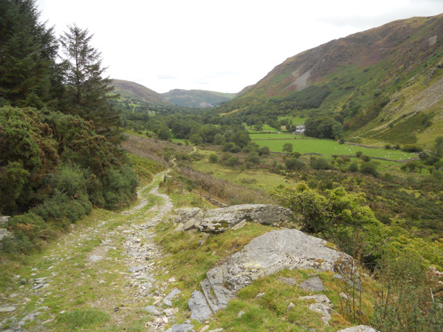
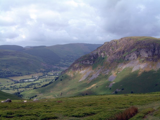
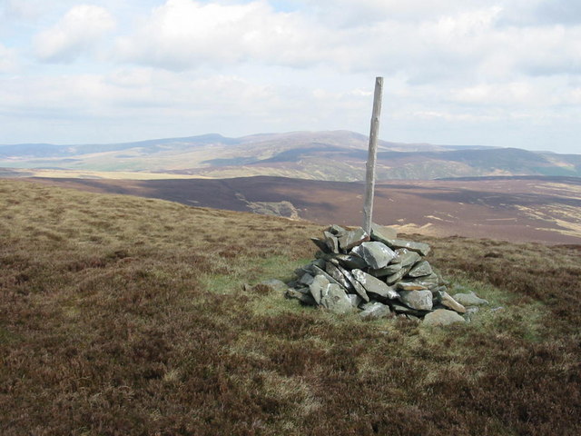
Bryn Gwyn is a stunning hill/mountain located in Montgomeryshire, Wales. With an elevation of approximately 1,874 feet (571 meters), it offers breathtaking panoramic views of the surrounding countryside. Situated in the southern part of the county, Bryn Gwyn is a prominent feature of the local landscape.

The hill/mountain is predominantly composed of ancient rocks, including slate and quartzite, which give it a unique and rugged appearance. The slopes of Bryn Gwyn are covered in heather and grasses, providing a rich habitat for a variety of wildlife, including birds, insects, and small mammals.

At the summit of Bryn Gwyn, visitors can enjoy uninterrupted vistas of the rolling hills and valleys that stretch out for miles in every direction. On a clear day, it is even possible to see as far as Snowdonia National Park to the west and the English border to the east.

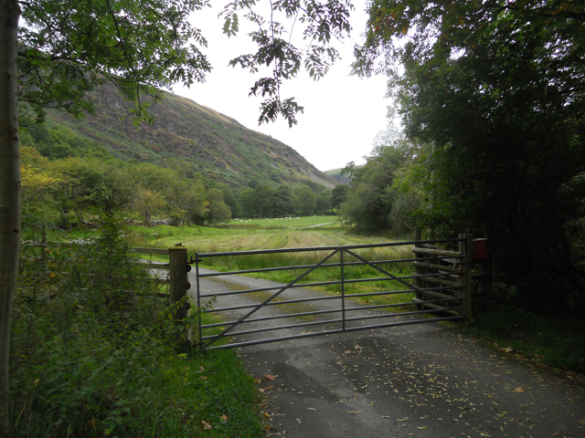
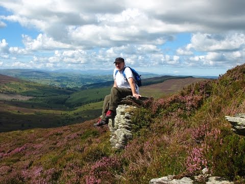
The hill/mountain is a popular destination for hikers and nature enthusiasts, who are drawn to its natural beauty and tranquility. Several well-marked trails lead to the summit, offering different levels of difficulty to cater to all abilities. These paths wind through meadows, woodlands, and moorland, providing an opportunity to explore the diverse ecosystems of the area.

Bryn Gwyn is not only a natural gem but also a cultural one, as it holds historical significance in the local folklore and traditions. It has become a symbol of Montgomeryshire's natural heritage and a place that locals and visitors alike hold dear.

If you have any feedback on the listing, please let us know in the comments section below.

Bryn Gwyn Images

Images are sourced within 2km of 52.854965/-3.4232412 or Grid Reference SJ0429. Thanks to Geograph Open Source API. All images are credited.

View from the stone circle Looking down the valley of the Afon Disgynfa towards Pistyll Rhaeadr from the stone circle.
View from the stone circle
Looking down the valley of the Afon Disgynfa towards Pistyll Rhaeadr from the stone circle.
Stone row Though the individual stones are small and partly obscured by vegetation, the double stone row can be discerned in this photograph. The site of the stone circle is also visible, but the stones of the circle itself cannot readily be seen in this photograph.
Stone row
Though the individual stones are small and partly obscured by vegetation, the double stone row can be discerned in this photograph. The site of the stone circle is also visible, but the stones of the circle itself cannot readily be seen in this photograph.
Stone circle In the foreground, one of the largest of the visible stones; the person in the photo is standing on another. In the background are the slopes of Moel Sych (<a href="https://www.geograph.org.uk/gridref/SJ0631">SJ0631</a>).
Stone circle
In the foreground, one of the largest of the visible stones; the person in the photo is standing on another. In the background are the slopes of Moel Sych (SJ0631).
Small rock outcrop on Cerrig Duon From the intermittent path that heads northwest to the ridge top from the stone circle, looking towards Moel Sych.
Small rock outcrop on Cerrig Duon
From the intermittent path that heads northwest to the ridge top from the stone circle, looking towards Moel Sych.
Footpath from Milltir Cerrig towards Berwyn ridge Recently renovated boardwalk section crossing difficult heather-clad terrain.
Footpath from Milltir Cerrig towards Berwyn ridge
Recently renovated boardwalk section crossing difficult heather-clad terrain.
Cattle grid on the B4391 Heading down to Llangynog.
Cattle grid on the B4391
Heading down to Llangynog.
Craig Rhiwarth a Hafod Hir Craig Rhiwarth (left) (532m) and Hafod Hir (right) (545m), above Cwm Rhiweirth of the Upper Tanat valley, seen from the B4391 road descending towards Llangynog from Bala.  Ref:PC110002a.
Craig Rhiwarth a Hafod Hir
Craig Rhiwarth (left) (532m) and Hafod Hir (right) (545m), above Cwm Rhiweirth of the Upper Tanat valley, seen from the B4391 road descending towards Llangynog from Bala. Ref:PC110002a.
Craig Rhiwarth a Hafod Hir Craig Rhiwarth (left) (532m) and Hafod Hir (right) (545m), above Cwm Rhiweirth of the Upper Tanat valley, seen from the B4391 road from Bala. Ref:PC110005a2.
Craig Rhiwarth a Hafod Hir
Craig Rhiwarth (left) (532m) and Hafod Hir (right) (545m), above Cwm Rhiweirth of the Upper Tanat valley, seen from the B4391 road from Bala. Ref:PC110005a2.
Craig Rhiwarth a Hafod Hir Craig Rhiwarth (centre) (532m) and Hafod Hir (right) (545m), above Cwm Rhiweirth of the Upper Tanat valley, seen from the B4391 road descending towards Llangynog from Bala. Ref:PC110004u.
Craig Rhiwarth a Hafod Hir
Craig Rhiwarth (centre) (532m) and Hafod Hir (right) (545m), above Cwm Rhiweirth of the Upper Tanat valley, seen from the B4391 road descending towards Llangynog from Bala. Ref:PC110004u.
The B4391 The B4391 above Cwm Rhiwarth.
The B4391
The B4391 above Cwm Rhiwarth.
Cwm Rhiwarth Cwm Rhiwarth viewed from the B4391.
Cwm Rhiwarth
Cwm Rhiwarth viewed from the B4391.
Cwm Rhiwarth Cwm Rhiwarth viewed from the B4391.
Cwm Rhiwarth
Cwm Rhiwarth viewed from the B4391.
Heading up Cwm Rhiwarth On the dead-end road.
Heading up Cwm Rhiwarth
On the dead-end road.
Old track down the valley
Gateway to Blaen-rhiwarth
Unclear footpath
Unclear footpath
The top of Cwm Orog
The top of Cwm Orog
Tre-y-Llan Pool on Tre-y-Llan
Tre-y-Llan
Pool on Tre-y-Llan
Show me another place!

Bryn Gwyn is located at Grid Ref: SJ0429 (Lat: 52.854965, Lng: -3.4232412)

Unitary Authority: Powys

Police Authority: Dyfed Powys

What 3 Words

///famines.toys.chaos. Near Llangynog, Powys

Nearby Locations

Bryn Gwyn Post Gwyn

Related Wikis

Milltir Cerrig

The Milltir Cerrig (Welsh for "mile of stones") is a mountain pass in Wales, on the B4391 between Bala (in the county of Gwynedd) and Llangynog (Powys...

Craig Rhiwarth

Craig Rhiwarth is a mountain in the Berwyn range, in Powys (formerly Montgomeryshire), Wales, overlooking the village of Llangynog to the south. On the...
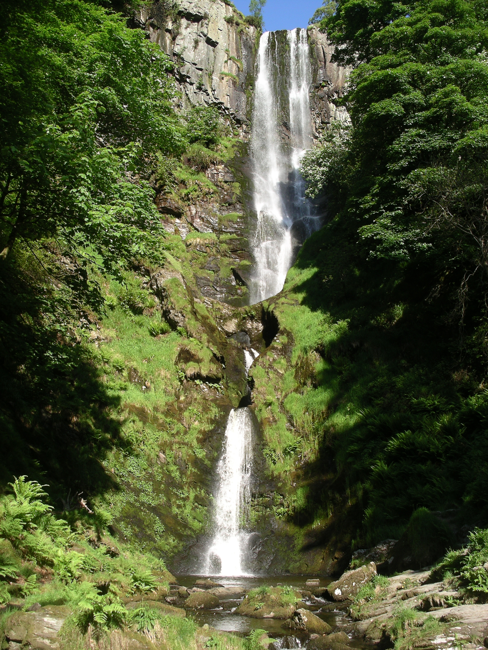
Pistyll Rhaeadr

Pistyll Rhaeadr (Welsh pronunciation: [pɪstɪɬ r̥aeadr], meaning "spring of the waterfall") is a waterfall 4 miles (6 kilometres) from the village of Llanrhaeadr...

Cyrniau Nod

Cyrniau Nod is a mountain summit in north east Wales. It is a former Marilyn, the Marilyn summit now being the nearby Foel Cedig. Its summit has the Snowdonia...

Related Videos

The Liberty Hall Round: Berwyns, NE Wales

A circular walk in the eastern Berwyn mountain range with drone footage above Liberty Hall.

Xmas Walk from Glyndyfrwdwy to Moel Ferna Quarry

A five mile circular walk from the Dee Valley up to the long abandoned Moel Ferna slate quarry.

Berwyns: A walk up Cerrig Coediog

A walk up two Dewey hills in the Berwyns in north wales.

Have you been to Bryn Gwyn?

Leave your review of Bryn Gwyn below (or comments, questions and feedback).