Bailey Hill
Hill, Mountain in Radnorshire
Wales
Bailey Hill
Bailey Hill is a prominent hill located in the county of Radnorshire, Wales. Rising to a height of approximately 1,257 feet (383 meters), it is considered one of the major hills in the area.
Situated near the town of Presteigne, Bailey Hill offers stunning panoramic views of the surrounding landscape. The hill is primarily composed of sedimentary rock formations, with layers of sandstone and shale visible on its slopes.
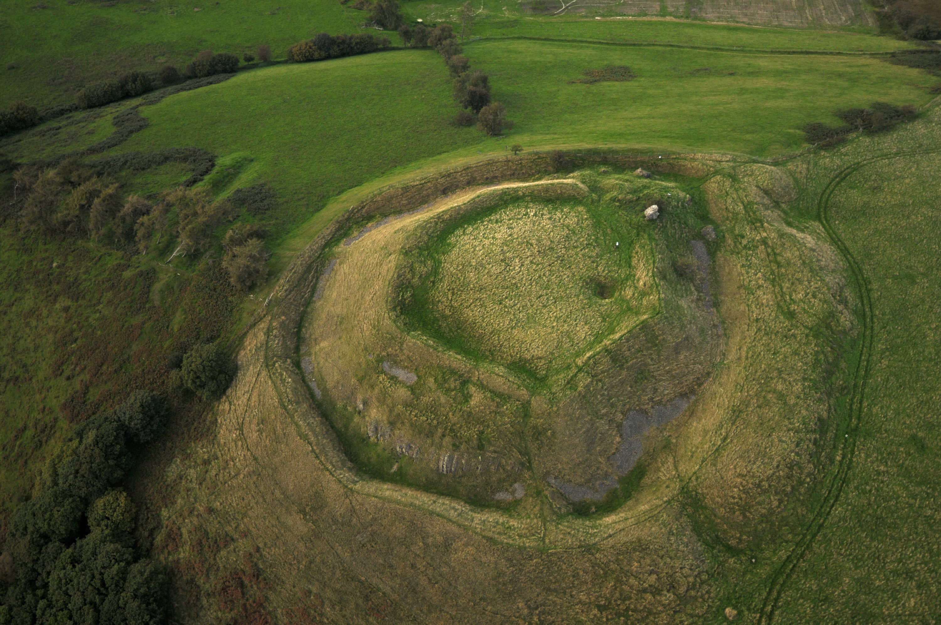
Bailey Hill has a rich historical significance, with evidence of human occupation dating back thousands of years. The hill is home to an Iron Age hillfort, which was likely used as a defensive structure during ancient times. The remnants of the fortifications can still be seen today, with a circular embankment and ditch encircling the summit.
The hill is popular among outdoor enthusiasts, offering various walking trails and hiking routes. It provides a challenging yet rewarding climb, with breathtaking vistas awaiting those who reach the summit. The diverse flora and fauna found on Bailey Hill add to its appeal, with wildflowers and small woodland areas dotting the landscape.
Additionally, Bailey Hill is a designated Site of Special Scientific Interest (SSSI), recognized for its geological importance. It boasts a range of geological features, including exposed rock formations and evidence of glacial activity.
Overall, Bailey Hill in Radnorshire is a captivating natural and historical landmark, drawing visitors with its stunning views, ancient fortifications, and geological significance.
If you have any feedback on the listing, please let us know in the comments section below.
Bailey Hill Images
Images are sourced within 2km of 52.369688/-3.4162388 or Grid Reference SO0375. Thanks to Geograph Open Source API. All images are credited.


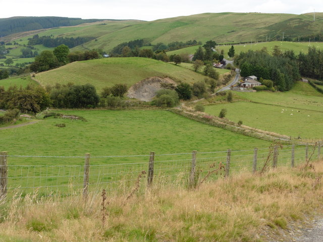
![Fields and forestry On the 1:25,000 map, Glyndwr's Way [long distance footpath] goes through this wood, but on the 1:50,000 it is shown as passing along the base of the hills about a kilometre beyond. Both lines are public rights of way.](https://s2.geograph.org.uk/photos/41/34/413454_7db46c88.jpg)


Bailey Hill is located at Grid Ref: SO0375 (Lat: 52.369688, Lng: -3.4162388)
Unitary Authority: Powys
Police Authority: Dyfed Powys
What 3 Words
///vintages.profited.evoke. Near Rhayader, Powys
Nearby Locations
Related Wikis

Red Lion Hill
Red Lion Hill (Welsh: Bryn Llew Goch) or Banc y Dolau is a hill in Powys, Wales, with a summit 484.6 metres (1,590 ft) above sea level. It is located in...

Abbey Cwmhir Hall
Abbey-Cwm-Hir Hall is a neo-Elizabethan country house in the Welsh county of Powys. == History == The hall was built in 1833 for Thomas Wilson, a London...

Abbeycwmhir
Abbeycwmhir or Abbey Cwmhir (Welsh: Abaty Cwm Hir, "Abbey in the Long Valley") is a village and community in the valley of the Nant Clywedog in Radnorshire...

Cwmhir Abbey
Cwmhir Abbey (Welsh: Abaty Cwm Hir), near Llandrindod Wells in Powys, is a Welsh Cistercian monastery founded in 1176 by Cadwallon ap Madog. A spurious...
Tinboeth Castle
Tinboeth Castle (Welsh: Castell Dinbod) was a medieval castle situated midway between Llanbister and Llanbadarn Fynydd in Wales, on a bend in the River...
Pantydwr railway station
Pantydwr railway station was a station to the north of St Harmon, Powys, Wales. The station was opened in 1864. The station was built at the highest point...
St Harmon
St Harmon (Welsh: Llanarmon) is a village in Radnorshire, Powys, Wales. The population of the Community at the 2011 census was 593. It is located on the...
St Harmons railway station
St Harmons railway station was a station in St Harmon, Powys, Wales. The station opened in 1872 and closed in 1962. == References == == Further reading... ==
Nearby Amenities
Located within 500m of 52.369688,-3.4162388Have you been to Bailey Hill?
Leave your review of Bailey Hill below (or comments, questions and feedback).