Horningsea

Settlement in Cambridgeshire South Cambridgeshire

England

Horningsea

Low Fen Drove Way at Snout Corner In The Fens just north of Cambridge at the end of summer.
Low Fen Drove Way at Snout Corner Credit: John Sutton

Horningsea is a picturesque village located in the county of Cambridgeshire, England. Situated just five miles northeast of the city of Cambridge, Horningsea is nestled along the banks of the River Cam, providing stunning views and a tranquil atmosphere. With a population of around 500 residents, the village retains a close-knit community feel.

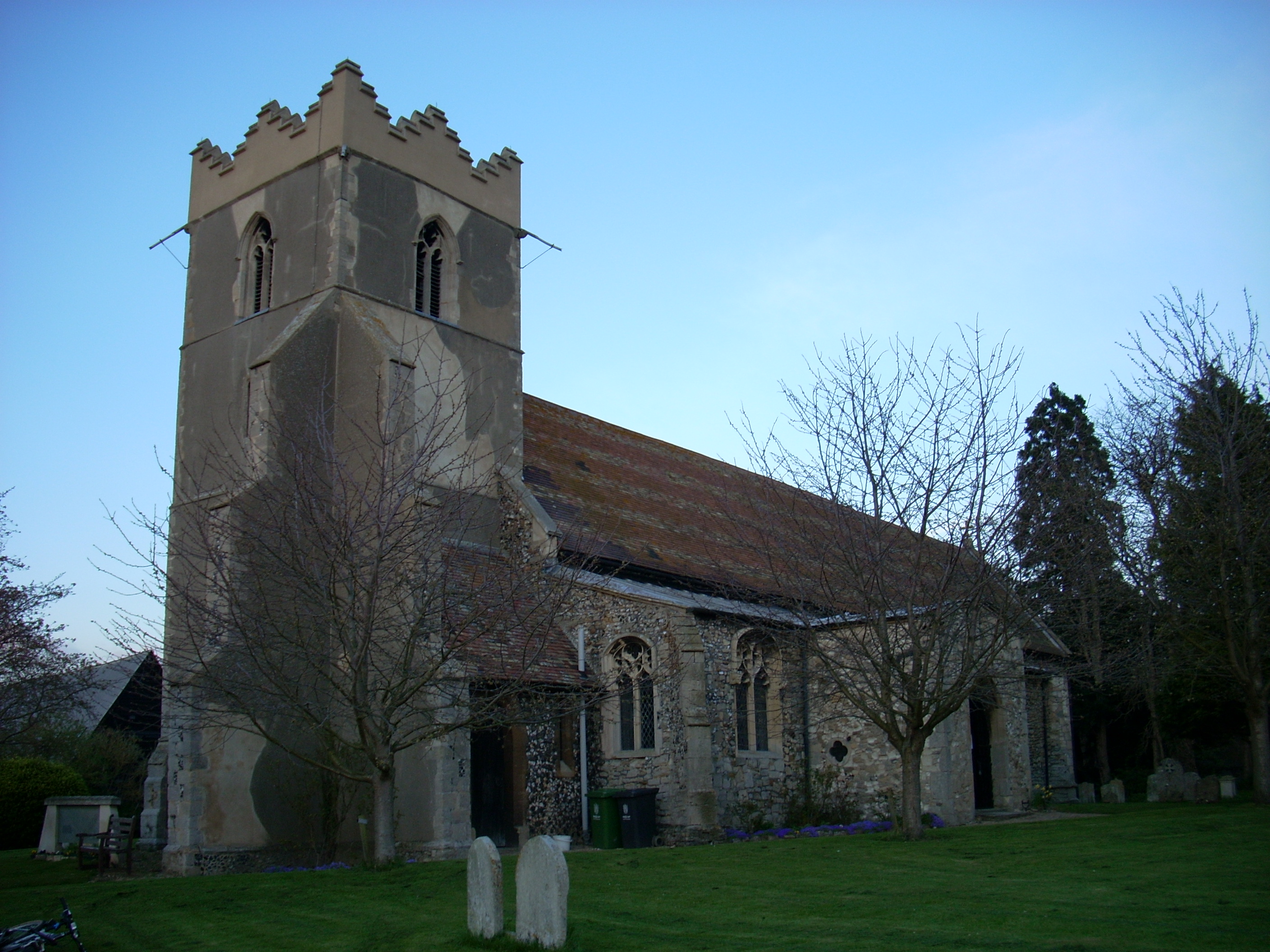
The village is known for its rich history, dating back to the Roman period. The remains of a Roman villa were discovered in the area, highlighting its ancient roots. Today, Horningsea showcases a charming blend of historical architecture and modern amenities. The prominent St. Peter's Church, with its Norman tower, stands as a testament to the village's heritage.

Nature enthusiasts will find themselves at home in Horningsea, as the surrounding countryside offers numerous walking and cycling paths. The village is also a popular spot for boating and fishing, with the River Cam providing ample opportunities for leisure activities.

Despite its small size, Horningsea boasts a vibrant community life. The village hall hosts various events and activities, including local fairs and social gatherings. The Plough and Fleece, a traditional English pub, serves as a meeting point for residents and visitors alike, offering a warm and friendly atmosphere.

With its idyllic setting, historical charm, and strong community spirit, Horningsea truly captures the essence of a quintessential English village. Whether it's exploring the countryside, immersing oneself in history, or simply enjoying the peaceful surroundings, Horningsea offers a delightful experience for all who visit.

If you have any feedback on the listing, please let us know in the comments section below.
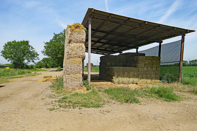
Horningsea Images

Images are sourced within 2km of 52.241582/0.186205 or Grid Reference TL4962. Thanks to Geograph Open Source API. All images are credited.

Low Fen Drove Way at Snout Corner In The Fens just north of Cambridge at the end of summer.
Low Fen Drove Way at Snout Corner
In The Fens just north of Cambridge at the end of summer.
Straw stacks at Allicky Farm The farm is on The Drove Way, part of the roundabout network of paths and tracks linking Horningsea to Lode or Stow-cum-Quy (ahead) in The Fens north-east of Cambridge. The picture was taken on a bright Sunday morning at the end of November.
Straw stacks at Allicky Farm
The farm is on The Drove Way, part of the roundabout network of paths and tracks linking Horningsea to Lode or Stow-cum-Quy (ahead) in The Fens north-east of Cambridge. The picture was taken on a bright Sunday morning at the end of November.
Oak leaves on the way to Horningsea This bridle way is part of a network of paths and tracks linking Lode, Stow-cum-Quy and Horningsea (ahead) in The Fens north-east of Cambridge.
Oak leaves on the way to Horningsea
This bridle way is part of a network of paths and tracks linking Lode, Stow-cum-Quy and Horningsea (ahead) in The Fens north-east of Cambridge.
Moored near Clayhithe Bridge A band of thick cloud which had obscured the sun for the previous quarter of an hour was moving south-eastwards on a very cold morning in early December.
Moored near Clayhithe Bridge
A band of thick cloud which had obscured the sun for the previous quarter of an hour was moving south-eastwards on a very cold morning in early December.
Moored near Clayhithe Reflections in still waters on a lovely January morning. Clayhithe Bridge is in the distance on the left.
Moored near Clayhithe
Reflections in still waters on a lovely January morning. Clayhithe Bridge is in the distance on the left.
On Low Fen Drove Way in early spring Autumn-sown cereals looked to be doing well in these fields in The Fens just north-east of Cambridge.
On Low Fen Drove Way in early spring
Autumn-sown cereals looked to be doing well in these fields in The Fens just north-east of Cambridge.
A May morning in the Cambridgeshire Fens Hawthorn in blossom and big arable fields south of the track linking Lode and Stow-cum-Quy to Horningsea, in The Fens north-east of Cambridge.
A May morning in the Cambridgeshire Fens
Hawthorn in blossom and big arable fields south of the track linking Lode and Stow-cum-Quy to Horningsea, in The Fens north-east of Cambridge.
Drain and pylons in the Cambridgeshire Fens Near the northern entrance to Quy Fen common on a bright May morning. The drain cuts across a huge field of barley. <a href="https://www.geograph.org.uk/photo/6300264">TL5162 : Drain and pylons on Quy Fen</a> is an autumn version of this view.
Drain and pylons in the Cambridgeshire Fens
Near the northern entrance to Quy Fen common on a bright May morning. The drain cuts across a huge field of barley. TL5162 : Drain and pylons on Quy Fen is an autumn version of this view.
Barley in the Cambridgeshire Fens Part of a huge field of autumn-sown barley north of the bridle track which links Horningsea (left) to Lode, Quy Fen and Stow-cum-Quy, photographed on a warm and sunny May morning.
Barley in the Cambridgeshire Fens
Part of a huge field of autumn-sown barley north of the bridle track which links Horningsea (left) to Lode, Quy Fen and Stow-cum-Quy, photographed on a warm and sunny May morning.
Barley ripening in the Cambridgeshire Fens A huge field north of the track which links Horningsea (left), Quy and Lode - villages in the southern part of The Fens north-east of Cambridge.
Barley ripening in the Cambridgeshire Fens
A huge field north of the track which links Horningsea (left), Quy and Lode - villages in the southern part of The Fens north-east of Cambridge.
Sugar beet in the Cambridgeshire Fens On the bridle track from Quy or Lode to Horningsea (ahead, in a roundabout way) on a fine June morning.
Sugar beet in the Cambridgeshire Fens
On the bridle track from Quy or Lode to Horningsea (ahead, in a roundabout way) on a fine June morning.
Allicky Farm: bales and a leaning barn The bridle path linking Quy, Lode and Horningsea (ahead) passes between farm buildings. This was a fine June morning in The Fens just north-east of Cambridge.
Allicky Farm: bales and a leaning barn
The bridle path linking Quy, Lode and Horningsea (ahead) passes between farm buildings. This was a fine June morning in The Fens just north-east of Cambridge.
On the Cam at Clayhithe Looking upstream from near Clayhithe Bridge on the sunny morning of the longest day. The motor boat "Binky" is operated by the Conservators of the River Cam, whose weed harvester "Berky" (see <a href="https://www.geograph.org.uk/photo/5303615">TL4659 : River Cam Conservancy weed harvester</a>) has been superseded by another craft.
On the Cam at Clayhithe
Looking upstream from near Clayhithe Bridge on the sunny morning of the longest day. The motor boat "Binky" is operated by the Conservators of the River Cam, whose weed harvester "Berky" (see TL4659 : River Cam Conservancy weed harvester) has been superseded by another craft.
Harcamlow Way
Harcamlow Way
Ditch and pylons
Ditch and pylons
Path from Stow cum Quy Fen
Cattle on Stow cum Quy Fen
End-of-summer sunflowers in The Fens Looking north-east from Low Fen Drove Way, not far from Fen Ditton on the edge of Cambridge, on a fine Sunday morning in September. The wheatfield beyond the strip of sunflowers was harvested in late July or early August in the hot and dry summer of 2022.
End-of-summer sunflowers in The Fens
Looking north-east from Low Fen Drove Way, not far from Fen Ditton on the edge of Cambridge, on a fine Sunday morning in September. The wheatfield beyond the strip of sunflowers was harvested in late July or early August in the hot and dry summer of 2022.
Show me another place!

Horningsea is located at Grid Ref: TL4962 (Lat: 52.241582, Lng: 0.186205)

Administrative County: Cambridgeshire

District: South Cambridgeshire

Police Authority: Cambridgeshire

What 3 Words

///parkland.carpentry.wages. Near Waterbeach, Cambridgeshire

Nearby Locations

Horningsea

Related Wikis

Horningsea

Horningsea is a small village north of Cambridge in Cambridgeshire in England. The parish covers an area of 2.6 square miles (6.7 km2; 1,700 acres). It...

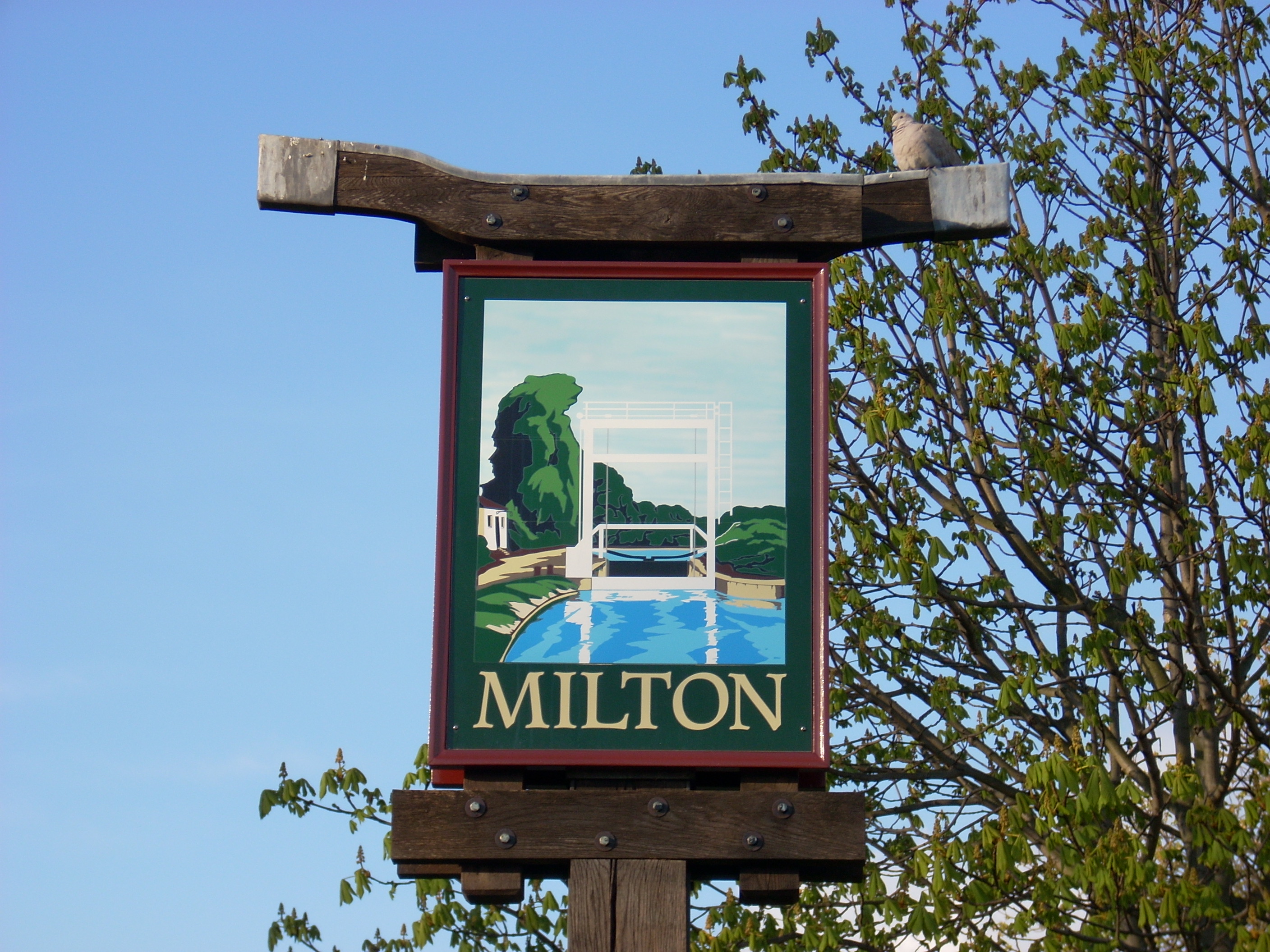
Milton, Cambridgeshire

Milton is a village just north of Cambridge, England, with a population of 4,679 at the 2011 census. == History == Milton grew from a small population...

Stow-Cum-Quy Fen

Stow-Cum-Quy Fen is a 29.9-hectare (74-acre) biological Site of Special Scientific Interest west of Lode in Cambridgeshire. Most of it is common land.The...

Quy railway station

Quy railway station served the parish of Stow cum Quy, Cambridgeshire, England from 1884 to 1964 on the Cambridge to Mildenhall railway. == History... ==

St John's Innovation Centre

St John's Innovation Centre (SJIC) is a business incubator in Cambridge, England. It houses a concentration of science and technology related businesses...

Waterbeach Abbey

Waterbeach Abbey was an abbey at Waterbeach in Cambridgeshire, England. It was established in 1294 by nuns from the Second Order of St. Francis who had...

Waterbeach railway station

Waterbeach railway station is on the Fen line in the east of England, serving the village of Waterbeach, Cambridgeshire. It is 61 miles 1 chain (98.2 km...

TeraView

TeraView Limited, or TeraView, is a company that designs terahertz imaging and spectroscopy instruments and equipment for measurement and evaluation of...

Nearby Amenities

Located within 500m of 52.241582,0.186205
Scotsdales Garden Centre
Shop: garden_centre
Lat/Long: 52.2379523/0.1858849
Horningsea
Is In: Cambridgeshire, England, UK
Place: village
Population: 330
Source Name: local knowledge
Source Population: http://www.scambs.gov.uk/CommunityandLiving/VillageServicesAndAmenities/
Wikidata: Q1919121
Lat/Long: 52.239366/0.1863126
Orchard Mobility
Addr City: Cambridge
Addr Housename: Orchard Mobility
Addr Housenumber: Scotsdales
Addr Postcode: CB25 9JG
Addr Street: High Street, Horningsea
Opening Hours: Mo-Sa 09:30-16:00
Operator: Orchard Mobility
Phone: +44 1223 863908
Shop: mobility_aids
Website: http://www.orchard-mobility.co.uk
Lat/Long: 52.2376376/0.1865846
Bus Stop
Priory Road
Naptan AtcoCode: 0500SHORN001
Naptan Bearing: N
Naptan BusStopType: CUS
Naptan CommonName: Priory Road
Naptan Indicator: near
Naptan Landmark: Priory Road
Naptan NaptanCode: cmbgadgd
Naptan Street: High Street
Naptan Verified: no
Source: naptan_import
Lat/Long: 52.2391839/0.1852218
Bus Stop
St. John's Lane
Naptan AtcoCode: 0500SHORN002
Naptan Bearing: SW
Naptan CommonName: St. John's Lane
Naptan Indicator: opp
Naptan Landmark: St. John's Lane
Naptan NaptanCode: cmbgadgj
Naptan Street: High Street
Naptan Verified: no
Shelter: yes
Source: naptan_import
Lat/Long: 52.2405046/0.1857701
Bus Stop
St. John's Lane
Naptan AtcoCode: 0500SHORN003
Naptan Bearing: NE
Naptan CommonName: St. John's Lane
Naptan Indicator: near
Naptan Landmark: St. John's Lane
Naptan NaptanCode: cmbgadgm
Naptan Street: High Street
Naptan Verified: no
Source: naptan_import
Lat/Long: 52.241061/0.1858268
Bus Stop
Priory Road
Naptan AtcoCode: 0500SHORN004
Naptan Bearing: S
Naptan CommonName: Priory Road
Naptan Indicator: opp
Naptan Landmark: Priory Road
Naptan NaptanCode: cmbgadgp
Naptan Street: High Street
Naptan Verified: no
Source: naptan_import
Lat/Long: 52.239137/0.1853221
Cafe
Sunflower Cafe
Lat/Long: 52.2379888/0.1853521
Barrier: kissing_gate
Lat/Long: 52.243803/0.1923184
Power: pole
Source: bing
Lat/Long: 52.2403479/0.1848363
Power: pole
Source: bing
Lat/Long: 52.2401606/0.1825671
Power: pole
Source: bing
Lat/Long: 52.24133/0.1841416
Design: h-frame
Line Attachment: anchor
Power: pole
Lat/Long: 52.2419039/0.1837143
Line Attachment: (anchor)|(pin)
Line Management: transition
Location Transition: yes
Power: pole
Lat/Long: 52.2430477/0.1845987
Power: pole
Source: bing
Lat/Long: 52.2388911/0.1808908
Power: pole
Source: bing
Lat/Long: 52.2395628/0.1817866
Power: pole
Source: bing
Lat/Long: 52.2407847/0.1833933
Post Box
Collection Times: Mo-Fr 09:00; Sa 07:00
Operator: Royal Mail
Post Box Type: lamp
Ref: CB25 377D
Royal Cypher: EIIR
Royal Cypher Wikidata: Q33102113
Lat/Long: 52.2385154/0.1849261
Power: pole
Lat/Long: 52.2437993/0.1852119
Power: pole
Lat/Long: 52.2441071/0.185491
Power: pole
Lat/Long: 52.2455742/0.1866554
Power: pole
Lat/Long: 52.2448417/0.1860707
Bicycle Parking
Bicycle Parking: stands
Capacity: 10
Covered: yes
Cyclestreets Id: 61775
Lat/Long: 52.2379434/0.1850048
Bench
Lat/Long: 52.2410212/0.1816406
Defibrillator
Access: yes
Defibrillator Location: The defibrillator is on the south wall of the brick bus shelter outside of the entrance to the Millenium Green, High Street, Horningsea. It is visible from the road and kept in a yellow security cabinet.
Emergency: defibrillator
Indoor: no
Opening Hours: 24/7
Owner: Horningsea Parish Council
Ref GB The Circuit: 31334C27-E680-42AF-A683-AF95017AE2E3
Lat/Long: 52.2404783/0.1857182
Bench
Backrest: yes
Material: wood
Seats: 4
Lat/Long: 52.2403529/0.1858802
Public Bookcase
Booth: K6
Colour: red
Disused Amenity: telephone
Listed Status: Grade II
Man Made: telephone_box
Public Bookcase Type: phone_box
Wikidata: Q26517893
Lat/Long: 52.2407372/0.1859093
Historic: yes
Man Made: water_well
Water Well: pump
Lat/Long: 52.240639/0.1858458
Advertising: board
Board Title: Horningsea Parish Council
Message: local
Lat/Long: 52.2406005/0.1860826
Bench
Backrest: yes
Inscription: IN MEMORY OF DOCTOR JOHN PRITCHARD OUR VILLAGE DOCTOR 1957-1979.
Material: wood
Openbenches Id: 19915
Lat/Long: 52.238487/0.1847927
Addr Housename: Linco Cottage
Addr Postcode: CB25 9JG
Addr Street: High Street
Lat/Long: 52.2409703/0.18566
Addr Full: St John's Cottages, High Street
Addr Housenumber: 2
Addr Postcode: CB25 9JG
Addr Street: St John's Cottages
Lat/Long: 52.2401426/0.1856278
Addr Full: St John's Cottages, High Street
Addr Housename: Meadow View
Addr Housenumber: 1
Addr Postcode: CB25 9JG
Addr Street: St John's Cottages
Lat/Long: 52.2401064/0.1856197
Addr Housenumber: 60a
Addr Postcode: CB25 9JG
Addr Street: High Street
Lat/Long: 52.2382767/0.1851475
Addr Housenumber: 60
Addr Postcode: CB25 9JG
Addr Street: High Street
Lat/Long: 52.2382897/0.1850429
Addr Housename: More Cottage
Addr Postcode: CB25 9JG
Addr Street: High Street
Lat/Long: 52.239272/0.1851475
Addr Housenumber: 5
Addr Postcode: CB25 9JJ
Addr Street: The Square
Lat/Long: 52.2399044/0.1847237
Addr Housenumber: 3
Addr Postcode: CB25 9JJ
Addr Street: The Square
Lat/Long: 52.2397533/0.1846781
Addr Housenumber: 6
Addr Postcode: CB25 9JJ
Addr Street: The Square
Lat/Long: 52.2399897/0.1847425
Addr Housename: Audley Cottage
Addr Postcode: CB25 9JG
Addr Street: High Street
Lat/Long: 52.2393097/0.1851448
Addr Housename: Lavender Cottage
Addr Postcode: CB25 9JG
Addr Street: High Street
Lat/Long: 52.2393459/0.1851448
Addr Housenumber: 2
Addr Postcode: CB25 9JJ
Addr Street: The Square
Lat/Long: 52.2397237/0.1850241
Addr Housenumber: 1
Addr Postcode: CB25 9JJ
Addr Street: The Square
Lat/Long: 52.2397106/0.1851851
Addr Housenumber: 4
Addr Postcode: CB25 9JJ
Addr Street: The Square
Lat/Long: 52.239832/0.184705
Addr Housename: 2, Kings Cottage
Addr Postcode: CB25 9JE
Addr Street: Clayhithe Road
Lat/Long: 52.2433665/0.1896214
Addr Housename: 1, Kings Cottage
Addr Postcode: CB25 9JE
Addr Street: Clayhithe Road
Lat/Long: 52.2434093/0.18971
Addr Housename: 3, Kings Cottage
Addr Postcode: CB25 9JE
Addr Street: Clayhithe Road
Lat/Long: 52.2433272/0.1895437
Advertising: board
Message: local
Lat/Long: 52.238546/0.1848664
Bench
Backrest: yes
Material: wood
Lat/Long: 52.2418428/0.1847579
Leisure: picnic_table
Material: wood
Lat/Long: 52.242489/0.1837688
Barrier: kissing_gate
Lat/Long: 52.2437271/0.1903721
Horningsea
Man Made: village_sign
Source: survey
Tourism: artwork
Lat/Long: 52.2404117/0.185775
Bench: yes
Leisure: picnic_table
Material: wood
Lat/Long: 52.2430257/0.1841076
Barrier: bollard
Lat/Long: 52.2429565/0.1843963
War Memorial
Historic: memorial
Material: bronze
Memorial: war_memorial
Lat/Long: 52.2401507/0.1851881
The data included in this document is from www.openstreetmap.org. The data is made available under ODbL.

Have you been to Horningsea?

Leave your review of Horningsea below (or comments, questions and feedback).