Bryn Gwyn
Hill, Mountain in Montgomeryshire
Wales
Bryn Gwyn

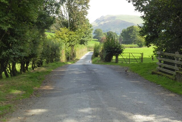
Bryn Gwyn is a prominent hill/mountain located in Montgomeryshire, Wales. It is situated in the eastern part of the county, near the border with Shropshire, England. With an elevation of approximately 475 meters (1,558 feet), Bryn Gwyn offers stunning panoramic views of the surrounding landscape.
The hill/mountain is part of the Cambrian Mountains, a range known for its rugged and unspoiled beauty. Bryn Gwyn is characterized by its steep slopes and rocky terrain, which make it a popular destination for hikers and nature enthusiasts. The hill/mountain is covered in heather and grass, providing habitat for a wide range of flora and fauna.
At the summit of Bryn Gwyn, visitors can appreciate breathtaking vistas of the rolling hills and valleys that define the Montgomeryshire region. On clear days, it is even possible to catch glimpses of the distant Snowdonia National Park to the northwest.
Access to Bryn Gwyn is relatively easy, with several footpaths and trails leading to the summit. The hill/mountain is a popular spot for outdoor activities such as walking, hiking, and birdwatching. It also attracts geologists and rock climbers due to its unique geological formations and challenging ascent routes.
Overall, Bryn Gwyn is a picturesque and captivating hill/mountain, offering visitors a chance to immerse themselves in the natural beauty of Montgomeryshire and the Cambrian Mountains.
If you have any feedback on the listing, please let us know in the comments section below.
Bryn Gwyn Images
Images are sourced within 2km of 52.805731/-3.4347023 or Grid Reference SJ0324. Thanks to Geograph Open Source API. All images are credited.


Bryn Gwyn is located at Grid Ref: SJ0324 (Lat: 52.805731, Lng: -3.4347023)
Unitary Authority: Powys
Police Authority: Dyfed Powys
What 3 Words
///dimension.headliner.crafted. Near Llangynog, Powys
Related Wikis

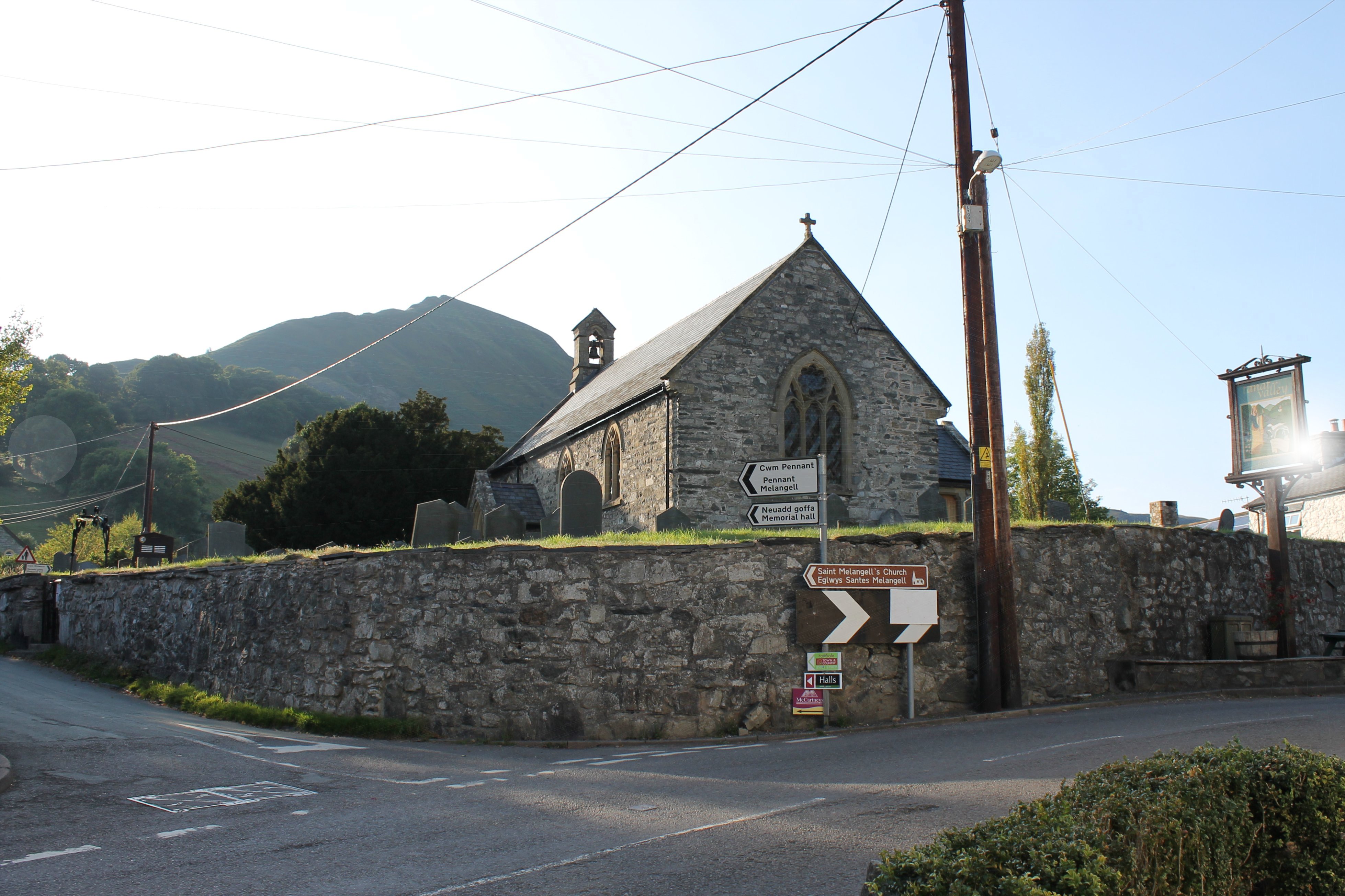
St Melangell's Church, Pennant Melangell
St Melangell's Church, Pennant Melangell, is a small church located on a minor road which joins the B4391 near the village of Llangynog, Powys, Wales....
Llangynog
Llangynog (; grid reference SJ053261) is a village and community at the confluence of the Afon Eirth and the Afon Tanat at the foot of the Berwyn range...

Llangynog railway station
Llangynog railway station was the western terminus station of the Tanat Valley Light Railway in Llangynog, Powys, Wales. The station opened in 1904, closed...
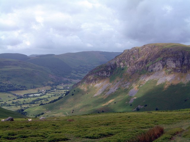
Craig Rhiwarth
Craig Rhiwarth is a mountain in the Berwyn range, in Powys (formerly Montgomeryshire), Wales, overlooking the village of Llangynog to the south. On the...
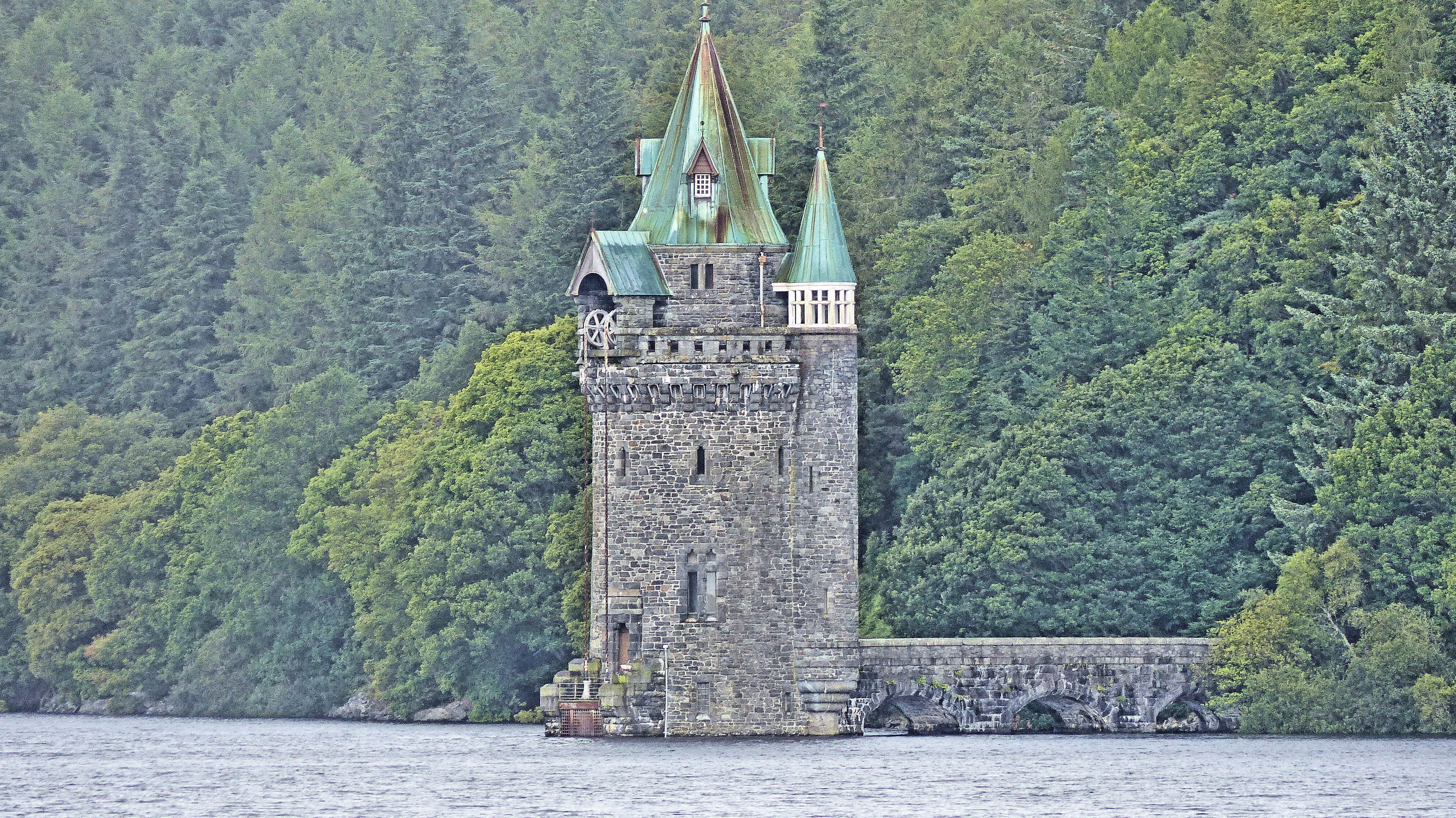
Lake Vyrnwy Straining Tower
The Straining Tower at Lake Vyrnwy is an intake tower built to extract water from the lake. The tower stands on the north shore of Lake Vyrnwy, near the...

Llanwddyn
Llanwddyn () is a village and community in Montgomeryshire, Powys, Wales. The community is centred on the Lake Vyrnwy reservoir. The original Llanwddyn...

Abertridwr, Powys
Abertridwr () is a small village in the historic county of Montgomeryshire in the north of Powys and close to Lake Vyrnwy in the community (civil parish...
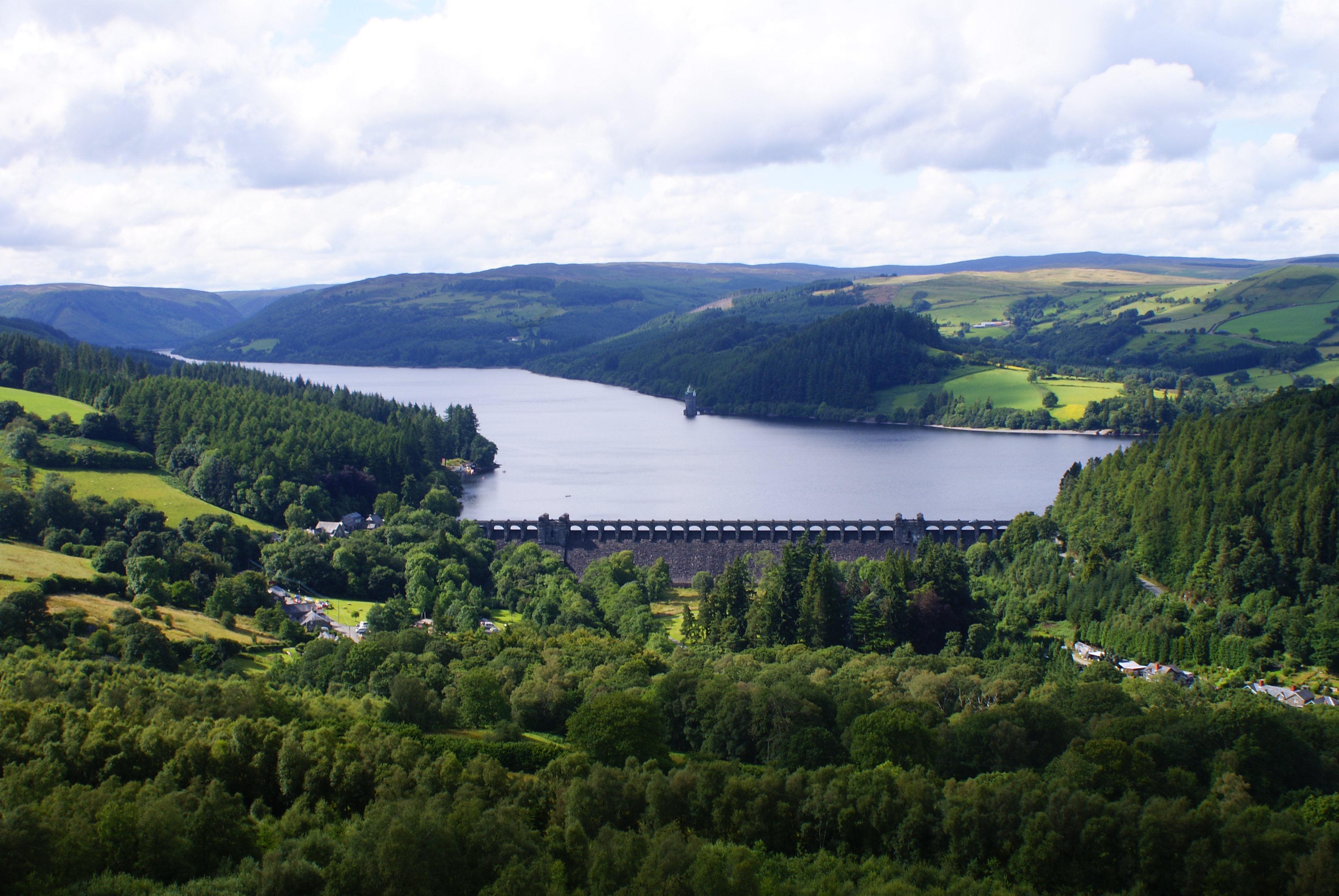
Lake Vyrnwy
Lake Vyrnwy (Welsh: Llyn Efyrnwy, pronounced [ɛˈvərnʊɨ] or Llyn Llanwddyn) is a reservoir in Powys, Wales, built in the 1880s for Liverpool Corporation...
Nearby Amenities
Located within 500m of 52.805731,-3.4347023Have you been to Bryn Gwyn?
Leave your review of Bryn Gwyn below (or comments, questions and feedback).