Allt y Moch

Hill, Mountain in Montgomeryshire

Wales

Allt y Moch

Access track and turbines on the moor In the southern part of the extensive P & L windfarm above Llandinam
Access track and turbines on the moor Credit: Richard Law

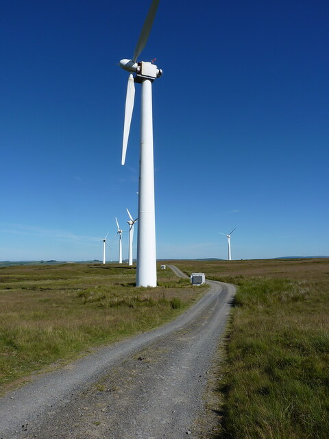
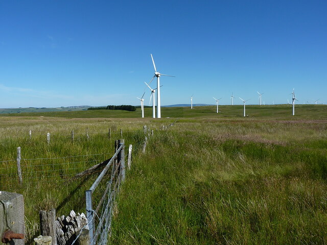
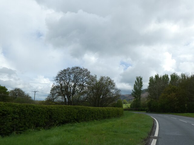
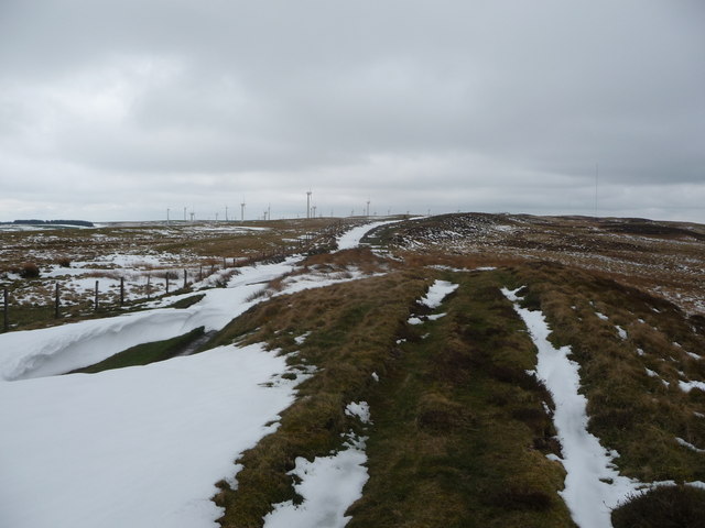
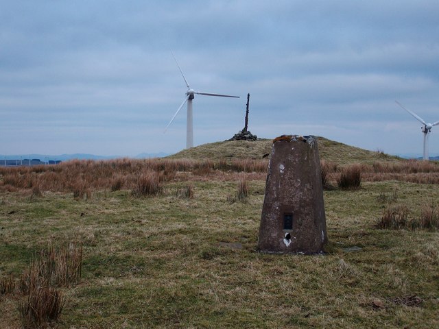
Allt y Moch is a prominent hill located in Montgomeryshire, Wales. Standing at an elevation of 480 meters (1,575 feet), it is considered a notable landmark in the region. The hill is situated approximately 3 miles northeast of the town of Montgomery and is part of the larger Clun Forest range.

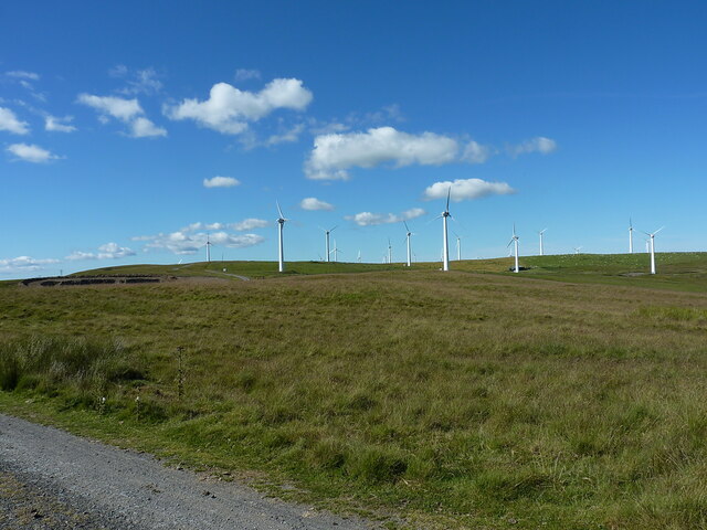
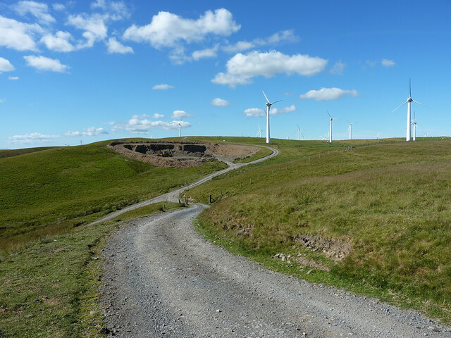
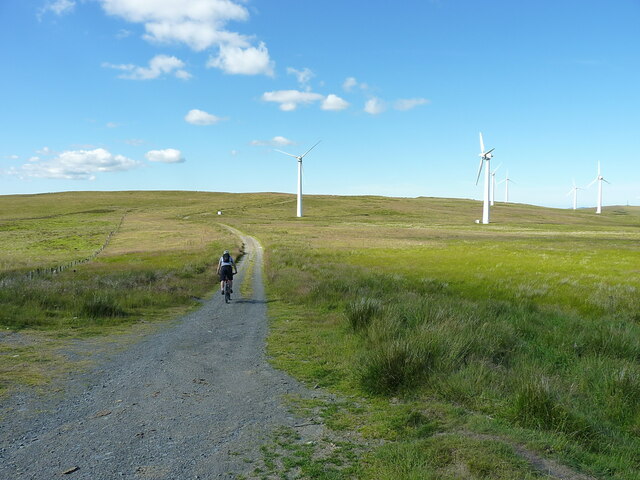
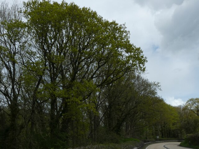
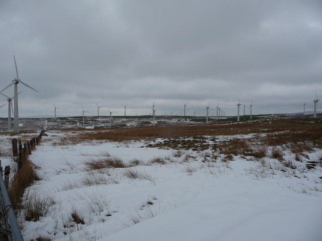
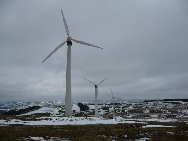
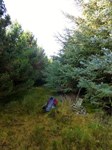
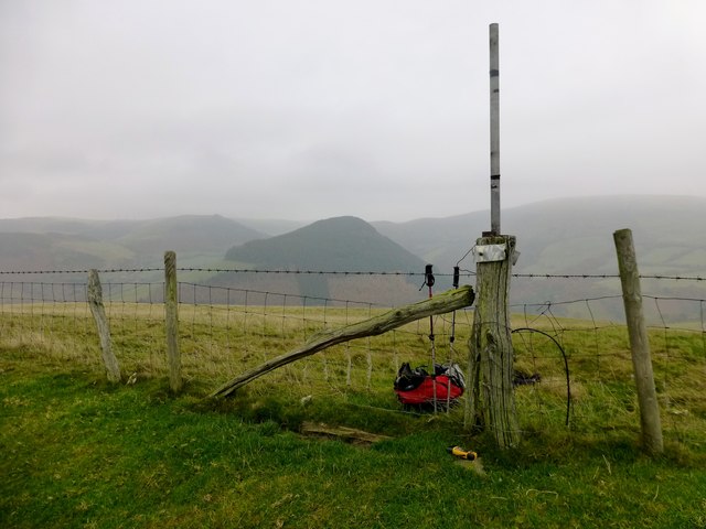
Allt y Moch offers breathtaking panoramic views of the surrounding countryside, making it a popular destination for hikers and nature enthusiasts. The hill is characterized by its gently sloping grassy terrain, which is largely devoid of trees. This open landscape allows visitors to enjoy unobstructed vistas of the rolling hills, farmland, and scattered rural settlements that stretch out below.

One of the notable features of Allt y Moch is its rich biodiversity. The hill is home to various species of flora and fauna, including a wide array of wildflowers and grasses. Birdwatchers can often spot common species such as skylarks and meadow pipits, as well as occasional sightings of raptors soaring above.

Access to Allt y Moch is facilitated by a network of footpaths and bridleways that crisscross the area, offering visitors opportunities for leisurely walks or more challenging hikes. There are also several designated viewpoints along the hill's slopes, providing ideal vantage points to admire the stunning scenery.

Overall, Allt y Moch is a stunning natural landmark that offers visitors a chance to immerse themselves in the beauty of Montgomeryshire's countryside. Whether exploring on foot or simply taking in the views, this hill is a must-visit for those seeking a tranquil and picturesque outdoor experience.

If you have any feedback on the listing, please let us know in the comments section below.

Allt y Moch Images

Images are sourced within 2km of 52.45362/-3.4405934 or Grid Reference SO0284. Thanks to Geograph Open Source API. All images are credited.

Access track and turbines on the moor In the southern part of the extensive P & L windfarm above Llandinam
Access track and turbines on the moor
In the southern part of the extensive P & L windfarm above Llandinam
View north across the moor of Waun Lluestowain The view over the moor includes much of this section of the windfarm high on the hills.
View north across the moor of Waun Lluestowain
The view over the moor includes much of this section of the windfarm high on the hills.
Large new borrow pit being created The turbines on the moor are apparently due to be replaced by fewer, but rather larger, units. This quarry-cum-borrowpit may well be supplying stone to upgrade the roadways in order to take the construction traffic for the new turbines.
Large new borrow pit being created
The turbines on the moor are apparently due to be replaced by fewer, but rather larger, units. This quarry-cum-borrowpit may well be supplying stone to upgrade the roadways in order to take the construction traffic for the new turbines.
High on the moor at the western edge of the windfarm Gravel riding along the track serving access to the turbines and infrastructure on Waun Lluestowain.
High on the moor at the western edge of the windfarm
Gravel riding along the track serving access to the turbines and infrastructure on Waun Lluestowain.
Fenceline near the northern end of the wind farm Ancient moorland, middle aged fence & posts and modern wind turbines.
Fenceline near the northern end of the wind farm
Ancient moorland, middle aged fence & posts and modern wind turbines.
A470 near Glanfeinion
A470 west of Glanfeinion
A470 entering Glanfeinion from west
A470 approaching Pen-rhuddlan Bridge
Trees lining A470 north of Pen-rhuddlan Bridge
A470 approaching Glan-Feinion Southbound A470
A470 approaching Glan-Feinion
Southbound A470
Moorland track above Yr Allt Gethin The recent April showers have fallen as snow up here and lie in drifts in places, the sort of drifts that are more often seen in the depths of winter.
Moorland track above Yr Allt Gethin
The recent April showers have fallen as snow up here and lie in drifts in places, the sort of drifts that are more often seen in the depths of winter.
Approaching the wind farm above Llandinam The wind turbines bring to mind War of the Worlds - I almost expect to see them stalk about the landscape and start trying to zap me with their lasers. 

My blood sugar level must be lower than I thought.
Approaching the wind farm above Llandinam
The wind turbines bring to mind War of the Worlds - I almost expect to see them stalk about the landscape and start trying to zap me with their lasers. My blood sugar level must be lower than I thought.
Wind turbines above Llandinam A windfarm is a confusing thing to most people; why are only half the turbines turning? do they rotate at the wind's power or by an internal motor? How much does one cost to build? How much to maintain each year? How much electricity do they contribute? Who are the operators accountable to? How many jobs do they create? Questions, questions...
Wind turbines above Llandinam
A windfarm is a confusing thing to most people; why are only half the turbines turning? do they rotate at the wind's power or by an internal motor? How much does one cost to build? How much to maintain each year? How much electricity do they contribute? Who are the operators accountable to? How many jobs do they create? Questions, questions...
Wind turbines The whirring of their motor and the whispering of their blades is unnatural up here.

Designed by an accountant aren't they.
Wind turbines
The whirring of their motor and the whispering of their blades is unnatural up here. Designed by an accountant aren't they.
A470 at Glanfeinon
A470 at Glanfeinon
Y Foel Parked easily to N. Followed track to ruined house. Then enter the forest. At point SO 01678 84331 a small path starts and goes all the way.

Name: Y Foel
Hill number: 5213
Height: 435m / 1427ft
Area: 31B: Welshpool to Hay-on-Wye
Class: Hu
Grid ref: SO 01868 84072
Summit feature: cairn with fence post
Drop: 116m
Col: 319m  SO022842
Y Foel
Parked easily to N. Followed track to ruined house. Then enter the forest. At point SO 01678 84331 a small path starts and goes all the way. Name: Y Foel Hill number: 5213 Height: 435m / 1427ft Area: 31B: Welshpool to Hay-on-Wye Class: Hu Grid ref: SO 01868 84072 Summit feature: cairn with fence post Drop: 116m Col: 319m SO022842
Coed y Gaer Coed y Gaer looking across to wooded summit of Y Foel. 

Name: Coed y Gaer
Hill number: 5223
Height: 362m / 1188ft
Area: 31B: Welshpool to Hay-on-Wye
Class: Hu
Grid ref: SO 00498 84396
Summit feature: ground beside fence
Drop: 120m
Col: 242m  SO005839
Coed y Gaer
Coed y Gaer looking across to wooded summit of Y Foel. Name: Coed y Gaer Hill number: 5223 Height: 362m / 1188ft Area: 31B: Welshpool to Hay-on-Wye Class: Hu Grid ref: SO 00498 84396 Summit feature: ground beside fence Drop: 120m Col: 242m SO005839
Show me another place!

Allt y Moch is located at Grid Ref: SO0284 (Lat: 52.45362, Lng: -3.4405934)

Unitary Authority: Powys

Police Authority: Dyfed Powys

What 3 Words

///goose.point.groomed. Near Mochdre, Powys

Nearby Locations

Allt y Moch

Related Wikis

Dolwen railway station

Dolwen railway station was a station to the southwest of Llandinam, Powys, Wales. The station was opened in 1859 and closed in 1963. The station building...

Penystrywad

Penystrywad is a village near Llandinam in Powys, central Wales, between Newtown and Llanidloes, located on the A470.

Llandinam

Llandinam () is a village and community in Montgomeryshire, Powys, central Wales, between Newtown and Llanidloes, located on the A470. As a community,...

Llandinam railway station

Llandinam railway station was a station serving Llandinam, Powys, on the Llanidloes and Newtown Railway (L&NR) line. The L&NR was authorised in August...
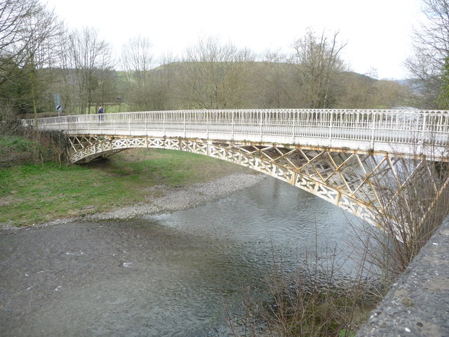
Llandinam Bridge

Llandinam Bridge (Welsh: Pont Llandinam) is a single-arch cast-iron Grade II*-listed bridge located in Llandinam, Powys, Wales. Constructed in 1846, it...

Pegwn Mawr

Pegwn Mawr is a mountain in Powys, Mid Wales, east of Llanidloes. It is 586 m (1,922 ft) high. It is surrounded by a wind farm. There is a trig point...

Broneirion

Broneirion is a Victorian house and grounds on the hillside across the River Severn from the village of Llandinam. It was built by Welsh industrialist...

Cefn Carnedd

Cefn Carnedd is an Iron Age hillfort, about 1.5 miles (2 km) south-west of Caersws, in Powys, Wales. It is a scheduled monument.It is on a hill overlooking...

Nearby Amenities

Located within 500m of 52.45362,-3.4405934
Allt-Y-Moch
Natural: peak
Lat/Long: 52.4544257/-3.443643
Building: yes
Lat/Long: 52.4564005/-3.4361125
Power: pole
Lat/Long: 52.4535459/-3.4337137
Power: pole
Lat/Long: 52.45376/-3.4348644
Power: pole
Lat/Long: 52.4539659/-3.4359829
Power: pole
Lat/Long: 52.4545037/-3.436581
Power: pole
Lat/Long: 52.4551624/-3.4373776
Power: pole
Lat/Long: 52.4558113/-3.4381018
Power: pole
Lat/Long: 52.4564626/-3.4389025
Power: pole
Lat/Long: 52.4570183/-3.4395542
Power: pole
Lat/Long: 52.4575168/-3.4401604
Power: pole
Lat/Long: 52.4580022/-3.4407237
Power: pole
Lat/Long: 52.4537253/-3.4335722
Power: pole
Lat/Long: 52.4539263/-3.4347149
Power: pole
Lat/Long: 52.4541404/-3.4358011
Power: pole
Lat/Long: 52.4545311/-3.436292
Power: pole
Lat/Long: 52.4551489/-3.436992
Power: pole
Lat/Long: 52.456025/-3.4379925
Power: pole
Lat/Long: 52.4563356/-3.4383868
Power: pole
Lat/Long: 52.4568226/-3.4389608
Power: pole
Lat/Long: 52.4572966/-3.4394329
Power: pole
Lat/Long: 52.4576709/-3.4399559
Barrier: cattle_grid
Bicycle: yes
Foot: yes
Lat/Long: 52.4509271/-3.4395592
The data included in this document is from www.openstreetmap.org. The data is made available under ODbL.

Have you been to Allt y Moch?

Leave your review of Allt y Moch below (or comments, questions and feedback).