Berry Hill

Hill, Mountain in Perthshire

Scotland

Berry Hill

Valley of the Oldie Burn Looking south-eastwards along the trench of the Ordie Burn.
Valley of the Oldie Burn Credit: Scott Cormie

Berry Hill is a prominent hill located in the scenic region of Perthshire, Scotland. With its elevation of 1,319 feet (402 meters), it offers breathtaking views of the surrounding landscape. Situated near the village of Abernyte, Berry Hill forms part of the Sidlaw Hills range, which is renowned for its natural beauty and outdoor recreational opportunities.

The hill is characterized by its gently sloping terrain, making it accessible to both experienced climbers and those seeking a leisurely hike. The ascent to the summit is relatively straightforward, with a well-marked trail that meanders through heather moorland and patches of woodland. As visitors navigate their way to the top, they are rewarded with panoramic vistas that encompass the Tay Estuary, the Carse of Gowrie, and the rolling countryside of Perthshire.

Berry Hill is also home to an abundance of wildlife, with various species of birds and mammals inhabiting the area. Birdwatchers can often spot red grouse, kestrels, and peregrine falcons soaring through the skies, while deer and hares can occasionally be seen darting across the hillside.

Due to its accessibility and natural beauty, Berry Hill is a popular destination for outdoor enthusiasts, nature lovers, and photographers alike. Visitors can enjoy picnicking, walking, or simply soaking in the tranquil atmosphere. With its picturesque surroundings and awe-inspiring vistas, Berry Hill provides an unforgettable experience for anyone seeking to explore the captivating landscapes of Perthshire.

If you have any feedback on the listing, please let us know in the comments section below.
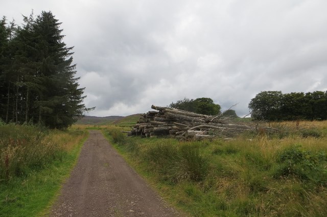
Berry Hill Images

Images are sourced within 2km of 56.501647/-3.5935773 or Grid Reference NO0235. Thanks to Geograph Open Source API. All images are credited.

Valley of the Oldie Burn Looking south-eastwards along the trench of the Ordie Burn.
Valley of the Oldie Burn
Looking south-eastwards along the trench of the Ordie Burn.
Track at Strath-head Track heading down the hill at Strath-head.
Track at Strath-head
Track heading down the hill at Strath-head.
Woodland lochan New lochan next to the track in the woodland west of The Glack.
Woodland lochan
New lochan next to the track in the woodland west of The Glack.
Potato field near Balquharn Potatoes ready for harvesting to the west of Balquharn.
Potato field near Balquharn
Potatoes ready for harvesting to the west of Balquharn.
Bales near Belstane Field of bales south of the road near Belstane.
Bales near Belstane
Field of bales south of the road near Belstane.
Road to Balquharn One of the roads radiating from Bankfoot.
Road to Balquharn
One of the roads radiating from Bankfoot.
Birchwood near Belstane An interruption to the mostly arable land around Bankfoot.
Birchwood near Belstane
An interruption to the mostly arable land around Bankfoot.
Barley near Bankfoot View towards the Highland Boundary Fault.
Barley near Bankfoot
View towards the Highland Boundary Fault.
Road to The Glack Nearing the end of the public road out of Blackfoot. An estate road continues by Loch Tullybelton to Little Glen Shee.
Road to The Glack
Nearing the end of the public road out of Blackfoot. An estate road continues by Loch Tullybelton to Little Glen Shee.
Field by The Glack View to Gibbeston near the edge of the arable farming region.  Hill country starts here.
Field by The Glack
View to Gibbeston near the edge of the arable farming region. Hill country starts here.
Road by The Glack An estate road, serving a big game shooting enterprise runs through woodland on the way to the moors.
Road by The Glack
An estate road, serving a big game shooting enterprise runs through woodland on the way to the moors.
Pond on Berry Hill A flight pool near The Glack.
Pond on Berry Hill
A flight pool near The Glack.
Estate road, The Glack A through route to Little Glen Shee.
Estate road, The Glack
A through route to Little Glen Shee.
Road, Strath Head The trees are growing along a boundary between the rough hill grazing and an improved field.
Road, Strath Head
The trees are growing along a boundary between the rough hill grazing and an improved field.
Flight pond, Berry Hill One of a series of pools on Berry Hill.
Flight pond, Berry Hill
One of a series of pools on Berry Hill.
Glack - Little Glenshee road The road, which is partly waymarked, runs past a flight pond on the way to Loch Tullybelton.
Glack - Little Glenshee road
The road, which is partly waymarked, runs past a flight pond on the way to Loch Tullybelton.
New lochan near Strath Head Only on some maps, this water is part of an obvious big investment in shooting here.
New lochan near Strath Head
Only on some maps, this water is part of an obvious big investment in shooting here.
Drum Tick There has been a lot of work done here recently setting up a shooting enterprise, or improving one. There is a complex pattern in the bracken surrounding a release pen, islands of bracken left presumably as cover for young birds.
Drum Tick
There has been a lot of work done here recently setting up a shooting enterprise, or improving one. There is a complex pattern in the bracken surrounding a release pen, islands of bracken left presumably as cover for young birds.
Show me another place!

Berry Hill is located at Grid Ref: NO0235 (Lat: 56.501647, Lng: -3.5935773)

Unitary Authority: Perth and Kinross

Police Authority: Tayside

What 3 Words

///readings.bulbs.puffed. Near Bankfoot, Perth & Kinross

Nearby Locations

Berry Hill

Related Wikis

Tullybelton

Tullybelton is a hamlet located in the Scottish county of Perth and Kinross about 8 miles (13 km) north-northeast of Perth. Ian Fraser, Baron Fraser of...

Waterloo, Perth and Kinross

Waterloo is a small hamlet in Perth and Kinross, Scotland approximately 1⁄2 mile (800 metres) north of Bankfoot on the old A9. == Etymology == Local opinion...

Bankfoot

Bankfoot is a village in Perth and Kinross, Scotland, approximately 8 miles (13 km) north of Perth and 7 miles (11 km) south of Dunkeld. Bankfoot had a...

Bankfoot railway station

Bankfoot railway station served the village of Bankfoot, Perth and Kinross, Scotland, from 1906 to 1964 on the Bankfoot Light Railway. In 1911, the registered...

Have you been to Berry Hill?

Leave your review of Berry Hill below (or comments, questions and feedback).