Horncastle

Settlement in Berkshire

England

Horncastle

Edward VII GPO cable marker on NW side of Bath Road More information about the marker can be found at <span class="nowrap"><a title="https://gpo-markers.derektp.co.uk/detail?post=576" rel="nofollow ugc noopener" href="https://gpo-markers.derektp.co.uk/detail?post=576">Link</a><img style="margin-left:2px;" alt="External link" title="External link - shift click to open in new window" src="https://s1.geograph.org.uk/img/external.png" width="10" height="10"/></span>
Edward VII GPO cable marker on NW side of Bath Road Credit: Roger Templeman

Horncastle is a small village located in the county of Berkshire, England. Situated approximately 10 miles southwest of Reading, it is known for its picturesque rural setting and charming atmosphere. Although it is a relatively small village, Horncastle offers a range of amenities and attractions to its residents and visitors.

One of the highlights of Horncastle is its stunning natural surroundings. The village is surrounded by lush green fields and rolling hills, providing ample opportunities for outdoor activities such as hiking, biking, and picnicking. Additionally, the nearby River Kennet offers beautiful spots for fishing and boating enthusiasts.

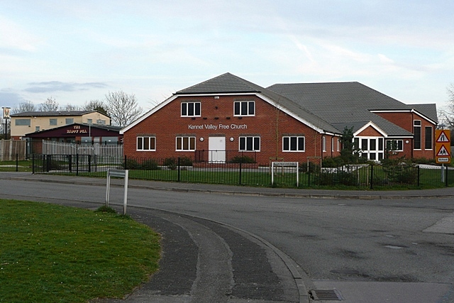
Horncastle is also home to a number of historic landmarks and buildings. The St. Michael and All Angels Church, dating back to the 12th century, is a prominent feature of the village's skyline. Its stunning architecture and rich history make it a popular destination for history buffs and architecture enthusiasts.

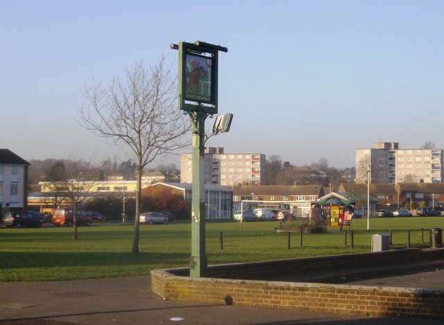
In terms of amenities, Horncastle boasts a village hall, local shops, and a cozy pub, providing residents with all the necessary conveniences. The village also has a strong sense of community and hosts various events throughout the year, including summer fairs and Christmas markets.

For those seeking a peaceful and idyllic village setting, Horncastle in Berkshire offers a perfect retreat. With its natural beauty, historic landmarks, and close-knit community, it is a place that captures the essence of rural England.

If you have any feedback on the listing, please let us know in the comments section below.

Horncastle Images

Images are sourced within 2km of 51.444796/-1.022551 or Grid Reference SU6872. Thanks to Geograph Open Source API. All images are credited.

Edward VII GPO cable marker on NW side of Bath Road More information about the marker can be found at <span class="nowrap"><a title="https://gpo-markers.derektp.co.uk/detail?post=576" rel="nofollow ugc noopener" href="https://gpo-markers.derektp.co.uk/detail?post=576">Link</a><img style="margin-left:2px;" alt="External link" title="External link - shift click to open in new window" src="https://s1.geograph.org.uk/img/external.png" width="10" height="10"/></span>
Edward VII GPO cable marker on NW side of Bath Road
More information about the marker can be found at LinkExternal link
Bath Road (A4) approaching Southcote Lane junction There is a GPO cable marker <a href="https://www.geograph.org.uk/photo/7196690">SU6972 : Edward VII GPO cable marker on NW side of Bath Road</a> located in the pavement against the wall in the left foreground of the image
Bath Road (A4) approaching Southcote Lane junction
There is a GPO cable marker SU6972 : Edward VII GPO cable marker on NW side of Bath Road located in the pavement against the wall in the left foreground of the image
Parish boundary stone on NW side of Bath Road Marking the boundary between Tilehurst and St Mary parishes
Parish boundary stone on NW side of Bath Road
Marking the boundary between Tilehurst and St Mary parishes
Bath Road (A4) approaching Liebenrood Road junction There is a parish boundary stone <a href="https://www.geograph.org.uk/photo/7197643">SU6972 : Parish boundary stone on NW side of Bath Road</a> on the pavement against the wall at the right hand side of the image. The face towards the camera shows Parish of St Mary
Bath Road (A4) approaching Liebenrood Road junction
There is a parish boundary stone SU6972 : Parish boundary stone on NW side of Bath Road on the pavement against the wall at the right hand side of the image. The face towards the camera shows Parish of St Mary
Parish of Tilehurst face of boundary stone on north side of Bath Road Other photos of the stone may be found at <a href="https://www.geograph.org.uk/photo/7197643">SU6972 : Parish boundary stone on NW side of Bath Road</a> and <a href="https://www.geograph.org.uk/photo/7197664">SU6972 : Bath Road (A4) approaching Liebenrood Road junction</a>
Parish of Tilehurst face of boundary stone on north side of Bath Road
Entrance road (East Drive) to Calcot Park Golf Club off Bath Road
Honey End Lane passing Prospect Park
Milepost on north side of A4 outside Prospect Park The post indicates London 41, Reading 2, Newbury 15
Milepost on north side of A4 outside Prospect Park
The post indicates London 41, Reading 2, Newbury 15
#76 Bath Road at Parkside Drive junction
Welcome vets, north side Bath Road at New Lane Hill junction
View towards Bath Road from Hogarth Avenue / Pentland Close junction
Prospect Park on north side of Bath Road
Berkshire Healthcare NHS Foundation Trust
Bath Road (A4) Towards Newbury.
Bath Road (A4)
Towards Newbury.
Prospect Park Public park in the western suburbs of Reading.
Looking very dry after recent high temperatrures.
Prospect Park
Public park in the western suburbs of Reading. Looking very dry after recent high temperatrures.
Houses on Waverley Road, Reading
Houses on Wantage Road, Reading
Waverley Road, Reading In the western suburbs.
Waverley Road, Reading
In the western suburbs.
Show me another place!

Horncastle is located at Grid Ref: SU6872 (Lat: 51.444796, Lng: -1.022551)

Unitary Authority: Reading

Police Authority: Thames Valley

What 3 Words

///path.spicy.zoom. Near Tilehurst, Berkshire

Nearby Locations

The Rookery Horncastle

Related Wikis

King's Academy Prospect

King's Academy Prospect is a coeducational secondary school and sixth form located in West Reading, Berkshire, England. == History == Stoneham Secondary...

Fords Farm

Fords Farm is a suburb in West Berkshire, west of Reading. Overall, it is in the Royal County of Berkshire in England. Fords Farm lies south of the Bath...

Calcot Park

Calcot Park is a country house, estate, and golf club in the English county of Berkshire. It is situated between Calcot and Tilehurst, suburbs of the town...

Southcote, Berkshire

Southcote ( ) is a suburb of Reading in the English county of Berkshire. Located to the south-west of Reading town centre, Southcote has a population of...

Nearby Amenities

Located within 500m of 51.444796,-1.022551
Mini Roundabout
Direction: clockwise
Lat/Long: 51.4415893/-1.0262001
Crossing
Man Made: manhole
Lat/Long: 51.4428081/-1.0252668
Noexit: yes
Lat/Long: 51.4434759/-1.0276062
Traffic Signals
Traffic Signals Direction: backward
Lat/Long: 51.4422762/-1.0191658
Traffic Calming: hump
Lat/Long: 51.4446894/-1.0222986
Traffic Calming: table
Lat/Long: 51.4482118/-1.0250749
Surface: asphalt
Traffic Calming: table
Lat/Long: 51.4480294/-1.0203732
Noexit: yes
Lat/Long: 51.444473/-1.0240208
Crossing
Crossing: unmarked
Crossing Markings: no
Kerb: lowered
Lat/Long: 51.4420994/-1.0256883
Barrier: bollard
Bicycle: yes
Foot: yes
Lat/Long: 51.4426493/-1.0223138
Barrier: bollard
Bicycle: yes
Foot: yes
Lat/Long: 51.4426367/-1.0214309
Barrier: bollard
Bicycle: yes
Foot: yes
Lat/Long: 51.4438566/-1.0219503
Barrier: cycle_barrier
Lat/Long: 51.4442258/-1.0221867
Barrier: cycle_barrier
Lat/Long: 51.4434313/-1.023437
Crossing
Bicycle: yes
Crossing: unmarked
Crossing Island: yes
Crossing Markings: no
Kerb: lowered
Tactile Paving: yes
Lat/Long: 51.4443985/-1.0234516
Barrier: cycle_barrier
Cycle Barrier: double
Lat/Long: 51.4442888/-1.0234815
Crossing
Crossing: uncontrolled
Crossing Ref: zebra
Lat/Long: 51.4440747/-1.0235762
Crossing
Crossing: uncontrolled
Crossing Ref: zebra
Lat/Long: 51.4440606/-1.0237172
Crossing
Crossing: uncontrolled
Crossing Ref: zebra
Lat/Long: 51.4441723/-1.023827
Turning Circle
Turning Circle: square
Lat/Long: 51.444772/-1.0199931
Barrier: sump_buster
Lat/Long: 51.4419897/-1.0249219
Barrier: cycle_barrier
Lat/Long: 51.441027/-1.0241206
Bus Stop
Honey End Lane
Bench: yes
Bin: yes
Bus: yes
Mapillary: 576462479987488
Naptan AtcoCode: 039026380002
Naptan NaptanCode: rdgawja
Public Transport: platform
Route Ref: 1;2;2a;28
Shelter: yes
Source: survey
Survey Date: 2021-04-14
Lat/Long: 51.4447665/-1.0153502
Speed Camera
Direction: 90
Lat/Long: 51.4427402/-1.0172032
Bus Stop
Ashampstead Road
Bench: yes
Bin: yes
Bus: yes
Naptan AtcoCode: 039025090001
Naptan NaptanCode: rdgadpm
Public Transport: platform
Shelter: yes
Source: survey
Tactile Paving: no
Lat/Long: 51.4427208/-1.0179012
Bus Stop
Ashampstead Road
Bench: no
Bin: yes
Bus: yes
Naptan AtcoCode: 039025090002
Naptan NaptanCode: rdgadpt
Public Transport: platform
Shelter: no
Source: survey
Tactile Paving: no
Lat/Long: 51.4426422/-1.0181297
Bus Stop
Prospect College
Bus: yes
Naptan AtcoCode: 039026990002
Naptan NaptanCode: rdgdjad
Public Transport: platform
Shelter: no
Source: survey
Tactile Paving: no
Lat/Long: 51.4467473/-1.016085
Bus Stop
Dwyer Road Boundary
Bench: no
Bin: no
Bus: yes
Mapillary: 462939918134467
Naptan AtcoCode: 039025950001
Naptan NaptanCode: rdgapjg
Network: Reading buses
Public Transport: platform
Shelter: no
Source: survey
Survey Date: 2020-01-11
Tactile Paving: yes
Lat/Long: 51.4418491/-1.0216521
Bus Stop
Swanholm Gardens
Bench: no
Bin: no
Bus: yes
Mapillary: 499972117796429
Naptan AtcoCode: 030055830001
Naptan NaptanCode: brkdmpg
Public Transport: platform
Shelter: no
Source: survey
Survey Date: 2019-05-28
Timetable: realtime
Lat/Long: 51.4421431/-1.0259966
Bench
Backrest: yes
Check Date: 2021-10-24
Lat/Long: 51.4414556/-1.0190584
Bus Stop
Dwyer Road
Bench: no
Bin: no
Bus: yes
Naptan AtcoCode: 039025940002
Naptan Bearing: S
Naptan CommonName: Dwyer Road
Naptan Indicator: Opp
Naptan NaptanCode: rdgapjd
Naptan PlusbusZoneRef: RDNGSTN
Naptan Street: Burghfield Road
Naptan Verified: no
Public Transport: platform
Shelter: no
Source: survey
Tactile Paving: no
Lat/Long: 51.4412609/-1.0185946
Bus Stop
Holybrook Crescent
Bench: yes
Bin: yes
Bus: yes
Mapillary: 320848026101458
Naptan AtcoCode: 039026370001
Naptan NaptanCode: rdgawgp
Public Transport: platform
Shelter: no
Source: survey
Survey Date: 2020-01-11
Tactile Paving: yes
Lat/Long: 51.4414346/-1.020023
Post Box
Collection Times: Mo-Fr 09:00, Sa 07:00
Drive Through: no
Ref: RG30 58D
Royal Cypher: VR
Royal Cypher Wikidata: Q33102356
Lat/Long: 51.4444065/-1.018171
Bus Stop
Swanholm Gardens
Bench: no
Bin: no
Bus: yes
Naptan AtcoCode: 030055830002
Naptan NaptanCode: brkdmpj
Public Transport: platform
Shelter: no
Source: survey
Lat/Long: 51.4420598/-1.026079
Recycling
Recycling Glass: yes
Lat/Long: 51.4443563/-1.0207103
Bus Stop
Holybrook Crescent
Bench: yes
Bin: yes
Bus: yes
Naptan AtcoCode: 039026370002
Naptan NaptanCode: rdgawgt
Public Transport: platform
Shelter: yes
Source: survey
Tactile Paving: no
Lat/Long: 51.4414882/-1.0198667
Speed Camera
Direction: 160
Maxspeed: 30 mph
Lat/Long: 51.4416298/-1.0188207
Bus Stop
Dwyer Road Boundary
Bench: yes
Bin: yes
Bus: yes
Mapillary: 1123872238113508
Naptan AtcoCode: 039025950002
Naptan NaptanCode: rdgapjm
Public Transport: platform
Route Ref: 26
Shelter: yes
Source: survey
Survey Date: 2020-01-11
Tactile Paving: yes
Lat/Long: 51.4420759/-1.0220905
Bus Stop
Bath Road / Burghfield Road
Bench: no
Bin: no
Bus: yes
Lit: yes
Naptan AtcoCode: 039025140002
Naptan NaptanCode: rdgadwd
Public Transport: platform
Route Ref: 1;28
Shelter: no
Source: survey
Tactile Paving: yes
Lat/Long: 51.4443839/-1.0183026
Post Box
Collection Times: Mo-Fr 07:00, Sa 09:00
Mapillary: 461604655139176
Operator: Royal Mail
Operator Wikidata: Q638098
Post Box Type: pillar
Ref: RG30 583D
Royal Cypher: EIIR
Royal Cypher Wikidata: Q33102113
Survey Date: 2020-01-11
Lat/Long: 51.4414882/-1.0202657
Bench
Backrest: yes
Lat/Long: 51.4420182/-1.0261145
Bus Stop
Bath Road / Burghfield Road
Bench: no
Bin: yes
Bus: yes
Naptan AtcoCode: 039025140003
Naptan Bearing: W
Naptan CommonName: Burghfield Road
Naptan Indicator: W-bound
Naptan NaptanCode: rdgadwg
Naptan PlusbusZoneRef: RDNGSTN
Naptan Street: Bath Road
Naptan Verified: no
Public Transport: platform
Route Ref: 1;28
Shelter: no
Source: survey
Lat/Long: 51.4441562/-1.0204163
Access: private
Entrance: staircase
Lat/Long: 51.4440573/-1.0230504
Bus Stop
Greenwood Road
Bus: yes
Naptan AtcoCode: 030052690001
Naptan NaptanCode: brkgtaj
Public Transport: platform
Route Ref: 1
Shelter: no
Source: survey
Lat/Long: 51.4437803/-1.0275212
Bus Stop
Greenwood Road
Bench: no
Bin: no
Bus: yes
Mapillary: 302204578014637
Naptan AtcoCode: 030052690002
Naptan NaptanCode: brkgtam
Public Transport: platform
Route Ref: 1
Shelter: no
Source: survey
Survey Date: 2019-04-26
Lat/Long: 51.4439316/-1.027627
Bus Stop
Horncastle
Bench: no
Bin: yes
Bus: yes
Lit: yes
Naptan AtcoCode: 039026390001
Naptan Bearing: E
Naptan CommonName: Horncastle
Naptan Indicator: Adj
Naptan NaptanCode: rdgawjd
Naptan PlusbusZoneRef: RDNGSTN
Naptan Street: Bath Road
Naptan Verified: no
Public Transport: platform
Route Ref: 1;N26;78
Shelter: no
Source: survey
Tactile Paving: yes
Lat/Long: 51.4443774/-1.0241304
Bus Stop
Dwyer Road
Bench: no
Bin: yes
Bus: yes
Naptan AtcoCode: 039025940001
Naptan NaptanCode: rdgapja
Public Transport: platform
Shelter: no
Source: survey
Tactile Paving: no
Lat/Long: 51.4413719/-1.0188201
Bus Stop
Lingholm Close
Bus: yes
Naptan AtcoCode: 030053700001
Naptan NaptanCode: brkmaga
Public Transport: platform
Route Ref: 28
Shelter: no
Source: survey
Lat/Long: 51.4467121/-1.0288619
Bus Stop
Lingholm Close
Bus: yes
Public Transport: platform
Route Ref: 28
Shelter: no
Source: survey
Lat/Long: 51.4466261/-1.0281777
Bus Stop
Haywood Way
Bench: no
Bin: no
Bus: yes
Mapillary: 188311226488612
Naptan AtcoCode: 039026280001
Naptan NaptanCode: rdgawad
Public Transport: platform
Route Ref: 28
Shelter: no
Source: survey
Survey Date: 2020-05-25
Lat/Long: 51.4454723/-1.0249911
Haywood Way
Bench: no
Note: not in service?
Route Ref: 28
Shelter: no
Source: survey
Was Highway: bus_stop
Lat/Long: 51.4452933/-1.0239601
Old Name: Horncastle
Route Ref: 1;N26;78
Source: survey
Was Highway: bus_stop
Lat/Long: 51.4441857/-1.0243064
Entrance: main
Lat/Long: 51.4440914/-1.0247785
Entrance: main
Lat/Long: 51.4432008/-1.0277934
Noexit: yes
Lat/Long: 51.4432547/-1.0249418
Traffic Signals
Traffic Signals Direction: backward
Lat/Long: 51.4445658/-1.0222375
Crossing
Bicycle: yes
Button Operated: yes
Crossing: traffic_signals
Crossing Island: yes
Crossing Ref: toucan
Kerb: lowered
Tactile Paving: yes
Traffic Signals Sound: no
Traffic Signals Vibration: yes
Lat/Long: 51.444483/-1.022233
Barrier: bollard
Bicycle: yes
Bollard: foldable
Foot: yes
Height: 1
Lit: no
Material: metal
Motor Vehicle: no
Lat/Long: 51.4452565/-1.0260211
Crossing
Bicycle: yes
Crossing: unmarked
Crossing Markings: no
Kerb: lowered
Lat/Long: 51.4443886/-1.01822
Barrier: bollard
Lat/Long: 51.444615/-1.0167316
Barrier: kerb
Kerb: flush
Tactile Paving: no
Lat/Long: 51.4443831/-1.0182647
Barrier: kerb
Kerb: flush
Tactile Paving: no
Lat/Long: 51.4443968/-1.0181524
Crossing
Crossing: unmarked
Crossing Island: no
Crossing Markings: no
Kerb: lowered
Tactile Paving: yes
Lat/Long: 51.4442842/-1.0178698
Crossing
Bicycle: yes
Crossing: unmarked
Crossing Markings: no
Kerb: lowered
Tactile Paving: yes
Lat/Long: 51.4446244/-1.0166805
Crossing
Bicycle: yes
Crossing: unmarked
Crossing Markings: no
Kerb: lowered
Lat/Long: 51.4444206/-1.0179711
Crossing
Bicycle: yes
Crossing: unmarked
Crossing Markings: no
Kerb: lowered
Lat/Long: 51.4442573/-1.0192405
Barrier: kerb
Kerb: lowered
Tactile Paving: yes
Lat/Long: 51.4445191/-1.0172761
Crossing
Crossing: unmarked
Crossing Markings: no
Tactile Paving: yes
Lat/Long: 51.4468465/-1.0161462
Barrier: kerb
Kerb: lowered
Tactile Paving: yes
Lat/Long: 51.4423239/-1.0190822
Crossing
Crossing: unmarked
Crossing Markings: no
Kerb: lowered
Lat/Long: 51.4434822/-1.019255
Traffic Signals
Traffic Signals Direction: forward
Lat/Long: 51.4423595/-1.0191791
Barrier: kerb
Kerb: lowered
Tactile Paving: no
Lat/Long: 51.442651/-1.0190147
Crossing
Button Operated: yes
Crossing: traffic_signals
Crossing Island: yes
Crossing Signals: yes
Crossing Ref: pelican
Kerb: lowered
Tactile Paving: yes
Traffic Signals Sound: yes
Traffic Signals Vibration: yes
Lat/Long: 51.4423195/-1.019173
Crossing
Crossing: unmarked
Crossing Island: yes
Crossing Markings: no
Kerb: lowered
Tactile Paving: no
Lat/Long: 51.4425911/-1.0190271
Crossing
Crossing: unmarked
Crossing Island: yes
Crossing Markings: no
Kerb: lowered
Tactile Paving: no
Lat/Long: 51.4415139/-1.0190023
Barrier: kerb
Kerb: lowered
Tactile Paving: no
Lat/Long: 51.4415896/-1.0190158
Barrier: kerb
Kerb: lowered
Tactile Paving: yes
Lat/Long: 51.4443514/-1.0211616
Crossing
Bicycle: yes
Crossing Island: yes
Kerb: lowered
Lat/Long: 51.444302/-1.0206323
Crossing
Crossing: unmarked
Crossing Markings: no
Kerb: lowered
Lat/Long: 51.4443069/-1.0236466
Barrier: kerb
Kerb: lowered
Tactile Paving: yes
Lat/Long: 51.4443364/-1.0210194
Crossing
Bicycle: yes
Crossing: unmarked
Crossing Island: no
Crossing Markings: no
Kerb: lowered
Tactile Paving: yes
Lat/Long: 51.4443471/-1.0211008
Bench
Backrest: yes
Lat/Long: 51.4414091/-1.0201049
Crossing
Crossing: unmarked
Crossing Markings: no
Kerb: lowered
Lat/Long: 51.4420803/-1.0261346
Crossing
Crossing: unmarked
Crossing Markings: no
Kerb: lowered
Lat/Long: 51.4418707/-1.0262193
Defibrillator
Emergency: defibrillator
Indoor: no
Lat/Long: 51.441558/-1.0256469
Traffic Calming: hump
Lat/Long: 51.4478051/-1.0194209
Addr City: Reading
Addr Housenumber: 2
Addr Street: Lingholm Close
Lat/Long: 51.4465157/-1.0267838
Addr City: Reading
Addr Housenumber: 4
Addr Postcode: RG30 4JS
Addr Street: Lingholm Close
Lat/Long: 51.4465492/-1.0266854
Waste Basket
Lat/Long: 51.4449695/-1.0258174
Waste Basket
Lat/Long: 51.4448174/-1.0259626
Crossing
Bicycle: yes
Crossing: unmarked
Crossing Markings: no
Kerb: lowered
Lat/Long: 51.4440273/-1.0271048
Crossing
Crossing: unmarked
Crossing Island: no
Crossing Markings: no
Kerb: lowered
Lat/Long: 51.4443066/-1.0247855
Crossing
Crossing: unmarked
Crossing Markings: no
Kerb: lowered
Lat/Long: 51.4440493/-1.0267316
Barrier: kerb
Kerb: lowered
Tactile Paving: yes
Lat/Long: 51.4442841/-1.0249257
Barrier: kerb
Kerb: lowered
Tactile Paving: yes
Lat/Long: 51.4444295/-1.0179033
Crossing
Crossing: unmarked
Crossing Markings: no
Kerb: lowered
Lat/Long: 51.4448014/-1.0225868
Barrier: kerb
Kerb: lowered
Tactile Paving: yes
Lat/Long: 51.4444144/-1.0180181
Crossing
Crossing: unmarked
Crossing Markings: no
Kerb: lowered
Lat/Long: 51.444801/-1.022291
Horncastle Mini Market
Addr Housenumber: 3
Addr Postcode: RG30 4JE
Addr Street: New Lane Hill
Disused Shop: convenience
Fhrs Id: 434453
Lat/Long: 51.4443746/-1.0253418
Barrier: bollard
Lat/Long: 51.4468849/-1.0234023
Direction: both
Surface: asphalt
Traffic Calming: hump
Lat/Long: 51.4467338/-1.028783
Traffic Calming: hump
Lat/Long: 51.4463998/-1.0278596
Crossing
Crossing: unmarked
Crossing Markings: no
Kerb: lowered
Lat/Long: 51.444476/-1.0175668
Traffic Calming: hump
Lat/Long: 51.4459537/-1.0265504
Traffic Calming: hump
Lat/Long: 51.4461942/-1.027269
Traffic Calming: bump
Lat/Long: 51.4480871/-1.022198
Traffic Calming: hump
Lat/Long: 51.4479948/-1.0185029
Entrance: main
Lat/Long: 51.444033/-1.0238325
Crossing
Crossing Island: yes
Lat/Long: 51.4442796/-1.0243842
Crossing
Crossing: uncontrolled
Tactile Paving: yes
Lat/Long: 51.4441372/-1.0249646
Squires Design
Addr Housenumber: 1
Addr Street: New Lane Hill
Craft: signmaker
Email: sales@squiresdesign.co.uk
Office: company
Opening Hours: Mo-Su “by appointment”
Lat/Long: 51.4443415/-1.0253031
Traffic Calming: hump
Lat/Long: 51.445483/-1.0248159
Traffic Calming: hump
Lat/Long: 51.4457495/-1.025825
Crossing
Crossing: unmarked
Crossing Island: no
Crossing Markings: no
Tactile Paving: no
Lat/Long: 51.4463784/-1.0275228
Traffic Calming: hump
Lat/Long: 51.4452195/-1.0238363
Bicycle Parking
Access: yes
Bicycle Parking: stands
Capacity: 10
Covered: yes
Lat/Long: 51.4438405/-1.02497
Post Box
Brand: Royal Mail
Brand Wikidata: Q638098
Check Date Collection Times: 2022-01-30
Collection Times: Mo-Fr 09:00; Sa 07:00
Drive Through: no
Mapillary: 2824267224555187
Operator: Royal Mail
Operator Wikidata: Q638098
Post Box Mounting: brick_pillar
Post Box Type: wall
Ref: RG30 388D
Royal Cypher: EIIR
Royal Cypher Wikidata: Q33102113
Lat/Long: 51.4444017/-1.0250403
Waste Basket
Lat/Long: 51.444342/-1.0206733
Entrance: yes
Lat/Long: 51.4442991/-1.0199588
Entrance: yes
Lat/Long: 51.4443483/-1.0201792
Waste Basket
Lat/Long: 51.4446745/-1.0164312
Man Made: mast
Lat/Long: 51.4440277/-1.0254736
Man Made: street_cabinet
Power: substation
Lat/Long: 51.4440075/-1.0254481
Waste Basket
Lat/Long: 51.4443864/-1.0241087
Crossing
Crossing Island: no
Kerb: lowered
Tactile Paving: no
Lat/Long: 51.4458173/-1.0263604
Barrier: kerb
Kerb: lowered
Tactile Paving: yes
Lat/Long: 51.4444655/-1.0176376
Barrier: kerb
Kerb: lowered
Tactile Paving: yes
Lat/Long: 51.4444847/-1.0175079
Barrier: kerb
Kerb: flush
Tactile Paving: yes
Lat/Long: 51.4443219/-1.0246904
Give Way
Direction: forward
Lat/Long: 51.4442914/-1.0247346
Addr Housenumber: 8
Addr Street: Lingholm Close
Lat/Long: 51.4465915/-1.0263864
Addr City: Reading
Addr Housenumber: 6
Addr Street: Lingholm Close
Lat/Long: 51.4465765/-1.0264707
Addr Housenumber: 10
Addr Street: Lingholm Close
Lat/Long: 51.4466088/-1.0261134
Addr Housenumber: 12
Addr Street: Lingholm Close
Lat/Long: 51.4466018/-1.0259631
Waste Basket
Lat/Long: 51.4445965/-1.0175944
Waste Basket
Lat/Long: 51.4445778/-1.0211201
Capital Tyres
Check Date: 2023-03-21
Service Vehicle Tyres: yes
Service Vehicle Wheels: yes
Shop: car_repair
Lat/Long: 51.4449479/-1.0178791
Shop: car_parts
Lat/Long: 51.4447456/-1.0180658
Man Made: street_cabinet
Lat/Long: 51.4442499/-1.02231
Barrier: cycle_barrier
Lat/Long: 51.4441358/-1.0214815
Waste Basket
Lat/Long: 51.444136/-1.0204652
Barrier: bollard
Lat/Long: 51.4453945/-1.0247705
Addr Housenumber: 7
Addr Street: New Lane Hill
Lat/Long: 51.4444377/-1.0254014
Addr Housenumber: 9
Addr Street: New Lane Hill
Lat/Long: 51.4444794/-1.0254223
Addr Housename: Horncastle Cottages
Addr Housenumber: 2
Lat/Long: 51.4447622/-1.0252434
Addr Housename: Horncastle Cottages
Addr Housenumber: 1
Lat/Long: 51.4446944/-1.0251722
Waste Basket
Lat/Long: 51.4480748/-1.0178249
Waste Basket
Lat/Long: 51.4479842/-1.0222786
Waste Basket
Lat/Long: 51.447946/-1.0193938
Barrier: bollard
Lat/Long: 51.4480494/-1.0222545
Waste Basket
Lat/Long: 51.4479697/-1.0183178
Waste Basket
Lat/Long: 51.4480994/-1.0203268
Addr Housenumber: 3
Addr Street: Lingholm Close
Lat/Long: 51.4467817/-1.027216
Crossing
Crossing: unmarked
Crossing Markings: no
Kerb: lowered
Tactile Paving: no
Lat/Long: 51.4457107/-1.0254591
Addr Housenumber: 25
Lat/Long: 51.4452687/-1.0247195
Man Made: street_cabinet
Telecom: connection_point
Lat/Long: 51.4463886/-1.0273971
Traffic Calming: hump
Lat/Long: 51.4449557/-1.022844
Addr Housenumber: 17
Addr Postcode: RG30 4QW
Lat/Long: 51.4451249/-1.0242417
Addr Housenumber: 15
Addr Postcode: RG30 4QW
Lat/Long: 51.4450815/-1.0241088
Man Made: street_cabinet
Lat/Long: 51.4440835/-1.0188684
Entrance: yes
Lat/Long: 51.4446275/-1.0175765
Entrance: yes
Lat/Long: 51.4470608/-1.0171069
Man Made: mast
Note: Meteo
Tower Type: observation
Lat/Long: 51.444109/-1.0188376
Waste Basket
Lat/Long: 51.4440732/-1.0189014
Traffic Calming: hump
Lat/Long: 51.4459167/-1.0155905
Waste Basket
Lat/Long: 51.442769/-1.0192832
Post Box
Collection Times: Mo-Fr 09:00, Sa 07:00
Drive Through: no
Ref: RG30 494D
Royal Cypher: EIIR
Royal Cypher Wikidata: Q33102113
Lat/Long: 51.4426151/-1.0178236
Crossing
Crossing: unmarked
Crossing Island: yes
Crossing Markings: no
Tactile Paving: no
Lat/Long: 51.4426818/-1.0177417
Crossing
Crossing: unmarked
Crossing Island: yes
Crossing Markings: no
Tactile Paving: no
Lat/Long: 51.4426932/-1.0173865
Addr Housenumber: 301
Addr Street: Southcote Lane
Lat/Long: 51.4424822/-1.0169263
Man Made: street_cabinet
Lat/Long: 51.4434318/-1.0192287
Parking
Access: permissive
Fee: no
Parking: surface
Lat/Long: 51.4437427/-1.022255
Access: private
Addr Flats: 56-69
Entrance: yes
Lat/Long: 51.4439765/-1.0231954
Bicycle Parking
Bicycle Parking: stands
Capacity: 8
Covered: yes
Note: partial cover
Lat/Long: 51.4439048/-1.0237801
Recycling
Recycling Clothes: yes
Recycling Type: container
Lat/Long: 51.4443932/-1.020735
Crossing
Kerb: flush
Tactile Paving: yes
Lat/Long: 51.4445298/-1.0172187
Man Made: street_cabinet
Lat/Long: 51.444668/-1.0165416
Atm
Check Date: 2021-07-04
Drive Through: no
Lat/Long: 51.4446907/-1.0175976
Operator: Scottish and Southern Electricity Networks
Operator Wikidata: Q43080530
Power: substation
Ref: 2425210
Lat/Long: 51.4457606/-1.0243728
Addr Housenumber: 11
Lat/Long: 51.4465/-1.0237371
Addr Housenumber: 34
Lat/Long: 51.4455098/-1.0243771
Man Made: street_cabinet
Lat/Long: 51.4461408/-1.0237569
Addr Housenumber: 5
Lat/Long: 51.4460195/-1.0240177
Man Made: manhole
Manhole: drain
Lat/Long: 51.4461627/-1.0270897
Content: fuel
Covered: yes
Layer: -1
Man Made: storage_tank
Lat/Long: 51.4445693/-1.0179833
Man Made: manhole
Manhole: drain
Lat/Long: 51.4453749/-1.0242206
Man Made: manhole
Manhole: drain
Lat/Long: 51.4457631/-1.0258661
Compressed Air
Fee: yes
Lat/Long: 51.4446069/-1.0181372
Man Made: street_cabinet
Power: yes
Lat/Long: 51.4444622/-1.0220117
Addr Housenumber: 38
Lat/Long: 51.4455752/-1.0245807
Toilets
Access: customers
Changing Table: yes
Operator: Lidl
Toilets Disposal: flush
Unisex: yes
Wheelchair: yes
Lat/Long: 51.4440496/-1.0247151
Manhole: yes
Lat/Long: 51.4461626/-1.0271851
Man Made: manhole
Manhole: drain
Lat/Long: 51.4454051/-1.0242876
Information: guidepost
Tourism: information
Lat/Long: 51.4444781/-1.022041
Waste Basket
Lat/Long: 51.4448395/-1.0256426
Crossing
Bicycle: yes
Crossing: traffic_signals
Crossing Ref: toucan
Kerb: lowered
Lat/Long: 51.4440372/-1.0192042
Crossing
Bicycle: yes
Crossing: traffic_signals
Crossing Ref: toucan
Kerb: lowered
Lat/Long: 51.4440671/-1.0190642
Traffic Signals
Traffic Signals Direction: forward
Lat/Long: 51.4440039/-1.0191952
Enforcement: junction
Lat/Long: 51.4442292/-1.0191017
Crossing
Crossing: unmarked
Crossing Island: yes
Crossing Markings: no
Kerb: lowered
Tactile Paving: yes
Lat/Long: 51.4444069/-1.0177762
Crossing
Bicycle: yes
Crossing: traffic_signals
Crossing Ref: toucan
Kerb: lowered
Lat/Long: 51.4442133/-1.0194742
Crossing
Crossing: unmarked
Crossing Island: yes
Crossing Markings: no
Kerb: lowered
Tactile Paving: yes
Lat/Long: 51.4443484/-1.0177532
Traffic Signals
Traffic Signals Direction: forward
Lat/Long: 51.4441999/-1.0188371
Crossing
Bicycle: yes
Crossing: traffic_signals
Crossing Ref: toucan
Kerb: lowered
Lat/Long: 51.4441441/-1.0194693
Traffic Signals
Traffic Signals Direction: forward
Lat/Long: 51.4444284/-1.022619
Traffic Signals
Traffic Signals Direction: forward
Lat/Long: 51.4443212/-1.0220396
Traffic Signals
Traffic Signals Direction: forward
Lat/Long: 51.4442133/-1.019547
Crossing
Bicycle: yes
Button Operated: yes
Crossing: traffic_signals
Crossing Ref: toucan
Kerb: lowered
Tactile Paving: yes
Traffic Signals Sound: no
Traffic Signals Vibration: yes
Lat/Long: 51.4444252/-1.0225361
Crossing
Bicycle: yes
Button Operated: yes
Crossing: traffic_signals
Crossing Ref: toucan
Kerb: lowered
Tactile Paving: yes
Traffic Signals Sound: no
Traffic Signals Vibration: yes
Lat/Long: 51.4443453/-1.0224836
Reading
Information: board
Tourism: information
Lat/Long: 51.4440777/-1.0269306
Addr Housenumber: 60
Addr Street: Granville Road
Lat/Long: 51.4441025/-1.0158727
Addr Housenumber: 60A
Addr Street: Granville Road
Lat/Long: 51.4440993/-1.0159709
Addr Housenumber: 60B
Addr Street: Granville Road
Lat/Long: 51.4440962/-1.0160514
Addr Housenumber: 58A
Addr Street: Granville Road
Lat/Long: 51.4439368/-1.0160479
Addr Flats: 1-4
Entrance: staircase
Lat/Long: 51.4442314/-1.0154301
Access: private
Entrance: staircase
Lat/Long: 51.4428374/-1.0177047
Access: private
Entrance: staircase
Lat/Long: 51.4438911/-1.0217607
Access: private
Addr Flats: 1-4
Entrance: staircase
Lat/Long: 51.4432703/-1.0199411
Access: private
Entrance: staircase
Lat/Long: 51.4428005/-1.0184519
Access: private
Entrance: staircase
Lat/Long: 51.4439965/-1.0222797
Access: private
Addr Housename: Helen Court
Entrance: staircase
Lat/Long: 51.4436231/-1.0205356
Access: private
Entrance: staircase
Lat/Long: 51.44241/-1.0195117
Access: private
Entrance: staircase
Lat/Long: 51.4428493/-1.0173951
Access: private
Entrance: staircase
Lat/Long: 51.4439628/-1.0230514
Access: private
Entrance: staircase
Lat/Long: 51.4439302/-1.0216504
Access: private
Addr Flats: 18-25
Entrance: staircase
Lat/Long: 51.4432047/-1.0194149
Access: private
Entrance: staircase
Lat/Long: 51.4428173/-1.0181556
Access: private
Entrance: staircase
Lat/Long: 51.443974/-1.0218187
Access: private
Entrance: staircase
Lat/Long: 51.4431448/-1.0195721
Addr Housenumber: 336
Addr Street: Southcote Lane
Lat/Long: 51.4427981/-1.0187642
Access: private
Addr Flats: 34-49
Entrance: staircase
Lat/Long: 51.4438673/-1.0222613
Access: private
Entrance: staircase
Lat/Long: 51.4438701/-1.0213835
Access: private
Addr Flats: 5-12;14-17
Entrance: staircase
Lat/Long: 51.4429952/-1.0194182
Addr Housenumber: 9
Addr Street: Lingholm Close
Lat/Long: 51.4468413/-1.0268268
Addr Housenumber: 13
Addr Postcode: RG30 4JS
Addr Street: Lingholm Close
Lat/Long: 51.4468917/-1.0265713
Addr Housenumber: 7
Addr Street: Lingholm Close
Lat/Long: 51.4468432/-1.0269396
Addr Housenumber: 11
Addr Postcode: RG30 4JS
Addr Street: Lingholm Close
Lat/Long: 51.4468923/-1.0266765
Addr Housenumber: 5
Addr Street: Lingholm Close
Lat/Long: 51.4467825/-1.0270999
Crossing
Tactile Paving: yes
Lat/Long: 51.4479321/-1.0192726
Addr Housename: Applecroft Cottage
Addr Housenumber: 1
Addr Street: Poplar Avenue
Building: semidetached_house
Lat/Long: 51.4451633/-1.0255996
Addr Housenumber: 15
Addr Street: Lingholm Close
Lat/Long: 51.4469288/-1.0263985
Defibrillator
Emergency: defibrillator
Indoor: yes
Lat/Long: 51.4446804/-1.0174766
Street Lamp
Ref: 1797
Lat/Long: 51.4450889/-1.0257375
Street Lamp
Ref: 1799
Lat/Long: 51.4445735/-1.0253693
Man Made: street_cabinet
Lat/Long: 51.4443558/-1.0244401
Street Lamp
Ref: 1798
Lat/Long: 51.4448387/-1.0256068
Entrance: main
Lat/Long: 51.4444368/-1.0246997
Addr Housenumber: 2
Addr Street: Appleford Road
Lat/Long: 51.4422549/-1.0221637
Umbrella Logistics
Office: logistics
Lat/Long: 51.4436561/-1.0194551
Crossing
Crossing: uncontrolled
Lat/Long: 51.4439366/-1.0249049
Addr Housenumber: 31
Lat/Long: 51.443232/-1.022674
Addr Housenumber: 35
Lat/Long: 51.4434122/-1.0226781
Access: private
Entrance: service
Lat/Long: 51.4436347/-1.0237048
Access Conditional: yes @ Mo-Fr 08:00-18:00
Barrier: bollard
Bollard: removable
Lat/Long: 51.4445816/-1.0172507
Barrier: kerb
Kerb: lowered
Tactile Paving: yes
Lat/Long: 51.4445387/-1.0171709
Barrier: bollard
Lat/Long: 51.4438373/-1.022327
Barrier: kerb
Lat/Long: 51.4437588/-1.0214808
Addr Housename: The Cottage
Addr Housenumber: 4
Lat/Long: 51.4449504/-1.0254585
Crossing
Lat/Long: 51.4433228/-1.0261079
Street Lamp
Lat/Long: 51.4452377/-1.0259307
Street Lamp
Lat/Long: 51.44543/-1.0261593
Street Lamp
Lat/Long: 51.4456045/-1.026328
Street Lamp
Lat/Long: 51.4459274/-1.0263325
Street Lamp
Lat/Long: 51.444901/-1.0259373
Shelter
Lat/Long: 51.4419617/-1.0252129
Parking
Capacity: 4
Fee: no
Parking: surface
Supervised: no
Lat/Long: 51.442659/-1.0267782
Noexit: yes
Lat/Long: 51.4436687/-1.0270182
Noexit: yes
Lat/Long: 51.4434333/-1.0243629
Crossing
Crossing: uncontrolled
Lat/Long: 51.4434396/-1.0247259
Grit Bin
Lat/Long: 51.4430484/-1.0268114
Parking
Access: private
Capacity: 15
Parking: surface
Supervised: no
Lat/Long: 51.4427305/-1.0281581
Parking
Access: customers
Fee: no
Parking: surface
Lat/Long: 51.4410437/-1.0256984
Parking
Parking: street_side
Lat/Long: 51.441367/-1.0258598
Noexit: yes
Lat/Long: 51.4434693/-1.0240197
Loading Dock
Manufacturer: Assa Adloy
Lat/Long: 51.4434578/-1.0243286
Loading Dock
Lat/Long: 51.4435335/-1.0239199
Man Made: street_cabinet
Lat/Long: 51.4422759/-1.0227027
Direction: 225
Generator Method: photovoltaic
Generator Output Electricity: yes
Generator Solar Modules: 8
Generator Source: solar
Generator Type: solar_photovoltaic_panel
Location: roof
Power: generator
Lat/Long: 51.4414849/-1.0209832
Direction: 200
Generator Method: photovoltaic
Generator Output Electricity: yes
Generator Solar Modules: 10
Generator Source: solar
Generator Type: solar_photovoltaic_panel
Location: roof
Power: generator
Lat/Long: 51.4419099/-1.0211465
Direction: 180
Generator Method: photovoltaic
Generator Output Electricity: yes
Generator Solar Modules: 12
Generator Source: solar
Generator Type: solar_photovoltaic_panel
Location: roof
Power: generator
Lat/Long: 51.4425297/-1.0219075
Direction: 180
Generator Method: photovoltaic
Generator Output Electricity: yes
Generator Solar Modules: 8
Generator Source: solar
Generator Type: solar_photovoltaic_panel
Location: roof
Power: generator
Lat/Long: 51.4431708/-1.0216679
Direction: 180
Generator Method: photovoltaic
Generator Output Electricity: yes
Generator Solar Modules: 10
Generator Source: solar
Generator Type: solar_photovoltaic_panel
Location: roof
Power: generator
Lat/Long: 51.443175/-1.0213872
Direction: 180
Generator Method: photovoltaic
Generator Output Electricity: yes
Generator Solar Modules: 10
Generator Source: solar
Generator Type: solar_photovoltaic_panel
Location: roof
Power: generator
Lat/Long: 51.4431716/-1.0212987
Direction: 180
Generator Method: photovoltaic
Generator Output Electricity: yes
Generator Solar Modules: 8
Generator Source: solar
Generator Type: solar_photovoltaic_panel
Location: roof
Power: generator
Lat/Long: 51.4431652/-1.020908
Direction: 175
Generator Method: photovoltaic
Generator Output Electricity: yes
Generator Solar Modules: 10
Generator Source: solar
Generator Type: solar_photovoltaic_panel
Location: roof
Power: generator
Lat/Long: 51.4424111/-1.0182244
Direction: 175
Generator Method: photovoltaic
Generator Output Electricity: yes
Generator Solar Modules: 9
Generator Source: solar
Generator Type: solar_photovoltaic_panel
Location: roof
Power: generator
Lat/Long: 51.44242/-1.0181259
Direction: 165
Generator Method: photovoltaic
Generator Output Electricity: yes
Generator Solar Modules: 18
Generator Source: solar
Generator Type: solar_photovoltaic_panel
Location: roof
Power: generator
Lat/Long: 51.4421435/-1.0181203
Direction: 175
Generator Method: photovoltaic
Generator Output Electricity: yes
Generator Solar Modules: 9
Generator Source: solar
Generator Type: solar_photovoltaic_panel
Location: roof
Power: generator
Lat/Long: 51.442434/-1.0178576
Direction: 180
Generator Method: photovoltaic
Generator Output Electricity: yes
Generator Solar Modules: 8
Generator Source: solar
Generator Type: solar_photovoltaic_panel
Location: roof
Power: generator
Lat/Long: 51.4424833/-1.016991
Direction: 180
Generator Method: photovoltaic
Generator Output Electricity: yes
Generator Solar Modules: 9
Generator Source: solar
Generator Type: solar_photovoltaic_panel
Location: roof
Power: generator
Lat/Long: 51.4424812/-1.0166048
Direction: 180
Generator Method: photovoltaic
Generator Output Electricity: yes
Generator Solar Modules: 12
Generator Source: solar
Generator Type: solar_photovoltaic_panel
Location: roof
Power: generator
Lat/Long: 51.4428674/-1.0167711
Direction: 180
Generator Method: photovoltaic
Generator Output Electricity: yes
Generator Solar Modules: 15
Generator Source: solar
Generator Type: solar_photovoltaic_panel
Location: roof
Power: generator
Lat/Long: 51.4428391/-1.0169619
Direction: 180
Generator Method: photovoltaic
Generator Output Electricity: yes
Generator Solar Modules: 12
Generator Source: solar
Generator Type: solar_photovoltaic_panel
Location: roof
Power: generator
Lat/Long: 51.4428402/-1.0170599
Direction: 130
Generator Method: photovoltaic
Generator Output Electricity: yes
Generator Solar Modules: 17
Generator Source: solar
Generator Type: solar_photovoltaic_panel
Location: roof
Power: generator
Lat/Long: 51.4433071/-1.0161327
Direction: 145
Generator Method: photovoltaic
Generator Output Electricity: yes
Generator Solar Modules: 18
Generator Source: solar
Generator Type: solar_photovoltaic_panel
Location: roof
Power: generator
Lat/Long: 51.4436233/-1.0155868
Direction: 90
Generator Method: photovoltaic
Generator Output Electricity: yes
Generator Solar Modules: 16
Generator Source: solar
Generator Type: solar_photovoltaic_panel
Location: roof
Power: generator
Lat/Long: 51.443309/-1.0226862
Parking
Access: permissive
Capacity: 10
Fee: no
Parking: surface
Supervised: no
Surface: asphalt
Lat/Long: 51.4423753/-1.0256462
Parking
Access: permissive
Fee: no
Parking: surface
Supervised: no
Surface: asphalt
Lat/Long: 51.4438416/-1.0258338
Parking
Access: private
Capacity: 10
Parking: surface
Lat/Long: 51.4439149/-1.016302
Barrier: cycle_barrier
Lat/Long: 51.4426412/-1.0275039
Parking
Access: private
Parking: garage_boxes
Lat/Long: 51.4436739/-1.0269624
Parking
Access: permissive
Capacity: 5
Parking: surface
Supervised: no
Lat/Long: 51.4426205/-1.0283743
Parking
Parking: lane
Lat/Long: 51.4427188/-1.0275166
Barrier: cycle_barrier
Lat/Long: 51.4425742/-1.0262249
Barrier: cycle_barrier
Lat/Long: 51.4422582/-1.027434
Building: service
Building Levels: 1
Operator: Southern Gas Networks
Pipeline: substation
Substance: gas
Lat/Long: 51.4435509/-1.027478
Man Made: street_cabinet
Lat/Long: 51.4430684/-1.0267518
Parking
Access: permissive
Capacity: 10
Parking: surface
Supervised: no
Lat/Long: 51.4435238/-1.0269263
Parking
Capacity: 5
Parking: surface
Lat/Long: 51.4422233/-1.0271328
Parking
Access: permissive
Capacity: 5
Parking: surface
Supervised: no
Lat/Long: 51.4419399/-1.0274471
Parking
Capacity: 5
Parking: surface
Lat/Long: 51.4428908/-1.0254826
Parking
Parking: surface
Lat/Long: 51.4422342/-1.0247434
Parking
Parking: lane
Lat/Long: 51.4429646/-1.0235794
Parking
Access: private
Parking: surface
Lat/Long: 51.4436115/-1.020327
Parking
Access: private
Lat/Long: 51.4431207/-1.0198686
Parking
Access: private
Parking: surface
Lat/Long: 51.4427812/-1.0199221
Crossing
Crossing: unmarked
Crossing Island: no
Crossing Markings: no
Tactile Paving: no
Lat/Long: 51.4414613/-1.0201661
Crossing
Crossing: unmarked
Crossing Island: no
Crossing Markings: no
Tactile Paving: no
Lat/Long: 51.4417235/-1.0211914
Crossing
Crossing: unmarked
Crossing Island: no
Crossing Markings: no
Tactile Paving: yes
Lat/Long: 51.4419314/-1.0219198
Crossing
Lat/Long: 51.4421714/-1.0225367
Parking
Lat/Long: 51.4411924/-1.0266168
Direction: 165
Generator Method: photovoltaic
Generator Output Electricity: yes
Generator Solar Modules: 12
Generator Source: solar
Generator Type: solar_photovoltaic_panel
Location: roof
Power: generator
Lat/Long: 51.4465608/-1.0264498
Direction: 180
Generator Method: photovoltaic
Generator Output Electricity: yes
Generator Solar Modules: 10
Generator Source: solar
Generator Type: solar_photovoltaic_panel
Location: roof
Power: generator
Lat/Long: 51.4465868/-1.0260951
Parking
Access: private
Parking: surface
Surface: gravel
Lat/Long: 51.4455129/-1.0261834
Parking
Lat/Long: 51.4449187/-1.0169617
Parking
Lat/Long: 51.4452659/-1.0171322
Parking
Access: customers
Parking: surface
Lat/Long: 51.4449916/-1.0174395
Parking
Access: customers
Parking: surface
Lat/Long: 51.4431515/-1.0167327
Parking
Access: private
Lat/Long: 51.4436232/-1.0196748
Parking
Parking: lane
Lat/Long: 51.4414182/-1.0215927
Parking
Access: permissive
Fee: no
Parking: surface
Lat/Long: 51.4438728/-1.0227159
Parking
Access: private
Parking: surface
Lat/Long: 51.441322/-1.0246499
Man Made: manhole
Manhole: yes
Lat/Long: 51.4421125/-1.0256386
Man Made: manhole
Manhole: yes
Lat/Long: 51.4423712/-1.0255085
Traffic Calming: hump
Lat/Long: 51.4442919/-1.0161706
Traffic Calming: hump
Lat/Long: 51.4442192/-1.0169262
Man Made: manhole
Manhole: yes
Lat/Long: 51.4424125/-1.0255043
Man Made: manhole
Manhole: yes
Lat/Long: 51.4424279/-1.0253763
Man Made: manhole
Manhole: yes
Lat/Long: 51.4424737/-1.0251973
Man Made: manhole
Manhole: yes
Lat/Long: 51.442798/-1.0252918
Man Made: manhole
Manhole: yes
Lat/Long: 51.443025/-1.0253392
Man Made: manhole
Manhole: yes
Lat/Long: 51.4429623/-1.0253771
Waste Basket
Lat/Long: 51.4439323/-1.0249459
Entrance: yes
Lat/Long: 51.4435824/-1.0221336
Entrance: yes
Lat/Long: 51.4440565/-1.0228511
Direction: 235
Generator Method: photovoltaic
Generator Output Electricity: yes
Generator Solar Modules: 14
Generator Source: solar
Generator Type: solar_photovoltaic_panel
Location: roof
Power: generator
Lat/Long: 51.4462965/-1.0270286
Waste Basket
Lat/Long: 51.4426123/-1.0174698
Entrance: main
Lat/Long: 51.4456435/-1.0260603
Access: private
Entrance: yes
Lat/Long: 51.4451944/-1.0257978
Entrance: emergency
Lat/Long: 51.4436608/-1.0241815
Entrance: service
Lat/Long: 51.443477/-1.0243349
Entrance: service
Lat/Long: 51.4434537/-1.0245619
Entrance: emergency
Lat/Long: 51.4434851/-1.0246177
Barrier: cycle_barrier
Lat/Long: 51.4441801/-1.0229591
Access: private
Entrance: staircase
Lat/Long: 51.4441299/-1.0229594
Horncastle
Place: locality
Lat/Long: 51.4447907/-1.0257948
Waste Basket
Indoor: no
Material: metal
Waste: trash
Lat/Long: 51.4440544/-1.0238198
Pipeline: valve
Ref: DPV
Lat/Long: 51.4452065/-1.0259835
Pipeline: valve
Ref: SPV
Lat/Long: 51.4452568/-1.0260614
Fixme: survey for panel count and direction
Generator Method: photovoltaic
Generator Output Electricity: yes
Generator Source: solar
Generator Type: solar_photovoltaic_panel
Power: generator
Lat/Long: 51.4459594/-1.025979
Colour: green
Man Made: street_cabinet
Ref: 23
Lat/Long: 51.4445465/-1.0228694
Street Lamp
Lat/Long: 51.4467751/-1.0234767
Colour: black
Man Made: street_cabinet
Material: metal
Operator: Fisher & Company
Start Date: 2021
Lat/Long: 51.4443885/-1.0182781
Direction: 170
Generator Method: photovoltaic
Generator Output Electricity: yes
Generator Solar Modules: 12
Generator Source: solar
Generator Type: solar_photovoltaic_panel
Location: roof
Power: generator
Lat/Long: 51.4487391/-1.0221337
Direction: 260
Generator Method: photovoltaic
Generator Output Electricity: yes
Generator Solar Modules: 9
Generator Source: solar
Generator Type: solar_photovoltaic_panel
Location: roof
Power: generator
Lat/Long: 51.4491546/-1.02175
Direction: 80
Generator Method: photovoltaic
Generator Output Electricity: yes
Generator Solar Modules: 11
Generator Source: solar
Generator Type: solar_photovoltaic_panel
Location: roof
Power: generator
Lat/Long: 51.4491663/-1.0217017
Give Way
Lat/Long: 51.4441625/-1.0249721
Barrier: block
Lat/Long: 51.4443164/-1.0206212
Street Lamp
Lat/Long: 51.4428764/-1.0197271
Surface: asphalt
Traffic Calming: cushion
Lat/Long: 51.4426133/-1.0187763
Traffic Signals
Disused: yes
Traffic Signals: traffic_lights
Traffic Signals Direction: backward
Lat/Long: 51.4443843/-1.0192162
Post Box
Collection Times: Mo-Fr 17:15; Sa 11:00
Description: Priority postbox
Drive Through: no
Note: Priority postbox
Ref: RG30 600
Royal Cypher: EIIR
Royal Cypher Wikidata: Q33102113
Lat/Long: 51.4411615/-1.0240212
Direction: 185
Fixme: survey for panel count. UPD: there are 11 rows, but not sure if it’s a solar panel
Generator Method: photovoltaic
Generator Output Electricity: yes
Generator Solar Modules: 8
Generator Source: solar
Generator Type: solar_photovoltaic_panel
Location: roof
Power: generator
Lat/Long: 51.4485055/-1.0259012
Direction: 185
Fixme: additional panels - thermal?
Generator Method: photovoltaic
Generator Output Electricity: yes
Generator Solar Modules: 10
Generator Source: solar
Generator Type: solar_photovoltaic_panel
Location: roof
Power: generator
Lat/Long: 51.4479674/-1.024568
Direction: 180
Generator Method: photovoltaic
Generator Output Electricity: yes
Generator Solar Modules: 18
Generator Source: solar
Generator Type: solar_photovoltaic_panel
Location: roof
Power: generator
Lat/Long: 51.4479266/-1.022852
Direction: 180
Generator Method: photovoltaic
Generator Output Electricity: yes
Generator Solar Modules: 8
Generator Source: solar
Generator Type: solar_photovoltaic_panel
Location: roof
Power: generator
Lat/Long: 51.4479167/-1.0224642
Direction: 175
Generator Method: photovoltaic
Generator Output Electricity: yes
Generator Solar Modules: 9
Generator Source: solar
Generator Type: solar_photovoltaic_panel
Location: roof
Power: generator
Lat/Long: 51.4483293/-1.0180836
Direction: 265
Generator Method: photovoltaic
Generator Output Electricity: yes
Generator Solar Modules: 7
Generator Source: solar
Generator Type: solar_photovoltaic_panel
Location: roof
Power: generator
Lat/Long: 51.4482895/-1.0180367
Direction: 175
Generator Method: photovoltaic
Generator Output Electricity: yes
Generator Solar Modules: 7
Generator Source: solar
Generator Type: solar_photovoltaic_panel
Location: roof
Power: generator
Lat/Long: 51.4477633/-1.0191879
Direction: 265
Generator Method: photovoltaic
Generator Output Electricity: yes
Generator Solar Modules: 10
Generator Source: solar
Generator Type: solar_photovoltaic_panel
Location: roof
Power: generator
Lat/Long: 51.44773/-1.0191309
Crossing
Crossing: uncontrolled
Crossing Markings: zebra
Lat/Long: 51.4478166/-1.0193977
Traffic Calming: hump
Lat/Long: 51.447663/-1.0196782
Direction: 150
Generator Method: photovoltaic
Generator Output Electricity: yes
Generator Solar Modules: 90
Generator Source: solar
Generator Type: solar_photovoltaic_panel
Location: roof
Power: generator
Tilt: 20
Lat/Long: 51.4467933/-1.0202866
Direction: 265
Generator Method: photovoltaic
Generator Output Electricity: yes
Generator Solar Modules: 8
Generator Source: solar
Generator Type: solar_photovoltaic_panel
Location: roof
Power: generator
Lat/Long: 51.4482234/-1.0191829
Direction: 85
Generator Method: photovoltaic
Generator Output Electricity: yes
Generator Solar Modules: 8
Generator Source: solar
Generator Type: solar_photovoltaic_panel
Location: roof
Power: generator
Lat/Long: 51.4482512/-1.0190758
Direction: 95
Generator Method: photovoltaic
Generator Output Electricity: yes
Generator Solar Modules: 14
Generator Source: solar
Generator Type: solar_photovoltaic_panel
Location: roof
Power: generator
Lat/Long: 51.4482855/-1.0208051
Direction: 275
Generator Method: photovoltaic
Generator Output Electricity: yes
Generator Solar Modules: 6
Generator Source: solar
Generator Type: solar_photovoltaic_panel
Location: roof
Power: generator
Lat/Long: 51.4482696/-1.0208516
Direction: 95
Generator Method: photovoltaic
Generator Output Electricity: yes
Generator Solar Modules: 9
Generator Source: solar
Generator Type: solar_photovoltaic_panel
Location: roof
Power: generator
Lat/Long: 51.4476348/-1.0279023
Direction: 180
Generator Method: photovoltaic
Generator Output Electricity: yes
Generator Solar Modules: 16
Generator Source: solar
Generator Type: solar_photovoltaic_panel
Location: roof
Power: generator
Lat/Long: 51.4465858/-1.0259817
Direction: 165
Generator Method: photovoltaic
Generator Output Electricity: yes
Generator Solar Modules: 14
Generator Source: solar
Generator Type: solar_photovoltaic_panel
Location: roof
Power: generator
Lat/Long: 51.4465753/-1.0263599
Direction: 145
Generator Method: photovoltaic
Generator Output Electricity: yes
Generator Solar Modules: 12
Generator Source: solar
Generator Type: solar_photovoltaic_panel
Location: roof
Power: generator
Lat/Long: 51.4462142/-1.0254752
Direction: 95
Generator Method: photovoltaic
Generator Output Electricity: yes
Generator Solar Modules: 12
Generator Source: solar
Generator Type: solar_photovoltaic_panel
Location: roof
Power: generator
Lat/Long: 51.4465788/-1.023145
Direction: 205
Generator Method: photovoltaic
Generator Output Electricity: yes
Generator Solar Modules: 11
Generator Source: solar
Generator Type: solar_photovoltaic_panel
Location: roof
Power: generator
Lat/Long: 51.4451958/-1.0244998
Direction: 205
Generator Method: photovoltaic
Generator Output Electricity: yes
Generator Solar Modules: 12
Generator Source: solar
Generator Type: solar_photovoltaic_panel
Location: roof
Power: generator
Lat/Long: 51.4447286/-1.0229268
Turning Circle
Turning Circle: knuckle
Lat/Long: 51.4445012/-1.0239276
Generator Method: photovoltaic
Generator Output Electricity: yes
Generator Solar Modules: 206
Generator Source: solar
Generator Type: solar_photovoltaic_panel
Location: roof
Power: generator
Tilted: no
Lat/Long: 51.4438009/-1.0239587
Fixme: solar panel?
Lat/Long: 51.4449203/-1.0247164
Direction: 180
Generator Method: photovoltaic
Generator Output Electricity: yes
Generator Solar Modules: 11
Generator Source: solar
Generator Type: solar_photovoltaic_panel
Location: roof
Power: generator
Lat/Long: 51.4424654/-1.0207342
Fire Extinguisher
Emergency: fire_extinguisher
Lat/Long: 51.4445698/-1.0175671
Bicycle Parking
Bicycle Parking: stands
Capacity: 1
Lat/Long: 51.4445908/-1.0175783
Direction: 170
Generator Method: photovoltaic
Generator Output Electricity: yes
Generator Solar Modules: 77
Generator Source: solar
Generator Type: solar_photovoltaic_panel
Location: roof
Power: generator
Lat/Long: 51.4440795/-1.0159133
Direction: 170
Generator Method: photovoltaic
Generator Output Electricity: yes
Generator Solar Modules: 10
Generator Source: solar
Generator Type: solar_photovoltaic_panel
Location: roof
Power: generator
Lat/Long: 51.4440315/-1.0164702
Direction: 170
Generator Method: photovoltaic
Generator Output Electricity: yes
Generator Solar Modules: 10
Generator Source: solar
Generator Type: solar_photovoltaic_panel
Location: roof
Power: generator
Lat/Long: 51.4440209/-1.0165878
Street Lamp
Lat/Long: 51.4434941/-1.0183363
Direction: 175
Generator Method: photovoltaic
Generator Output Electricity: yes
Generator Solar Modules: 5
Generator Source: solar
Generator Type: solar_photovoltaic_panel
Location: roof
Power: generator
Lat/Long: 51.4435602/-1.0177131
Direction: 265
Generator Method: photovoltaic
Generator Output Electricity: yes
Generator Solar Modules: 12
Generator Source: solar
Generator Type: solar_photovoltaic_panel
Location: roof
Power: generator
Lat/Long: 51.443584/-1.0177543
Direction: 175
Generator Method: photovoltaic
Generator Output Electricity: yes
Generator Solar Modules: 8
Generator Source: solar
Generator Type: solar_photovoltaic_panel
Location: roof
Power: generator
Lat/Long: 51.4424458/-1.0180538
Direction: 85
Generator Method: photovoltaic
Generator Output Electricity: yes
Generator Solar Modules: 4
Generator Source: solar
Generator Type: solar_photovoltaic_panel
Location: roof
Power: generator
Lat/Long: 51.4424697/-1.0180019
Street Lamp
Lat/Long: 51.4419702/-1.0184561
Street Lamp
Lat/Long: 51.4414064/-1.0181051
Barrier: cycle_barrier
Lat/Long: 51.4481842/-1.023029
Waste Basket
Waste: dog_excrement
Lat/Long: 51.448243/-1.0230098
Dead Simple Accounting
Addr City: Reading
Addr Housenumber: 3
Addr Postcode: RG31 7YE
Addr Street: Avon Close
Addr Suburb: Calcot
Email: info@deadsimpleaccounting.co.uk
Office: accountant
Opening Hours: Mo-Fr 09:00-17:00
Phone: +44 118 359 3666
Website: https://www.deadsimpleaccounting.co.uk
Lat/Long: 51.4435037/-1.0264469
Addr Housenumber: 40
Addr Street: Dwyer Road
Lat/Long: 51.4421555/-1.021946
Addr Housenumber: 42
Addr Street: Dwyer Road
Lat/Long: 51.4421875/-1.0220458
Generator Method: photovoltaic
Generator Output Electricity: yes
Generator Source: solar
Generator Type: solar_photovoltaic_panel
Location: roof
Power: generator
Lat/Long: 51.444659/-1.021959
Motor Pro
Service Vehicle Car Repair: yes
Service Vehicle Diagnostics: yes
Service Vehicle Inspection: yes
Shop: car_repair
Lat/Long: 51.4449266/-1.0180808
PurcoPrint
Shop: copyshop
Website: https://purcoprint.co.uk
Lat/Long: 51.4448477/-1.0178308
Generator Method: photovoltaic
Generator Output Electricity: yes
Generator Source: solar
Generator Type: solar_photovoltaic_panel
Location: roof
Power: generator
Lat/Long: 51.446075/-1.026435
Parcel Locker
Brand: InPost
Brand Wikidata: Q3182097
Opening Hours: 24/7
Parcel Mail In: yes
Parcel Pickup: yes
Lat/Long: 51.4437683/-1.0247074
Addr Housename: Savoys
Addr Housenumber: 3
Addr Street: New Lane Hill
Lat/Long: 51.4443729/-1.0253616
Access: private
Addr Flats: 1-3
Entrance: staircase
Ref: 1
Lat/Long: 51.444389/-1.0253192
Power: pole
Ref: DP368
Lat/Long: 51.4482196/-1.0259447
Waste Basket
Lat/Long: 51.4483644/-1.0264952
Addr Housenumber: 64A
Lat/Long: 51.4474778/-1.0232366
Addr Housenumber: 58
Lat/Long: 51.4480126/-1.0239904
Was Man Made: water_well
Lat/Long: 51.448229/-1.026639
Entrance: yes
Lat/Long: 51.448147/-1.0245346
Fire Hydrant
Emergency: fire_hydrant
Marker: yes
Ref: 64
Lat/Long: 51.4481509/-1.0217249
Fire Hydrant
Emergency: fire_hydrant
Ref: 150
Lat/Long: 51.4480355/-1.0189587
Beat The Street
Fixme: Tags?
Man Made: nfc_reader
Material: plastic
Lat/Long: 51.4480478/-1.0219176
Street Lamp
Lat/Long: 51.4480478/-1.0219014
Material: wood
Power: pole
Ref: DP1524
Lat/Long: 51.4480821/-1.0206401
Entrance: home
Lat/Long: 51.4465923/-1.0267849
Entrance: home
Lat/Long: 51.4466006/-1.0267592
Crossing
Lat/Long: 51.4468917/-1.0260494
Man Made: street_cabinet
Lat/Long: 51.4450694/-1.0259177
Marker: yes
Material: concrete
Operator: Thames Water
Ref: AV
Utility: water
Lat/Long: 51.4482384/-1.0243117
Building: garage
Lat/Long: 51.4483998/-1.0206181
Barrier: swing_gate
Lat/Long: 51.4415564/-1.0194379
Man Made: surveillance
Lat/Long: 51.4441306/-1.0191614
Advertising: billboard
Man Made: video_wall
Support: wall
Lat/Long: 51.4444722/-1.0183296
The data included in this document is from www.openstreetmap.org. The data is made available under ODbL.

Have you been to Horncastle?

Leave your review of Horncastle below (or comments, questions and feedback).