Hornby

Settlement in Lancashire Lancaster

England

Hornby

Approaching Neddy Park Wood Footpath from the village of Wray crosses the stile to follow the boundary of the wood and ploughed field.
Approaching Neddy Park Wood Credit: Chris Heaton

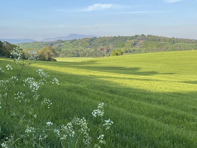
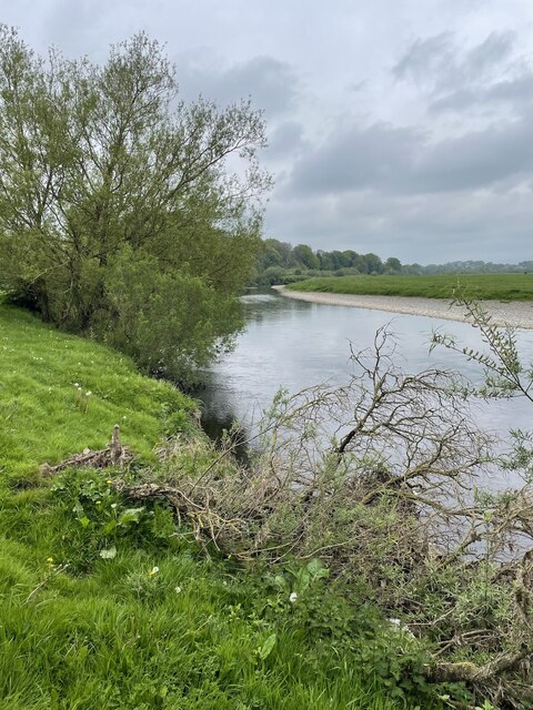
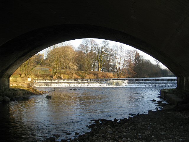
Hornby is a picturesque village located in the district of Lancaster, in the county of Lancashire, England. Situated on the banks of the River Wenning, it is surrounded by stunning countryside and offers a charming and idyllic setting for both residents and visitors alike.

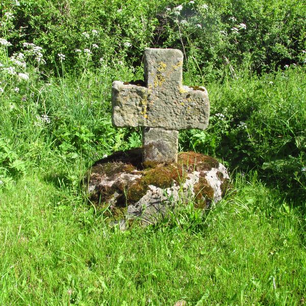
The village is renowned for its rich history, dating back to the Roman era, with archaeological evidence of Roman settlements in the area. It is also famous for Hornby Castle, a magnificent Grade I listed building that dates back to the 16th century. The castle, with its stunning gardens and parkland, is a prominent feature of the village and serves as a popular tourist attraction.

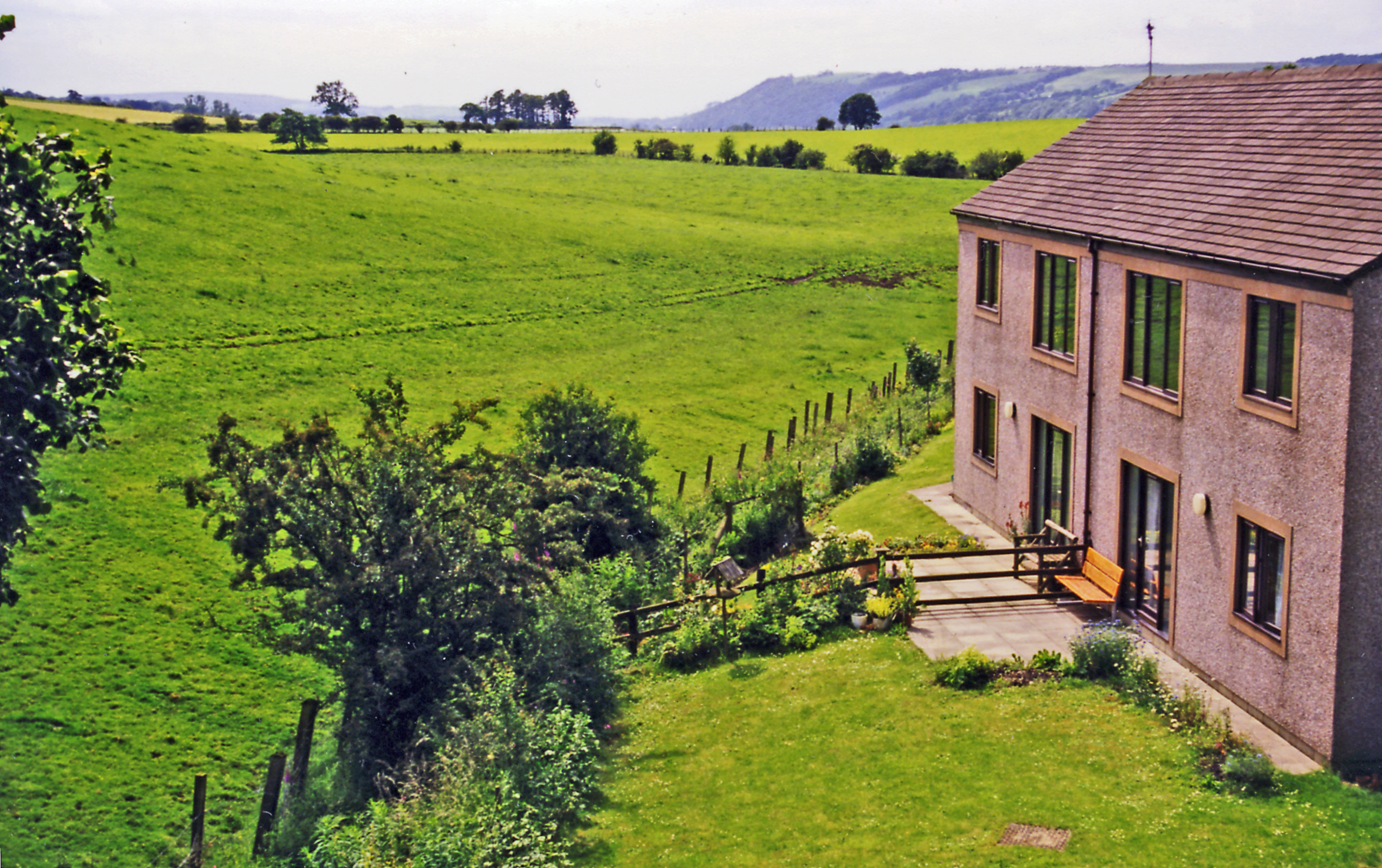
In addition to its historical significance, Hornby offers a range of amenities and facilities for its residents. The village boasts a primary school, a village hall, a post office, and a few shops and pubs. The local community is close-knit and organizes various events and activities throughout the year, fostering a strong sense of community spirit.

The surrounding countryside provides ample opportunities for outdoor pursuits such as hiking, cycling, and fishing. The village is also located in close proximity to the Forest of Bowland, an Area of Outstanding Natural Beauty, which further enhances the appeal of Hornby as a destination for nature lovers.

Overall, Hornby offers a tranquil and scenic setting, combined with a rich history and a tight-knit community, making it a desirable place to live or visit in Lancashire.

If you have any feedback on the listing, please let us know in the comments section below.

Hornby Images

Images are sourced within 2km of 54.108364/-2.635901 or Grid Reference SD5868. Thanks to Geograph Open Source API. All images are credited.

Approaching Neddy Park Wood Footpath from the village of Wray crosses the stile to follow the boundary of the wood and ploughed field.
Approaching Neddy Park Wood
Footpath from the village of Wray crosses the stile to follow the boundary of the wood and ploughed field.
Approaching Scale House Farm The map marks this collection of buildings as Scale House Barn, while the gate on Moor Lane proclaims this as Scale House Farm.
Approaching Scale House Farm
The map marks this collection of buildings as Scale House Barn, while the gate on Moor Lane proclaims this as Scale House Farm.
Moor Lane descending towards Cat Clough Wood
Lune valley near Gressingham Looking across the flood plain to Hornby from Sandbeds Lane. Hedge laying has been carried out in the foreground. The trimmings have not yet been burnt.
Lune valley near Gressingham
Looking across the flood plain to Hornby from Sandbeds Lane. Hedge laying has been carried out in the foreground. The trimmings have not yet been burnt.
Weir on River Wenning Hornby Castle stands beyond
Weir on River Wenning
Hornby Castle stands beyond
Lunesdale Court With jubilee bunting. Converted into separate housing units in the mid-1980s.
Built in 1874 as the Lunesdale Union Workhouse, later known as Hornby Institution. In WW2 the building became a children's hostel which continued until 1953. Lunesdale Rural District Council then used the site for their offices and workshops, until the local government reorganisation in 1974.   [David Kenyon]
Also see <span class="nowrap"><a title="https://www.workhouses.org.uk/Lunesdale/" rel="nofollow ugc noopener" href="https://www.workhouses.org.uk/Lunesdale/">Link</a><img style="margin-left:2px;" alt="External link" title="External link - shift click to open in new window" src="https://s1.geograph.org.uk/img/external.png" width="10" height="10"/></span>
Lunesdale Court
With jubilee bunting. Converted into separate housing units in the mid-1980s. Built in 1874 as the Lunesdale Union Workhouse, later known as Hornby Institution. In WW2 the building became a children's hostel which continued until 1953. Lunesdale Rural District Council then used the site for their offices and workshops, until the local government reorganisation in 1974. [David Kenyon] Also see LinkExternal link
Old Wayside Cross on Moor Lane in Hornby with Farleton parish Curwen Hall Cross, an old shaft and base in a new wayside cross. Set on the southeast side of the junction of Moor Lane, the old road over Salter Fell to Slaidburn, and the entrance drive to Curwen Hall Farm. Hornby with Farleton parish. Grade II Listed <span class="nowrap"><a title="https://historicengland.org.uk/listing/the-list/list-entry/1164896" rel="nofollow ugc noopener" href="https://historicengland.org.uk/listing/the-list/list-entry/1164896">Link</a><img style="margin-left:2px;" alt="External link" title="External link - shift click to open in new window" src="https://s1.geograph.org.uk/img/external.png" width="10" height="10"/></span>. See also <a title="https://www.geograph.org.uk/photo/3102030" href="https://www.geograph.org.uk/photo/3102030">Link</a> and <a title="https://www.geograph.org.uk/photo/116818" href="https://www.geograph.org.uk/photo/116818">Link</a>.

Milestone Society National ID: LALA_HOR02
Old Wayside Cross on Moor Lane in Hornby with Farleton parish
Curwen Hall Cross, an old shaft and base in a new wayside cross. Set on the southeast side of the junction of Moor Lane, the old road over Salter Fell to Slaidburn, and the entrance drive to Curwen Hall Farm. Hornby with Farleton parish. Grade II Listed LinkExternal link. See also Link and Link. Milestone Society National ID: LALA_HOR02
Benchmark on Hornby railway bridge Ordnance Survey benchmark on the former railway bridge south of Hornby. Still in use as a road bridge. <a href="https://www.geograph.org.uk/photo/7454475">SD5868 : Parapet of Hornby railway bridge, Station Road</a>  The mark was levelled at 36.270m above Newlyn Datum. <span class="nowrap"><a title="https://www.bench-marks.org.uk/bm189957" rel="nofollow ugc noopener" href="https://www.bench-marks.org.uk/bm189957">Link</a><img style="margin-left:2px;" alt="External link" title="External link - shift click to open in new window" src="https://s1.geograph.org.uk/img/external.png" width="10" height="10"/></span>
Benchmark on Hornby railway bridge
Ordnance Survey benchmark on the former railway bridge south of Hornby. Still in use as a road bridge. SD5868 : Parapet of Hornby railway bridge, Station Road The mark was levelled at 36.270m above Newlyn Datum. LinkExternal link
Parapet of Hornby railway bridge, Station Road Looking across Station Road in the direction of the old railway track from the former railway bridge south of Hornby. The parapet has an Ordnance Survey benchmark on the lowest full line of stones <a href="https://www.geograph.org.uk/photo/7454469">SD5868 : Benchmark on Hornby railway bridge</a>
Parapet of Hornby railway bridge, Station Road
Looking across Station Road in the direction of the old railway track from the former railway bridge south of Hornby. The parapet has an Ordnance Survey benchmark on the lowest full line of stones SD5868 : Benchmark on Hornby railway bridge
Landscape near Eskrigge in Lancashire Some lush spring greenery here besides the  lane towards Gressingham. The mountain in the distance is one of the Three Peaks - Ingleborough, I think.
Landscape near Eskrigge in Lancashire
Some lush spring greenery here besides the lane towards Gressingham. The mountain in the distance is one of the Three Peaks - Ingleborough, I think.
Hornby Castle viewed from Hornby Bridge The River Wenning weir is in the foreground. The avenue of trees lead the eye gently up to the remains of Hornby Castle.
Hornby Castle viewed from Hornby Bridge
The River Wenning weir is in the foreground. The avenue of trees lead the eye gently up to the remains of Hornby Castle.
Meeting of the Wenning and Lune rivers Lively confluence of these black peaty rivers. A sand martin colony is on the opposite bank from here, and the air is full of their constant activity and twittering.
Meeting of the Wenning and Lune rivers
Lively confluence of these black peaty rivers. A sand martin colony is on the opposite bank from here, and the air is full of their constant activity and twittering.
River Lune just north of Loyn Bridge Walking north on the Lune Valley Ramble, a glorious trail alongside the river and through some wildflower strewn woodland.
River Lune just north of Loyn Bridge
Walking north on the Lune Valley Ramble, a glorious trail alongside the river and through some wildflower strewn woodland.
Loyn Bridge on the Lune
River Hindburn from bridge
Wray Methodist Church
Holy Trinity Church, Wray
River Hindburn near sewage works Looking downstream.
River Hindburn near sewage works
Looking downstream.
Show me another place!

Hornby is located at Grid Ref: SD5868 (Lat: 54.108364, Lng: -2.635901)

Administrative County: Lancashire

District: Lancaster

Police Authority: Lancashire

What 3 Words

///votes.paradise.spearing. Near Caton, Lancashire

Related Wikis

Hornby Village Institute

Hornby Village Institute is a public building in Main Street, Hornby, Lancashire, England. It is considered to be important architecturally, and is recorded...

Hornby railway station

Hornby railway station served the village of Hornby in the City of Lancaster district of Lancashire, England. The station was located in a cutting off...

Hornby-with-Farleton

Hornby-with-Farleton is a civil parish in the City of Lancaster in Lancashire, England. It had a population of 729 recorded in the 2001 census, increasing...

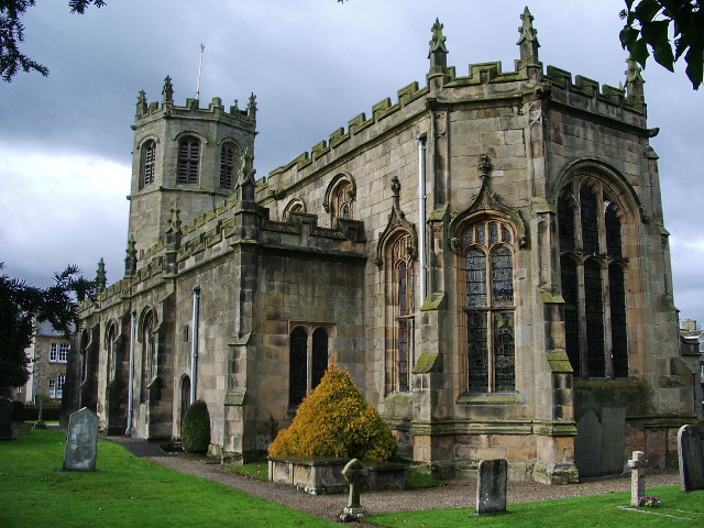
St Margaret's Church, Hornby

St Margaret's Church is in Main Street, Hornby, Lancashire, England. The church is recorded in the National Heritage List for England as a designated Grade...

Nearby Amenities

Located within 500m of 54.108364,-2.635901
Hornby
Is In: Lancaster, Lancashire, England, UK
Place: village
Source: survey
Wikidata: Q23897904
Lat/Long: 54.1113256/-2.6356844
Post Box
Ref: LA2 180
Lat/Long: 54.1085867/-2.6356937
Post Office
Hornby Post Office
Addr City: Hornby
Addr Housenumber: 8
Addr Postcode: LA2 8JR
Addr Street: Main Street
Brand: Post Office
Brand Wikidata: Q1783168
Check Date: 2023-09-27
Ref Pol Id: 5459
Lat/Long: 54.1085688/-2.635658
Turning Circle
Lat/Long: 54.1105356/-2.6382596
Turning Circle
Lat/Long: 54.1120458/-2.6384565
Turning Circle
Lat/Long: 54.106401/-2.63774
Turning Circle
Lat/Long: 54.1064549/-2.6366187
Noexit: yes
Lat/Long: 54.1066344/-2.6350999
Londis
Addr City: Hornby
Addr Housenumber: 11-13
Addr Postcode: LA2 8JR
Addr Street: Main Street
Brand: Londis
Brand Wikidata: Q21008564
Brand Wikipedia: en:Londis (United Kingdom)
Fhrs Id: 112646
Shop: convenience
Lat/Long: 54.1087883/-2.6359918
Cafe
Hornby Post Office and Tearoom
Addr City: Hornby
Addr Housenumber: 8
Addr Postcode: LA2 8JR
Addr Street: Main Street
Fhrs Id: 114442
Lat/Long: 54.1085949/-2.6356527
Flower Bank
Addr Housenumber: 28
Addr Street: Main Street
Shop: florist
Lat/Long: 54.1091249/-2.6356229
Barrier: stile
Material: wood
Source: survey;gps
Stile: stepover
Lat/Long: 54.1090428/-2.6344643
Information: board
Tourism: information
Lat/Long: 54.1093777/-2.6360047
Barrier: stile
Material: stone
Source: survey;gps
Stile: stepover
Lat/Long: 54.1094019/-2.6360232
Barrier: stile
Material: stone
Source: survey;gps
Stile: stepover
Lat/Long: 54.1102568/-2.6387004
Bench
Source: survey;gps
Lat/Long: 54.1099407/-2.6371839
Bench
Source: survey;gps
Lat/Long: 54.1099741/-2.6375847
Bench
Source: survey;gps
Lat/Long: 54.1102046/-2.6387227
Fountain
Cat and the Rat
Lat/Long: 54.1082907/-2.6359982
Bus Stop
Ingleborough View
Bench: no
Bin: no
Bus: yes
Lit: yes
Naptan AtcoCode: 2500DCL3178
Naptan Bearing: SE
Naptan BusStopType: CUS
Naptan CommonName: Ingleborough View
Naptan Indicator: opp
Naptan Landmark: Station Road
Naptan LocalityCode: E0015947
Naptan NaptanCode: landgtdw
Naptan Street: Station Road
Naptan Verified: no
Note: "Both directions" sign on other side
Public Transport: platform
Ref: landgtdw
Shelter: no
Tactile Paving: no
Lat/Long: 54.1057782/-2.6333349
Bus Stop
Ingleborough View
Bench: no
Bin: no
Bus: yes
Lit: yes
Naptan AtcoCode: 2500IMG1366
Naptan Bearing: NW
Naptan BusStopType: MKD
Naptan CommonName: Ingleborough View
Naptan Indicator: by
Naptan Landmark: Station Road
Naptan LocalityCode: E0015947
Naptan NaptanCode: landpwtd
Naptan Street: Station Road
Naptan Verified: no
Public Transport: platform
Ref: landpwtd
Shelter: no
Tactile Paving: no
Lat/Long: 54.1057218/-2.6335404
Bus Stop
Day Nursery
Bench: no
Bin: no
Bus: yes
Lit: yes
Naptan AtcoCode: 250020105
Naptan Bearing: S
Naptan BusStopType: MKD
Naptan CommonName: Day Nursery
Naptan Indicator: by
Naptan Landmark: Lambs Garage
Naptan LocalityCode: E0047436
Naptan NaptanCode: lanatpgp
Naptan Street: Station Road
Naptan Verified: no
Public Transport: platform
Ref: lanatpgp
Shelter: no
Tactile Paving: no
Lat/Long: 54.1079667/-2.6357306
Board Type: notice
Information: board
Tourism: information
Lat/Long: 54.1087969/-2.6356399
Addr Housenumber: 74
Addr Street: Main Street
Building: house
Lat/Long: 54.1117004/-2.6365767
Addr Housenumber: 26
Addr Street: Main Street
Lat/Long: 54.1090778/-2.6356186
Bus Stop
Institute
Bench: no
Bin: no
Bus: yes
Naptan AtcoCode: 25001893
Naptan Bearing: S
Naptan BusStopType: MKD
Naptan CommonName: Institute
Naptan Indicator: by
Naptan Landmark: Institute
Naptan LocalityCode: E0047436
Naptan NaptanCode: lanatjag
Naptan Street: Melling Road
Naptan Verified: no
Public Transport: platform
Ref: lanatjag
Shelter: yes
Tactile Paving: no
Lat/Long: 54.1088596/-2.6356603
Bus Stop
Wenning Stores
Bench: no
Bin: no
Bus: yes
Naptan AtcoCode: 25001892
Naptan Bearing: N
Naptan BusStopType: MKD
Naptan CommonName: Wenning Stores
Naptan Indicator: by
Naptan Landmark: Wenning Stores
Naptan LocalityCode: E0047436
Naptan NaptanCode: lanatjad
Naptan Street: Melling Road
Naptan Verified: no
Public Transport: platform
Ref: lanatjad
Shelter: no
Tactile Paving: no
Lat/Long: 54.1087836/-2.6358646
Wenning Stores
Bus: yes
Public Transport: stop_position
Lat/Long: 54.1087836/-2.6357941
Ingleborough View
Bus: yes
Public Transport: stop_position
Lat/Long: 54.105746/-2.6334914
Lunesdale Court
Bus: yes
Naptan AtcoCode: 2500LAA00252
Naptan Bearing: E
Naptan BusStopType: MKD
Naptan CommonName: Lunesdale Court
Naptan Indicator: opp
Naptan Landmark: Lunesdale Court
Naptan LocalityCode: E0015947
Naptan NaptanCode: langtpma
Naptan Street: Wennington Road
Naptan Verified: no
Public Transport: stop_position
Ref: langtpma
Lat/Long: 54.1043385/-2.6372579
Ingleborough View
Bus: yes
Public Transport: stop_position
Lat/Long: 54.1057259/-2.6334653
Day Nursery
Bus: yes
Public Transport: stop_position
Lat/Long: 54.1079644/-2.6357943
Institute
Bus: yes
Public Transport: stop_position
Lat/Long: 54.1088844/-2.6357923
War Memorial
Bus: yes
Public Transport: stop_position
Lat/Long: 54.1114972/-2.636698
Lunesdale Court
Bus: yes
Naptan AtcoCode: 250014802
Naptan Bearing: W
Naptan BusStopType: CUS
Naptan CommonName: Lunesdale Court
Naptan Indicator: by
Naptan Landmark: Lunesdale Court
Naptan LocalityCode: E0015947
Naptan NaptanCode: lanapamd
Naptan Street: Wennington Road
Naptan Verified: no
Public Transport: stop_position
Ref: lanapamd
Lat/Long: 54.1043163/-2.6373342
War Memorial
Bus: yes
Public Transport: stop_position
Lat/Long: 54.1115145/-2.6367077
Day Nursery
Bus: yes
Naptan AtcoCode: 2500859
Naptan Bearing: N
Naptan BusStopType: CUS
Naptan CommonName: Day Nursery
Naptan Indicator: opp
Naptan Landmark: Lambs Garage
Naptan LocalityCode: E0047436
Naptan NaptanCode: landagam
Naptan Street: Station Road
Naptan Verified: no
Public Transport: stop_position
Ref: landagam
Lat/Long: 54.1082474/-2.6357962
Bus Stop
War Memorial
Bus: yes
Naptan AtcoCode: 2500LAA07477
Naptan Bearing: S
Naptan BusStopType: MKD
Naptan CommonName: War Memorial
Naptan Indicator: opp
Naptan Landmark: War Memorial
Naptan LocalityCode: E0047436
Naptan NaptanCode: lanjpgma
Naptan Street: Main Street
Naptan Verified: no
Public Transport: platform
Ref: lanjpgma
Lat/Long: 54.1115186/-2.6366717
Bus Stop
War Memorial
Bench: yes
Bus: yes
Naptan AtcoCode: 250012060
Naptan Bearing: N
Naptan BusStopType: MKD
Naptan CommonName: War Memorial
Naptan Indicator: o/s
Naptan Landmark: Church
Naptan LocalityCode: E0047436
Naptan NaptanCode: lanagwam
Naptan Street: Melling Road
Naptan Verified: no
Public Transport: platform
Ref: lanagwam
Shelter: yes
Lat/Long: 54.1114768/-2.6368345
Bench
Backrest: yes
Layer: 1
Material: wood
Lat/Long: 54.1094086/-2.6359623
Bench
Backrest: yes
Layer: 1
Material: wood
Lat/Long: 54.1098652/-2.6360674
Waste Basket
Layer: 1
Lat/Long: 54.110108/-2.6361459
Give Way
Direction: forward
Lat/Long: 54.1118882/-2.636954
Give Way
Direction: forward
Lat/Long: 54.1107981/-2.6363949
Historic: memorial
Material: stone
Memorial: war_memorial
Lat/Long: 54.1114605/-2.6367735
Entrance: main
Wheelchair: no
Lat/Long: 54.1089128/-2.6356285
Entrance: yes
Wheelchair: yes
Lat/Long: 54.1089787/-2.6353744
Bicycle Parking
Access: yes
Bicycle Parking: stands
Capacity: 6
Covered: no
Lat/Long: 54.1089383/-2.6356447
Turning Loop
Lat/Long: 54.1039818/-2.6374864
Generator Method: photovoltaic
Generator Orientation: west
Generator Output Electricity: yes
Generator Solar Modules: 16
Generator Source: solar
Generator Type: solar_photovoltaic_panel
Location: roof
Power: generator
Lat/Long: 54.1117511/-2.6365194
Stop
Direction: forward
Stop: minor
Lat/Long: 54.1053754/-2.6328994
Give Way
Direction: backward
Lat/Long: 54.1060092/-2.6337539
Turning Circle
Lat/Long: 54.1062757/-2.6334279
Give Way
Direction: forward
Lat/Long: 54.1071219/-2.6354237
Grit Bin
Lat/Long: 54.1069825/-2.6358027
Barrier: cattle_grid
Lat/Long: 54.1122682/-2.6396178
Entrance: main
Lat/Long: 54.1125819/-2.6372453
Recycling
Recycling Clothes: yes
Recycling Type: container
Lat/Long: 54.1125058/-2.6373366
Grit Bin
Lat/Long: 54.1125038/-2.6373622
Loading Dock
Lat/Long: 54.1123432/-2.637395
Entrance: main
Lat/Long: 54.112444/-2.6374045
Generator Method: solar_thermal
Generator Orientation: west
Generator Output Hot Water: yes
Generator Solar Modules: 2
Generator Source: solar
Generator Type: solar_thermal_collector
Location: roof
Power: generator
Lat/Long: 54.1117857/-2.6387018
Generator Method: photovoltaic
Generator Orientation: west
Generator Output Electricity: yes
Generator Solar Modules: 14
Generator Source: solar
Generator Type: solar_photovoltaic_panel
Location: roof
Power: generator
Lat/Long: 54.1120807/-2.6382969
Man Made: manhole
Manhole: telecom
Lat/Long: 54.1115814/-2.6368154
Barrier: entrance
Lat/Long: 54.1115786/-2.6368971
Waste Basket
Lat/Long: 54.1112316/-2.6367252
Waste Basket
Waste: dog_excrement
Lat/Long: 54.1112449/-2.6367297
Give Way
Direction: backward
Lat/Long: 54.1083558/-2.6358244
Speed Camera
Lat/Long: 54.1069888/-2.6401547
Speed Camera
Lat/Long: 54.1078171/-2.6382448
The data included in this document is from www.openstreetmap.org. The data is made available under ODbL.

Have you been to Hornby?

Leave your review of Hornby below (or comments, questions and feedback).