Black Hill of Kippen
Hill, Mountain in Perthshire
Scotland
Black Hill of Kippen

Black Hill of Kippen is a prominent hill located in the county of Perthshire, Scotland. With an elevation of 512 meters (1,680 feet), it is classified as a Marilyn, which means it has a relative height of at least 150 meters (492 feet) and stands independently from any other higher summit.
Situated near the village of Kippen, the hill offers breathtaking panoramic views of the surrounding countryside. It is a popular destination for hikers and outdoor enthusiasts, attracting both locals and tourists alike. The ascent to the summit is moderately challenging, with a well-defined path leading through heather moorland and rocky terrain.
From the top of Black Hill, visitors can enjoy stunning vistas of the surrounding Perthshire landscape, including the rolling hills, lush farmlands, and distant mountains. On clear days, it is even possible to see as far as Loch Lomond and the Trossachs National Park. The hill is particularly renowned for its picturesque sunsets, as the fiery hues illuminate the sky and cast a magical glow over the countryside.
Black Hill of Kippen is also home to a diverse range of flora and fauna. The heather-covered slopes provide habitat for numerous bird species, including red grouse and skylarks. The hill is also known for its population of mountain hares, which can often be spotted darting across the rugged landscape.
Overall, Black Hill of Kippen is a stunning natural landmark that offers visitors the opportunity to immerse themselves in the beauty of the Scottish countryside and enjoy unparalleled views of the surrounding area.
If you have any feedback on the listing, please let us know in the comments section below.
Black Hill of Kippen Images
Images are sourced within 2km of 56.285876/-3.6035533 or Grid Reference NO0011. Thanks to Geograph Open Source API. All images are credited.


Black Hill of Kippen is located at Grid Ref: NO0011 (Lat: 56.285876, Lng: -3.6035533)
Unitary Authority: Perth and Kinross
Police Authority: Tayside
What 3 Words
///disbelief.bulk.extremes. Near Auchterarder, Perth & Kinross
Nearby Locations
Related Wikis

Dunning, Perth and Kinross
Dunning is a small village in Perth and Kinross in Scotland with a population of about 1,000. The village centres around the 12th–13th century former parish...

Dupplin Cross
The Dupplin Cross is a carved, monumental Pictish stone, which dates from around 800 AD. It was first recorded by Thomas Pennant in 1769, on a hillside...
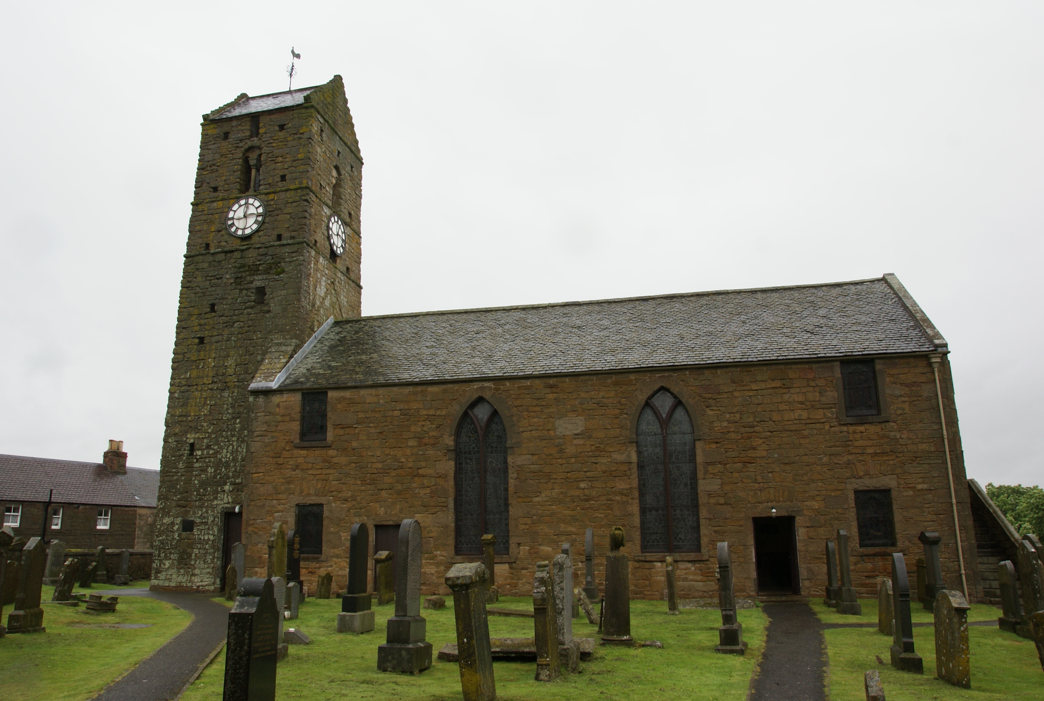
St Serf's Church, Dunning
St Serf's Church in the Scottish village of Dunning, Perth and Kinross is a Category A listed building largely dating to the early 19th century, but incorporating...

Ochil and South Perthshire (UK Parliament constituency)
Ochil and South Perthshire is a county constituency of the House of Commons of the Parliament of the United Kingdom. It elects one Member of Parliament...

Innerdouny Hill
Innerdouny Hill (497 m) is a hill in the Ochil Hills of Perth and Kinross, Scotland. It is located northwest of the town of Kinross. The second highest...
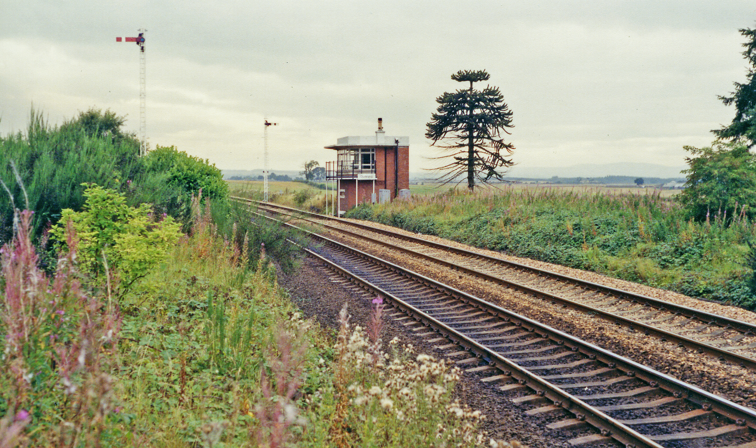
Dunning railway station
Dunning railway station served the village of Dunning, Perth and Kinross, Scotland from 1848 to 1956 on the Scottish Central Railway. == History == The...
Aberuthven
Aberuthven (; Gaelic: Obar Ruadhainn) is a small village in Perth and Kinross, Scotland. It lies approximately 2+1⁄2 miles (4 kilometres) northeast of...

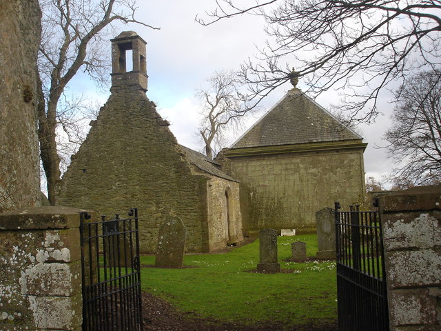
Montrose Mausoleum
Montrose Mausoleum is located in the Scottish village of Aberuthven, Perth and Kinross. Dating to 1736, it is a Category A listed building. It stands in...
Nearby Amenities
Located within 500m of 56.285876,-3.6035533Have you been to Black Hill of Kippen?
Leave your review of Black Hill of Kippen below (or comments, questions and feedback).