Beinn Mhòr

Hill, Mountain in Morayshire

Scotland

Beinn Mhòr

Masts, Laggan Hill A television relay above Grantown.
Masts, Laggan Hill Credit: Richard Webb

The requested URL returned error: 429 Too Many Requests

If you have any feedback on the listing, please let us know in the comments section below.
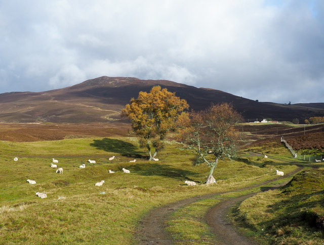
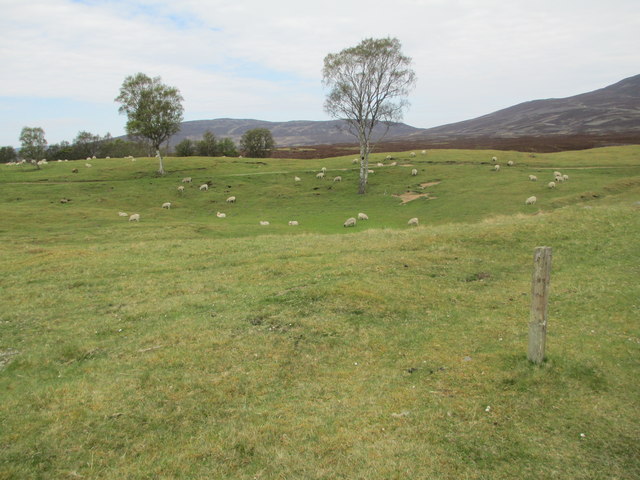
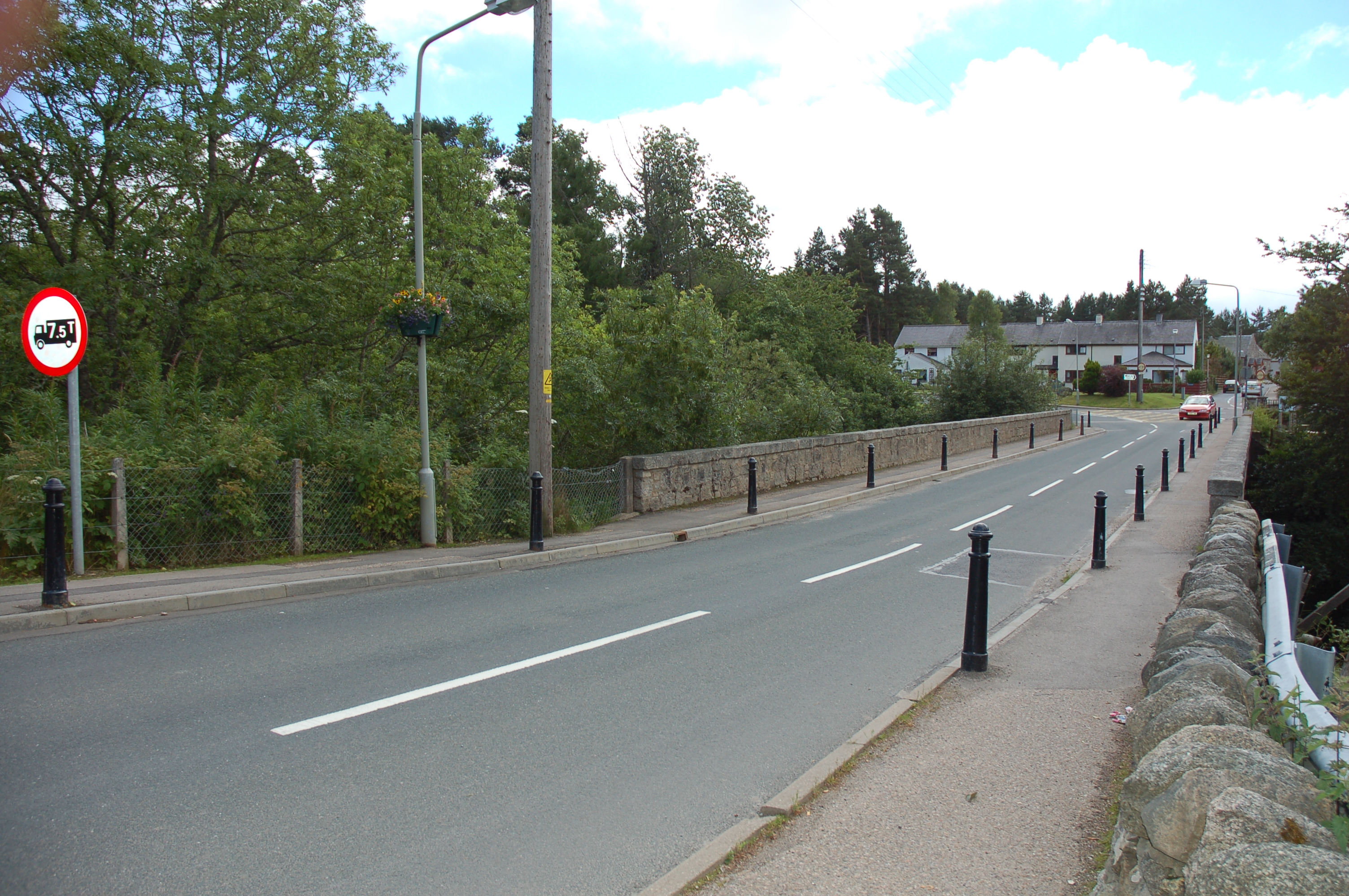
Beinn Mhòr Images

Images are sourced within 2km of 57.332305/-3.6731229 or Grid Reference NH9928. Thanks to Geograph Open Source API. All images are credited.

Masts, Laggan Hill A television relay above Grantown.
Masts, Laggan Hill
A television relay above Grantown.
Farm road heading north from public road end A narrow minor road heads north from the A938 west of Dulnain Bridge ending close to the farm at Achnahannet; this farm road goes on north towards the hill, Càm Scriob.
Farm road heading north from public road end
A narrow minor road heads north from the A938 west of Dulnain Bridge ending close to the farm at Achnahannet; this farm road goes on north towards the hill, Càm Scriob.
Walker climbing on hill track The track rises from the farm at Achnahannet which can be seen below; it's rising towards Beinn Mhòr on the hill's western slope but soon peters out.
Walker climbing on hill track
The track rises from the farm at Achnahannet which can be seen below; it's rising towards Beinn Mhòr on the hill's western slope but soon peters out.
Heathery hill slope with pine trees The slope is on the western side of Beinn Mhòr. The view is to the north where the prominent hill beyond the trees is Càm Scriob.
Heathery hill slope with pine trees
The slope is on the western side of Beinn Mhòr. The view is to the north where the prominent hill beyond the trees is Càm Scriob.
Heather slope north of Beinn Mhòr A gentle slope of heather on the north side of Beinn Mhòr with Càm Scriob shadowed in the distance.
Heather slope north of Beinn Mhòr
A gentle slope of heather on the north side of Beinn Mhòr with Càm Scriob shadowed in the distance.
View from Auchnahannet Trig Point/Beinn Mhor Summit
Whins above Finlarig A vast yellow patch of land, visible from a great distance.
Whins above Finlarig
A vast yellow patch of land, visible from a great distance.
Declining slope of Laggan Hill The view is from Laggan Hill, easily climbed by an access road to an aerial, over its north-west slope to Beinn Mhòr.
Declining slope of Laggan Hill
The view is from Laggan Hill, easily climbed by an access road to an aerial, over its north-west slope to Beinn Mhòr.
Slope rising to hill at 417 metres The heather slope is close to the high point of an apparently un-named hill top south of Beinn Mhòr and west of Laggan Hill; scattered conifers grow on this part of the hill. The distant hill seen centrally in the photograph is Ben Rinnes.
Slope rising to hill at 417 metres
The heather slope is close to the high point of an apparently un-named hill top south of Beinn Mhòr and west of Laggan Hill; scattered conifers grow on this part of the hill. The distant hill seen centrally in the photograph is Ben Rinnes.
Moorland with scattered trees The southern slopes of Beinn Mhòr are in view with, in the distance, Ben Rinnes and behind the nearest tree, Carn a’ Ghille Chearr, one of the Hills of Cromdale.
Moorland with scattered trees
The southern slopes of Beinn Mhòr are in view with, in the distance, Ben Rinnes and behind the nearest tree, Carn a’ Ghille Chearr, one of the Hills of Cromdale.
Summit area of Beinn Mhòr Forestry reaches the summit area of Beinn Mhòr though the trees grew sparsely when this image was recorded. Carn Glas-choire lies distantly to the west.
Summit area of Beinn Mhòr
Forestry reaches the summit area of Beinn Mhòr though the trees grew sparsely when this image was recorded. Carn Glas-choire lies distantly to the west.
Farmland, Wester Gorton Sheep grazing below Gorton Hill.
Farmland, Wester Gorton
Sheep grazing below Gorton Hill.
Track to Clachbain
Track to Clachbain
Grazing near Achnahannet
Southern Slope of Beinn Mhor Looking along a fenceline on the southern side of Beinn Mhor, the summit (not named on OS maps) to the south of Beinn Mhor can be seen in the background.
Southern Slope of Beinn Mhor
Looking along a fenceline on the southern side of Beinn Mhor, the summit (not named on OS maps) to the south of Beinn Mhor can be seen in the background.
Beinn Mhor Summit Looking toward the summit of Beinn Mhor from a small rocky outcrop to the north.
Beinn Mhor Summit
Looking toward the summit of Beinn Mhor from a small rocky outcrop to the north.
Clachbain Farmland on the southern edge of Dava Moor, seen from Cam Sgriob.
Clachbain
Farmland on the southern edge of Dava Moor, seen from Cam Sgriob.
Moorland road near Clachbain Looking south from Cam Sgriob over muirburn patterns and improved grassland.
Moorland road near Clachbain
Looking south from Cam Sgriob over muirburn patterns and improved grassland.
Show me another place!

Beinn Mhòr is located at Grid Ref: NH9928 (Lat: 57.332305, Lng: -3.6731229)

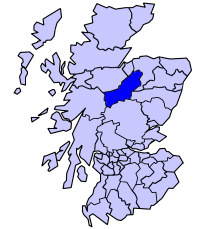
Unitary Authority: Highland

Police Authority: Highlands and Islands

What 3 Words

///seats.dizziness.aquatics. Near Grantown-on-Spey, Highland

Nearby Locations

Beinn Mhòr

Related Wikis

Achnahannet, Strathspey

Achnahannet (Scottish Gaelic: Achadh na h-Annaid) is a hamlet located northwest of Dulnain Bridge, and three and a half miles west-south-west of Grantown...

Badenoch and Strathspey

Badenoch and Strathspey is a former district of Highland region in Scotland. The district was created under the Local Government (Scotland) Act 1973 as...

Dulnain Bridge

Dulnain Bridge (Scottish Gaelic: Drochaid Thulnain) is a village in Strathspey, next to the meeting of the River Dulnain and the River Spey, three miles...
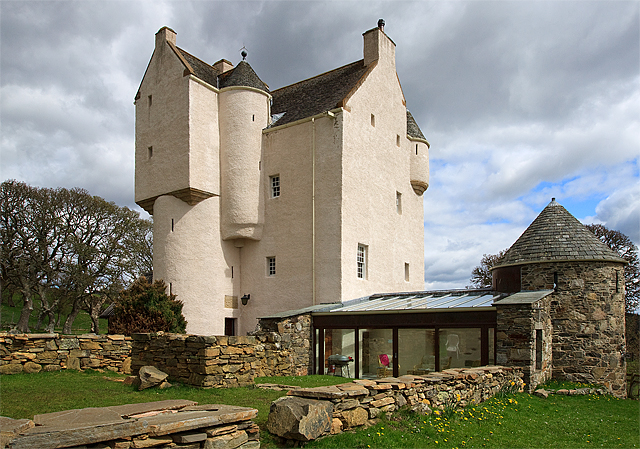
Muckrach Castle

Muckrach Castle, also known as Muchrach or Muckerach Castle, is a tower house near the Scottish town of Dulnain Bridge in the Highland council area. In...

Nearby Amenities

Located within 500m of 57.332305,-3.6731229
Beinn Mhòr
Corbett: no
Ele: 471
Graham: no
Man Made: survey_point
Marilyn: yes
Munro: no
Natural: peak
Prominence: 192
Ref: S7415
Lat/Long: 57.3323154/-3.6731401
Man Made: cairn
Lat/Long: 57.3335687/-3.6719415
Man Made: cairn
Lat/Long: 57.3351168/-3.6730299
The data included in this document is from www.openstreetmap.org. The data is made available under ODbL.

Have you been to Beinn Mhòr?

Leave your review of Beinn Mhòr below (or comments, questions and feedback).