Seamab Hill

Hill, Mountain in Perthshire

Scotland

Seamab Hill

Castlehill Reservoir, Glen Devon
Castlehill Reservoir, Glen Devon Credit: Richard Webb

Seamab Hill is a prominent landmark located in Perthshire, Scotland. Standing at an elevation of approximately 329 meters (1,079 feet), it is classified as a hill rather than a mountain. Despite its modest height, it offers breathtaking panoramic views of the surrounding countryside and is a popular destination for outdoor enthusiasts.

Situated near the village of Kinloch Rannoch, Seamab Hill is part of the larger Schiehallion range. It is characterized by its gently sloping terrain, covered in heather, grasses, and scattered woodland. The hill's sides are relatively easy to climb, making it accessible to walkers of all abilities.

The summit of Seamab Hill offers a stunning vantage point from which visitors can take in the picturesque landscapes of Perthshire. On a clear day, one can see the sprawling green fields, meandering rivers, and distant mountains that make up the region's natural beauty.

The hill is also known for its rich biodiversity. Its varied habitats provide a home to a wide range of plant and animal species, including birds, mammals, and insects. Nature enthusiasts can spot red deer, golden eagles, and even rare orchids during their explorations.

Seamab Hill is a popular destination for hikers, nature lovers, and photographers due to its accessibility and stunning views. Its tranquil and serene environment offers a much-needed respite from the hustle and bustle of everyday life, making it an ideal spot for relaxation and connecting with nature.

If you have any feedback on the listing, please let us know in the comments section below.
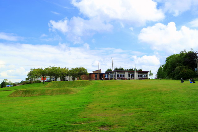
Seamab Hill Images

Images are sourced within 2km of 56.197105/-3.6236851 or Grid Reference NN9901. Thanks to Geograph Open Source API. All images are credited.

Castlehill Reservoir, Glen Devon
Mona's Café
Mona's Café
Old milestone This granite milestone is at the complex junction at Yetts o' Muckhart of the A91 from west to east and the A823 from south to north.  As the years pass, the 18 painted on both faces in black is slowly fading away.  It is one of only two milestones that have been found in Clackmannanshire.   It is on HES Canmore 353389.
Old milestone
This granite milestone is at the complex junction at Yetts o' Muckhart of the A91 from west to east and the A823 from south to north. As the years pass, the 18 painted on both faces in black is slowly fading away. It is one of only two milestones that have been found in Clackmannanshire. It is on HES Canmore 353389.
A91 near Yetts o’ Muckhart
Location of OS Flush Bracket S5116
OS Flush Bracket S5116 - Muckhart, Church <span class="nowrap"><a title="https://www.bench-marks.org.uk/bm20788" rel="nofollow ugc noopener" href="https://www.bench-marks.org.uk/bm20788">Link</a><img style="margin-left:2px;" alt="External link" title="External link - shift click to open in new window" src="https://s1.geograph.org.uk/img/external.png" width="10" height="10"/></span>
OS Flush Bracket S5116 - Muckhart, Church
A823 near Yetts o’ Muckhart
The Inn at Muckhart Wayside inn on the A91 at Muckhart
The Inn at Muckhart
Wayside inn on the A91 at Muckhart
Castlehill Reservoir from Innerdownie (611m) Where the name "Castlehill" came from is not apparent as it is not given to any of the adjacent features on the map.  It is one of no less than five reservoirs in the Glen Devon area.
Castlehill Reservoir from Innerdownie (611m)
Where the name "Castlehill" came from is not apparent as it is not given to any of the adjacent features on the map. It is one of no less than five reservoirs in the Glen Devon area.
Castlehill Reservoir Looking towards the dam and spillway from the parking area beside the A823.   The reservoir is fed by the River Devon.
Castlehill Reservoir
Looking towards the dam and spillway from the parking area beside the A823. The reservoir is fed by the River Devon.
Castlehill Reservoir Seen from the parking area beside the A823.   The reservoir is fed by the River Devon.  On the hilltops in the distance are the wind turbines of Green Knowes Wind Farm.
Castlehill Reservoir
Seen from the parking area beside the A823. The reservoir is fed by the River Devon. On the hilltops in the distance are the wind turbines of Green Knowes Wind Farm.
Abandoned car An abandoned and burned out car on the Muckhart - Dunning road  - provenance unknown.
Abandoned car
An abandoned and burned out car on the Muckhart - Dunning road - provenance unknown.
Muckhart Golf Clubhouse. The clubhouse viewed from the eighteenth green.
Muckhart Golf Clubhouse.
The clubhouse viewed from the eighteenth green.
Commonedge Hill A view to the east from Commonedge Hill, with Seamab Hill visible in the distance.
Commonedge Hill
A view to the east from Commonedge Hill, with Seamab Hill visible in the distance.
View from Castleton Hill An eastern view from Castleton Hill towards Seamab Hill, with West Lomond and Bishop Hill visible in the distance.
View from Castleton Hill
An eastern view from Castleton Hill towards Seamab Hill, with West Lomond and Bishop Hill visible in the distance.
Ochil Hills near Yetts o' Muckhart Fields near the River Devon in the foreground, with Seamab Hill in the Eastern Ochil Hills visible in the distance. Image taken at 12:20pm on Christmas Day 2011, during a period of high wind and rainfall.
Ochil Hills near Yetts o' Muckhart
Fields near the River Devon in the foreground, with Seamab Hill in the Eastern Ochil Hills visible in the distance. Image taken at 12:20pm on Christmas Day 2011, during a period of high wind and rainfall.
Field by Westerhall Grass field behind a large roadside ash tree.
Field by Westerhall
Grass field behind a large roadside ash tree.
Show me another place!

Seamab Hill is located at Grid Ref: NN9901 (Lat: 56.197105, Lng: -3.6236851)

Unitary Authority: Clackmannanshire

Police Authority: Forth Valley

What 3 Words

///classmate.beanbag.fidgeted. Near Dollar, Clackmannanshire

Nearby Locations

Seamab Hill

Related Wikis

Roman Catholic Archdiocese of St Andrews and Edinburgh

The Archdiocese of Saint Andrews & Edinburgh (Latin: Archidioecesis Sancti Andreae et Edimburgensis) is an archdiocese of the Latin Church of the Catholic...

Muckhart

Muckhart (Scottish Gaelic: Muc-Àird) commonly refers to two small villages in Clackmannanshire, Scotland, Pool of Muckhart (Scottish Gaelic: Poll Mhuc...

A823 road

The A823 is a road in Scotland which goes from south of Crieff to Dunfermline. It joins onto the A823(M) and the A822 which runs to Crieff.

Cauldron Linn (River Devon)

Cauldron Linn, or Caldron Linn, is a waterfall on the River Devon on the border between Clackmannanshire and Perth and Kinross in Scotland. == Location... ==

Rumbling Bridge

Rumbling Bridge is a small village built on both side of a gorge of the River Devon, which formed the boundary between the historic counties of Perthshire...

Rumbling Bridge railway station

Rumbling Bridge railway station served the village of Rumbling Bridge, Kinross-shire, Scotland from 1863 to 1964 on the Devon Valley Railway. == History... ==
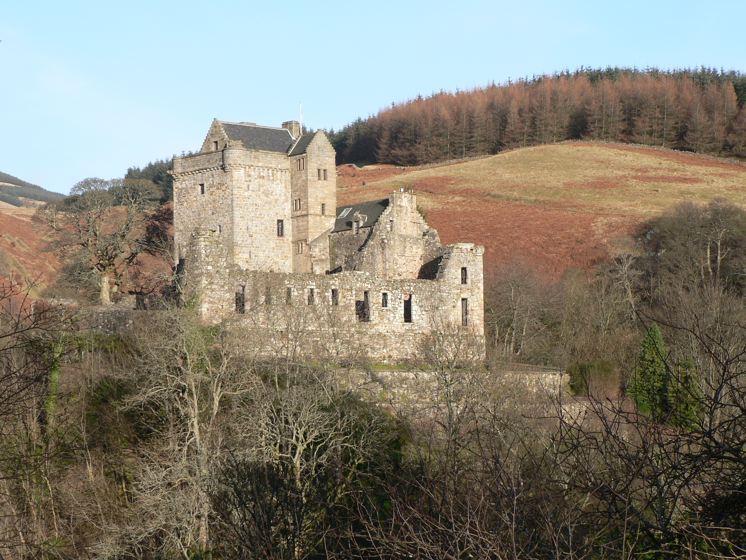
Castle Campbell

Castle Campbell is a medieval castle situated above the town of Dollar, Clackmannanshire, in central Scotland. It was the lowland seat of the earls and...

Glendevon Castle

Glendevon Castle is a collection of conjoined structures dating from the 15th century. The property is now (2022) semi-derelict. It lies on a private road...

Nearby Amenities

Located within 500m of 56.197105,-3.6236851
Seamab Hill
Ele: 440
Natural: peak
Source: npe
Lat/Long: 56.1970669/-3.6237203
Barrier: stile
Lat/Long: 56.1963984/-3.6286675
The data included in this document is from www.openstreetmap.org. The data is made available under ODbL.

Have you been to Seamab Hill?

Leave your review of Seamab Hill below (or comments, questions and feedback).