Carn Ruigh Chorrach

Hill, Mountain in Morayshire

Scotland

Carn Ruigh Chorrach

Wester Limekilns On Dava Moor.
Wester Limekilns Credit: Richard Webb

The requested URL returned error: 429 Too Many Requests

If you have any feedback on the listing, please let us know in the comments section below.

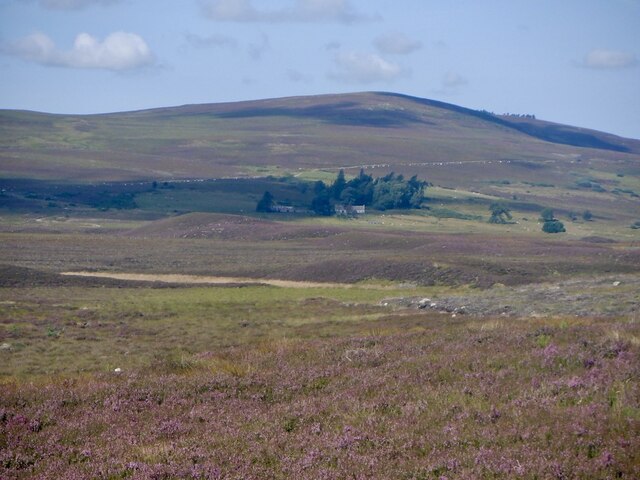
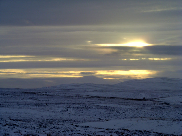
Carn Ruigh Chorrach Images

Images are sourced within 2km of 57.391154/-3.682443 or Grid Reference NH9834. Thanks to Geograph Open Source API. All images are credited.

Wester Limekilns On Dava Moor.
Wester Limekilns
On Dava Moor.
Roadside tree by Lochindorb
View Across Dava Moor towards Carn Ruig Chorrach Looking across the moor towards the slopes of Carn Ruig Chorrach.
View Across Dava Moor towards Carn Ruig Chorrach
Looking across the moor towards the slopes of Carn Ruig Chorrach.
Carn Ruig Chorrach Looking over Deva Moor towards Carn Ruig Chorrach (summit 484 metres).
Carn Ruig Chorrach
Looking over Deva Moor towards Carn Ruig Chorrach (summit 484 metres).
Minor road beside Lochindorb Looking south-westward.
Minor road beside Lochindorb
Looking south-westward.
Moorland minor road beside :Lochindorb Wood Looking north-eastward.
Moorland minor road beside :Lochindorb Wood
Looking north-eastward.
Carn Ruigh Chorrach Trig Point Flush Bracket S7484
Easter Crannich On Dava Moor.
Easter Crannich
On Dava Moor.
Dava Moor
Dava Moor
Tranquillity on the Moor Nature in the raw, what a wonderful world.
Tranquillity on the Moor
Nature in the raw, what a wonderful world.
Ruined mill at Easter Crannich The circle in the foreground shows that this was a horse powered mill. One of many abandoned farms on Dava Moor.
Ruined mill at Easter Crannich
The circle in the foreground shows that this was a horse powered mill. One of many abandoned farms on Dava Moor.
Jetty, Loch Mhic Leoid Frozen loch on Dava Moor.
Jetty, Loch Mhic Leoid
Frozen loch on Dava Moor.
A939 and Sidhean an Aiteil
Track to Easter Crannich Between the Anaboard Burn and the A940.
Track to Easter Crannich
Between the Anaboard Burn and the A940.
'Jesus saves' rock on Dava Moor
Sidhean an Aiteil by the A939 A fairy knoll.
Sidhean an Aiteil by the A939
A fairy knoll.
Sidhean an Aitil Glacial deposits on Dava Moor. The hills formed by gravel deposited by streams flowing off glaciers were attributed to fairies and supposed to be their home.
Sidhean an Aitil
Glacial deposits on Dava Moor. The hills formed by gravel deposited by streams flowing off glaciers were attributed to fairies and supposed to be their home.
The Anaboard Burn The burn drains under an estate track forming a small weed-filled pond, before flowing in a much narrower channel to the west
The Anaboard Burn
The burn drains under an estate track forming a small weed-filled pond, before flowing in a much narrower channel to the west
Show me another place!

Carn Ruigh Chorrach is located at Grid Ref: NH9834 (Lat: 57.391154, Lng: -3.682443)

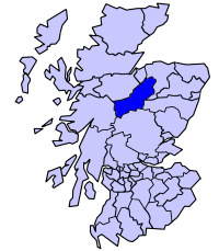
Unitary Authority: Highland

Police Authority: Highlands and Islands

What 3 Words

///roadblock.inch.moisture. Near Grantown-on-Spey, Highland

Nearby Locations

Carn Ruigh Chorrach

Related Wikis

Lochindorb

Lochindorb (from the Scottish Gaelic: Loch nan Doirb meaning "loch of the minnows") is a freshwater loch north of Grantown on Spey in the Highland council...

Dava railway station

Dava railway station was opened in 1864, on the Inverness and Perth Junction Railway, one year after the route was opened. == Station layout == The station...

Badenoch and Strathspey

Badenoch and Strathspey is a former district of Highland region in Scotland. The district was created under the Local Government (Scotland) Act 1973 as...

Castle Grant platform railway station

Castle Grant platform railway station was a railway station serving Castle Grant, in Strathspey in Scotland. == History == This station was opened with...

Have you been to Carn Ruigh Chorrach?

Leave your review of Carn Ruigh Chorrach below (or comments, questions and feedback).