Hopton Castle
Settlement in Shropshire
England
Hopton Castle
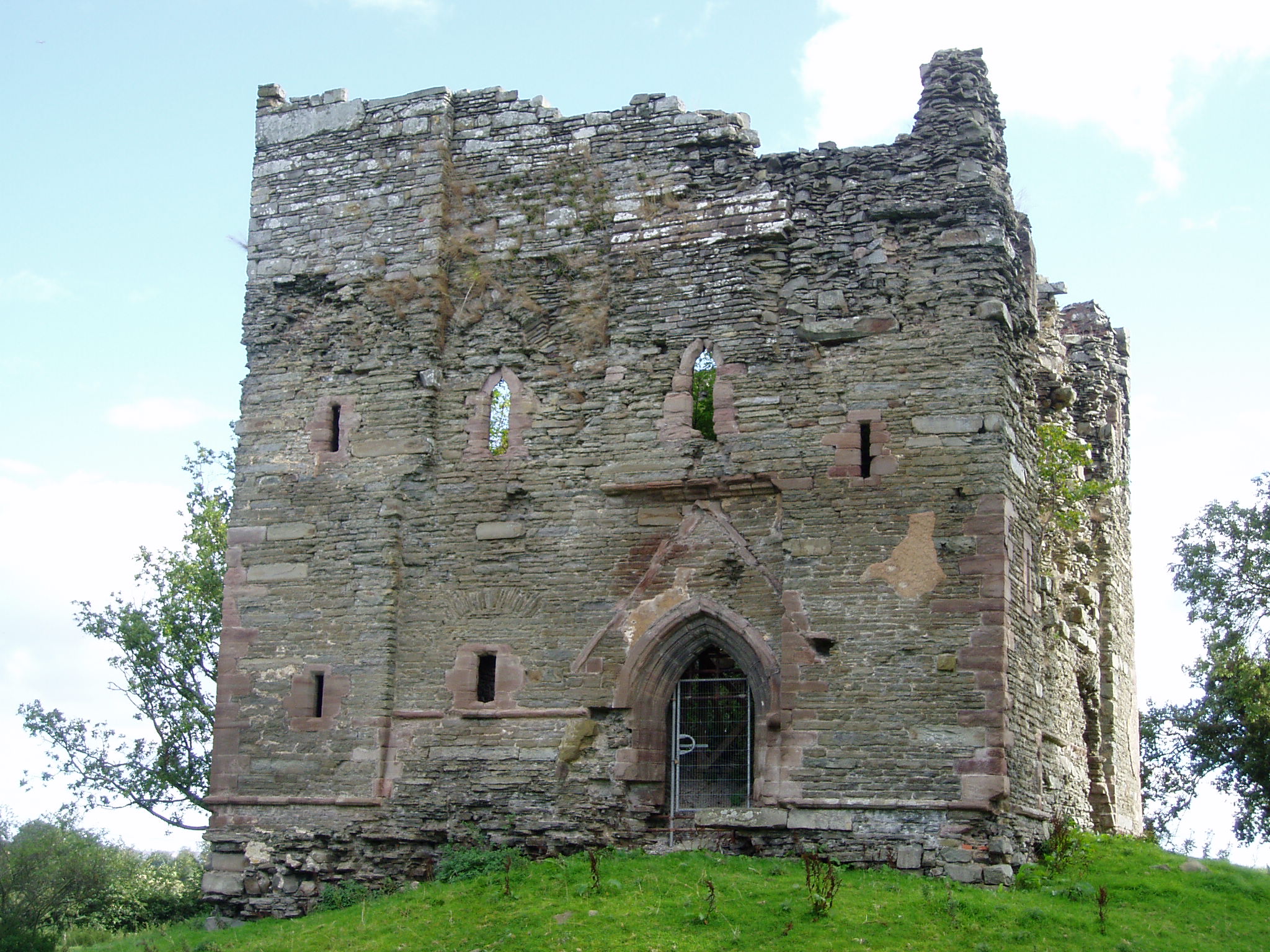
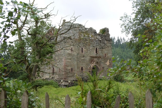
Hopton Castle is a historic fortress located in the county of Shropshire, England. Situated on a hilltop overlooking the picturesque Hopton Valley, the castle is a fine example of medieval architecture and a testament to the region's rich history.
The castle was built in the 13th century by the powerful de Say family, who were prominent landowners in the area. Constructed using local red sandstone, Hopton Castle was designed to be a defensive stronghold, with thick walls, towers, and a moat. The castle's strategic location allowed it to control the surrounding countryside and serve as a symbol of power and authority.
Throughout its history, Hopton Castle has witnessed various conflicts and sieges. One notable event occurred during the English Civil War in 1644 when the castle was besieged by Parliamentary forces. Despite being heavily outnumbered, the Royalist garrison held out for several weeks before finally surrendering. The castle was subsequently slighted, or deliberately damaged, to render it unusable as a military fortification.
Today, Hopton Castle stands as a picturesque ruin, with its walls and towers still visible. The site is managed by the Hopton Castle Preservation Trust, which works to preserve the castle's heritage and promote its historical significance. Visitors can explore the remains of the castle, admire its architectural features, and learn about its fascinating past.
Hopton Castle is a popular destination for history enthusiasts, photographers, and nature lovers. Its idyllic setting amidst the Shropshire countryside provides a tranquil atmosphere, making it a perfect spot for a leisurely walk or a picnic.
If you have any feedback on the listing, please let us know in the comments section below.
Hopton Castle Images
Images are sourced within 2km of 52.396965/-2.933237 or Grid Reference SO3678. Thanks to Geograph Open Source API. All images are credited.


Hopton Castle is located at Grid Ref: SO3678 (Lat: 52.396965, Lng: -2.933237)
Unitary Authority: Shropshire
Police Authority: West Mercia
What 3 Words
///mysteries.surprised.fast. Near Bucknell, Shropshire
Nearby Locations
Related Wikis
Hopton Castle
Hopton Castle is situated in the village of the same name which lies approximately halfway between Knighton and Craven Arms, in the English county of Shropshire...
Hopton Castle (village)
Hopton Castle is a small village and civil parish in south Shropshire, England. The village grew up near to the keep of Hopton Castle, which was opened...
Twitchen, Shropshire
Twitchen is a hamlet in Shropshire, England, on the B4385 south of Purslow and near to Hopton Castle. The southern part of the settlement is called Three...

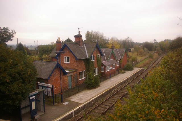
Hopton Heath railway station
Hopton Heath railway station in Hopton Heath, Shropshire, England, lies on the Heart of Wales Line, 25+1⁄2 miles (41.0 km) south west of Shrewsbury. The...

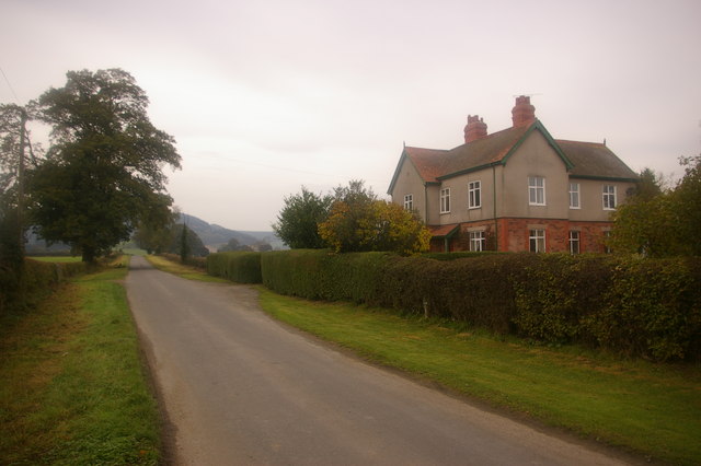
Hopton Heath
Hopton Heath, or Hoptonheath, is a hamlet in south Shropshire, England. The border with Herefordshire is close by. It lies on the border of the civil parishes...

Heath, Herefordshire
Heath (or The Heath) is a dispersed hamlet in north Herefordshire, England. It lies in the civil parish of Leintwardine, on the other side of the River...

Bedstone
Bedstone is a small village and civil parish in south Shropshire, England, close to the border with Herefordshire. The village is approximately 1+1⁄2 miles...

Clunbury
Clunbury is a village and civil parish in south Shropshire, England. It is near to the small town of Clun and the villages of Clunton, Purslow and Aston...
Nearby Amenities
Located within 500m of 52.396965,-2.933237Have you been to Hopton Castle?
Leave your review of Hopton Castle below (or comments, questions and feedback).