Teth Hill
Hill, Mountain in Perthshire
Scotland
Teth Hill

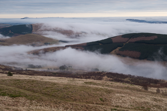
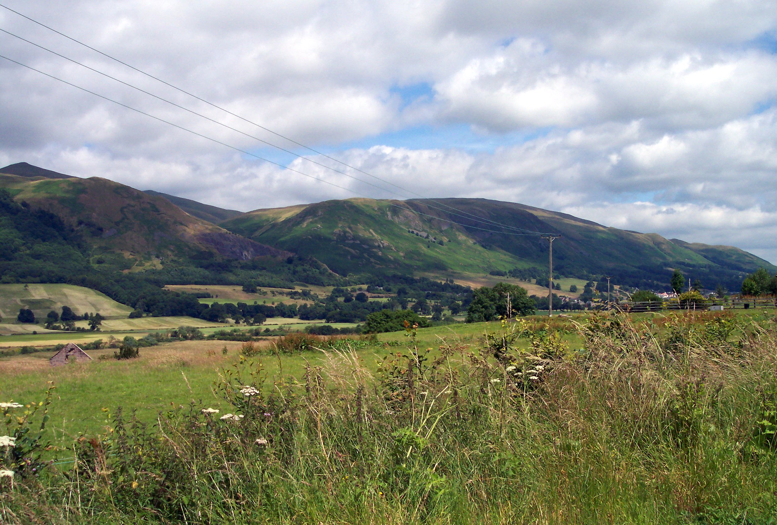
Teth Hill, located in Perthshire, Scotland, is a prominent hill that offers breathtaking views of the surrounding landscape. Situated in the picturesque countryside, this mountainous terrain stands at an elevation of approximately 1,121 feet (341 meters) above sea level. Teth Hill is part of the Ochil Hills range, known for their stunning natural beauty and rich historical significance.
The hill is covered in lush green vegetation, with patches of heather and grasses dotting the landscape. Hikers and nature enthusiasts are drawn to Teth Hill for its well-marked trails, making it a popular destination for outdoor activities. The paths wind through the hillside, leading visitors through woodlands and open fields, offering a chance to spot local wildlife, including deer, rabbits, and a variety of bird species.
At the summit, visitors are rewarded with panoramic views of the surrounding countryside, with vistas stretching across Perthshire and beyond. On a clear day, it is possible to spot landmarks such as the impressive Ben Vorlich and Loch Leven. The hill's location also provides a unique vantage point to observe the changing seasons, with vibrant autumn colors and snowy winter landscapes.
Teth Hill is easily accessible, with nearby parking and well-maintained paths suitable for walkers of all skill levels. Whether it's a leisurely stroll or a more challenging hike, Teth Hill offers a tranquil escape from city life, allowing visitors to connect with nature and immerse themselves in the beauty of Perthshire's countryside.
If you have any feedback on the listing, please let us know in the comments section below.
Teth Hill Images
Images are sourced within 2km of 56.226473/-3.655317 or Grid Reference NN9705. Thanks to Geograph Open Source API. All images are credited.


Teth Hill is located at Grid Ref: NN9705 (Lat: 56.226473, Lng: -3.655317)
Unitary Authority: Perth and Kinross
Police Authority: Tayside
What 3 Words
///gather.saved.condensed. Near Dollar, Clackmannanshire
Nearby Locations
Related Wikis

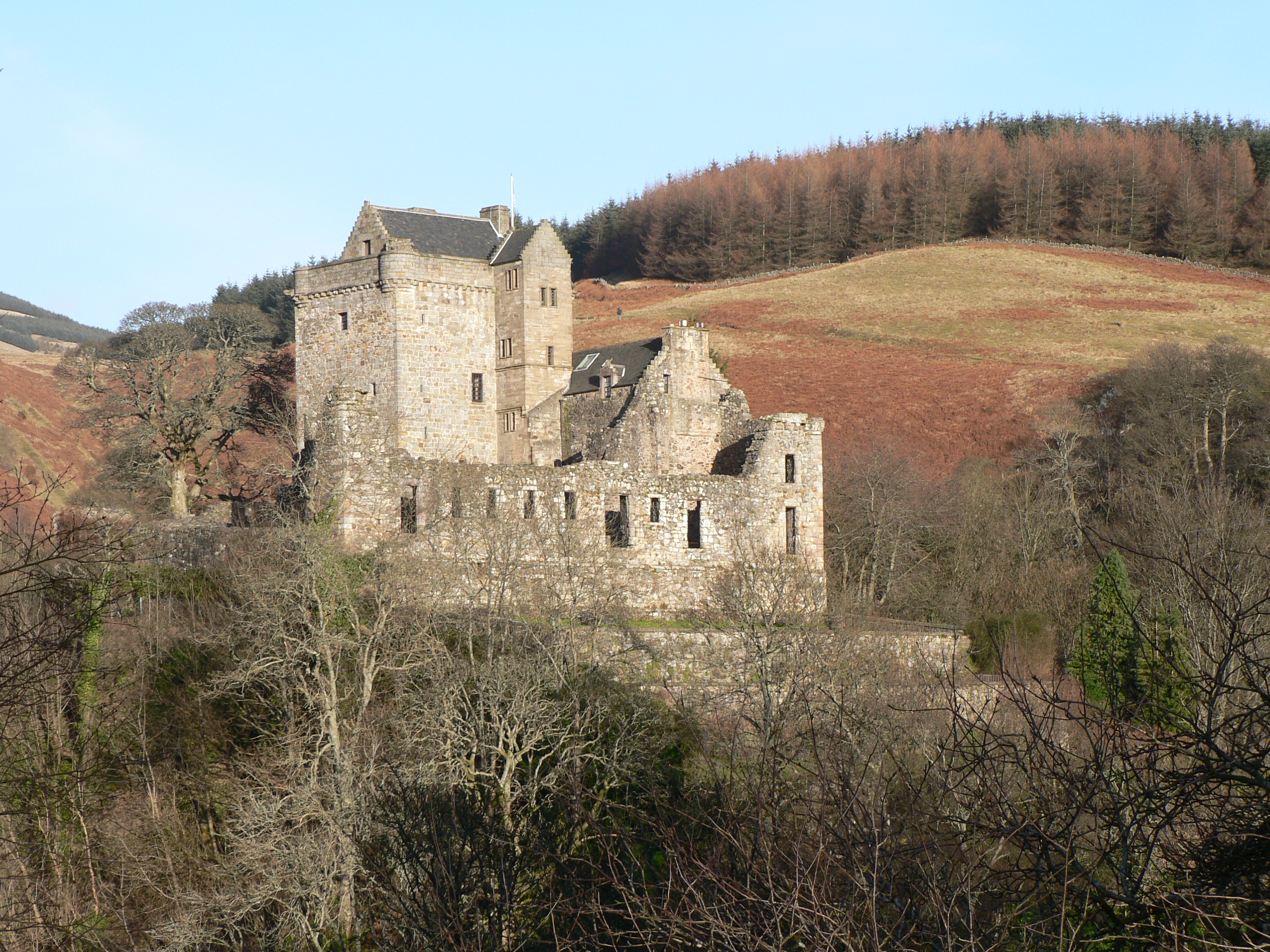
Glendevon Castle
Glendevon Castle is a collection of conjoined structures dating from the 15th century. The property is now (2022) semi-derelict. It lies on a private road...
Ochil Hills
The Ochil Hills ( ; Scottish Gaelic: Monadh Ochail is a range of hills in Scotland north of the Forth valley bordered by the cities of Stirling, Perth...
Strathdevon
Strathdevon is the strath of the River Devon in Clackmannanshire, Scotland. Strathdevon is associated with the parish of Muckhart and was up until 1971...
A823 road
The A823 is a road in Scotland which goes from south of Crieff to Dunfermline. It joins onto the A823(M) and the A822 which runs to Crieff.

Roman Catholic Archdiocese of St Andrews and Edinburgh
The Archdiocese of Saint Andrews & Edinburgh (Latin: Archidioecesis Sancti Andreae et Edimburgensis) is an archdiocese of the Latin Church of the Catholic...
Muckhart
Muckhart (Scottish Gaelic: Muc-Àird) commonly refers to two small villages in Clackmannanshire, Scotland, Pool of Muckhart (Scottish Gaelic: Poll Mhuc...
Castle Campbell
Castle Campbell is a medieval castle situated above the town of Dollar, Clackmannanshire, in central Scotland. It was the lowland seat of the earls and...

Innerdouny Hill
Innerdouny Hill (497 m) is a hill in the Ochil Hills of Perth and Kinross, Scotland. It is located northwest of the town of Kinross. The second highest...
Nearby Amenities
Located within 500m of 56.226473,-3.655317Have you been to Teth Hill?
Leave your review of Teth Hill below (or comments, questions and feedback).