Black Hill
Hill, Mountain in Perthshire
Scotland
Black Hill

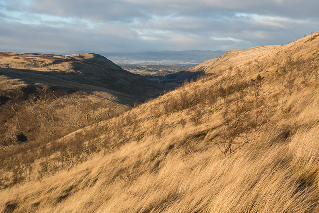
Black Hill is a prominent hill located in the region of Perthshire, Scotland. Standing at an impressive height of 741 meters (2,431 feet), it is often regarded as a popular destination for outdoor enthusiasts and hikers alike. Situated around 4 kilometers northwest of the village of Glenshee, it offers breathtaking views of the surrounding landscape, including the nearby Cairnwell Pass.
The ascent to the summit of Black Hill is relatively straightforward, with several well-defined paths and trails available for visitors to follow. The terrain consists mainly of heather-covered slopes, with occasional rocky outcrops adding to the scenic beauty of the area. The summit itself is marked by a trig point, providing a sense of accomplishment for those who reach the top.
Due to its accessibility and relatively modest elevation, Black Hill attracts a wide range of visitors throughout the year. During the summer months, hikers can enjoy the vibrant colors of the heather in full bloom, while in winter, the hill is a popular spot for snowshoeing and winter walking. The panoramic views from the top are particularly renowned, offering a sweeping vista of the surrounding mountains, glens, and valleys.
Black Hill is also renowned for its diverse wildlife, with a variety of bird species, including golden eagles, peregrine falcons, and red grouse, frequently spotted in the area. Additionally, the hill is home to a range of plant life, including rare alpine flowers that thrive in the higher altitudes.
Overall, Black Hill in Perthshire offers a captivating outdoor experience, combining stunning natural beauty with opportunities for exploration and adventure.
If you have any feedback on the listing, please let us know in the comments section below.
Black Hill Images
Images are sourced within 2km of 56.221702/-3.6680301 or Grid Reference NN9604. Thanks to Geograph Open Source API. All images are credited.


Black Hill is located at Grid Ref: NN9604 (Lat: 56.221702, Lng: -3.6680301)
Unitary Authority: Perth and Kinross
Police Authority: Tayside
What 3 Words
///recording.surviving.drop. Near Dollar, Clackmannanshire
Nearby Locations
Related Wikis
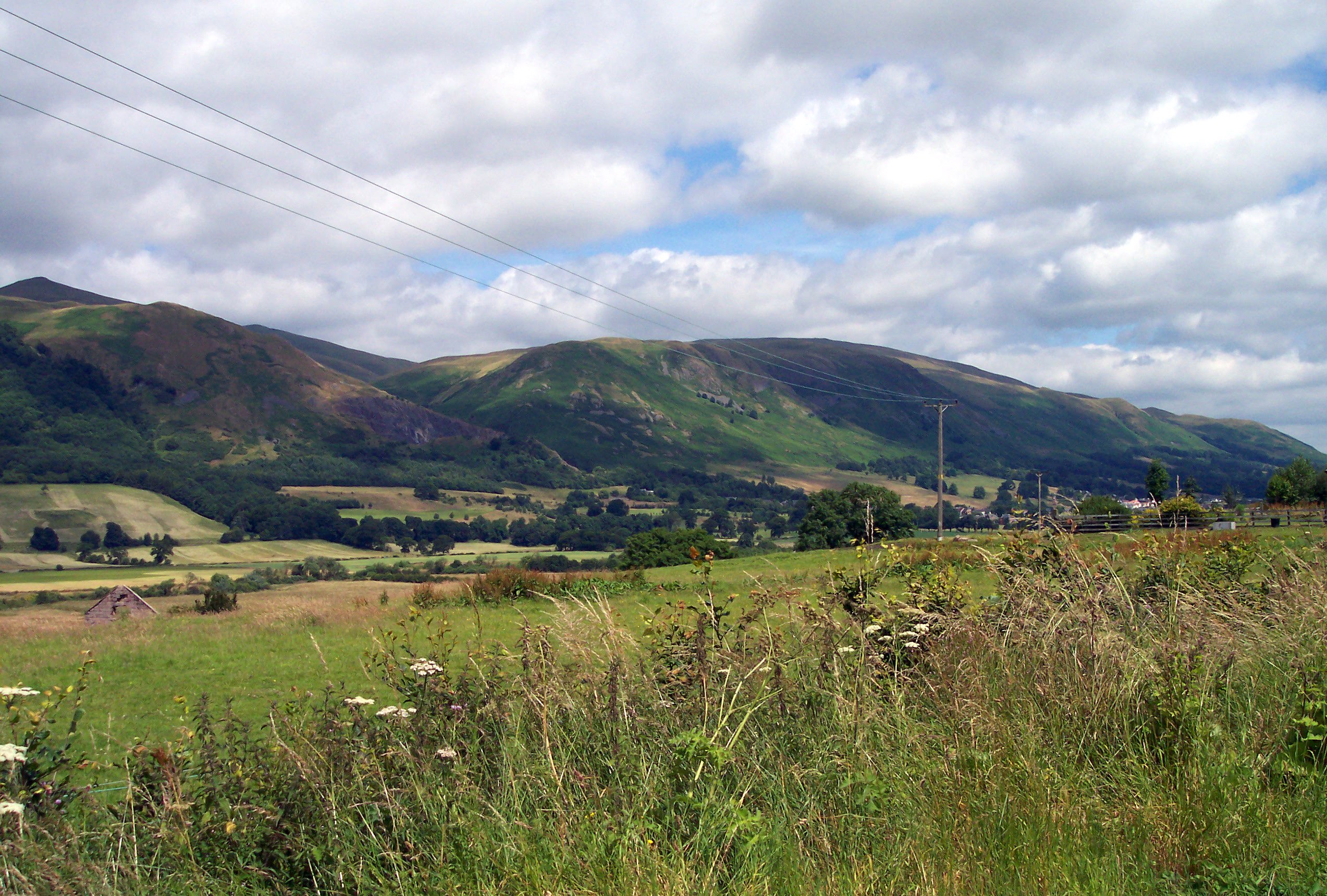
Ochil Hills
The Ochil Hills ( ; Scottish Gaelic: Monadh Ochail is a range of hills in Scotland north of the Forth valley bordered by the cities of Stirling, Perth...

Strathdevon
Strathdevon is the strath of the River Devon in Clackmannanshire, Scotland. Strathdevon is associated with the parish of Muckhart and was up until 1971...
Glendevon Castle
Glendevon Castle is a collection of conjoined structures dating from the 15th century. The property is now (2022) semi-derelict. It lies on a private road...
A823 road
The A823 is a road in Scotland which goes from south of Crieff to Dunfermline. It joins onto the A823(M) and the A822 which runs to Crieff.

Roman Catholic Archdiocese of St Andrews and Edinburgh
The Archdiocese of Saint Andrews & Edinburgh (Latin: Archidioecesis Sancti Andreae et Edimburgensis) is an archdiocese of the Latin Church of the Catholic...
Muckhart
Muckhart (Scottish Gaelic: Muc-Àird) commonly refers to two small villages in Clackmannanshire, Scotland, Pool of Muckhart (Scottish Gaelic: Poll Mhuc...
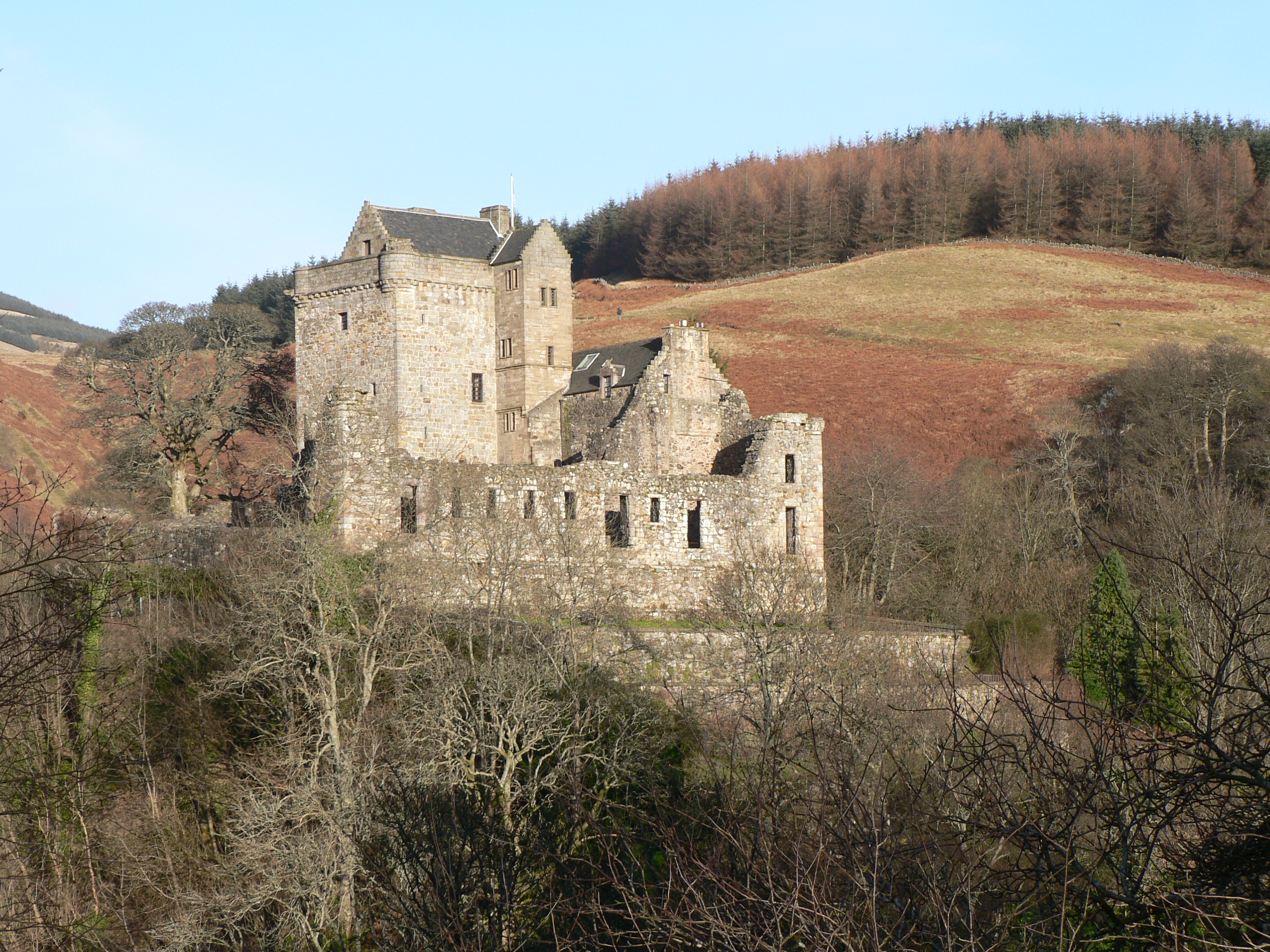
Castle Campbell
Castle Campbell is a medieval castle situated above the town of Dollar, Clackmannanshire, in central Scotland. It was the lowland seat of the earls and...

Dollar Glen
Dollar Glen is a small glen (valley) owned by the National Trust for Scotland. It is located in the Ochils that dramatically mark the Highland fault. It...
Nearby Amenities
Located within 500m of 56.221702,-3.6680301Have you been to Black Hill?
Leave your review of Black Hill below (or comments, questions and feedback).