Airgiod-Meall
Hill, Mountain in Inverness-shire
Scotland
Airgiod-Meall

Airgiod-Meall is a prominent hill located in Inverness-shire, a county in the Scottish Highlands. Standing at an elevation of 626 meters (2,054 feet), it offers breathtaking panoramic views of the surrounding countryside and is a popular destination for hikers and outdoor enthusiasts.
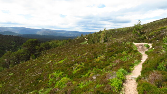
The hill is characterized by its rugged terrain, with steep slopes and rocky outcrops making it a challenging yet rewarding climb. The summit of Airgiod-Meall is marked by a cairn, which serves as a point of reference for those reaching the top.
The name Airgiod-Meall translates to "silver lump" in Gaelic, a reference to the silvery sheen that can be seen on the rocks in certain lights. The hill is situated within a designated conservation area, ensuring the protection of its natural beauty and wildlife.
Visitors to Airgiod-Meall can expect to encounter a variety of flora and fauna, including heather, grasses, and possibly deer or other wildlife. The hill is accessible via a network of trails and footpaths, making it a popular choice for both experienced hikers and those looking for a more leisurely stroll in the stunning Scottish countryside.
If you have any feedback on the listing, please let us know in the comments section below.
Airgiod-Meall Images
Images are sourced within 2km of 57.139985/-3.7096311 or Grid Reference NH9606. Thanks to Geograph Open Source API. All images are credited.


Airgiod-Meall is located at Grid Ref: NH9606 (Lat: 57.139985, Lng: -3.7096311)
Unitary Authority: Highland
Police Authority: Highlands and Islands
What 3 Words
///flock.leafing.fidgeted. Near Aviemore, Highland
Nearby Locations
Related Wikis
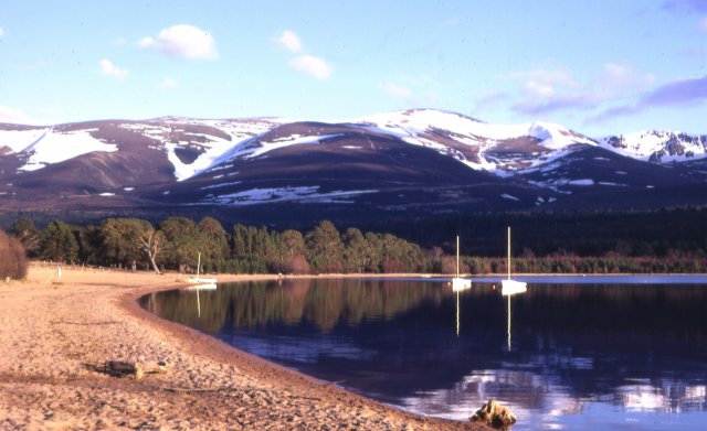
Loch Morlich
Loch Morlich (Scottish Gaelic, Loch Mhùrlaig) is a freshwater loch in the Badenoch and Strathspey area of Highland, Scotland near Aviemore. The loch is...

Cairngorm Mountain Railway
The Cairngorm Mountain Railway, which opened in 2001, is the highest railway in the United Kingdom. The two-kilometre long funicular ascends the northern...

Glenmore Forest Park
Glenmore Forest Park is a remnant of the Caledonian Forest near Aviemore in the Badenoch and Strathspey district of Highland, Scotland. Owned and managed...

Coire an t-Sneachda
Coire an t-Sneachda (sometimes misspelled as Coire an t'Sneachda) is a glacial cirque or corrie landform in the Cairngorm or Am Monadh Ruadh mountain range...
Nearby Amenities
Located within 500m of 57.139985,-3.7096311Have you been to Airgiod-Meall?
Leave your review of Airgiod-Meall below (or comments, questions and feedback).