Beinn Bhrotain

Hill, Mountain in Aberdeenshire

Scotland

Beinn Bhrotain

Flank of Monadh Mòr
Flank of Monadh Mòr Credit: Hugh Venables

The requested URL returned error: 429 Too Many Requests

If you have any feedback on the listing, please let us know in the comments section below.

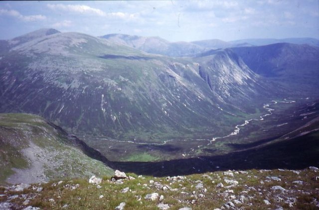
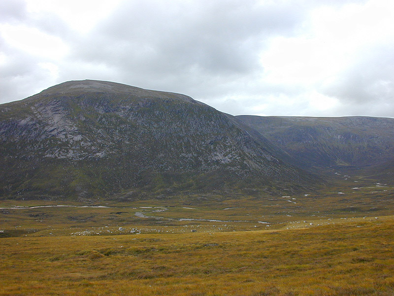
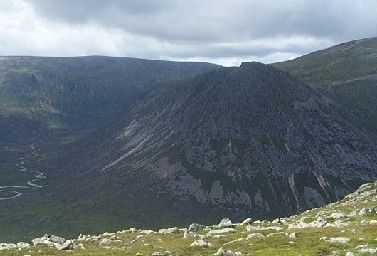
Beinn Bhrotain Images

Images are sourced within 2km of 57.009871/-3.723796 or Grid Reference NN9592. Thanks to Geograph Open Source API. All images are credited.

Flank of Monadh Mòr
Flank of Monadh Mòr
Flank of Monadh Mòr Short vegetation, due to the altitude of about 950m and probably some fairly heavy grazing pressure as well.
Flank of Monadh Mòr
Short vegetation, due to the altitude of about 950m and probably some fairly heavy grazing pressure as well.
Low vegetation below Leac Ghorm Making for extremely easy walking.
Low vegetation below Leac Ghorm
Making for extremely easy walking.
Beinn Bhrotain Seen from Carn Liath.
Beinn Bhrotain
Seen from Carn Liath.
Big Cairngorm scenery Looking across the Munro of Monadh Mor from Beinn Bhrotain to distant Munro Sgor Gaoith.
Big Cairngorm scenery
Looking across the Munro of Monadh Mor from Beinn Bhrotain to distant Munro Sgor Gaoith.
The summit cairns of Beinn Bhrotain In the far distance, Sgor Gaoith and its neighbours can be seen
The summit cairns of Beinn Bhrotain
In the far distance, Sgor Gaoith and its neighbours can be seen
View north from Beinn Bhrotain In the distance, the 4000 foot peaks which run from Braeriach round to Cairn Toul. Braeriach itself is largely hidden; the three peaks most prominent are Einich Cairn, Sgùrr an Lochan Uaine, and Cairn Toul
View north from Beinn Bhrotain
In the distance, the 4000 foot peaks which run from Braeriach round to Cairn Toul. Braeriach itself is largely hidden; the three peaks most prominent are Einich Cairn, Sgùrr an Lochan Uaine, and Cairn Toul
South east from Beinn Bhrotain Ahead lies the gently sloping mix of moss and heather which feeds the Allt Garbh. Beyond lies Carn Cloich-mhuilinn, once the Munro on which Munro planned to complete his round, now a Munro no more.
South east from Beinn Bhrotain
Ahead lies the gently sloping mix of moss and heather which feeds the Allt Garbh. Beyond lies Carn Cloich-mhuilinn, once the Munro on which Munro planned to complete his round, now a Munro no more.
Glen Geusachan A view down Glen Geusachan to the Devils Point and Cairn Toul, with Ben MacDhui in the background.
Glen Geusachan
A view down Glen Geusachan to the Devils Point and Cairn Toul, with Ben MacDhui in the background.
Hillwalkers on the southeast ridge of Beinn Bhrotain
Glen south of Beinn Bhrotain - Monadh Mor col
Aghaidh Gharbh A windswept tundra sitting high on Beinn Bhrotain's southern flank.  Vegetation is usually short, or abscent altogether on much of the high plateaus of the Cairngorms.
Aghaidh Gharbh
A windswept tundra sitting high on Beinn Bhrotain's southern flank. Vegetation is usually short, or abscent altogether on much of the high plateaus of the Cairngorms.
Leac Ghorm Fine gravel mixed with short heather makes for easy walking.  This is the southeastern end of Mondah Mòr's long whaleback ridge.
Leac Ghorm
Fine gravel mixed with short heather makes for easy walking. This is the southeastern end of Mondah Mòr's long whaleback ridge.
Allt Dhàidh Beag The source of the Allt Dhàidh Beag high on Beinn Bhrotain.  The burn flows for less than four kilometres before it joins Gelgie Burn.
Allt Dhàidh Beag
The source of the Allt Dhàidh Beag high on Beinn Bhrotain. The burn flows for less than four kilometres before it joins Gelgie Burn.
Beinn Bhrotain's south ridge Beinn Bhrotain is a substantial mountain with a lot of ground above 900m.  The approach to the summit from the south leads up this gentle ridge.
Beinn Bhrotain's south ridge
Beinn Bhrotain is a substantial mountain with a lot of ground above 900m. The approach to the summit from the south leads up this gentle ridge.
Scree, Beinn Bhrotain A descent west from Beinn Bhrotain's summit leads down steadily steepening bouldery scree making progress rather slow.
Scree, Beinn Bhrotain
A descent west from Beinn Bhrotain's summit leads down steadily steepening bouldery scree making progress rather slow.
975m col A high col between Beinn Bhrotain and Monadh Mòr.  Most hillwalkers traverse between the two mountains but there is some evidence of people having descended down to, or climbed up from the Geusachan Burn to the col.
975m col
A high col between Beinn Bhrotain and Monadh Mòr. Most hillwalkers traverse between the two mountains but there is some evidence of people having descended down to, or climbed up from the Geusachan Burn to the col.
Crags, Beinn Bhrotain Beinn Bhrotain's northern side and some of its eastern side are defended by some quite sizeable crags overhanging Glen Geusachan and Glen Dee.
Crags, Beinn Bhrotain
Beinn Bhrotain's northern side and some of its eastern side are defended by some quite sizeable crags overhanging Glen Geusachan and Glen Dee.
Show me another place!

Beinn Bhrotain is located at Grid Ref: NN9592 (Lat: 57.009871, Lng: -3.723796)

Unitary Authority: Aberdeenshire

Police Authority: North East

What 3 Words

///certified.helm.apes. Near Inverey, Aberdeenshire

Nearby Locations

Beinn Bhrotain

Related Wikis

Beinn Bhrotain

Beinn Bhrotain (Scottish Gaelic: Hill of the mastiff) or Ben Vrottan is a Scottish mountain in the Cairngorms range, 18 kilometres west of Braemar in the...

Falls of Dee

Falls of Dee is a waterfall on Braeriach in the Cairngorms, Scotland. == See also == Waterfalls of Scotland == References ==

Monadh Mòr

Monadh Mòr (Scottish Gaelic: Big Hill) is a mountain in the Cairngorms region of the Highlands of Scotland. A pass connects it with Beinn Bhrotain. �...

The Devil's Point

The Devil's Point (Scottish Gaelic: Bod an Deamhain) is a mountain in the Cairngorms of Scotland, lying to the west of the Lairig Ghru pass. The Gaelic...

Nearby Amenities

Located within 500m of 57.009871,-3.723796
Beinn Bhrotain
Description: Hill of the mastiff
Ele: 1157
Man Made: survey_point
Marilyn: yes
Munro: yes
Munro Number: M019
Natural: peak
Prominence: 258
Source: NPE
Wikidata: Q3397864
Wikipedia: en:Beinn Bhrotain
Lat/Long: 57.0098569/-3.7237921
Man Made: cairn
Lat/Long: 57.0093432/-3.7237721
The data included in this document is from www.openstreetmap.org. The data is made available under ODbL.

Have you been to Beinn Bhrotain?

Leave your review of Beinn Bhrotain below (or comments, questions and feedback).