Hannah Moor

Hill, Mountain in Cumberland Copeland

England

Hannah Moor

The bird ledges at St Bees Head Thousands of sea birds nest here - some are just visible. The white streaks are from their droppings.
The bird ledges at St Bees Head Credit: David Medcalf

Hannah Moor, located in Cumberland, is a prominent hill/mountain that offers picturesque views and outdoor recreational opportunities. Rising to an elevation of approximately 1,450 feet, it is a notable landmark in the Cumberland region of the United States.

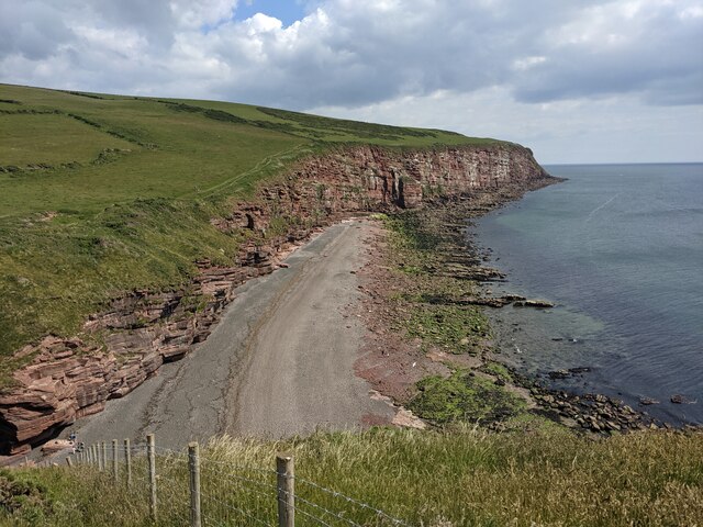
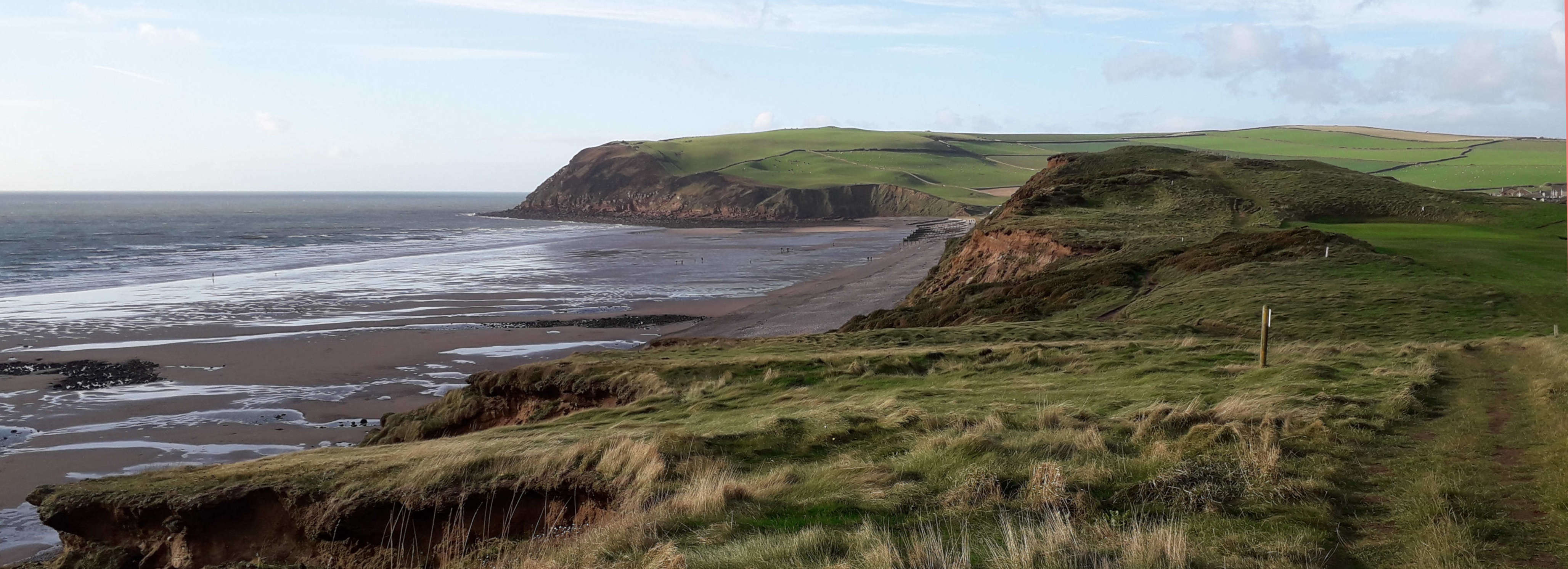
The hill/mountain is characterized by its rugged terrain, with steep slopes and rocky outcrops. Its unique geological formations attract hikers, climbers, and nature enthusiasts from all around. The hill/mountain is covered in a mix of deciduous and coniferous trees, creating a beautiful and diverse landscape.

Hannah Moor is known for its well-maintained hiking trails that cater to various skill levels. The trails traverse through dense forests, across babbling brooks, and up rocky slopes, providing an immersive experience in nature. The hill/mountain is also home to a variety of wildlife, including deer, squirrels, and various bird species, making it a popular spot for wildlife watching and birding.

In addition to hiking, Hannah Moor offers opportunities for other outdoor activities like camping, picnicking, and photography. The hill/mountain's elevation also makes it an excellent location for paragliding and hang gliding, attracting thrill-seekers and adventure enthusiasts.

Overall, Hannah Moor in Cumberland is a scenic and adventure-filled destination that offers a range of outdoor activities for visitors of all ages and interests. Whether it's exploring the trails, capturing stunning photographs, or simply enjoying the tranquility of nature, this hill/mountain provides a memorable experience for all who visit.

If you have any feedback on the listing, please let us know in the comments section below.

Hannah Moor Images

Images are sourced within 2km of 54.504375/-3.6196728 or Grid Reference NX9513. Thanks to Geograph Open Source API. All images are credited.

The bird ledges at St Bees Head Thousands of sea birds nest here - some are just visible. The white streaks are from their droppings.
The bird ledges at St Bees Head
Thousands of sea birds nest here - some are just visible. The white streaks are from their droppings.
Gate and fishing boat On the Coast Path.
Gate and fishing boat
On the Coast Path.
Ground slump field? I think the land has dropped seawards here, creating a convenient small field.
Ground slump field?
I think the land has dropped seawards here, creating a convenient small field.
Down the steps to Fleswick On the Coast Path.
Down the steps to Fleswick
On the Coast Path.
Rock architecture at Fleswick
A field above Fleswick
Coastline at St Bees Head
Broken stile and locked gate On the public footpath.
Broken stile and locked gate
On the public footpath.
Farm track and footpath
Hannahmoor Lane
Hannahmoor Lane
B5345 at Byerstead Road junction
St. Bees Head The 75m high red sandstone cliffs of St. Bees North Head.
The Cumbria Coastal Way runs along the cliff top behind the post and wire fence.
St. Bees Head
The 75m high red sandstone cliffs of St. Bees North Head. The Cumbria Coastal Way runs along the cliff top behind the post and wire fence.
St. Bees Lighthouse
St. Bees Lighthouse
St. Bees Lighthouse The substantial stone wall separates a lawned area in front of the lighthouse from the farmer's field in the foreground.
St. Bees Lighthouse
The substantial stone wall separates a lawned area in front of the lighthouse from the farmer's field in the foreground.
Dramatic coastline by the Cumbria Coastal Way Whitehaven is in the distance: time to glimpse back en route to St Bees Head.

This photograph was taken during the Coronavirus (COVID-19) pandemic of 2020/21/22.
Dramatic coastline by the Cumbria Coastal Way
Whitehaven is in the distance: time to glimpse back en route to St Bees Head. This photograph was taken during the Coronavirus (COVID-19) pandemic of 2020/21/22.
On the Cumbria Coastal Way near North Head An easy section of the Way with spectacular views.

This photograph was taken during the Coronavirus (COVID-19) pandemic of 2020/21/22.
On the Cumbria Coastal Way near North Head
An easy section of the Way with spectacular views. This photograph was taken during the Coronavirus (COVID-19) pandemic of 2020/21/22.
St Bees Head fog signal station The disused triple frequency Tannoy fog signal station which was operational from the 1960s until 1987.  The building had 36 Tannoy loudspeakers, the recesses for two can be noted on the tower above the roof line of the building.

This photograph was taken during the Coronavirus (COVID-19) pandemic of 2020/21/22.
St Bees Head fog signal station
The disused triple frequency Tannoy fog signal station which was operational from the 1960s until 1987. The building had 36 Tannoy loudspeakers, the recesses for two can be noted on the tower above the roof line of the building. This photograph was taken during the Coronavirus (COVID-19) pandemic of 2020/21/22.
St Bees Head fog signal station and the Solway Firth The view near St Bees Lighthouse on a beautiful early March afternoon encompasses the fog signal station, Solway Firth and Scottish coastline.

This photograph was taken during the Coronavirus (COVID-19) pandemic of 2020/21/22.
St Bees Head fog signal station and the Solway Firth
The view near St Bees Lighthouse on a beautiful early March afternoon encompasses the fog signal station, Solway Firth and Scottish coastline. This photograph was taken during the Coronavirus (COVID-19) pandemic of 2020/21/22.
Show me another place!

Hannah Moor is located at Grid Ref: NX9513 (Lat: 54.504375, Lng: -3.6196728)

Administrative County: Cumbria

District: Copeland

Police Authority: Cumbria

What 3 Words

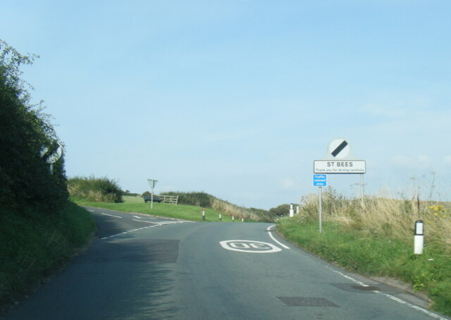
///salsa.either.daredevil. Near St Bees, Cumbria

Related Wikis

St Bees Head

St Bees Head is a headland on the North West coast of the English county of Cumbria and is named after the nearby village of St Bees. It is the only stretch...

Rottington

Rottington is a hamlet and former civil parish which is 3 miles (4.8 km) from Whitehaven; now in the parish of St Bees, Cumberland, Cumbria, England. It...
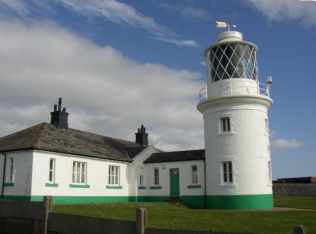
St Bees Lighthouse

St Bees Lighthouse is a lighthouse located on St Bees Head near the village of St Bees in Cumbria, England. The cliff-top light is the highest in England...

St Bees Head RSPB reserve

St Bees Head RSPB Reserve at St Bees Head, Cumbria, England, is a coastal site which provides a home for thousands of seabirds under the care of the RSPB...

Nearby Amenities

Located within 500m of 54.504375,-3.6196728
The data included in this document is from www.openstreetmap.org. The data is made available under ODbL.

Have you been to Hannah Moor?

Leave your review of Hannah Moor below (or comments, questions and feedback).