Ben Vrackie

Hill, Mountain in Perthshire

Scotland

Ben Vrackie

Ben Vrackie The goat is hoping to have a bite of Tom Weir's piece.
Ben Vrackie Credit: Raibeart MacAoidh

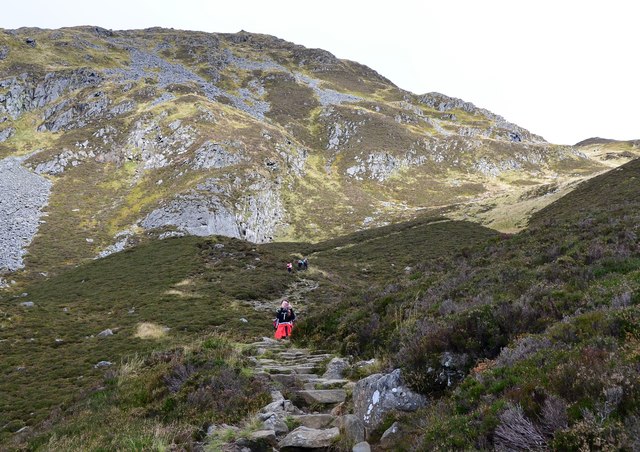
Ben Vrackie is a prominent hill located in Perthshire, Scotland. Standing at a height of 841 meters (2,759 feet), it is a popular destination for hikers and outdoor enthusiasts. The name "Ben Vrackie" is derived from the Gaelic Beinn a' Bhreacaidh, meaning "speckled mountain," which is a reference to the patches of heather and bracken that cover its slopes.

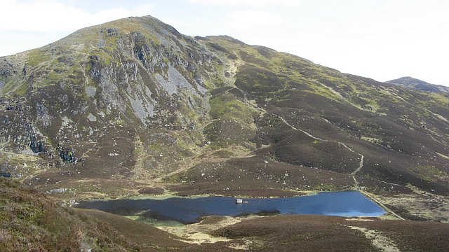
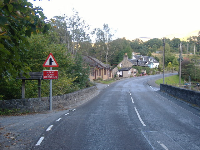
The hill is situated near the town of Pitlochry, making it easily accessible for visitors. The ascent to the summit of Ben Vrackie offers stunning panoramic views of the surrounding countryside, including Loch a' Choire, the Tummel Valley, and the Cairngorms National Park.

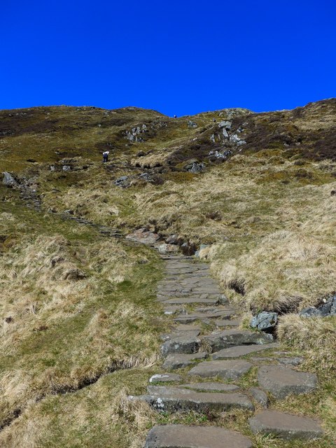
The well-maintained path to the top of Ben Vrackie passes through a variety of landscapes, from dense forests to open moorland, providing a diverse and rewarding hiking experience. Wildlife such as red deer, mountain hares, and a variety of bird species can often be spotted along the way.

Overall, Ben Vrackie is a must-visit destination for those looking to experience the natural beauty and rugged terrain of Perthshire.

If you have any feedback on the listing, please let us know in the comments section below.

Ben Vrackie Images

Images are sourced within 2km of 56.749008/-3.7173378 or Grid Reference NN9563. Thanks to Geograph Open Source API. All images are credited.

Ben Vrackie The goat is hoping to have a bite of Tom Weir's piece.
Ben Vrackie
The goat is hoping to have a bite of Tom Weir's piece.
Ben Vrackie Tom Weir (centre) on Ben Vrackie.
Ben Vrackie
Tom Weir (centre) on Ben Vrackie.
Snow covered summit of Ben Vrackie towards Beinn a' Ghlo
Gate on the Ben Vrackie path A gate in the fence west of Creag Bhreac with the heathery slopes of Meall Uaine in the background.
Gate on the Ben Vrackie path
A gate in the fence west of Creag Bhreac with the heathery slopes of Meall Uaine in the background.
Ben Vrackie The last 350m of the ascent from Pitlochry start from the dam on Loch a' Choire. Much of the path has been rebuilt as a stone staircase.
Ben Vrackie
The last 350m of the ascent from Pitlochry start from the dam on Loch a' Choire. Much of the path has been rebuilt as a stone staircase.
On the way up Ben Vrackie The path from Pitlochry is heavily used and has been built up as a stone staircase on the steeper parts.
On the way up Ben Vrackie
The path from Pitlochry is heavily used and has been built up as a stone staircase on the steeper parts.
A busy day on Ben Vrackie The Corbett Ben Vrackie is a popular ascent from Pitlochry and the path above Loch a' Choire was busy in both directions.
A busy day on Ben Vrackie
The Corbett Ben Vrackie is a popular ascent from Pitlochry and the path above Loch a' Choire was busy in both directions.
Looking east from Ben Vrackie The nearby cairn is on Creag Tharsuinn with Carn Geal (776m) beyond.
Looking east from Ben Vrackie
The nearby cairn is on Creag Tharsuinn with Carn Geal (776m) beyond.
Descending Ben Vrackie The stone-stepped path down to Loch a' Choire needs a bit of care in the wet.
Descending Ben Vrackie
The stone-stepped path down to Loch a' Choire needs a bit of care in the wet.
Walkers by Loch a' Choire, Ben Vrackie A group on the path by the loch which leads around Meall na h-Aodainn Moire to join the bealach path from Killiekrankie.
Walkers by Loch a' Choire, Ben Vrackie
A group on the path by the loch which leads around Meall na h-Aodainn Moire to join the bealach path from Killiekrankie.
A rest stop on the Ben Vrackie path There are two comfortable benches here by the side of the path.  Ben Vrackie summit is directly above the bench.
A rest stop on the Ben Vrackie path
There are two comfortable benches here by the side of the path. Ben Vrackie summit is directly above the bench.
Gate on the Ben Vrackie path The summit itself just the pimple on the left horizon.
Gate on the Ben Vrackie path
The summit itself just the pimple on the left horizon.
The Ben Vrackie path Loch a' Choire, with its earth dam, in the distance.
The Ben Vrackie path
Loch a' Choire, with its earth dam, in the distance.
The Ben Vrackie path This 'tourist path' is quite tough going, but on this glorious May day there must have been over 100 people on or near the summit.
The Ben Vrackie path
This 'tourist path' is quite tough going, but on this glorious May day there must have been over 100 people on or near the summit.
Steps on the Ben Vrackie path The final third or so of this walk is on rough steps;  steep going up and care needed on the way down!
Steps on the Ben Vrackie path
The final third or so of this walk is on rough steps; steep going up and care needed on the way down!
Crowded summit of Ben Vrackie In the far left distance the hills of The Blackmount and Glencoe are just visible
Crowded summit of Ben Vrackie
In the far left distance the hills of The Blackmount and Glencoe are just visible
The path down to Bealach na Searmoin Note that the actual path has moved a good bit from the OS 25,000 mapping.
The path down to Bealach na Searmoin
Note that the actual path has moved a good bit from the OS 25,000 mapping.
Muirburn markings approaching the Killiecrankie path
Show me another place!

Ben Vrackie is located at Grid Ref: NN9563 (Lat: 56.749008, Lng: -3.7173378)

Unitary Authority: Perth and Kinross

Police Authority: Tayside

What 3 Words

///earpiece.unfocused.pioneered. Near Pitlochry, Perth & Kinross

Nearby Locations

Ben Vrackie

Related Wikis

Ben Vrackie

Ben Vrackie (Scottish Gaelic: Beinn a' Bhreacaidh; sometimes anglicised as Ben Y Vrackie) is a mountain in Perthshire, Scotland. It lies north of the town...

Pass of Killiecrankie

Three miles north of Pitlochry by the A9 road, the Pass of Killiecrankie (Gaelic: Coille Chneagaidh), is a gorge lying between Ben Vrackie (841 m (2,759...

Killiecrankie

Killiecrankie ( ; (Scottish Gaelic: Coille Chreithnich, meaning aspen wood) is a village in Perth and Kinross, Scotland on the River Garry. It lies at...

Battle of Killiecrankie

The Battle of Killiecrankie (Scottish Gaelic: Blàr Choille Chnagaidh), also referred to as the Battle of Rinrory, took place on 27 July 1689 during the...

Nearby Amenities

Located within 500m of 56.749008,-3.7173378
Ben Vrackie
Alt Name: Ben-y-Vrackie
Corbett: yes
Ele: 841
Graham: no
Marilyn: yes
Munro: no
Natural: peak
Prominence: 402
Wikidata: Q2658333
Wikipedia: en:Ben Vrackie
Lat/Long: 56.749/-3.7173179
Tourism: viewpoint
Lat/Long: 56.7490578/-3.7171811
Inscription: Perth and Kinross Council has adopted this triangulation point in memory of Councillor John Wilson / Died 11 September 1998, age 82 / Who strived to improve access to Ben Vrackie through his work within the Council
Man Made: survey_point
Ref: S9444
Source: survey
Lat/Long: 56.7489743/-3.7172587
The data included in this document is from www.openstreetmap.org. The data is made available under ODbL.

Have you been to Ben Vrackie?

Leave your review of Ben Vrackie below (or comments, questions and feedback).