Beinn Bheag

Hill, Mountain in Perthshire

Scotland

Beinn Bheag

Bràigh Coire Chruinn-bhalgain and Beinn Bheag South side of Beinn a' Ghlo with the new path which has a branch either side of Beinn Bheag (right)
Bràigh Coire Chruinn-bhalgain and Beinn Bheag Credit: Richard Webb

The requested URL returned error: 429 Too Many Requests

If you have any feedback on the listing, please let us know in the comments section below.
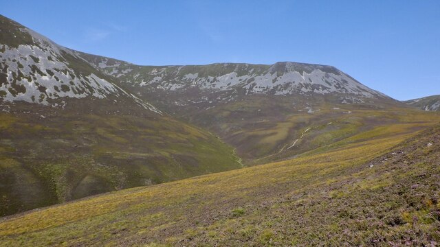
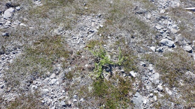
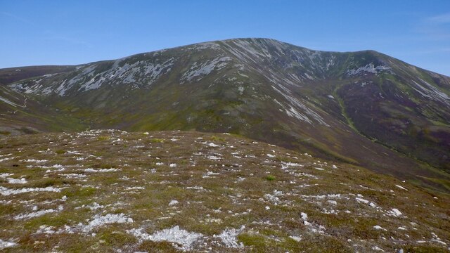
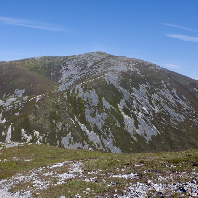
Beinn Bheag Images

Images are sourced within 2km of 56.812805/-3.7230734 or Grid Reference NN9470. Thanks to Geograph Open Source API. All images are credited.

Bràigh Coire Chruinn-bhalgain and Beinn Bheag South side of Beinn a' Ghlo with the new path which has a branch either side of Beinn Bheag (right)
Bràigh Coire Chruinn-bhalgain and Beinn Bheag
South side of Beinn a' Ghlo with the new path which has a branch either side of Beinn Bheag (right)
Coire na Saobhaidh, Beinn a' Ghlo View towards the screes below the main ridge on Beinn Mhaol.
Coire na Saobhaidh, Beinn a' Ghlo
View towards the screes below the main ridge on Beinn Mhaol.
Coire na Saobhaidh, Beinn a' Ghlo The path is excellent and a worthy objective in itself, especially now when the deer grass is turning and the hill is covered in blaeberries.
Coire na Saobhaidh, Beinn a' Ghlo
The path is excellent and a worthy objective in itself, especially now when the deer grass is turning and the hill is covered in blaeberries.
Larch, Beinn Bheag A larch tree having a go at it at over 700m above sea level, and by a summit.
Larch, Beinn Bheag
A larch tree having a go at it at over 700m above sea level, and by a summit.
Summit, Beinn Bheag With Bràigh Coire Chruinn-bhalgain and Airgiod-bheinn beyond and a lot higher.
Summit, Beinn Bheag
With Bràigh Coire Chruinn-bhalgain and Airgiod-bheinn beyond and a lot higher.
Coire na Saobhaidh, Beinn a' Ghlo Typical curvy Beinn a' Ghlo scenery. The corrie under Carn Liath with the main ridge above it.
Coire na Saobhaidh, Beinn a' Ghlo
Typical curvy Beinn a' Ghlo scenery. The corrie under Carn Liath with the main ridge above it.
Summit ridge, Beinn Bheag Bràigh Coire Chruinn-bhalgain forms the background.
Summit ridge, Beinn Bheag
Bràigh Coire Chruinn-bhalgain forms the background.
Beinn Bheag / Carn Liath col Crossed by a useful path out of Coire na Saobhaidhe up to the main ridge. Very colourful as the deer grass turns yellow orange.
Beinn Bheag / Carn Liath col
Crossed by a useful path out of Coire na Saobhaidhe up to the main ridge. Very colourful as the deer grass turns yellow orange.
Path on Beinn a' Ghlo This path comes in from Coire na Saobhaidh and runs up to the ridge between Bràigh Coire Chruinn-bhalgain and Carn Liath.
Path on Beinn a' Ghlo
This path comes in from Coire na Saobhaidh and runs up to the ridge between Bràigh Coire Chruinn-bhalgain and Carn Liath.
Path on Beinn a' Ghlo
Paths, Beinn a' Ghlo The col between Bràigh Coire Chruinn-bhalgain and Carn Liath where a path from the south meets the main ridge route. The usual way to Bràigh Coire Chruinn-bhalgain cuts a corner and can be seen as a white line in the background.
Paths, Beinn a' Ghlo
The col between Bràigh Coire Chruinn-bhalgain and Carn Liath where a path from the south meets the main ridge route. The usual way to Bràigh Coire Chruinn-bhalgain cuts a corner and can be seen as a white line in the background.
Path on Bràigh Coire Chruinn-bhalgain The path from Carn Liath ascending Bràigh Coire Chruinn-bhalgain.
Path on Bràigh Coire Chruinn-bhalgain
The path from Carn Liath ascending Bràigh Coire Chruinn-bhalgain.
Coire Crom On the north side of Beinn a' Ghlo between Bràigh Coire Chruinn-bhalgain and Carn Liath.
Coire Crom
On the north side of Beinn a' Ghlo between Bràigh Coire Chruinn-bhalgain and Carn Liath.
Bràigh Coire Chruinn-bhalgain / Carn Liath col The main path on Beinn a' Ghlo.
Bràigh Coire Chruinn-bhalgain / Carn Liath col
The main path on Beinn a' Ghlo.
Bràigh Coire Chruinn-bhalgain View from Beinn Mhaol.
Bràigh Coire Chruinn-bhalgain
View from Beinn Mhaol.
On Beinn a' Ghlo The path of Beinn Mhaol, the curving ridge between Carn Liath and Bràigh Coire Chruinn-bhalgain. The highest summit, Carn nan Gabhar is also visible in the background.
On Beinn a' Ghlo
The path of Beinn Mhaol, the curving ridge between Carn Liath and Bràigh Coire Chruinn-bhalgain. The highest summit, Carn nan Gabhar is also visible in the background.
Path on Beinn Mhaol The north ridge of Carn Liath on Beinn a' Ghlo.
Path on Beinn Mhaol
The north ridge of Carn Liath on Beinn a' Ghlo.
Beinn Bheag View from the main ridge on Beinn Mhaol.
Beinn Bheag
View from the main ridge on Beinn Mhaol.
Show me another place!

Beinn Bheag is located at Grid Ref: NN9470 (Lat: 56.812805, Lng: -3.7230734)

Unitary Authority: Perth and Kinross

Police Authority: Tayside

What 3 Words

///anchovies.studs.claims. Near Blair Atholl, Perth & Kinross

Related Wikis

Càrn Liath (Munro)

Carn Liath (976 m) is a mountain in the Grampian Mountains of Scotland. It lies east of Blair Atholl in Perthshire, Scotland. Although belonging to the...

Beinn a' Ghlò

Beinn a’ Ghlò is a Scottish mountain situated roughly 10 km (6 mi) north east of Blair Atholl in the Forest of Atholl in between Glen Tilt and Glen Loch...

Glen Tilt

Glen Tilt (Scottish Gaelic: Gleann Teilt) is a glen in the extreme north of Perthshire, Scotland. Beginning at the confines of Aberdeenshire, it follows...

Ben Vuirich

Ben Vuirich (903 m) is a mountain in the Grampian Mountains of Scotland. It is located in Perthshire, north of the town of Pitlochry. A mountain of heather...

Nearby Amenities

Located within 500m of 56.812805,-3.7230734
Ford: yes
Lat/Long: 56.8159153/-3.7190411
The data included in this document is from www.openstreetmap.org. The data is made available under ODbL.

Have you been to Beinn Bheag?

Leave your review of Beinn Bheag below (or comments, questions and feedback).