Airdrie Hill

Hill, Mountain in Kirkcudbrightshire

Scotland

Airdrie Hill

Criffel Very prominent hill seen from the A710 near Kirkbean
Criffel Credit: Eirian Evans

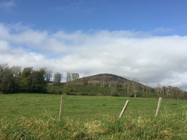
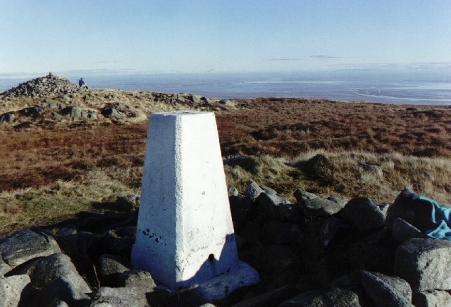
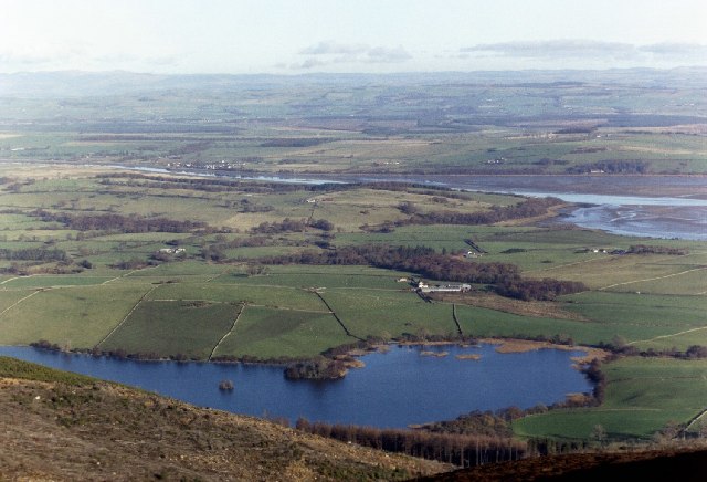
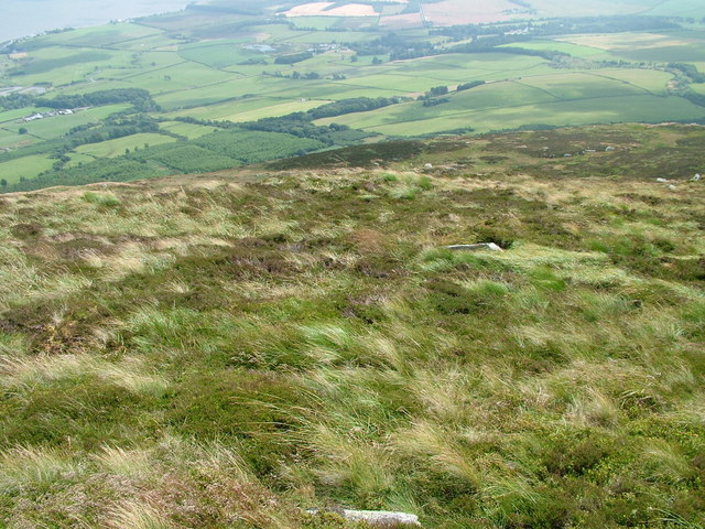
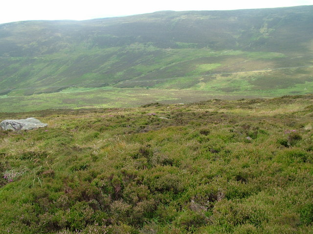
Airdrie Hill is a prominent geographical feature located in the region of Kirkcudbrightshire in Scotland. Rising to an elevation of approximately 1,000 feet (305 meters), it is categorized as a hill rather than a mountain due to its height. Situated in the southern part of the country, Airdrie Hill offers breathtaking panoramic views of the surrounding landscape.

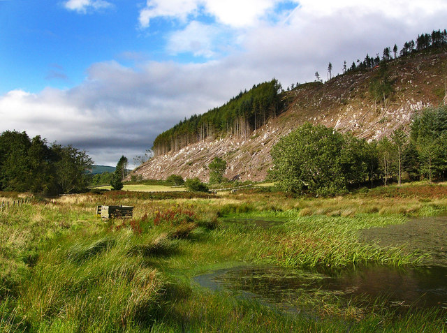
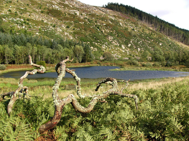
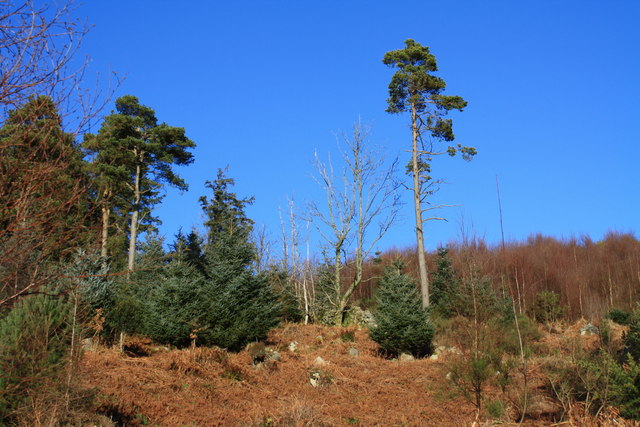
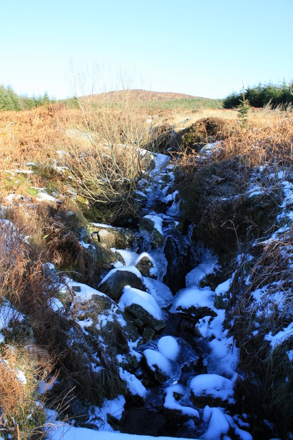
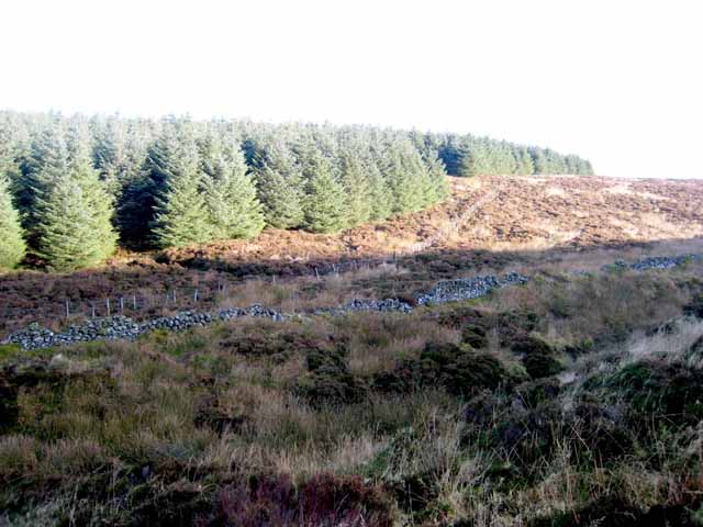
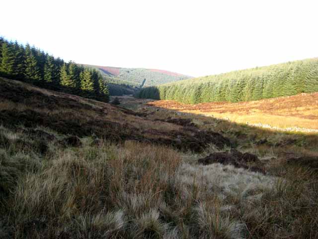
The hill is covered in a mixture of grass and heather, creating a vibrant display of colors during the summer months. It is also home to a variety of plant and animal species, including foxes, rabbits, and various species of birds. The diverse ecosystem of Airdrie Hill makes it an ideal location for nature enthusiasts and hikers to explore.

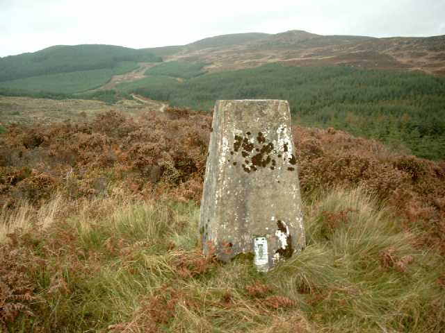
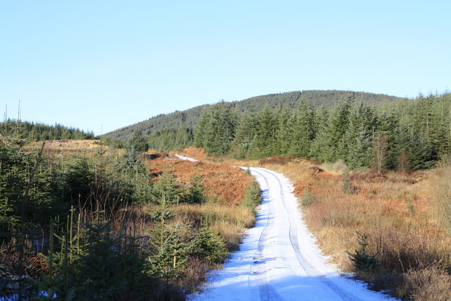
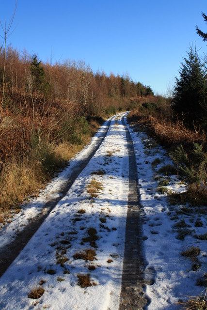
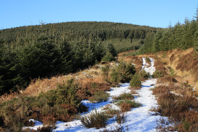
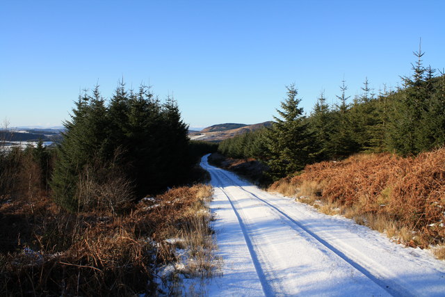
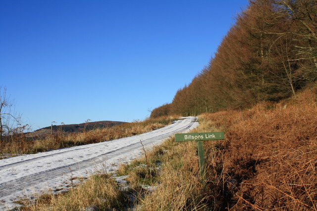
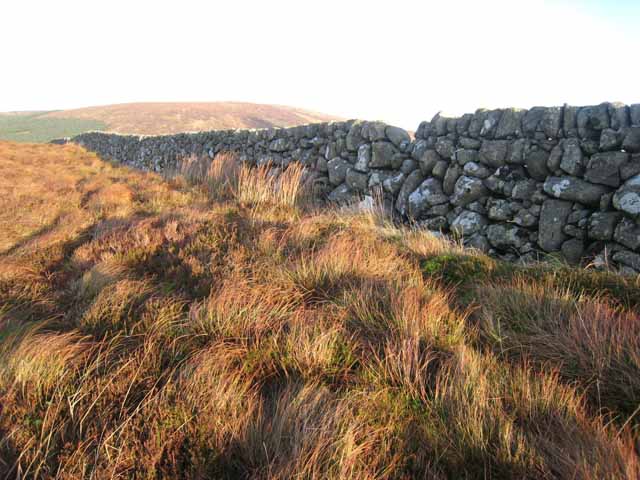
Access to Airdrie Hill is relatively straightforward, with several walking paths and trails leading up to its summit. These trails are suitable for individuals of varying fitness levels, although caution should be exercised as some sections can be steep and uneven.

The hill has historical significance, with evidence of human activity dating back to prehistoric times. Archaeological discoveries have uncovered ancient settlements and burial sites in the vicinity. These findings provide insight into the rich history of the area and offer a glimpse into the lives of the people who once inhabited the region.

Overall, Airdrie Hill is a captivating natural landmark that not only offers stunning views but also serves as a reminder of the area's historical and ecological importance.

If you have any feedback on the listing, please let us know in the comments section below.

Airdrie Hill Images

Images are sourced within 2km of 54.920401/-3.6431643 or Grid Reference NX9459. Thanks to Geograph Open Source API. All images are credited.

Criffel Very prominent hill seen from the A710 near Kirkbean
Criffel
Very prominent hill seen from the A710 near Kirkbean
Redbank Hill Seen from the bank of a little lochan on the Brough Burn. Recent tree felling has exposed the rocky granite boulders on the flanks of Redbank Hill.
Redbank Hill
Seen from the bank of a little lochan on the Brough Burn. Recent tree felling has exposed the rocky granite boulders on the flanks of Redbank Hill.
Lochan on the Brough Burn This lochan is shaped exactly like a heart.
Lochan on the Brough Burn
This lochan is shaped exactly like a heart.
Trig Pillar S8463, Redbank Hill The pillar is in good condition. The flush bracket faces 178°, south. The pillar was completed on 27th August 1955 costing £55.10s.6d. In 1958 this marker was computed for triangulation as tertiary station NX56/DM/T36 in the Kirkcudbright secondary block. The flush bracket was levelled for height also in 1958. The trig point was last maintained by the OS in June 1988. Views to surrounding hills and the Solway Firth.
Trig Pillar S8463, Redbank Hill
The pillar is in good condition. The flush bracket faces 178°, south. The pillar was completed on 27th August 1955 costing £55.10s.6d. In 1958 this marker was computed for triangulation as tertiary station NX56/DM/T36 in the Kirkcudbright secondary block. The flush bracket was levelled for height also in 1958. The trig point was last maintained by the OS in June 1988. Views to surrounding hills and the Solway Firth.
Redbank Hill - hillside Mixed woodland on the southern slopes of Redbank Hill.
Redbank Hill - hillside
Mixed woodland on the southern slopes of Redbank Hill.
Redbank Hill Track A forest track which cuts between Redbank Hill and Airdrie Hill.
Redbank Hill Track
A forest track which cuts between Redbank Hill and Airdrie Hill.
Track on Redbank Hill Forest track on southern flanks of Redbank Hill.
Track on Redbank Hill
Forest track on southern flanks of Redbank Hill.
Track towards Bail Fell Rather overgrown forest track heading up on to Bail Fell ,which is the hill on the horizon.
Track towards Bail Fell
Rather overgrown forest track heading up on to Bail Fell ,which is the hill on the horizon.
Parruten Burn The frozen Parruten Burn below Bail Fell.
Parruten Burn
The frozen Parruten Burn below Bail Fell.
Track at  Parruten Burn Forest track at the Parruten Burn below Bail Fell.
Track at Parruten Burn
Forest track at the Parruten Burn below Bail Fell.
Bilsons Link Forest track below Bail Fell.
Bilsons Link
Forest track below Bail Fell.
Trig point and Douglas's Cairn, Criffel
Loch Kindar and River Nith From the top of Criffel, looking north east towards the river Nith which flows into the Solway Estuary
Loch Kindar and River Nith
From the top of Criffel, looking north east towards the river Nith which flows into the Solway Estuary
At the head of the Glen Burn Impenetrable forest and very wet and rough moorland make this an area not be entered lightly.
At the head of the Glen Burn
Impenetrable forest and very wet and rough moorland make this an area not be entered lightly.
The valley of the Glen Burn Looking down into the valley of the Glen Burn. Forestry Commission forest to the left, private forest to the right.
The valley of the Glen Burn
Looking down into the valley of the Glen Burn. Forestry Commission forest to the left, private forest to the right.
Wall on Boreland Hill Criffel <a href="https://www.geograph.org.uk/gridref/NX9561">NX9561</a> lies on the horizon.
Wall on Boreland Hill
Criffel NX9561 lies on the horizon.
South-east slope of Criffel
Valley of Kirkbean Burn
Show me another place!

Airdrie Hill is located at Grid Ref: NX9459 (Lat: 54.920401, Lng: -3.6431643)

Unitary Authority: Dumfries and Galloway

Police Authority: Dumfries and Galloway

What 3 Words

///barbarian.unlimited.adapt. Near Dalbeattie, Dumfries & Galloway

Nearby Locations

Airdrie Hill

Related Wikis

Criffel

Criffel is a hill in the historical county of Kirkcudbrightshire, Dumfries and Galloway, south-west Scotland. It is 570 m (1,870 ft) high but appears higher...

Kirkbean

Kirkbean (Scottish Gaelic: Cille Bheathain) is a Scottish village and civil parish on the Solway Firth, in the historic county of Kirkcudbrightshire and...

John Paul Jones Cottage Museum

The John Paul Jones Cottage Museum is located on the Arbigland Estate near Kirkbean in the historical county of Kirkcudbrightshire, Dumfries and Galloway...

Southerness

Southerness (/sʌðə'nɛs/; Scots: Satterness) is a small, compact coastal village in Dumfries and Galloway, Scotland. Southerness is located approximately...

Southerness Lighthouse

Southerness lighthouse is located at the village of Southerness in South West Scotland. It is at present the second oldest lighthouse in Scotland. The...

Abbey Vale F.C.

Abbey Vale Football Club are a football club based in the village of New Abbey in the historical county of Kirkcudbright shire in the Dumfries and Galloway...

New Abbey

New Abbey (Scottish Gaelic: An Abaid Ùr) is a village in the historical county of Kirkcudbrightshire in Dumfries and Galloway, Scotland. It is 6 miles...

Sweetheart Abbey

The Abbey of Dulce Cor, better known as Sweetheart Abbey (Gaelic: An Abaid Ur), was a Cistercian monastery founded in 1275 in what is now the village of...

Have you been to Airdrie Hill?

Leave your review of Airdrie Hill below (or comments, questions and feedback).