Bràigh Coire Chruinn-Bhalgain

Hill, Mountain in Perthshire

Scotland

Bràigh Coire Chruinn-Bhalgain

Summit of Braigh Coire Chruinn bhalgain Cairn on the summit of the Munro.
Summit of Braigh Coire Chruinn bhalgain Credit: Iain Russell

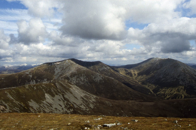
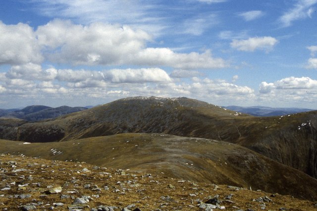
Bràigh Coire Chruinn-Bhalgain is a prominent hill located in Perthshire, Scotland. Standing at an elevation of 1,070 meters (3,510 feet), it is considered a Munro, which means it is one of the many mountains in Scotland that exceeds 3,000 feet in height. The hill is situated in the Grampian Mountains range, within close proximity to other notable peaks such as Beinn a' Ghlo and Carn Liath.

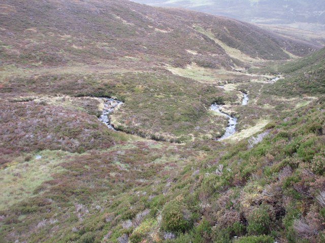
The name Bràigh Coire Chruinn-Bhalgain translates to "top of the round corrie of Bhalgain" in English, referring to the distinct shape of the corrie that can be observed from certain angles. This corrie is a glacial feature, characterized by a semi-circular hollow located on the eastern side of the mountain.

Bràigh Coire Chruinn-Bhalgain is a popular destination for hillwalkers and hikers due to its accessibility and stunning views from the summit. The ascent of the hill typically begins from the village of Blair Atholl, with various routes available to choose from depending on the level of difficulty one desires. The most common route is via the path starting from Glen Tilt, which offers a gradual ascent through picturesque landscapes.

Once at the summit, visitors are rewarded with panoramic views of the surrounding mountains, including the neighboring Munros of Carn Liath and Braigh Coire an Lochain. On a clear day, one can even catch a glimpse of the Cairngorms National Park to the north.

Bràigh Coire Chruinn-Bhalgain provides a memorable outdoor experience for nature enthusiasts, offering a combination of challenging terrain, stunning scenery, and a sense of tranquility amidst the rugged beauty of the Scottish Highlands.

If you have any feedback on the listing, please let us know in the comments section below.

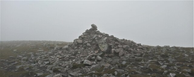
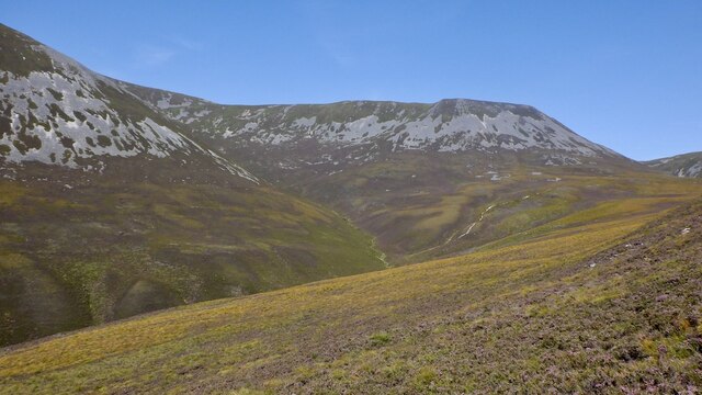
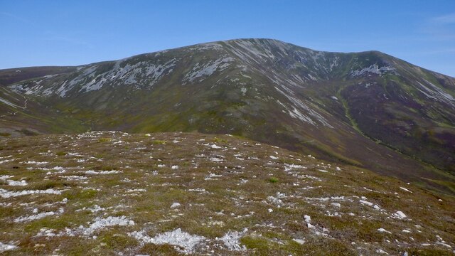
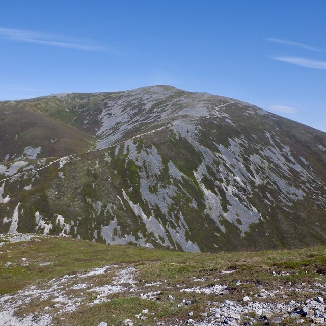
Bràigh Coire Chruinn-Bhalgain Images

Images are sourced within 2km of 56.831126/-3.7294876 or Grid Reference NN9472. Thanks to Geograph Open Source API. All images are credited.

Summit of Braigh Coire Chruinn bhalgain Cairn on the summit of the Munro.
Summit of Braigh Coire Chruinn bhalgain
Cairn on the summit of the Munro.
Coire na Saobhaidh, Beinn a' Ghlo View towards the screes below the main ridge on Beinn Mhaol.
Coire na Saobhaidh, Beinn a' Ghlo
View towards the screes below the main ridge on Beinn Mhaol.
Summit ridge, Beinn Bheag Bràigh Coire Chruinn-bhalgain forms the background.
Summit ridge, Beinn Bheag
Bràigh Coire Chruinn-bhalgain forms the background.
Beinn Bheag / Carn Liath col Crossed by a useful path out of Coire na Saobhaidhe up to the main ridge. Very colourful as the deer grass turns yellow orange.
Beinn Bheag / Carn Liath col
Crossed by a useful path out of Coire na Saobhaidhe up to the main ridge. Very colourful as the deer grass turns yellow orange.
Path on Beinn a' Ghlo This path comes in from Coire na Saobhaidh and runs up to the ridge between Bràigh Coire Chruinn-bhalgain and Carn Liath.
Path on Beinn a' Ghlo
This path comes in from Coire na Saobhaidh and runs up to the ridge between Bràigh Coire Chruinn-bhalgain and Carn Liath.
Path on Beinn a' Ghlo
Paths, Beinn a' Ghlo The col between Bràigh Coire Chruinn-bhalgain and Carn Liath where a path from the south meets the main ridge route. The usual way to Bràigh Coire Chruinn-bhalgain cuts a corner and can be seen as a white line in the background.
Paths, Beinn a' Ghlo
The col between Bràigh Coire Chruinn-bhalgain and Carn Liath where a path from the south meets the main ridge route. The usual way to Bràigh Coire Chruinn-bhalgain cuts a corner and can be seen as a white line in the background.
Path on Bràigh Coire Chruinn-bhalgain The path from Carn Liath ascending Bràigh Coire Chruinn-bhalgain.
Path on Bràigh Coire Chruinn-bhalgain
The path from Carn Liath ascending Bràigh Coire Chruinn-bhalgain.
Coire Crom On the north side of Beinn a' Ghlo between Bràigh Coire Chruinn-bhalgain and Carn Liath.
Coire Crom
On the north side of Beinn a' Ghlo between Bràigh Coire Chruinn-bhalgain and Carn Liath.
Bràigh Coire Chruinn-bhalgain / Carn Liath col The main path on Beinn a' Ghlo.
Bràigh Coire Chruinn-bhalgain / Carn Liath col
The main path on Beinn a' Ghlo.
Bràigh Coire Chruinn-bhalgain View from Beinn Mhaol.
Bràigh Coire Chruinn-bhalgain
View from Beinn Mhaol.
On Beinn a' Ghlo The path of Beinn Mhaol, the curving ridge between Carn Liath and Bràigh Coire Chruinn-bhalgain. The highest summit, Carn nan Gabhar is also visible in the background.
On Beinn a' Ghlo
The path of Beinn Mhaol, the curving ridge between Carn Liath and Bràigh Coire Chruinn-bhalgain. The highest summit, Carn nan Gabhar is also visible in the background.
Path on Beinn Mhaol The north ridge of Carn Liath on Beinn a' Ghlo.
Path on Beinn Mhaol
The north ridge of Carn Liath on Beinn a' Ghlo.
Beinn Bheag View from the main ridge on Beinn Mhaol.
Beinn Bheag
View from the main ridge on Beinn Mhaol.
Path on Beinn Mhaol, Beinn a' Ghlo On the north ridge of Carn Liath with a view towards Bràigh Coire Chruinn-bhalgain and Carn nan Gabhar.
Path on Beinn Mhaol, Beinn a' Ghlo
On the north ridge of Carn Liath with a view towards Bràigh Coire Chruinn-bhalgain and Carn nan Gabhar.
Allt na Beinne Bige Looking down on the Allt na Beinne Bige snaking its way between Beinn Bheag and Airgiod Bheinn.
Allt na Beinne Bige
Looking down on the Allt na Beinne Bige snaking its way between Beinn Bheag and Airgiod Bheinn.
Braigh Coire Chruinn-bhalgain & Beinn a' Ghlo as seen from Carn Liath
Eastern ridge from Braigh Coire Chruinn-bhalgain with view to Beinn a' Ghlo
Show me another place!

Bràigh Coire Chruinn-Bhalgain is located at Grid Ref: NN9472 (Lat: 56.831126, Lng: -3.7294876)

Unitary Authority: Perth and Kinross

Police Authority: Tayside

What 3 Words

///bikers.scoring.refills. Near Blair Atholl, Perth & Kinross

Related Wikis

Beinn a' Ghlò

Beinn a’ Ghlò is a Scottish mountain situated roughly 10 km (6 mi) north east of Blair Atholl in the Forest of Atholl in between Glen Tilt and Glen Loch...

Càrn Liath (Munro)

Carn Liath (976 m) is a mountain in the Grampian Mountains of Scotland. It lies east of Blair Atholl in Perthshire, Scotland. Although belonging to the...

Glen Tilt

Glen Tilt (Scottish Gaelic: Gleann Teilt) is a glen in the extreme north of Perthshire, Scotland. Beginning at the confines of Aberdeenshire, it follows...

Carn a' Chlamain

Càrn a' Chlamain (Gaelic: Càrn a' Chlamhain) is a Scottish mountain situated roughly 12 kilometres north of Blair Atholl in the Forest of Atholl. It is...

Loch Loch

Loch Loch is a remote freshwater loch, located in Glen Loch in Perth and Kinross, some 9.5 miles north of Pitlochry, Scotland and is within the Forest...

Ben Vuirich

Ben Vuirich (903 m) is a mountain in the Grampian Mountains of Scotland. It is located in Perthshire, north of the town of Pitlochry. A mountain of heather...

Loch Moraig

Loch Moraig is a freshwater loch, located 2 miles northeast of Blair Atholl. Loch Moraig was an artificial loch, originally a Snipe marsh, that was dammed...
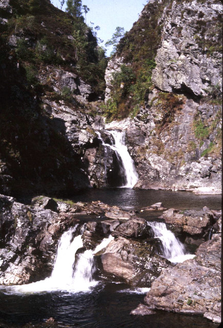
Falls of Tarf

The Falls of Tarf is a waterfall on the Tarf Water in the eastern Highlands of Scotland. Immediately downstream of the falls the Tarf is joined by a second...

Nearby Amenities

Located within 500m of 56.831126,-3.7294876
Braigh Coire Chruinn-bhalgain
Description: Upland of the corrie of the round blisters
Ele: 1070
Marilyn: yes
Munro: yes
Munro Number: M066
Natural: peak
Prominence: 223
Source: survey
Wikidata: Q3397088
Wikipedia: en:Beinn a' Ghlò
Lat/Long: 56.831175/-3.7297152
The data included in this document is from www.openstreetmap.org. The data is made available under ODbL.

Have you been to Bràigh Coire Chruinn-Bhalgain?

Leave your review of Bràigh Coire Chruinn-Bhalgain below (or comments, questions and feedback).