Boreland Hill

Hill, Mountain in Kirkcudbrightshire

Scotland

Boreland Hill

Criffel Very prominent hill seen from the A710 near Kirkbean
Criffel Credit: Eirian Evans

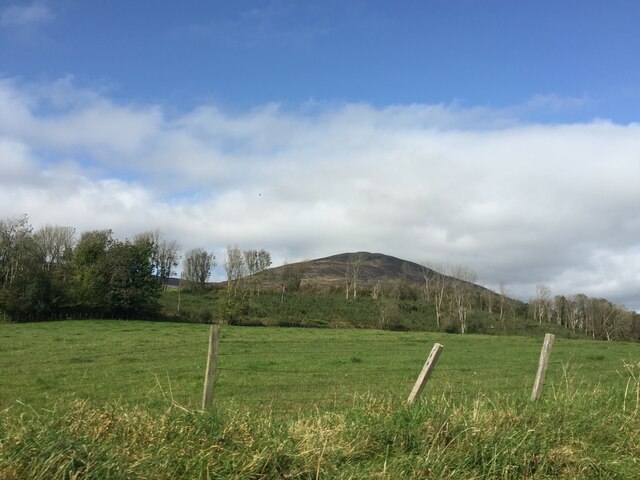
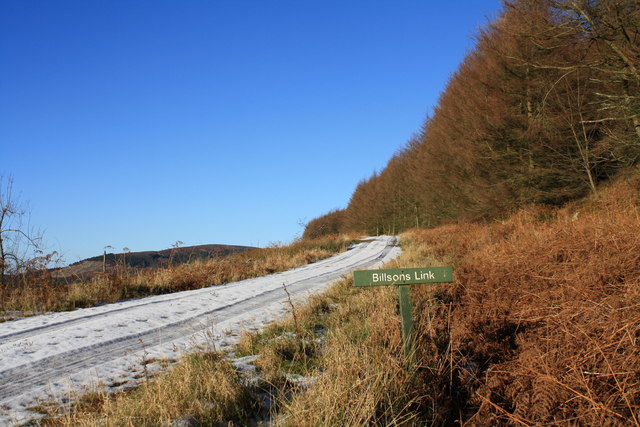
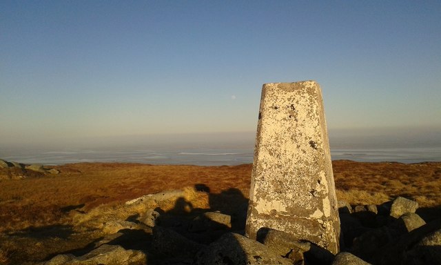
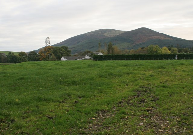
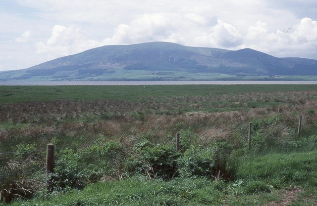
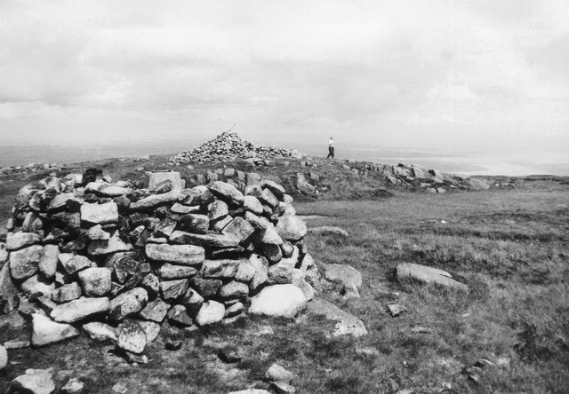
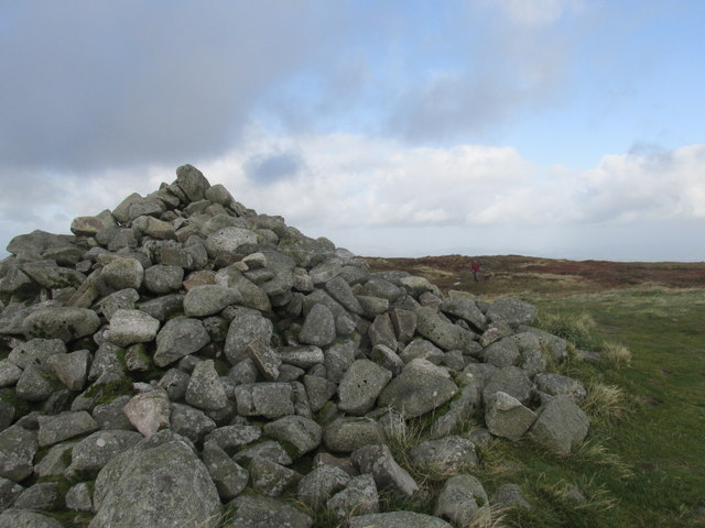
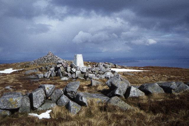
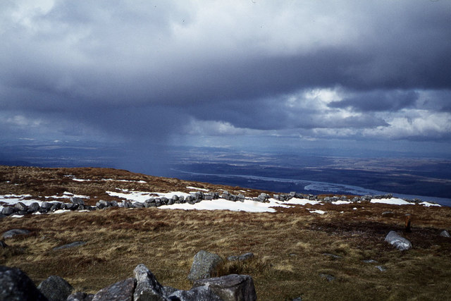
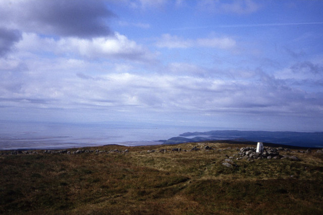
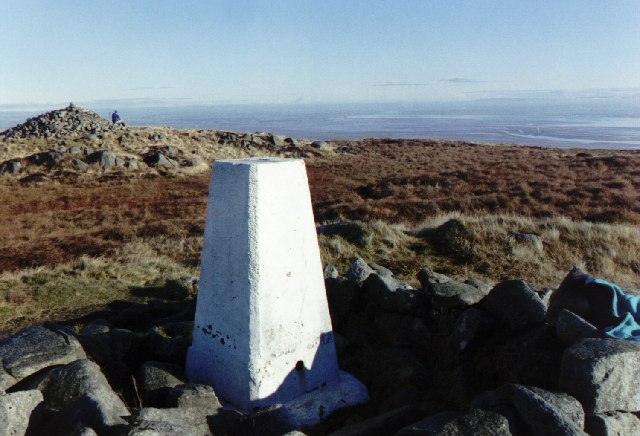
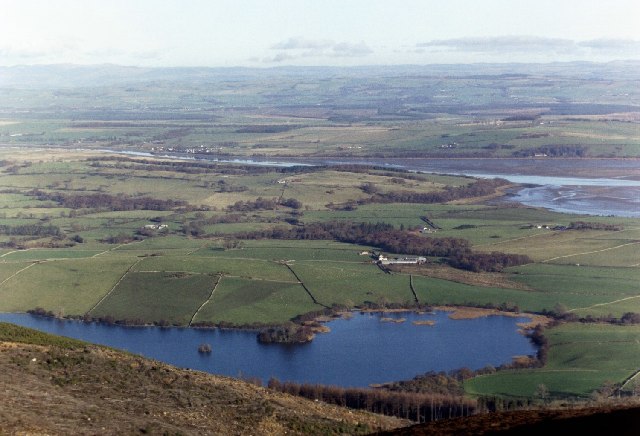
Boreland Hill is a prominent hill located in Kirkcudbrightshire, Scotland. It is part of the Galloway Hills range and stands at an elevation of 315 meters (1,033 feet) above sea level. The hill is a popular destination for hikers and outdoor enthusiasts due to its stunning views of the surrounding countryside and the nearby Loch Ken.

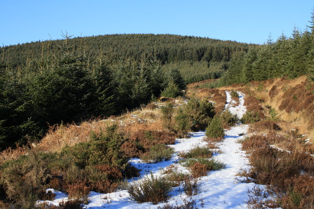
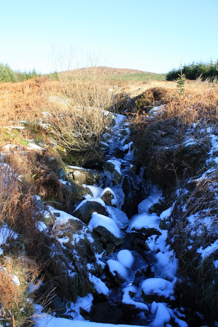
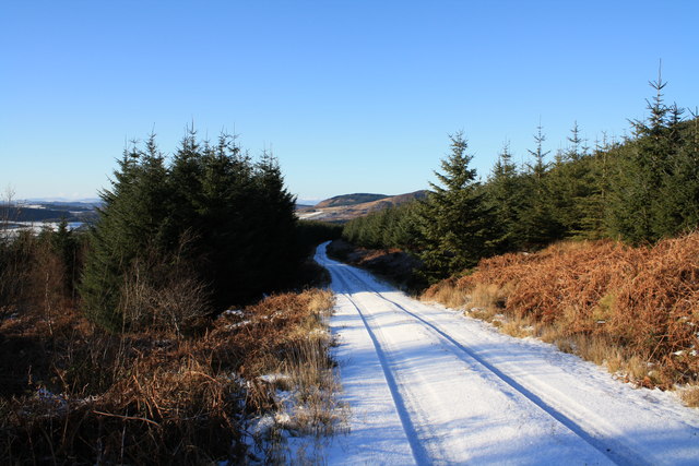
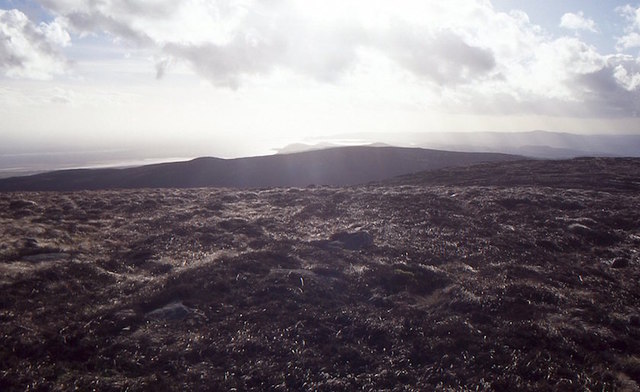
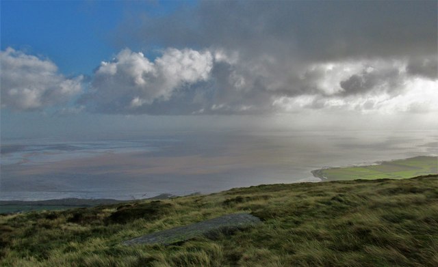
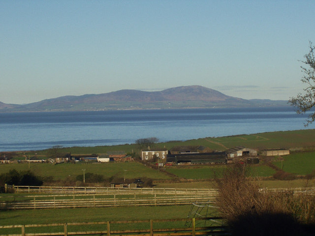
Boreland Hill is characterized by its gentle slopes and heather-covered terrain, making it a relatively easy climb for hikers of all skill levels. The summit offers panoramic views of the Galloway Forest Park to the north and the Solway Firth to the south, providing a picturesque backdrop for those who reach the top.

The hill is home to a variety of wildlife, including red deer, foxes, and a wide range of bird species. Hikers may also encounter grazing sheep and cattle along the way, adding to the rural charm of the area.

Overall, Boreland Hill is a beautiful and accessible destination for those looking to explore the natural beauty of Kirkcudbrightshire and enjoy a peaceful hike in the Scottish countryside.

If you have any feedback on the listing, please let us know in the comments section below.

Boreland Hill Images

Images are sourced within 2km of 54.930657/-3.6496539 or Grid Reference NX9460. Thanks to Geograph Open Source API. All images are credited.

Criffel Very prominent hill seen from the A710 near Kirkbean
Criffel
Very prominent hill seen from the A710 near Kirkbean
Track towards Bail Fell Rather overgrown forest track heading up on to Bail Fell ,which is the hill on the horizon.
Track towards Bail Fell
Rather overgrown forest track heading up on to Bail Fell ,which is the hill on the horizon.
Parruten Burn The frozen Parruten Burn below Bail Fell.
Parruten Burn
The frozen Parruten Burn below Bail Fell.
Track at  Parruten Burn Forest track at the Parruten Burn below Bail Fell.
Track at Parruten Burn
Forest track at the Parruten Burn below Bail Fell.
Bilsons Link Forest track below Bail Fell.
Bilsons Link
Forest track below Bail Fell.
On Criffel View across the rough summit area and along the Solway coast.
On Criffel
View across the rough summit area and along the Solway coast.
Criffel trig point The trig point on the summit of Criffel.
Criffel trig point
The trig point on the summit of Criffel.
Criffel and Knockendoch The two dominant hills behind New Abbey. The houses are on Shebburn View.
Criffel and Knockendoch
The two dominant hills behind New Abbey. The houses are on Shebburn View.
Criffel from Caerlaverock NNR Looking across the Nith from Caerlaverock National Nature Reserve.
Criffel from Caerlaverock NNR
Looking across the Nith from Caerlaverock National Nature Reserve.
On Criffel summit 1972 The trig pillar within a drystone shelter with Douglas's Cairn and the Solway beyond.
On Criffel summit 1972
The trig pillar within a drystone shelter with Douglas's Cairn and the Solway beyond.
Douglas cairn on the summit of Criffel. No idea who Douglas was but it's a huge cairn.
Douglas cairn on the summit of Criffel.
No idea who Douglas was but it's a huge cairn.
High ground on Criffel. Looking out to the Solway.
High ground on Criffel.
Looking out to the Solway.
On summit of Criffel
On summit of Criffel - view towards Dumfries
Summit of Criffel with view towards Isle of Man
Trig point and Douglas's Cairn, Criffel
Loch Kindar and River Nith From the top of Criffel, looking north east towards the river Nith which flows into the Solway Estuary
Loch Kindar and River Nith
From the top of Criffel, looking north east towards the river Nith which flows into the Solway Estuary
Criffel, Dumfriesshire, from Crosby, Cumbria New Year's Day view of Criffel across the Solway Firth from Cumbria.
Criffel, Dumfriesshire, from Crosby, Cumbria
New Year's Day view of Criffel across the Solway Firth from Cumbria.
Show me another place!

Boreland Hill is located at Grid Ref: NX9460 (Lat: 54.930657, Lng: -3.6496539)

Unitary Authority: Dumfries and Galloway

Police Authority: Dumfries and Galloway

What 3 Words

///canal.comb.concluded. Near Dalbeattie, Dumfries & Galloway

Nearby Locations

Boreland Hill Craigtappock

Related Wikis

Criffel

Criffel is a hill in the historical county of Kirkcudbrightshire, Dumfries and Galloway, south-west Scotland. It is 570 m (1,870 ft) high but appears higher...

Kirkbean

Kirkbean (Scottish Gaelic: Cille Bheathain) is a Scottish village and civil parish on the Solway Firth, in the historic county of Kirkcudbrightshire and...

John Paul Jones Cottage Museum

The John Paul Jones Cottage Museum is located on the Arbigland Estate near Kirkbean in the historical county of Kirkcudbrightshire, Dumfries and Galloway...

New Abbey

New Abbey (Scottish Gaelic: An Abaid Ùr) is a village in the historical county of Kirkcudbrightshire in Dumfries and Galloway, Scotland. It is 6 miles...

Nearby Amenities

Located within 500m of 54.930657,-3.6496539
Boreland Hill
Ele: 497
Natural: peak
Note: OS7 says 1631 ft
Source: os7
Lat/Long: 54.9306415/-3.6496329
The data included in this document is from www.openstreetmap.org. The data is made available under ODbL.

Have you been to Boreland Hill?

Leave your review of Boreland Hill below (or comments, questions and feedback).