Dunfallandy Hill

Hill, Mountain in Perthshire

Scotland

Dunfallandy Hill

Path in Fonab Forest The path in the forest before the descent towards Pitlochry.
Path in Fonab Forest Credit: Jim Barton

The requested URL returned error: 429 Too Many Requests

If you have any feedback on the listing, please let us know in the comments section below.

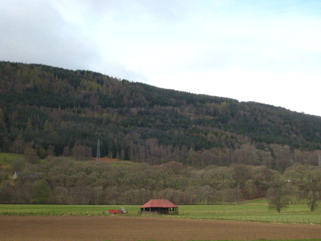
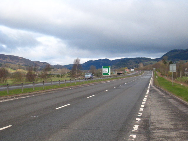
Dunfallandy Hill Images

Images are sourced within 2km of 56.674044/-3.7258392 or Grid Reference NN9454. Thanks to Geograph Open Source API. All images are credited.

Path in Fonab Forest The path in the forest before the descent towards Pitlochry.
Path in Fonab Forest
The path in the forest before the descent towards Pitlochry.
Small barn on the edge of Tomdachoille Island South of Pitlochry.
Small barn on the edge of Tomdachoille Island
South of Pitlochry.
North end of a lay-by on the A9 southbound south of Pitlochry
Farm building at Mains of Killichangie
Perth and Kinross : The A9 Looking along the A9.
Perth and Kinross : The A9
Looking along the A9.
Perth and Kinross : Grassy Field A grassy field near the River Garry.
Perth and Kinross : Grassy Field
A grassy field near the River Garry.
Valley cloud above the River Tummel Low cloud hanging above the valley after a cold misty morning, seen from a height of about 400m on the path to Ben Vrackie.
Valley cloud above the River Tummel
Low cloud hanging above the valley after a cold misty morning, seen from a height of about 400m on the path to Ben Vrackie.
Sunlit leaves in Fonab Forest On the Rob Roy Way between Pitlochry and Strathtay.
Sunlit leaves in Fonab Forest
On the Rob Roy Way between Pitlochry and Strathtay.
Morning sunlight in Fonab Forest On the Rob Roy Way to Strathtay.
Morning sunlight in Fonab Forest
On the Rob Roy Way to Strathtay.
Grazing, Easthaugh of Dalshian
Mains of Dunfallandy
Forest access road, Fonab There is work in progress on the power line.
Forest access road, Fonab
There is work in progress on the power line.
Forest road, Fonab The sign points to work being done on a power line.
Forest road, Fonab
The sign points to work being done on a power line.
Logging road, Fonab A signpost points to a path which cuts out a big zigzag in the forest road.
Logging road, Fonab
A signpost points to a path which cuts out a big zigzag in the forest road.
Logging road, Fonab Climbing with the help of one sharp bend.
Logging road, Fonab
Climbing with the help of one sharp bend.
Path signpost, Fonab There is a big network of signposted walks around Pitlochry.
Path signpost, Fonab
There is a big network of signposted walks around Pitlochry.
Logging road, Fonab Nearing the top of a long climb from Pitlochry.
Logging road, Fonab
Nearing the top of a long climb from Pitlochry.
Fonab Woods A view over Pitlochry.
Fonab Woods
A view over Pitlochry.
Show me another place!

Dunfallandy Hill is located at Grid Ref: NN9454 (Lat: 56.674044, Lng: -3.7258392)

Unitary Authority: Perth and Kinross

Police Authority: Tayside

What 3 Words

///uppermost.rather.thumbnail. Near Pitlochry, Perth & Kinross

Nearby Locations

Dunfallandy Hill

Related Wikis

Ballechin Wood

Ballechin Wood is a large coniferous forest site, around 805 acres (326 ha) in area, located above Ballechin in Perth and Kinross, Scotland. It is located...

Ballechin distillery

Ballechin distillery was a Scotch whisky distillery operated between 1810 and 1927 and was one of seven original farm distilleries operating in Perthshire...

Ballechin House

Ballechin House was a Georgian estate home near Grandtully, Perthshire, Scotland. It was built in 1806, on the site of an old manor house which had been...

Port na Craig

Port na Craig (also spelt Port-na-Craig or Port-na-craig) is a historic village in Perth and Kinross, Scotland, located directly across the River Tummel...

Nearby Amenities

Located within 500m of 56.674044,-3.7258392
Dunfallandy Hill
Ele: 409
Natural: peak
Lat/Long: 56.6738037/-3.7260673
The data included in this document is from www.openstreetmap.org. The data is made available under ODbL.

Have you been to Dunfallandy Hill?

Leave your review of Dunfallandy Hill below (or comments, questions and feedback).