Bràigh Coire na Conlaich

Hill, Mountain in Perthshire

Scotland

Bràigh Coire na Conlaich

The Tarf Hotel More correctly known as the Feith Uaine Bothy, but the AA Hotel sign on the door has given it its nickname. It seems in excellent condition for a bothy, but it is very remote and river crossings can be awkward in wet weather.
The Tarf Hotel Credit: Michael Earnshaw

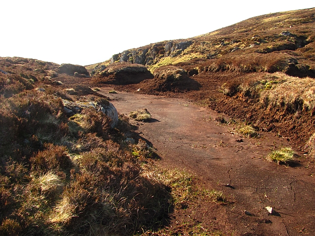
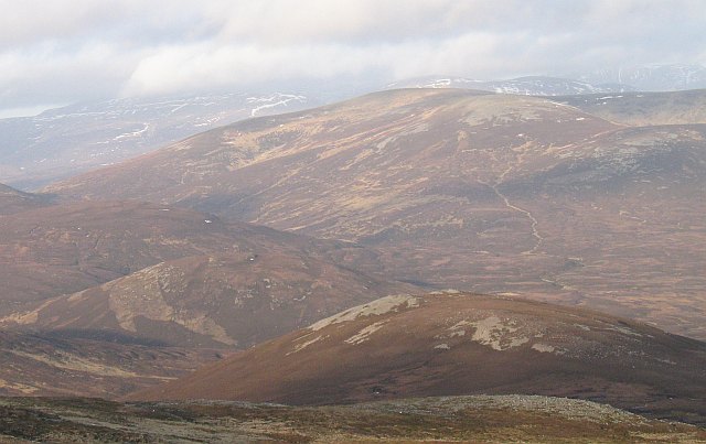
Bràigh Coire na Conlaich is a prominent hill located in the region of Perthshire, Scotland. With an elevation of approximately 1,021 meters (3,350 feet), it is considered one of the significant peaks in the area. The hill is situated within the Cairngorms National Park, known for its stunning landscapes and diverse wildlife.

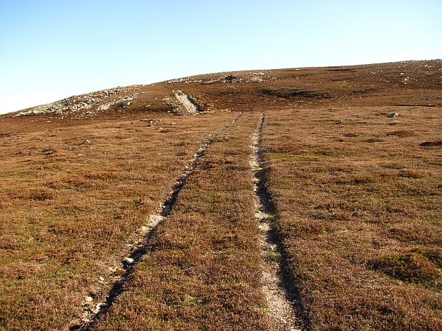
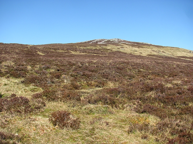
Bràigh Coire na Conlaich offers breathtaking views of the surrounding countryside and is a popular destination for hikers and nature enthusiasts. The ascent to the summit can be challenging, but the reward is a panoramic vista that stretches across the vast expanse of the national park. On clear days, it is possible to see other prominent peaks such as Ben Macdui and Braeriach.

The hill is characterized by its rugged terrain, with rocky slopes and scree fields that add to the adventure of climbing. It is home to a variety of flora and fauna, including mountain hares, golden eagles, and ptarmigans, which can be spotted by those with a keen eye.

Access to Bràigh Coire na Conlaich is typically gained from the nearby village of Braemar, where there are ample parking facilities. Several well-marked trails lead to the summit, offering different levels of difficulty to cater to various fitness levels.

Overall, Bràigh Coire na Conlaich is a remarkable hill in Perthshire, attracting outdoor enthusiasts who seek a challenging yet rewarding experience amidst the stunning natural beauty of the Cairngorms National Park.

If you have any feedback on the listing, please let us know in the comments section below.

Bràigh Coire na Conlaich Images

Images are sourced within 2km of 56.879819/-3.7416159 or Grid Reference NN9377. Thanks to Geograph Open Source API. All images are credited.

The Tarf Hotel More correctly known as the Feith Uaine Bothy, but the AA Hotel sign on the door has given it its nickname. It seems in excellent condition for a bothy, but it is very remote and river crossings can be awkward in wet weather.
The Tarf Hotel
More correctly known as the Feith Uaine Bothy, but the AA Hotel sign on the door has given it its nickname. It seems in excellent condition for a bothy, but it is very remote and river crossings can be awkward in wet weather.
Feith Uaine Bothy 1984 Feith Uaine Bothy ("The Tarf Hotel") 30th March,1984.
Feith Uaine Bothy 1984
Feith Uaine Bothy ("The Tarf Hotel") 30th March,1984.
Feith Uaine Bothy 1984 Feith Uaine Bothy ("The Tarf Hotel") 30th March,1984.
Feith Uaine Bothy 1984
Feith Uaine Bothy ("The Tarf Hotel") 30th March,1984.
Feith Uaine Bothy 1984 Feith Uaine Bothy ("The Tarf Hotel") 30th March,1984.
Feith Uaine Bothy 1984
Feith Uaine Bothy ("The Tarf Hotel") 30th March,1984.
Feith Uaine Bothy 1984 Feith Uaine Bothy ("The Tarf Hotel") 30th March,1984.
Feith Uaine Bothy 1984
Feith Uaine Bothy ("The Tarf Hotel") 30th March,1984.
North flank of Glen Tilt
Tarf bothy by Tarf Water
Fèith Uaine Mhòr Grass on well drained land beside the burn contrasts with the surrounding peatland. The Fèith Uaine Mhòr runs into the Tarf.
Fèith Uaine Mhòr
Grass on well drained land beside the burn contrasts with the surrounding peatland. The Fèith Uaine Mhòr runs into the Tarf.
Fèith Uaine Bheag The eastern fork of the Fèith Uaine, a tributary of the Tarf. View towards the stony Conlach Mhòr.
Fèith Uaine Bheag
The eastern fork of the Fèith Uaine, a tributary of the Tarf. View towards the stony Conlach Mhòr.
Fèith Uaine Bheag - east fork An unmapped bifurcation of the Fèith Uaine Bheag provides an easy passage through the peatlands. Looking down to bags of grouse grit (bright green).
Fèith Uaine Bheag - east fork
An unmapped bifurcation of the Fèith Uaine Bheag provides an easy passage through the peatlands. Looking down to bags of grouse grit (bright green).
Fèith Uaine Bheag Burn under Conlach Mhòr in the Tarf peatlands.
Fèith Uaine Bheag
Burn under Conlach Mhòr in the Tarf peatlands.
Col at the head of Coire na Conlaich A boggy pass between Coire na Conlaich and the Tarf. The peat is drying out after a long warm and windy spell.
Col at the head of Coire na Conlaich
A boggy pass between Coire na Conlaich and the Tarf. The peat is drying out after a long warm and windy spell.
Vehicle track on Bràigh Coire na Conlaich Continuation of the bulldozed road now shown on Ordnance Survey maps.  The soils are very thin here, only supporting sparse heather.
Vehicle track on Bràigh Coire na Conlaich
Continuation of the bulldozed road now shown on Ordnance Survey maps. The soils are very thin here, only supporting sparse heather.
Moorland, Bràigh Coire na Conlaich Near the summit of Bràigh Coire na Conlaich, looking over short cropped heather towards the upper reaches of the Tarf
Moorland, Bràigh Coire na Conlaich
Near the summit of Bràigh Coire na Conlaich, looking over short cropped heather towards the upper reaches of the Tarf
Track on An Sligearnach Looking over high altitude heath towards An Sligearnach from Bràigh Coire na Conlaich. As is often the case in Atholl there is a vehicle track across the tundra.  
Moss campion has just started to flower.
Track on An Sligearnach
Looking over high altitude heath towards An Sligearnach from Bràigh Coire na Conlaich. As is often the case in Atholl there is a vehicle track across the tundra. Moss campion has just started to flower.
Track, Bràigh Coire na Conlaich Vehicle tracks on the close cropped heather and infertile thin soils of Bràigh Coire na Conlaich. Exposure to wind has ensured no peat deposits have built up here.
Track, Bràigh Coire na Conlaich
Vehicle tracks on the close cropped heather and infertile thin soils of Bràigh Coire na Conlaich. Exposure to wind has ensured no peat deposits have built up here.
Conlach Mhòr Heather and peaty ground on Conlach Mhòr, a top of Carn a' Chlamhain. The summit area is stony with lots of boulders, this could be due to it once being a nunatak and prone to frost shattering.
Conlach Mhòr
Heather and peaty ground on Conlach Mhòr, a top of Carn a' Chlamhain. The summit area is stony with lots of boulders, this could be due to it once being a nunatak and prone to frost shattering.
Meall Tionail Peaty slopes above the two Fèith Uaine burns. Meall Tionail is one of the many tops of Carn a' Chlamhain.
Meall Tionail
Peaty slopes above the two Fèith Uaine burns. Meall Tionail is one of the many tops of Carn a' Chlamhain.
Show me another place!

Bràigh Coire na Conlaich is located at Grid Ref: NN9377 (Lat: 56.879819, Lng: -3.7416159)

Unitary Authority: Perth and Kinross

Police Authority: Tayside

What 3 Words

///daffodils.reclined.fines. Near Blair Atholl, Perth & Kinross

Related Wikis

Carn a' Chlamain

Càrn a' Chlamain (Gaelic: Càrn a' Chlamhain) is a Scottish mountain situated roughly 12 kilometres north of Blair Atholl in the Forest of Atholl. It is...
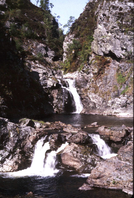
Falls of Tarf

The Falls of Tarf is a waterfall on the Tarf Water in the eastern Highlands of Scotland. Immediately downstream of the falls the Tarf is joined by a second...

Beinn a' Ghlò

Beinn a’ Ghlò is a Scottish mountain situated roughly 10 km (6 mi) north east of Blair Atholl in the Forest of Atholl in between Glen Tilt and Glen Loch...

Glen Tilt

Glen Tilt (Scottish Gaelic: Gleann Teilt) is a glen in the extreme north of Perthshire, Scotland. Beginning at the confines of Aberdeenshire, it follows...

Loch Loch

Loch Loch is a remote freshwater loch, located in Glen Loch in Perth and Kinross, some 9.5 miles north of Pitlochry, Scotland and is within the Forest...

An Sgarsoch

An Sgarsoch (1,006.5m) is a mountain in the Grampian Mountains of Scotland. It lies north of Blair Atholl in a very remote part of the Highlands, on the...

Loch Tilt

Loch Tilt is a small mountain freshwater loch that sits at the end of Glen Tilt and is located in north-east Perth and Kinross, Scotland. Loch Tilt has...

Carn an Fhidhleir

Carn an Fhidhleir (994 m) is a mountain in the Grampian Mountains of Scotland. It lies on the border of Inverness-shire, Perthshire and Aberdeenshire,...

Nearby Amenities

Located within 500m of 56.879819,-3.7416159
Braigh Coire na Conlaich
Ele: 835
Natural: peak
Lat/Long: 56.8798434/-3.7417674
The data included in this document is from www.openstreetmap.org. The data is made available under ODbL.

Have you been to Bràigh Coire na Conlaich?

Leave your review of Bràigh Coire na Conlaich below (or comments, questions and feedback).