Bail Fell

Hill, Mountain in Kirkcudbrightshire

Scotland

Bail Fell

Criffel Very prominent hill seen from the A710 near Kirkbean
Criffel Credit: Eirian Evans

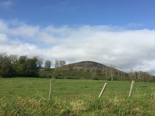
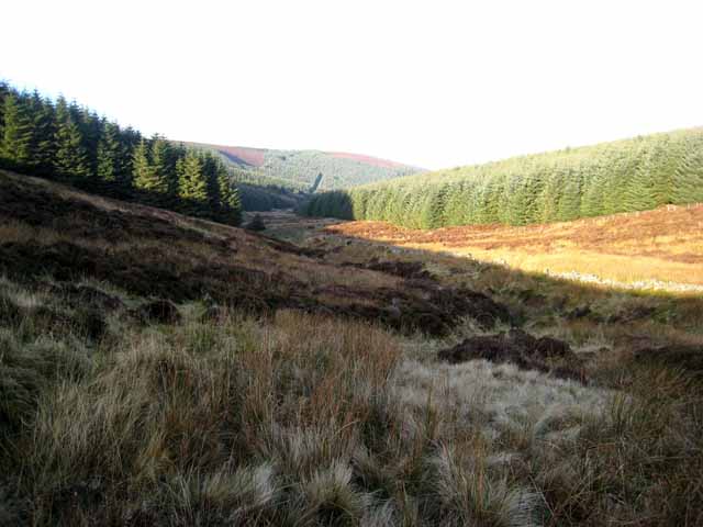
Bail Fell is a prominent hill located in the rural area of Kirkcudbrightshire, in southwestern Scotland. Rising to an elevation of 421 meters (1,381 feet), it forms part of the Galloway Hills, which are known for their picturesque landscapes and rich natural beauty.

Situated between the towns of Castle Douglas and New Galloway, Bail Fell offers stunning vistas of the surrounding countryside. The hill is characterized by its gentle slopes and grassy terrain, making it a popular destination for hikers and nature enthusiasts. Its location within the Galloway Forest Park further adds to its appeal, as this vast area is recognized as one of the best places in the United Kingdom for stargazing, due to its low light pollution.

Bail Fell is home to a diverse range of wildlife, with several species of birds, including buzzards and kestrels, often spotted soaring above its slopes. The hill also supports a variety of plant life, including heather, bracken, and wildflowers, which add splashes of color to the landscape during the warmer months.

Access to Bail Fell is relatively straightforward, with several well-marked trails leading to the summit. The hill offers breathtaking panoramic views from its peak, allowing visitors to admire the rolling hills, green valleys, and shimmering lochs that make up Kirkcudbrightshire's countryside.

Overall, Bail Fell is a tranquil and scenic hill that offers outdoor enthusiasts a chance to appreciate the natural beauty of Kirkcudbrightshire and immerse themselves in its peaceful surroundings.

If you have any feedback on the listing, please let us know in the comments section below.
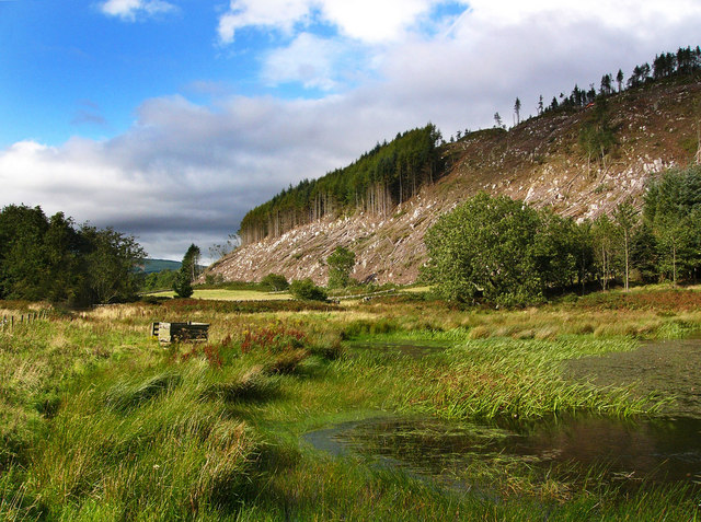
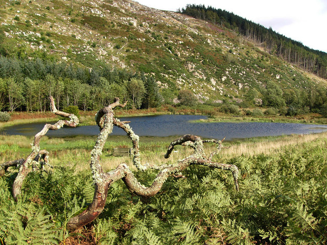
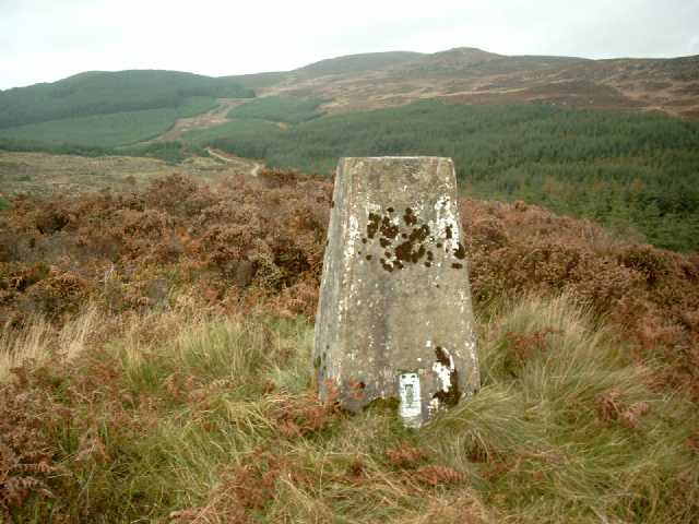
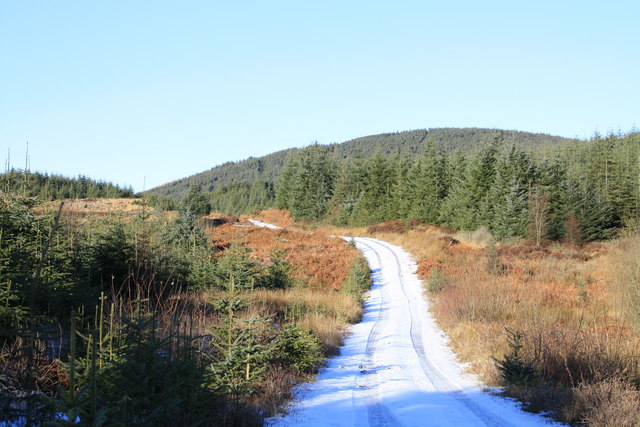
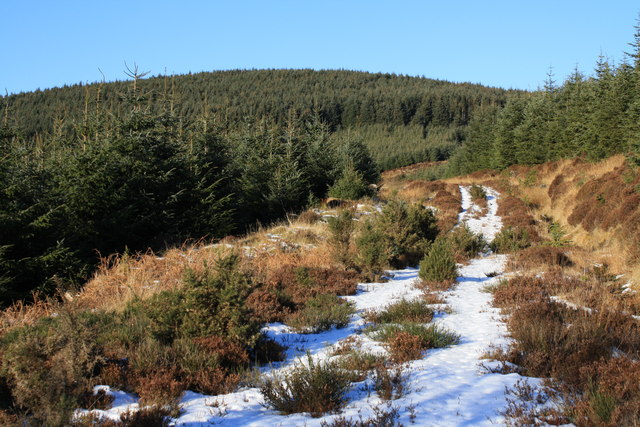
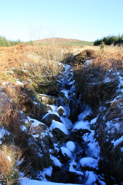
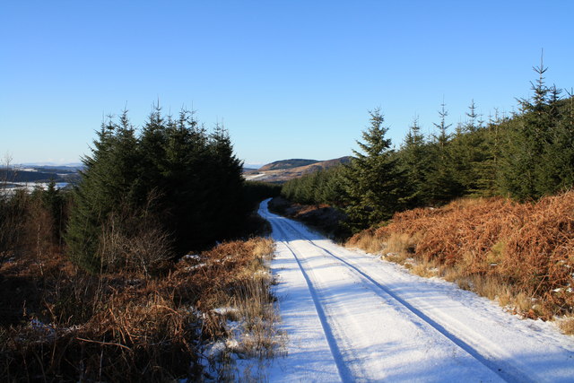
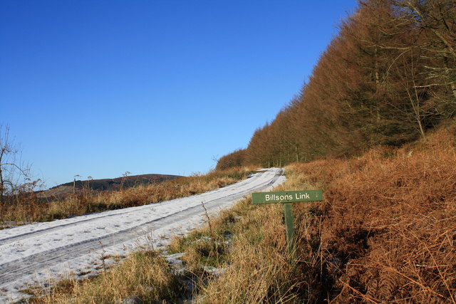
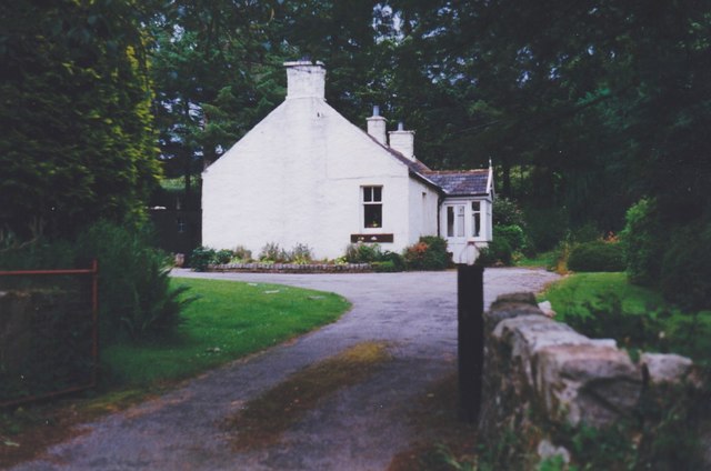
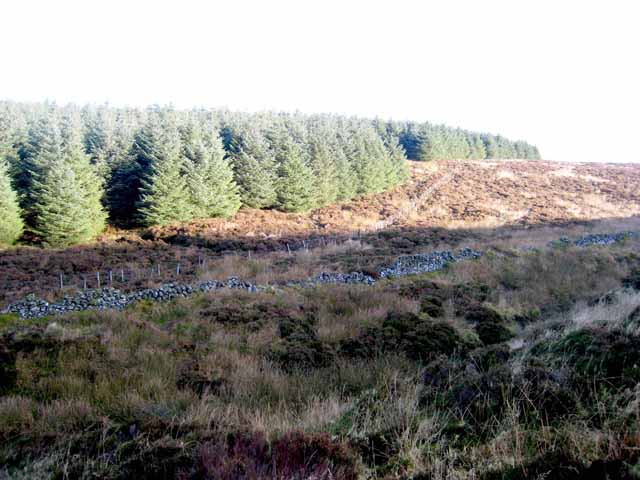
Bail Fell Images

Images are sourced within 2km of 54.924825/-3.6607914 or Grid Reference NX9360. Thanks to Geograph Open Source API. All images are credited.

Criffel Very prominent hill seen from the A710 near Kirkbean
Criffel
Very prominent hill seen from the A710 near Kirkbean
Boreland Lane, Caulkerbush View north up the Boreland lane between Dunmuck and Boreland Bridge. Footpath to Castle Farm on left.
Boreland Lane, Caulkerbush
View north up the Boreland lane between Dunmuck and Boreland Bridge. Footpath to Castle Farm on left.
Ryes Farm, Caulkerbush Ryes Farmhouse, situated in Boreland north of Caulkerbush
Ryes Farm, Caulkerbush
Ryes Farmhouse, situated in Boreland north of Caulkerbush
Ryes Farm from Boreland Bridge View through trees from Boreland Bridge (over the Boreland Burn) of Ryes Farm buildings.
Ryes Farm from Boreland Bridge
View through trees from Boreland Bridge (over the Boreland Burn) of Ryes Farm buildings.
Redbank Hill Seen from the bank of a little lochan on the Brough Burn. Recent tree felling has exposed the rocky granite boulders on the flanks of Redbank Hill.
Redbank Hill
Seen from the bank of a little lochan on the Brough Burn. Recent tree felling has exposed the rocky granite boulders on the flanks of Redbank Hill.
Lochan on the Brough Burn This lochan is shaped exactly like a heart.
Lochan on the Brough Burn
This lochan is shaped exactly like a heart.
Fields near Dunmuck Looking southeast down the valley between Redbank Hill on the left, and Doon Hill to the right. The name Dunmuck is either from gaelic Dun muc  (the swine's stronghold) or Dun m-buic (hill of the he-goat).
Fields near Dunmuck
Looking southeast down the valley between Redbank Hill on the left, and Doon Hill to the right. The name Dunmuck is either from gaelic Dun muc (the swine's stronghold) or Dun m-buic (hill of the he-goat).
Fields near Dunmuck Looking northwest towards Maidenpap on the left and Cuil Hill to the right.
Fields near Dunmuck
Looking northwest towards Maidenpap on the left and Cuil Hill to the right.
Trig Pillar S8463, Redbank Hill The pillar is in good condition. The flush bracket faces 178°, south. The pillar was completed on 27th August 1955 costing £55.10s.6d. In 1958 this marker was computed for triangulation as tertiary station NX56/DM/T36 in the Kirkcudbright secondary block. The flush bracket was levelled for height also in 1958. The trig point was last maintained by the OS in June 1988. Views to surrounding hills and the Solway Firth.
Trig Pillar S8463, Redbank Hill
The pillar is in good condition. The flush bracket faces 178°, south. The pillar was completed on 27th August 1955 costing £55.10s.6d. In 1958 this marker was computed for triangulation as tertiary station NX56/DM/T36 in the Kirkcudbright secondary block. The flush bracket was levelled for height also in 1958. The trig point was last maintained by the OS in June 1988. Views to surrounding hills and the Solway Firth.
Redbank Hill Track A forest track which cuts between Redbank Hill and Airdrie Hill.
Redbank Hill Track
A forest track which cuts between Redbank Hill and Airdrie Hill.
Track towards Bail Fell Rather overgrown forest track heading up on to Bail Fell ,which is the hill on the horizon.
Track towards Bail Fell
Rather overgrown forest track heading up on to Bail Fell ,which is the hill on the horizon.
Parruten Burn The frozen Parruten Burn below Bail Fell.
Parruten Burn
The frozen Parruten Burn below Bail Fell.
Track at  Parruten Burn Forest track at the Parruten Burn below Bail Fell.
Track at Parruten Burn
Forest track at the Parruten Burn below Bail Fell.
Bilsons Link Forest track below Bail Fell.
Bilsons Link
Forest track below Bail Fell.
Glen Helen A house near Dunmuck.
Glen Helen
A house near Dunmuck.
Abbey Fell Extremely wet and difficult heather moorland. Criffel <a href="https://www.geograph.org.uk/gridref/NX9561">NX9561</a> lies on the horizon.
Abbey Fell
Extremely wet and difficult heather moorland. Criffel NX9561 lies on the horizon.
At the head of the Glen Burn Impenetrable forest and very wet and rough moorland make this an area not be entered lightly.
At the head of the Glen Burn
Impenetrable forest and very wet and rough moorland make this an area not be entered lightly.
The valley of the Glen Burn Looking down into the valley of the Glen Burn. Forestry Commission forest to the left, private forest to the right.
The valley of the Glen Burn
Looking down into the valley of the Glen Burn. Forestry Commission forest to the left, private forest to the right.
Show me another place!

Bail Fell is located at Grid Ref: NX9360 (Lat: 54.924825, Lng: -3.6607914)

Unitary Authority: Dumfries and Galloway

Police Authority: Dumfries and Galloway

What 3 Words

///brisk.comfort.banquets. Near Dalbeattie, Dumfries & Galloway

Nearby Locations

Bail Fell

Related Wikis

Criffel

Criffel is a hill in the historical county of Kirkcudbrightshire, Dumfries and Galloway, south-west Scotland. It is 570 m (1,870 ft) high but appears higher...

Kirkbean

Kirkbean (Scottish Gaelic: Cille Bheathain) is a Scottish village and civil parish on the Solway Firth, in the historic county of Kirkcudbrightshire and...

John Paul Jones Cottage Museum

The John Paul Jones Cottage Museum is located on the Arbigland Estate near Kirkbean in the historical county of Kirkcudbrightshire, Dumfries and Galloway...

New Abbey

New Abbey (Scottish Gaelic: An Abaid Ùr) is a village in the historical county of Kirkcudbrightshire in Dumfries and Galloway, Scotland. It is 6 miles...

Nearby Amenities

Located within 500m of 54.924825,-3.6607914
Bail Fell
Natural: peak
Lat/Long: 54.9250817/-3.6602497
The data included in this document is from www.openstreetmap.org. The data is made available under ODbL.

Have you been to Bail Fell?

Leave your review of Bail Fell below (or comments, questions and feedback).