An Sgarsoch

Hill, Mountain in Perthshire

Scotland

An Sgarsoch

Stony and thinly vegetated summit area of An Sgarsoch The summit area of An Sgarsoch with Carn an Fhidhlier in the distance. The walker sheltering in the cairn had just made the traverse between the two mountains.
Stony and thinly vegetated summit area of An Sgarsoch Credit: Trevor Littlewood

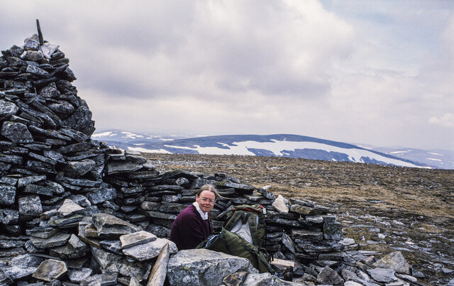
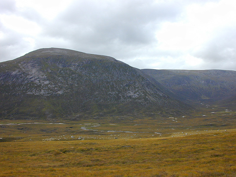
An Sgarsoch is a prominent hill located in the Cairngorms National Park in Perthshire, Scotland. Standing at an impressive height of 1,008 meters (3,307 feet), it is classified as a Munro, which means it is one of the many Scottish mountains with a summit above 3,000 feet.

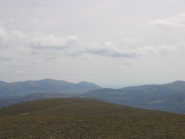
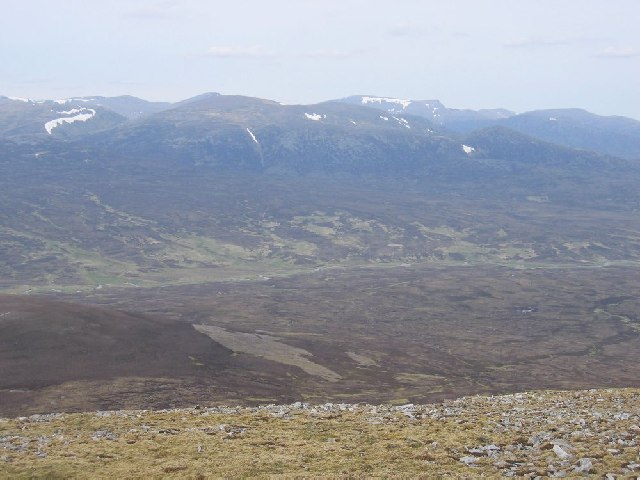
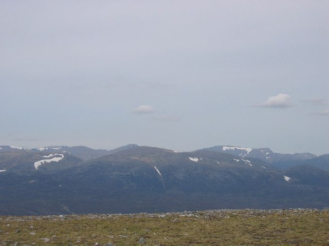
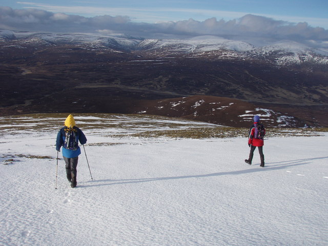
Situated in a remote and wild area, An Sgarsoch offers a challenging yet rewarding hiking experience for outdoor enthusiasts. Its isolated location provides breathtaking views of the surrounding landscape, including the neighboring hills and mountains such as Beinn Dearg and Carn a'Chlamain.

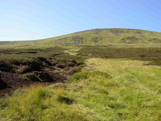
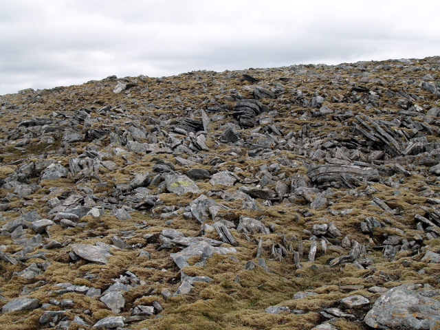
The ascent to the summit of An Sgarsoch typically begins from the Linn of Dee car park, passing through expansive moorland and peat bogs before reaching the hill's steep slopes. The terrain consists of heather-covered hillsides, rocky outcrops, and occasional patches of boggy ground, requiring navigation skills and sturdy footwear.

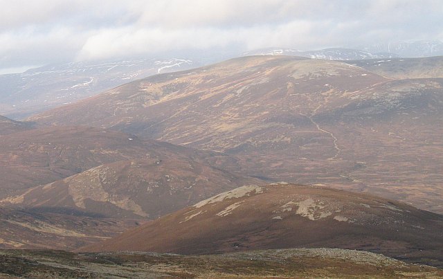
Reaching the top of An Sgarsoch rewards hikers with panoramic vistas of the Cairngorms National Park, characterized by its vast plateaus, deep glens, and winding rivers. On a clear day, it is even possible to catch a glimpse of the distant Ben Nevis, the highest mountain in the British Isles.

Due to its remote location, it is advisable for hikers to be well-prepared with appropriate clothing, navigation tools, and provisions. An Sgarsoch offers a challenging and rewarding adventure for those seeking to explore the rugged beauty of the Scottish Highlands.

If you have any feedback on the listing, please let us know in the comments section below.

An Sgarsoch Images

Images are sourced within 2km of 56.931906/-3.754413 or Grid Reference NN9383. Thanks to Geograph Open Source API. All images are credited.

Stony and thinly vegetated summit area of An Sgarsoch The summit area of An Sgarsoch with Carn an Fhidhlier in the distance. The walker sheltering in the cairn had just made the traverse between the two mountains.
Stony and thinly vegetated summit area of An Sgarsoch
The summit area of An Sgarsoch with Carn an Fhidhlier in the distance. The walker sheltering in the cairn had just made the traverse between the two mountains.
West side of An Sgarsoch
Belach between Sgarsoch and Carn Ealar
Southern ridge of An Sgarsoch
Leaving An Sgarsoch Looking north
Leaving An Sgarsoch
Looking north
Cairngorms from the summit of An Sgarsoch
The Gentle Slopes of Carn Ealar
heading north from An Sgarsoch back to pick up the stalkers' path to Geldie Lodge
heading north from An Sgarsoch
back to pick up the stalkers' path to Geldie Lodge
An Sgarsoch View across the Tarf towards An Sgarsoch, a notoriously remote hill. At 1006m asl it is dwarfed by Braigh Riabhach and Carn an t-Sabhail beyond.
An Sgarsoch
View across the Tarf towards An Sgarsoch, a notoriously remote hill. At 1006m asl it is dwarfed by Braigh Riabhach and Carn an t-Sabhail beyond.
Cloud sea from Sgarsoch Beag ridge. A temperature inversion with the tops of the Cairngorms across Glen Dee. Taken from the ridge leading to Sgarsoch Beag after camping on it.
Cloud sea from Sgarsoch Beag ridge.
A temperature inversion with the tops of the Cairngorms across Glen Dee. Taken from the ridge leading to Sgarsoch Beag after camping on it.
Col between Carn an Fhidhleir and An Sgarsoch At 710m, this is approx 300m below the two Munros.
Col between Carn an Fhidhleir and An Sgarsoch
At 710m, this is approx 300m below the two Munros.
Peat Hag, An Sgarsoch Mostly the hill is well-drained turf and heather, but there are occasionally wetter patches like this.
Peat Hag, An Sgarsoch
Mostly the hill is well-drained turf and heather, but there are occasionally wetter patches like this.
Summit, Pt. 967, An Sgarsoch The flat S ridge of An Sgarsoch drops to a col at 959 before rising slightly to this top.
Summit, Pt. 967, An Sgarsoch
The flat S ridge of An Sgarsoch drops to a col at 959 before rising slightly to this top.
Summit cairn, Pt. 967, An Sgarsoch Looking N towards the summit of the Munro.
Summit cairn, Pt. 967, An Sgarsoch
Looking N towards the summit of the Munro.
Boulder field below S ridge of An Sgarsoch
Boulder field below summit, An Sgarsoch
NW slopes, An Sgarsoch Looking down towards the Allt a' Chaoraine
NW slopes, An Sgarsoch
Looking down towards the Allt a' Chaoraine
Small burn, N face of An Sgarsoch
Show me another place!

An Sgarsoch is located at Grid Ref: NN9383 (Lat: 56.931906, Lng: -3.754413)

Unitary Authority: Perth and Kinross

Police Authority: Tayside

What 3 Words

///void.flick.rush. Near Inverey, Aberdeenshire

Nearby Locations

An Sgarsoch

Related Wikis

An Sgarsoch

An Sgarsoch (1,006.5m) is a mountain in the Grampian Mountains of Scotland. It lies north of Blair Atholl in a very remote part of the Highlands, on the...

Carn an Fhidhleir

Carn an Fhidhleir (994 m) is a mountain in the Grampian Mountains of Scotland. It lies on the border of Inverness-shire, Perthshire and Aberdeenshire,...

Loch Tilt

Loch Tilt is a small mountain freshwater loch that sits at the end of Glen Tilt and is located in north-east Perth and Kinross, Scotland. Loch Tilt has...
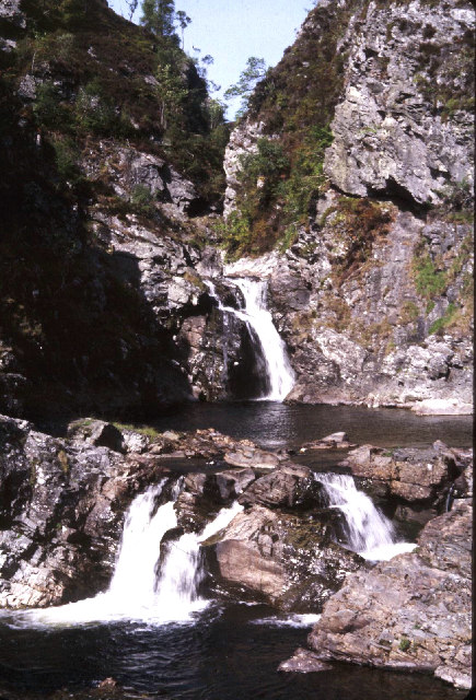
Falls of Tarf

The Falls of Tarf is a waterfall on the Tarf Water in the eastern Highlands of Scotland. Immediately downstream of the falls the Tarf is joined by a second...
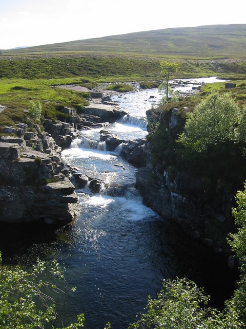
Falls of Dee

Falls of Dee is a waterfall on Braeriach in the Cairngorms, Scotland. == See also == Waterfalls of Scotland == References ==

Carn a' Chlamain

Càrn a' Chlamain (Gaelic: Càrn a' Chlamhain) is a Scottish mountain situated roughly 12 kilometres north of Blair Atholl in the Forest of Atholl. It is...

Beinn Bhrotain

Beinn Bhrotain (Scottish Gaelic: Hill of the mastiff) or Ben Vrottan is a Scottish mountain in the Cairngorms range, 18 kilometres west of Braemar in the...

Chest of Dee

Chest of Dee is a waterfall of Scotland. == See also == Waterfalls of Scotland == References ==

Nearby Amenities

Located within 500m of 56.931906,-3.754413
An Sgarsoch
Description: The place of the sharp rocks
Ele: 1006
Marilyn: yes
Munro: yes
Munro Number: M126
Natural: peak
Prominence: 319
Source: NPE
Wikidata: Q13125504
Wikipedia: en:An Sgarsoch
Lat/Long: 56.9319217/-3.7544005
The data included in this document is from www.openstreetmap.org. The data is made available under ODbL.

Have you been to An Sgarsoch?

Leave your review of An Sgarsoch below (or comments, questions and feedback).