Bryn y Fan

Hill, Mountain in Montgomeryshire

Wales

Bryn y Fan

Glyndwr's Way near Van
Glyndwr's Way near Van Credit: Dave Kelly

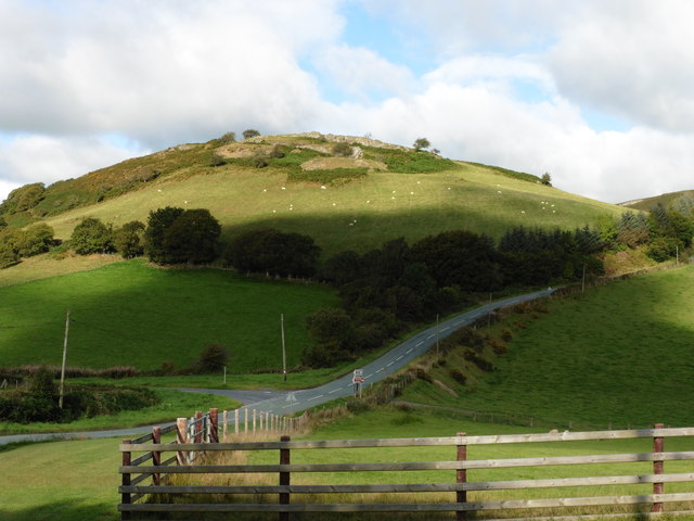
Bryn y Fan is a prominent hill/mountain located in the county of Montgomeryshire, Wales. Situated within the picturesque landscape of the Cambrian Mountains, it stands at an elevation of approximately 1,190 feet (363 meters) above sea level.

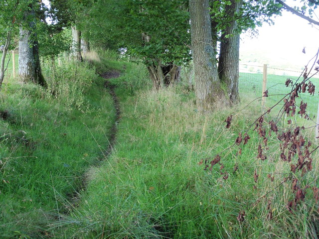
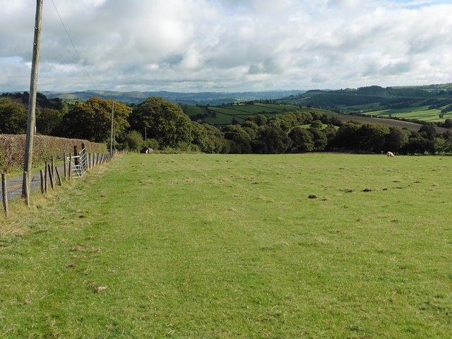
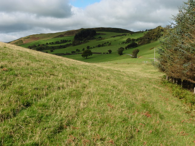
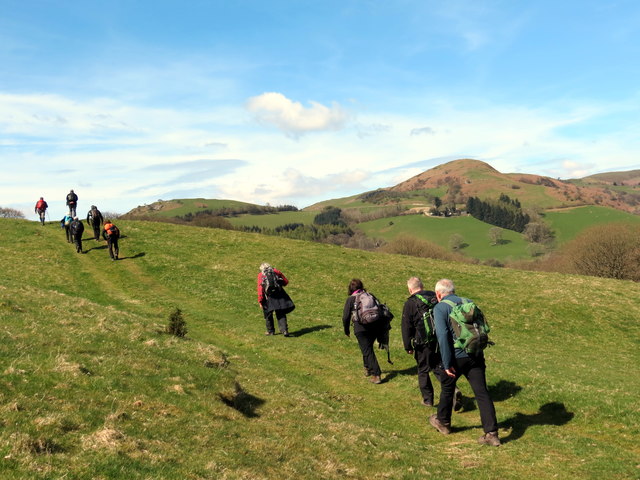
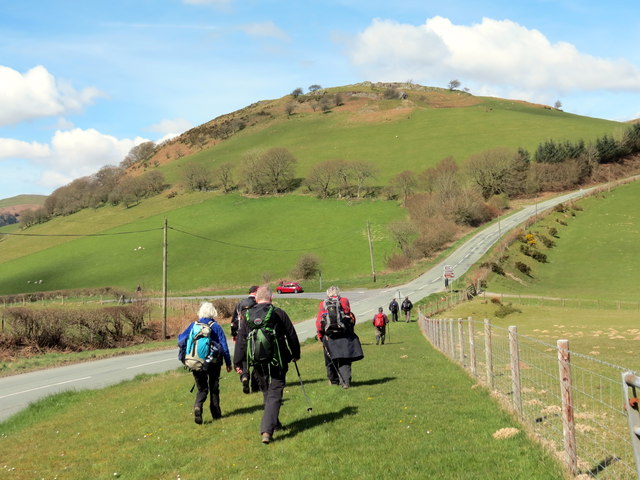
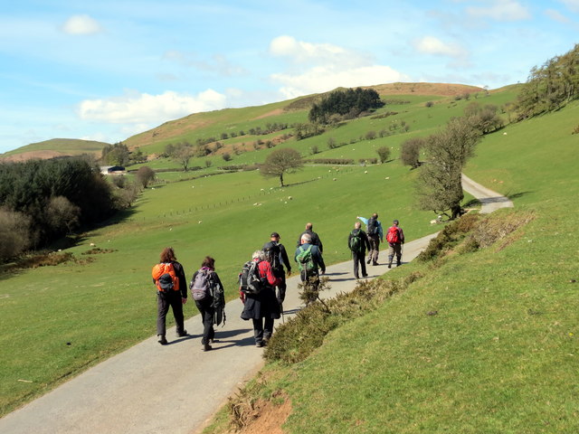
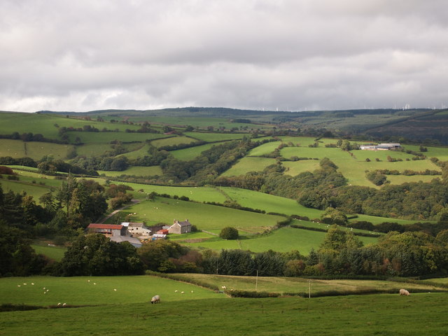
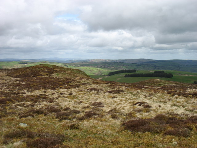
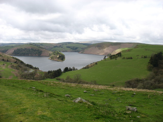
The hill/mountain is known for its stunning natural beauty, boasting panoramic views of the surrounding countryside. Its slopes are covered in lush greenery, with a mixture of grasses, heather, and shrubs. The summit offers breathtaking vistas of the Montgomeryshire countryside, with rolling hills and valleys stretching out as far as the eye can see.

Bryn y Fan is a popular destination for outdoor enthusiasts and nature lovers, offering a range of activities such as hiking, walking, and birdwatching. The hill/mountain is home to a variety of wildlife, including birds of prey like red kites and buzzards, as well as smaller mammals such as rabbits and foxes.

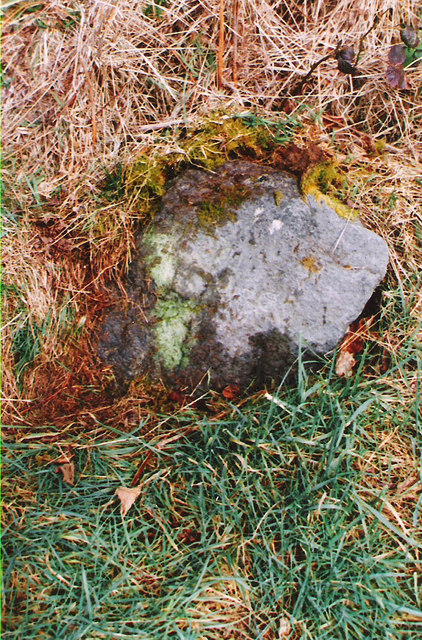
The area surrounding Bryn y Fan is also steeped in history, with evidence of human settlements dating back thousands of years. Ancient burial mounds and stone circles can be found in the vicinity, adding to the allure and intrigue of the landscape.

Overall, Bryn y Fan is a haven of natural beauty and a must-visit for those seeking tranquility and a connection with the great outdoors.

If you have any feedback on the listing, please let us know in the comments section below.
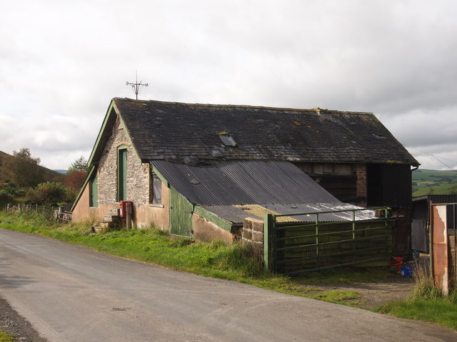
Bryn y Fan Images

Images are sourced within 2km of 52.483899/-3.5753896 or Grid Reference SN9388. Thanks to Geograph Open Source API. All images are credited.

Glyndwr's Way near Van
Glyndwr's Way near to the B4518
Glyndwr's Way by the B4518
Glyndwr's Way near to the B4518 This section of the path has been re-routed to a field parallel to the road.
Glyndwr's Way near to the B4518
This section of the path has been re-routed to a field parallel to the road.
Y Garth / Garth Hill Cerddwyr yn dilyn Llwybr Glyndwr ar fryn o'r enw'r Garth.

Walkers following Glyndwr's Way on Garth Hill.
Y Garth / Garth Hill
Cerddwyr yn dilyn Llwybr Glyndwr ar fryn o'r enw'r Garth. Walkers following Glyndwr's Way on Garth Hill.
Ger Bidffald/ Nead Bidffald Cerddwyr yn dilyn Llwybr Glyndwr ar hyd y B4518.

Walkers following Glyndwr's Way along the B4518.
Ger Bidffald/ Nead Bidffald
Cerddwyr yn dilyn Llwybr Glyndwr ar hyd y B4518. Walkers following Glyndwr's Way along the B4518.
Heol Ffarm Bryntail Road Cerddwyr yn dilyn Llwybr Glyndwr ar heol sy'n arwain at Ffarm Bryntail.

Walkers following Glyndwr's Way along the access road to Bryntail Farm (trans. dung hill).
Heol Ffarm Bryntail Road
Cerddwyr yn dilyn Llwybr Glyndwr ar heol sy'n arwain at Ffarm Bryntail. Walkers following Glyndwr's Way along the access road to Bryntail Farm (trans. dung hill).
Bryn Tail Gat fach ar Lwybr Glyndwr uwchlaw Ffarm Bryn Tail.

A small gate on the Glyndwr's Way above Bryntail Farm (trans. dung hill).
Bryn Tail
Gat fach ar Lwybr Glyndwr uwchlaw Ffarm Bryn Tail. A small gate on the Glyndwr's Way above Bryntail Farm (trans. dung hill).
Faedre Fawr
Faedre Fawr
Old Barn Near Bwlchyfan
The summit ridge of Bryn y Fan Seen from the trig point.
The summit ridge of Bryn y Fan
Seen from the trig point.
Llyn Clywedog reservoir Looking down to the Bwlch-y-gle dam from the slopes of Bryn y Fan. This dam is not the main one for the reservoir (that is in <a href="https://www.geograph.org.uk/gridref/SN9187">SN9187</a>), but was constructed to enable the level to be that much higher without the water escaping down this minor alternative outlet.

I have to say that I think the design of these essential reservoirs, here and in the Elan Valley, was an excellent example of sensitive landscape modification.
Llyn Clywedog reservoir
Looking down to the Bwlch-y-gle dam from the slopes of Bryn y Fan. This dam is not the main one for the reservoir (that is in SN9187), but was constructed to enable the level to be that much higher without the water escaping down this minor alternative outlet. I have to say that I think the design of these essential reservoirs, here and in the Elan Valley, was an excellent example of sensitive landscape modification.
Llyn Clywedog A most attractive reservoir with several arms into the surrounding hills, popular with both sailors and fishermen.
Rather unusually  the reservoir has two dams, as the main one (just visible in the distance) raised the level so much that a second dam (the Bwlch-y-gle dam) had to be built to prevent the water flowing out down quite the wrong valley.
Llyn Clywedog
A most attractive reservoir with several arms into the surrounding hills, popular with both sailors and fishermen. Rather unusually the reservoir has two dams, as the main one (just visible in the distance) raised the level so much that a second dam (the Bwlch-y-gle dam) had to be built to prevent the water flowing out down quite the wrong valley.
Old Milestone east of Llyn Clywedog By the UC, in parish of Trefeglwys (Powys District), East of Esgair Maen, on verge, North side of road.

Inscription once read:- : (Llanidloes 4) : : (Machynlleth 16) :

Surveyed

Milestone Society National ID: MOT_LIMC04.
Old Milestone east of Llyn Clywedog
By the UC, in parish of Trefeglwys (Powys District), East of Esgair Maen, on verge, North side of road. Inscription once read:- : (Llanidloes 4) : : (Machynlleth 16) : Surveyed Milestone Society National ID: MOT_LIMC04.
A4518 passing the Llyn Clywedog Reservoir
View to Bwlch-y-gle dam
A view over Llyn Clywedog From beside the B4518 road.
A view over Llyn Clywedog
From beside the B4518 road.
View over Llyn Clywedog
Show me another place!

Bryn y Fan is located at Grid Ref: SN9388 (Lat: 52.483899, Lng: -3.5753896)

Unitary Authority: Powys

Police Authority: Dyfed Powys

What 3 Words

///blogging.joyously.discusses. Near Llanidloes, Powys

Nearby Locations

Bryn y Fan

Related Wikis

Garth and Van Road railway station

Garth and Van Road railway station served the village of Garth, in the historical county of Montgomeryshire, Wales, from 1873 to 1940 on the Van Railway...

Van, Llanidloes

Van (Welsh: Y Fan) is a hamlet in Powys, Mid Wales, located to the north west of Llanidloes. Its name, an anglicisation of the local Welsh placename "Fan...
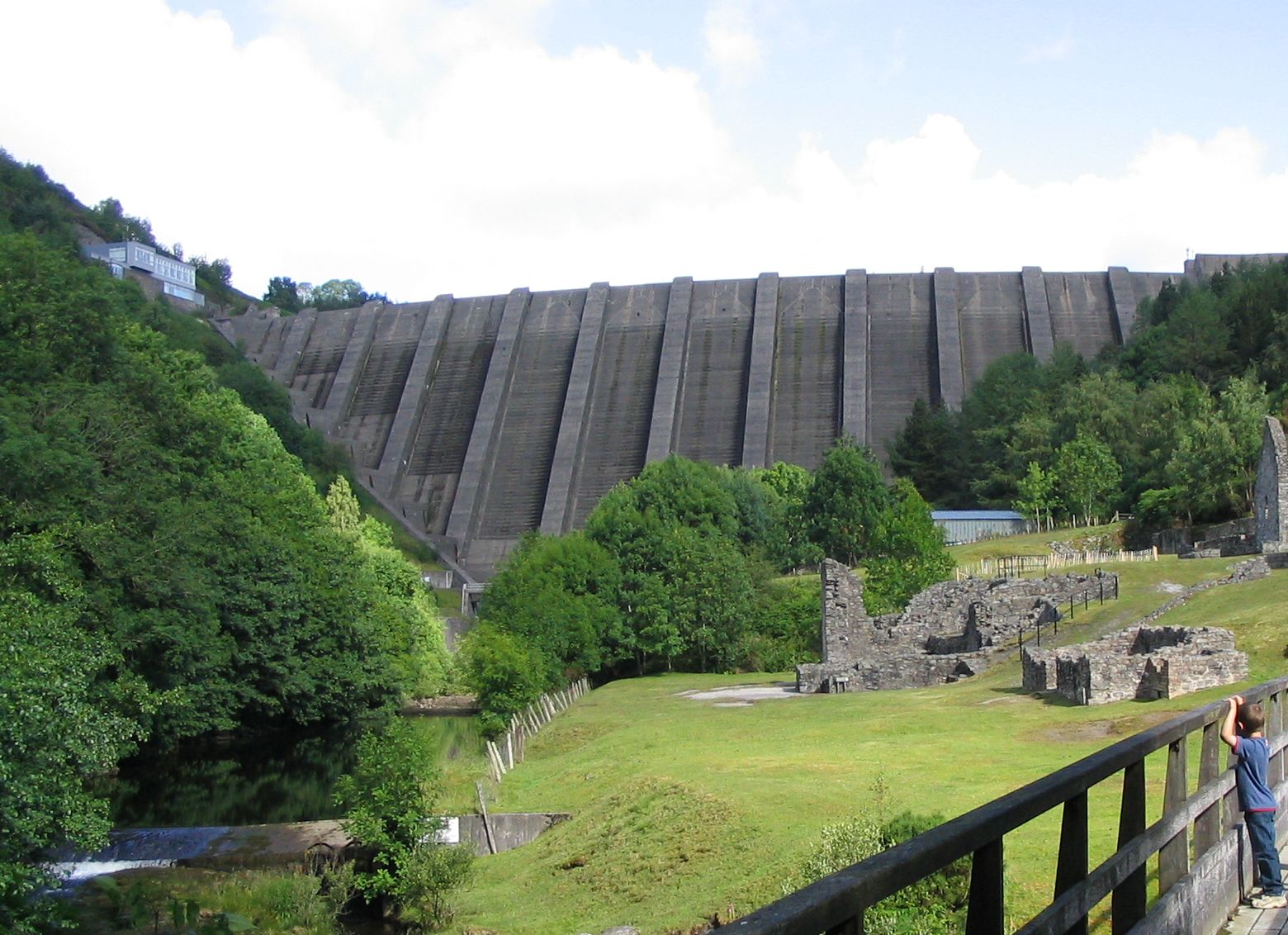
Bryntail lead mine

Bryntail lead mine is a disused lead mine near Llanidloes in Powys, Wales. Sited on the Afon Clywedog and in the shadow on the Clywedog reservoir dam,...

Llawryglyn

Llawr y Glyn (or Llawryglyn) is a hamlet in Powys, Wales. It lies about 10 miles west of the town of Newtown, in the historic county of Montgomeryshire...

Cerist railway station

Cerist railway station served the town of Llanidloes, in the historical county of Montgomeryshire, Wales, from 1873 to 1940 on the Van Railway. == History... ==
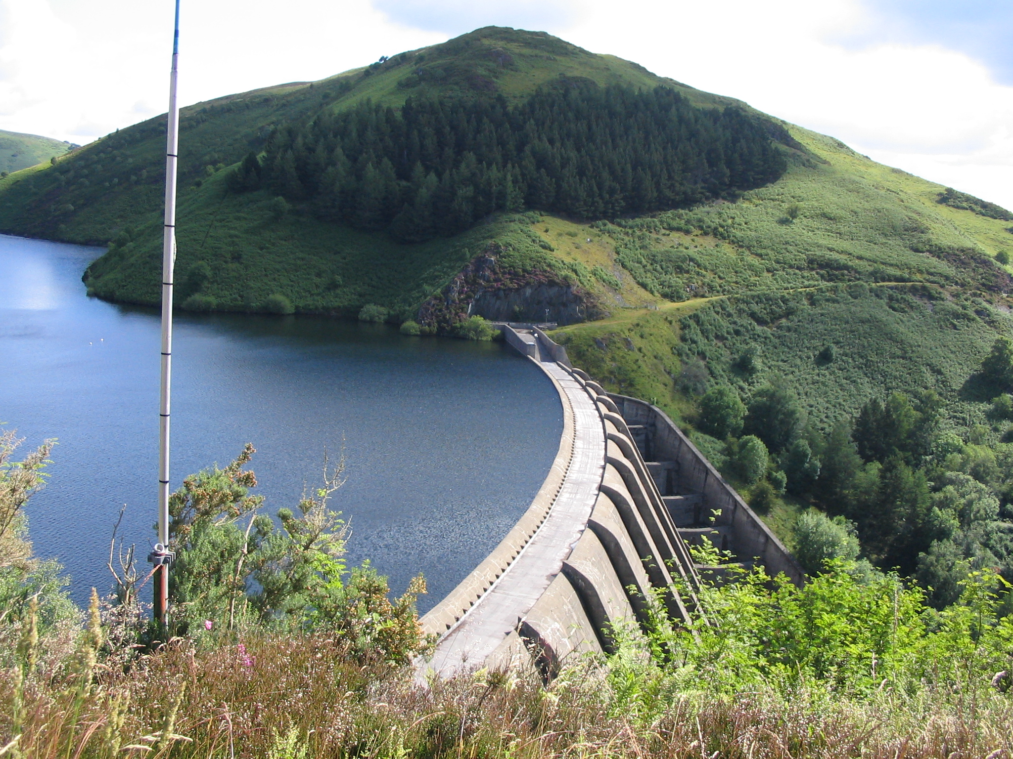
Clywedog Reservoir

The Clywedog Reservoir (Welsh: Llyn Clywedog) is a reservoir near Llanidloes, Wales on the head-waters of the River Severn. The construction of the reservoir...

Llanidloes War Memorial Hospital

Llanidloes War Memorial Hospital (Welsh: Ysbyty Coffa Rhyfel Llanidloes) is a health facility in Eastgate Street, Llanidloes, Powys, Wales. It is managed...

Trefeglwys

Trefeglwys is a village and community in Powys, Wales, within the historic county of Montgomeryshire. The name derives from the Welsh language tref 'township...

Nearby Amenities

Located within 500m of 52.483899,-3.5753896
Bryn-Y-Fan
Ele: 482
Natural: peak
Lat/Long: 52.48391/-3.5754098
The data included in this document is from www.openstreetmap.org. The data is made available under ODbL.

Have you been to Bryn y Fan?

Leave your review of Bryn y Fan below (or comments, questions and feedback).