Carnedd Wen

Hill, Mountain in Montgomeryshire

Wales

Carnedd Wen

Carnedd Wen Wet feet crossing ford right at the start from the NE. 3 miles each way on forestry tracks. Trig point is rather sad at the edge of the forest and for the anoraks, the land just east is slightly higher.
Name: Carnedd Wen
Hill number: 2168
Height: 523m / 1716ft
Area: 31A: Aberystwyth to Welshpool
Class: Ma,5
Grid ref: SH 92417 09921
Summit feature: grassy tussock 8m east of trig point
Drop: 228m
Col: 295m  SH934138
Carnedd Wen Credit: Rude Health

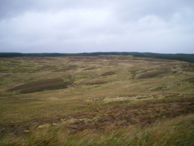
Carnedd Wen is a prominent hill located in Montgomeryshire, Wales. It is part of the Berwyn range of mountains and sits at an elevation of 617 meters (2024 feet) above sea level. The hill is known for its stunning views of the surrounding countryside and is a popular destination for hikers and outdoor enthusiasts.

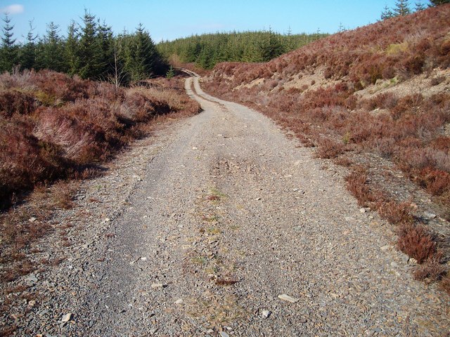
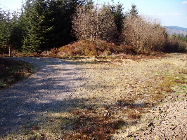
Carnedd Wen is characterized by its rugged terrain, with rocky outcrops and steep slopes. The hill is covered in grasses, heather, and bracken, providing habitat for a variety of wildlife including birds, insects, and small mammals.

The summit of Carnedd Wen offers breathtaking panoramic views of the surrounding landscape, including the nearby peaks of Cadair Berwyn and Moel Sych. On a clear day, it is possible to see as far as Snowdonia National Park to the west.

Access to Carnedd Wen is via a network of footpaths and bridleways, making it an accessible destination for walkers of all abilities. The hill is a popular spot for picnics, photography, and nature watching, and is a peaceful retreat for those looking to escape the hustle and bustle of everyday life.

If you have any feedback on the listing, please let us know in the comments section below.

Carnedd Wen Images

Images are sourced within 2km of 52.67622/-3.5928186 or Grid Reference SH9209. Thanks to Geograph Open Source API. All images are credited.

Carnedd Wen Wet feet crossing ford right at the start from the NE. 3 miles each way on forestry tracks. Trig point is rather sad at the edge of the forest and for the anoraks, the land just east is slightly higher.
Name: Carnedd Wen
Hill number: 2168
Height: 523m / 1716ft
Area: 31A: Aberystwyth to Welshpool
Class: Ma,5
Grid ref: SH 92417 09921
Summit feature: grassy tussock 8m east of trig point
Drop: 228m
Col: 295m  SH934138
Carnedd Wen
Wet feet crossing ford right at the start from the NE. 3 miles each way on forestry tracks. Trig point is rather sad at the edge of the forest and for the anoraks, the land just east is slightly higher. Name: Carnedd Wen Hill number: 2168 Height: 523m / 1716ft Area: 31A: Aberystwyth to Welshpool Class: Ma,5 Grid ref: SH 92417 09921 Summit feature: grassy tussock 8m east of trig point Drop: 228m Col: 295m SH934138
Ordnance Survey Triangulation Pillar Carnedd Wen Secondary Triangulation Pillar carries Flush Bracket S8512 which marks a point 523.836m above mean sea level.
Ordnance Survey Triangulation Pillar
Carnedd Wen Secondary Triangulation Pillar carries Flush Bracket S8512 which marks a point 523.836m above mean sea level.
Boundary Fence Boundary fence line on heathery slope.
Boundary Fence
Boundary fence line on heathery slope.
Llyn Northern shore of Llyn Coch-hwyad, some sort of boating activity goes on here as there are upturned boats on shore.
Llyn
Northern shore of Llyn Coch-hwyad, some sort of boating activity goes on here as there are upturned boats on shore.
Many a mile of this Forest road leading down to Llyn Coch-hwyad.
Many a mile of this
Forest road leading down to Llyn Coch-hwyad.
Nant Lyn Coch-hwyad Course of stream running down to Llyn.
Nant Lyn Coch-hwyad
Course of stream running down to Llyn.
Nant Llyn Coch-hwyad Stream heads down to Cwm Tafalog.
Nant Llyn Coch-hwyad
Stream heads down to Cwm Tafalog.
Track junction One of many track junctions in forest.
Track junction
One of many track junctions in forest.
A dry one Site of pool on Carnedd Wen, no sign of water at this time.
A dry one
Site of pool on Carnedd Wen, no sign of water at this time.
Carnedd Wen Trig point marking summit of Carnedd Wen.
Carnedd Wen
Trig point marking summit of Carnedd Wen.
Forest track Another section of track in this vast forest.
Forest track
Another section of track in this vast forest.
Moorland and track above Esgair Ganol This track hugs the forest edge between Esgair y Llyn and Waun Lwyd to the north, but I wasn't going to head any further along it, due to the filthy weather that was coming in.
Moorland and track above Esgair Ganol
This track hugs the forest edge between Esgair y Llyn and Waun Lwyd to the north, but I wasn't going to head any further along it, due to the filthy weather that was coming in.
A small trackside pool in the forest The rain had started in earnest by the time I arrived here, so the quality of this picture isn't great.
A small trackside pool in the forest
The rain had started in earnest by the time I arrived here, so the quality of this picture isn't great.
Forest firebreak After an abortive attempt to find the cairn of Carnedd y Cylch, the view down this firebreak presented itself.
Forest firebreak
After an abortive attempt to find the cairn of Carnedd y Cylch, the view down this firebreak presented itself.
Cwm Ganol I may have invented the name, but as it's the cwm that incorporates Fridd Ganol and Esgair Ganol, it seems a reasonable name for this large open moorland.
Cwm Ganol
I may have invented the name, but as it's the cwm that incorporates Fridd Ganol and Esgair Ganol, it seems a reasonable name for this large open moorland.
Disused quarry in Esgair y Llyn
Track junction in the forest
Disused (and boggy) quarry
Show me another place!

Carnedd Wen is located at Grid Ref: SH9209 (Lat: 52.67622, Lng: -3.5928186)

Unitary Authority: Powys

Police Authority: Dyfed Powys

What 3 Words

///shopping.passenger.ruler. Near Cwm-Llinau, Powys

Nearby Locations

Carnedd Wen

Related Wikis

Pandy, Powys

Pandy is a small village in Powys, Wales located off the main A470 road near Llanbrynmair.

Mallwyd

Mallwyd () is a small village at the most southern end of Gwynedd, Wales, in the Mawddwy community, in the valley of the River Dyfi. It lies on the A470...

Llanbrynmair railway station

Llanbrynmair railway station was a railway station on the Newtown and Machynlleth Railway (N&MR) in Mid-Wales, serving the village of Llanbrynmair. After...

Llanbrynmair

Llanbrynmair or Llanbryn-mair () is a village, community and electoral ward in Montgomeryshire, Powys, on the A470 road between Caersws and Machynlleth...

Nearby Amenities

Located within 500m of 52.67622,-3.5928186
Carnedd Wen
Ele: 523
Man Made: survey_point
Natural: peak
Wikidata: Q20589221
Wikipedia: cy:Carnedd Wen
Lat/Long: 52.676217/-3.5928042
The data included in this document is from www.openstreetmap.org. The data is made available under ODbL.

Have you been to Carnedd Wen?

Leave your review of Carnedd Wen below (or comments, questions and feedback).