Bryn Glâs

Hill, Mountain in Merionethshire

Wales

Bryn Glâs

Along the fence to Carreg y Bîg The fence marks the rough line of the boundary between the historic Welsh counties of Meirionethshire and Montgomeryshire, which essentially ceased to exist when they merged into the newly created Gwynedd and Powys counties respectively under the 1972 Local Government Act.
Along the fence to Carreg y Bîg Credit: Richard Law

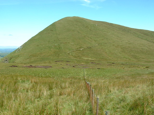
Bryn Glâs is a prominent hill located in the county of Merionethshire, Wales. Rising to an elevation of approximately 420 meters (1,380 feet), it is known for its stunning panoramic views and rugged natural beauty. Situated within the Snowdonia National Park, Bryn Glâs is a popular destination for hikers, nature enthusiasts, and photographers.

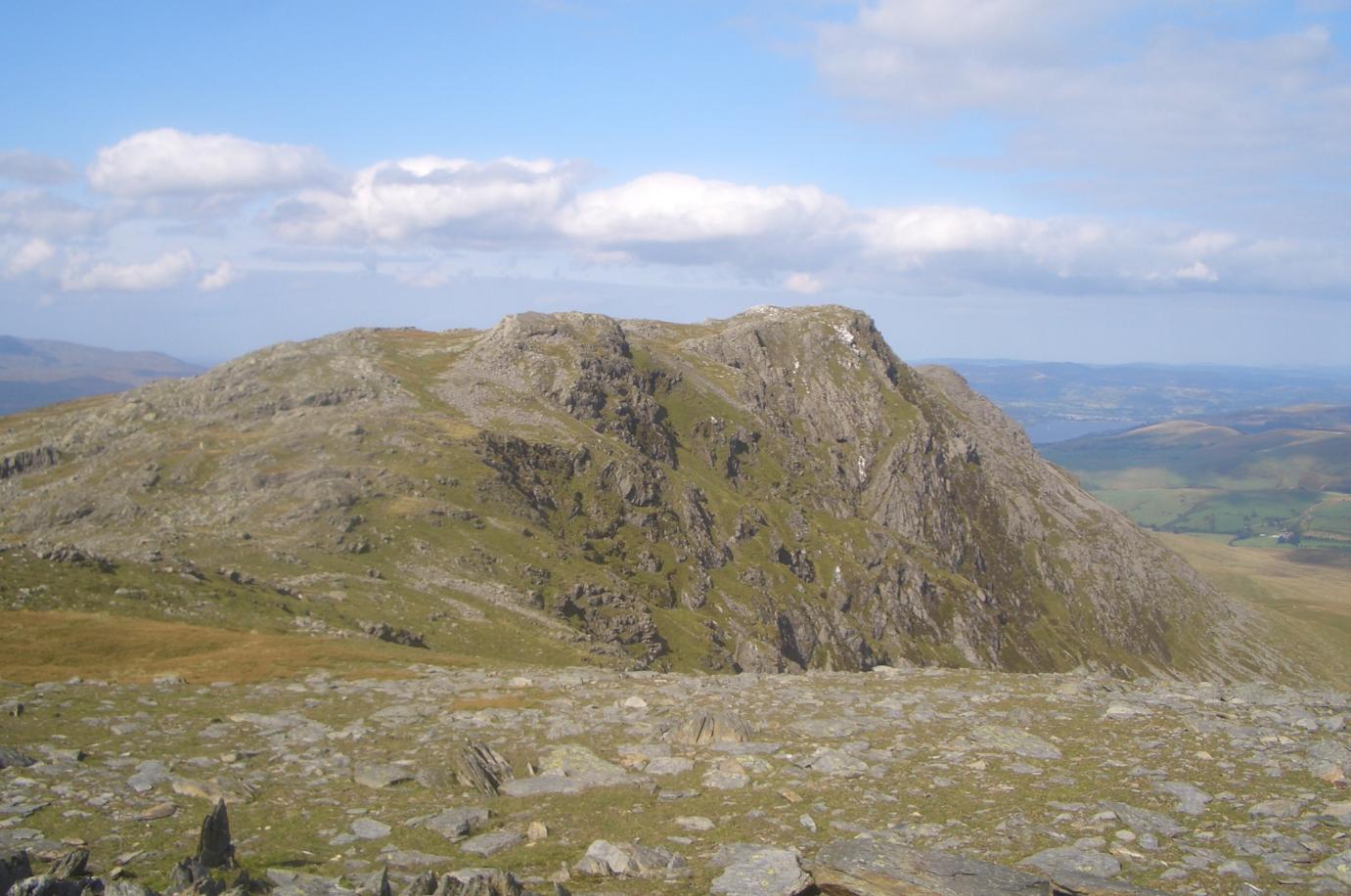
The hill is characterized by its rocky terrain, covered in heather and other hardy vegetation. Its slopes are dotted with scattered outcrops of rocks, giving it a distinctive appearance. From the summit, visitors can enjoy breathtaking vistas of the surrounding countryside, including the nearby peaks of Snowdon, Cadair Idris, and Rhinog Fawr.

Bryn Glâs offers a range of walking routes to suit various abilities. A well-marked footpath leads visitors to the summit, offering a moderate challenge with rewarding views. The hill is also a great spot for birdwatching, with species such as red grouse, peregrine falcons, and kestrels often spotted in the area.

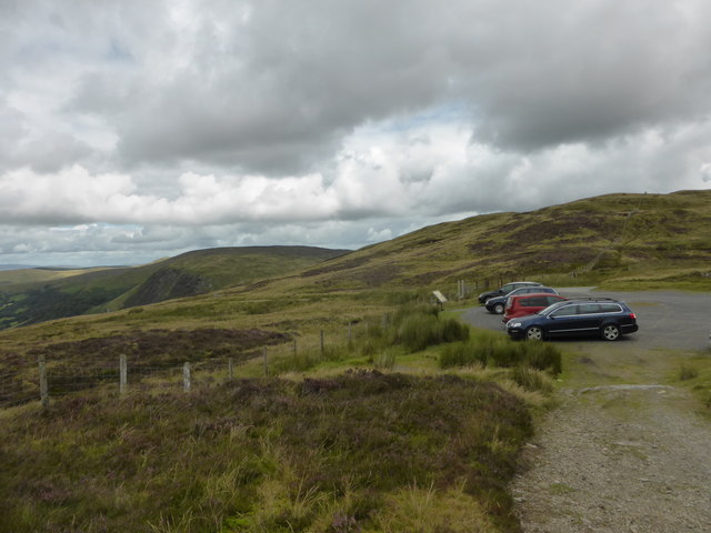
Access to Bryn Glâs is relatively easy, with a car park located nearby for visitors. It is recommended to come prepared with suitable clothing and footwear, as weather conditions can change rapidly in the area. The hill is also a popular spot for picnics, providing a peaceful and picturesque setting for visitors to relax and enjoy the surrounding wilderness.

If you have any feedback on the listing, please let us know in the comments section below.

Bryn Glâs Images

Images are sourced within 2km of 52.780463/-3.5989364 or Grid Reference SH9221. Thanks to Geograph Open Source API. All images are credited.

Along the fence to Carreg y Bîg The fence marks the rough line of the boundary between the historic Welsh counties of Meirionethshire and Montgomeryshire, which essentially ceased to exist when they merged into the newly created Gwynedd and Powys counties respectively under the 1972 Local Government Act.
Along the fence to Carreg y Bîg
The fence marks the rough line of the boundary between the historic Welsh counties of Meirionethshire and Montgomeryshire, which essentially ceased to exist when they merged into the newly created Gwynedd and Powys counties respectively under the 1972 Local Government Act.
Fenceline down to Mynydd Coch A relatively new fence (my evidence being several pieces of the wrappers from the wire which were lying in the heather) leading from Carreg y Bîg off to the main eastern summit of Mynydd Coch.
Fenceline down to Mynydd Coch
A relatively new fence (my evidence being several pieces of the wrappers from the wire which were lying in the heather) leading from Carreg y Bîg off to the main eastern summit of Mynydd Coch.
Fenceline below Mynydd Coch A new fence running across the moor between Carreg y Bîg and Mynydd Coch.
Fenceline below Mynydd Coch
A new fence running across the moor between Carreg y Bîg and Mynydd Coch.
Substantial corner-bracing On the new fence across the moor, no-one's taking any chances with the bracing at this corner.
Substantial corner-bracing
On the new fence across the moor, no-one's taking any chances with the bracing at this corner.
Road leading down to Blaen-pennant from Bwlch y Groes
Road leading up to Bwlch y Groes from Blaen-pennant
Craggy ridge at Wenallt above Blaen-pennant
View toward the Dovey Valley
Afon Rhiwlech View from the top of the valley of the Afon Rhiwlech.
Afon Rhiwlech
View from the top of the valley of the Afon Rhiwlech.
Eunant Fawr Head of the river Eunant.
Eunant Fawr
Head of the river Eunant.
Descent from Bwlch y Groes Looking down the spectacular and revered road towards Dyffryn Dyfi. The extraordinary plateau above the locally incised valleys is well displayed in the distance. There is a small quarry here, which was presumably the source of construction material locally.
Descent from Bwlch y Groes
Looking down the spectacular and revered road towards Dyffryn Dyfi. The extraordinary plateau above the locally incised valleys is well displayed in the distance. There is a small quarry here, which was presumably the source of construction material locally.
Towards Bwlch y Groes Looking up the famous climb. Rocks at the roadside were have cushions of thyme with pink flowers.
Towards Bwlch y Groes
Looking up the famous climb. Rocks at the roadside were have cushions of thyme with pink flowers.
Gate and track above Blaen-pennant
The car park at Bwlch y Groes
Gwaun yr Hen-Luest [Moor of the Old Hut] To the right of the photo is an ancient & boggy track, not shown on the map.
Gwaun yr Hen-Luest [Moor of the Old Hut]
To the right of the photo is an ancient & boggy track, not shown on the map.
A challenge for the fence builders ...and also for walkers.
A challenge for the fence builders
...and also for walkers.
Bog and sheep Inhospitable ground, with just a few sheep [the white dot in the distance].
Bog and sheep
Inhospitable ground, with just a few sheep [the white dot in the distance].
A bend in the fence The fence is the main feature of the square, but why does it have bends?
A bend in the fence
The fence is the main feature of the square, but why does it have bends?
Show me another place!

Bryn Glâs is located at Grid Ref: SH9221 (Lat: 52.780463, Lng: -3.5989364)

Unitary Authority: Gwynedd

Police Authority: North Wales

What 3 Words

///bystander.sensual.unstated. Near Llanuwchllyn, Gwynedd

Nearby Locations

Bryn Glâs

Related Wikis

Bwlch y Groes

Bwlch y Groes (translates from Welsh as pass of the cross) is the second highest public road mountain pass in Wales, with a summit altitude of 545 metres...

Llanymawddwy

Llanymawddwy () is a village in the community of Mawddwy in south-east Gwynedd, Wales, which is to the north of the larger village of Dinas Mawddwy, on...

Esgeiriau Gwynion

Esgeiriau Gwynion (Welsh for "white shanks") is a mountain in north Wales. It is the smallest of the three Marilyns that form the Aran range, the others...

Rhiwargor

Rhiwargor is a hamlet in Powys, Wales. It is located north of Lake Vyrnwy. The hamlet is made up of a few houses with no amenities. It does however, lie...

Aran Benllyn

Aran Benllyn is a subsidiary summit of Aran Fawddwy in southern Snowdonia, North Wales, Wales, United Kingdom. It is the second highest peak in the Aran...

Gwaun y Llwyni

Gwaun y Llwyni is a subsidiary summit of Aran Fawddwy in southern Snowdonia, Wales. It forms a part of the Aran mountain range. The peak's southern face...

Foel Hafod-fynydd

Foel Hafod-fynydd is a subsidiary summit of Aran Fawddwy in southern Snowdonia, North Wales, Wales, United Kingdom. It tops the east ridge of Erw y Ddafad...

Pen yr Allt Uchaf

Pen yr Allt Uchaf is a subsidiary summit of Aran Fawddwy in the south of the Snowdonia National Park in Gwynedd, Wales. The summit is the highest point...

Nearby Amenities

Located within 500m of 52.780463,-3.5989364
Bryn Glas
Ele: 558
Natural: peak
Wikidata: Q14565701
Wikipedia: cy:Bryn Glas
Lat/Long: 52.7800437/-3.5994781
The data included in this document is from www.openstreetmap.org. The data is made available under ODbL.

Have you been to Bryn Glâs?

Leave your review of Bryn Glâs below (or comments, questions and feedback).