Cadair Benllyn

Hill, Mountain in Merionethshire

Wales

Cadair Benllyn

Afon Nant Fach Taken from the bridge (which has no parapet) by the road gate, and showing the many huge glacial-erratic boulders which have been lifted from the course of the river. Presumably, the work was done to improve the flow of this busy river at times of flooding.
Afon Nant Fach Credit: Jonathan Wilkins

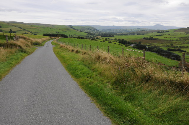
Cadair Benllyn is a prominent hill located in the county of Merionethshire, Wales. Standing at an elevation of 1,423 feet (434 meters), it offers breathtaking panoramic views of the surrounding countryside.

Situated in the southern part of the Snowdonia National Park, Cadair Benllyn is part of the Rhinogydd range, which is known for its rugged and wild landscapes. The hill is composed mainly of hard rock, giving it a distinctive and imposing appearance. It is often described as having a pyramid-like shape, with a sharp peak and steep slopes.

Accessing Cadair Benllyn can be done from various starting points, including the village of Trawsfynydd to the northwest and the picturesque Cwm Bychan valley to the south. Hikers and outdoor enthusiasts are drawn to this area for its challenging trails and stunning natural beauty.

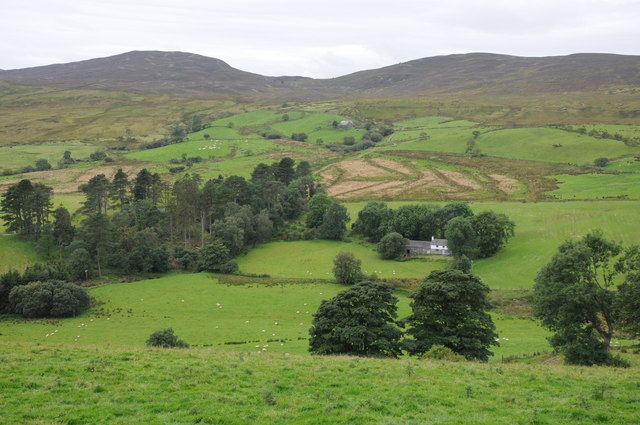
The summit of Cadair Benllyn offers commanding views of the surrounding peaks, including Rhinog Fawr and Rhinog Fach. On clear days, it is possible to see as far as the Cambrian Coast and even the distant peaks of Snowdonia. The hill is also known for its unique flora and fauna, with heather, bilberry, and mountain ponies being common sightings.

Cadair Benllyn attracts visitors seeking a rewarding outdoor experience, whether it be hiking, photography, or simply enjoying the peacefulness of the Welsh countryside. It is a place where nature enthusiasts can immerse themselves in the beauty and tranquility of this stunning part of Wales.

If you have any feedback on the listing, please let us know in the comments section below.

Cadair Benllyn Images

Images are sourced within 2km of 52.994169/-3.6321369 or Grid Reference SH9045. Thanks to Geograph Open Source API. All images are credited.

Afon Nant Fach Taken from the bridge (which has no parapet) by the road gate, and showing the many huge glacial-erratic boulders which have been lifted from the course of the river. Presumably, the work was done to improve the flow of this busy river at times of flooding.
Afon Nant Fach
Taken from the bridge (which has no parapet) by the road gate, and showing the many huge glacial-erratic boulders which have been lifted from the course of the river. Presumably, the work was done to improve the flow of this busy river at times of flooding.
Ucheldre View across to the upland grazing on Ucheldre, viewed here from the B4501.
Ucheldre
View across to the upland grazing on Ucheldre, viewed here from the B4501.
The B4501 near Gellioedd The B4501 links Bala with the A5 near Cerrigydrudion, here it is pictured near Gellioedd.
The B4501 near Gellioedd
The B4501 links Bala with the A5 near Cerrigydrudion, here it is pictured near Gellioedd.
View to Arenig Fawr View to Arenig Fawr from the B4501 near Hafod-y-Bryn.  Craig yr Hafod can be seen in the middle distance on the right.
View to Arenig Fawr
View to Arenig Fawr from the B4501 near Hafod-y-Bryn. Craig yr Hafod can be seen in the middle distance on the right.
Moel y Gydros Upland grazing on the 521m high Moel y Gydros, viewed from the country road passing over Cadair Benllyn.
Moel y Gydros
Upland grazing on the 521m high Moel y Gydros, viewed from the country road passing over Cadair Benllyn.
Woodland strip Woodland strip on the eastern slopes of Moel y Gydros.
Woodland strip
Woodland strip on the eastern slopes of Moel y Gydros.
Valley near Gydros The Afon Nant Fach flows through this valley near Gydros.
Valley near Gydros
The Afon Nant Fach flows through this valley near Gydros.
Cae'r-gerreg View to Graig Ddu and Craig yr Hafod from near Cae'r-gerreg.
Cae'r-gerreg
View to Graig Ddu and Craig yr Hafod from near Cae'r-gerreg.
Road to Bala View down a country road as it passes upland near Cae'r-gerreg, Bala is in the valley in the middle distance and Aran Fawddwy can be seen to the right in the distance.
Road to Bala
View down a country road as it passes upland near Cae'r-gerreg, Bala is in the valley in the middle distance and Aran Fawddwy can be seen to the right in the distance.
Cae-hir View to Graig Ddu and Craig yr Hafod with Cae-hir in the valley near the trees.
Cae-hir
View to Graig Ddu and Craig yr Hafod with Cae-hir in the valley near the trees.
View to Graig Ddu and Craig yr Hafod View to Graig Ddu and Craig yr Hafod view across the upper reaches of Cwmtirmynach.
View to Graig Ddu and Craig yr Hafod
View to Graig Ddu and Craig yr Hafod view across the upper reaches of Cwmtirmynach.
Wood on Moel y Gydros Woodland strip on the western slopes of Moel y Gydros.
Wood on Moel y Gydros
Woodland strip on the western slopes of Moel y Gydros.
Grazing land above Cwm Penanner Upland grazing land above Cwm Penanner, the north slopes of Moel y Gydros can be seen on the right.
Grazing land above Cwm Penanner
Upland grazing land above Cwm Penanner, the north slopes of Moel y Gydros can be seen on the right.
Road by Ty Mawr Cwm Road passing a farm at Ty Mawr Cwm in Cwm Penanner.
Road by Ty Mawr Cwm
Road passing a farm at Ty Mawr Cwm in Cwm Penanner.
Moel y Gydros from the Cwm Penanner road At the foot of Moel y Gydros looking east from the single track road to Cwm Penanner. The smaller summit of Moel Cwm-Main is to the left and a small spruce plantation clings to the hillside on the right.
Moel y Gydros from the Cwm Penanner road
At the foot of Moel y Gydros looking east from the single track road to Cwm Penanner. The smaller summit of Moel Cwm-Main is to the left and a small spruce plantation clings to the hillside on the right.
Moel y Gydros summit panorama looking southwest Looking west from the summit of Moel y Gydros in the direction of Bala. At a maximum elevation of 1713ft (522m) it is modest by Welsh mountain standards but the views it commands are impressive. Aran Benllyn and Aran Fawddwy can be seen in the centre background approx 14 miles distant. Esgeiriau Gwynion, Foel Figenau and Moel-y-Cerrig Duon are among the peaks seen to the left, with the most distant summits being Cadair Idris (24 miles) and Tarren Y Gesail (28 miles) on the right. The unnamed south top is in the foreground.
Moel y Gydros summit panorama looking southwest
Looking west from the summit of Moel y Gydros in the direction of Bala. At a maximum elevation of 1713ft (522m) it is modest by Welsh mountain standards but the views it commands are impressive. Aran Benllyn and Aran Fawddwy can be seen in the centre background approx 14 miles distant. Esgeiriau Gwynion, Foel Figenau and Moel-y-Cerrig Duon are among the peaks seen to the left, with the most distant summits being Cadair Idris (24 miles) and Tarren Y Gesail (28 miles) on the right. The unnamed south top is in the foreground.
Moel y Gydros summit panorama looking northeast Looking northeast from Moel y Gydros the wind turbines at Hafotty Uchaf, Pen y Gop and the tiny hamlet of Gellioedd on B4501 road can be seen in the foreground. Further out to the right is Cadair Bronwen and Moel yr Henfaes, with the town of Corwen and the Dee valley visible approx 10 miles away. Further left is Moel Morfydd, Moel y Gamelin and Cyrn y Brain with its transmitter towers visible on a clear day. At the far left the Clwydian range comes into view and on exceptionally clear days and under perfect conditions, Kinder Scout and Fairbrook Naze in the Derbyshire Peak District can be seen almost 80 miles away!
Moel y Gydros summit panorama looking northeast
Looking northeast from Moel y Gydros the wind turbines at Hafotty Uchaf, Pen y Gop and the tiny hamlet of Gellioedd on B4501 road can be seen in the foreground. Further out to the right is Cadair Bronwen and Moel yr Henfaes, with the town of Corwen and the Dee valley visible approx 10 miles away. Further left is Moel Morfydd, Moel y Gamelin and Cyrn y Brain with its transmitter towers visible on a clear day. At the far left the Clwydian range comes into view and on exceptionally clear days and under perfect conditions, Kinder Scout and Fairbrook Naze in the Derbyshire Peak District can be seen almost 80 miles away!
Moel y Gydros summit panorama looking north Looking northwards from Moel y Gydros, the tranquil farming communites of Ty Mawr Cwm and Cwm Penanner can be seen in the foreground at the foot of Garn Prys. To the right is the moorland covered top of Moel Eglwys and the vast, wild expanse of Mynydd Hiraethog (Denbigh Moors). Further left past Moel Seisiog, the towering peaks of the Carneddau come into view with the highest point of Carnedd Llewelyn clearly visible approx 19 miles away. On the far left are the Glyderau, with Tryfan, Elidir Fawr and Glyder Fawr/Fach. Slightly closer is Moel Siabod, 14 miles distant.
Moel y Gydros summit panorama looking north
Looking northwards from Moel y Gydros, the tranquil farming communites of Ty Mawr Cwm and Cwm Penanner can be seen in the foreground at the foot of Garn Prys. To the right is the moorland covered top of Moel Eglwys and the vast, wild expanse of Mynydd Hiraethog (Denbigh Moors). Further left past Moel Seisiog, the towering peaks of the Carneddau come into view with the highest point of Carnedd Llewelyn clearly visible approx 19 miles away. On the far left are the Glyderau, with Tryfan, Elidir Fawr and Glyder Fawr/Fach. Slightly closer is Moel Siabod, 14 miles distant.
Show me another place!

Cadair Benllyn is located at Grid Ref: SH9045 (Lat: 52.994169, Lng: -3.6321369)

Unitary Authority: Gwynedd

Police Authority: North Wales

What 3 Words

///imperious.invest.adjust. Near Llangwm, Conwy

Nearby Locations

Cadair Benllyn

Related Wikis

Moel y Gydros

Moel y Gydros (English: Bare Hill of Gydros) is a hill located just outside the Snowdonia National Park on the Gwynedd / Conwy border in North Wales. The...

Carnedd y Filiast (Cerrigydrudion)

Carnedd y Filiast is a mountain near Cerrigydrudion on the border of the Snowdonia National Park, North Wales and is 669 metres (2,195 ft) high. ��2...

Waun Garnedd-y-filiast

Waun Garnedd-y-filiast is a top of Carnedd y Filiast on the border of the Snowdonia National park near Cerrigydrudion in North Wales. It is part of the...

Carnedd Llechwedd-llyfn

Carnedd Llechwedd-llyfn is a subsidiary summit of Carnedd y Filiast on the border of Snowdonia National Park in Llandderfel, in Gwynedd. The northern...

Trum y Gwragedd

Trum y Gwragedd is a top of Foel y Geifr in the Hirnantau. These hills rise from the south east shores of Bala Lake.The summit is boggy and marked by a...
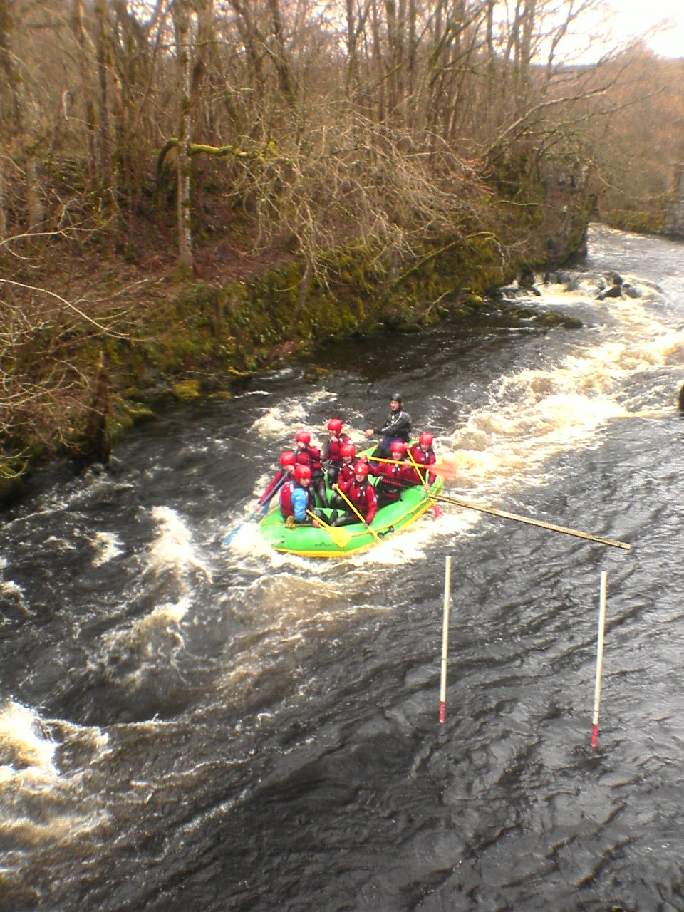
Canolfan Tryweryn

Canolfan Tryweryn is the National White Water Centre for Wales, and is based near Bala in north Wales. In 1986, it developed the first commercial white...

Frongoch

Frongoch is a village located in Gwynedd, Wales. It lies close to the market town of Bala, on the A4212 road. It was the home of the Frongoch internment...

Cerrigydrudion

Cerrigydrudion, sometimes spelt Cerrig-y-drudion, () is a village and community in Conwy, Wales. Until 1974 it was part of the historic county Denbighshire...

Nearby Amenities

Located within 500m of 52.994169,-3.6321369
Cadair Benllyn
Ele: 410
Natural: peak
Lat/Long: 52.9944578/-3.6332086
The data included in this document is from www.openstreetmap.org. The data is made available under ODbL.

Have you been to Cadair Benllyn?

Leave your review of Cadair Benllyn below (or comments, questions and feedback).