Aonach na Cloiche Mòire

Hill, Mountain in Perthshire

Scotland

Aonach na Cloiche Mòire

Very small shelter on NW slopes of Aonach na Cloiche Mòire About the right size to fit a solitary sheep, but I don't think that is the purpose of this wee shelter.  Possibly a grouse butt?  But no others in sight nearby, and still too small to duck behind and surprise a startled bird.
Very small shelter on NW slopes of Aonach na Cloiche Mòire Credit: Gary Dickson

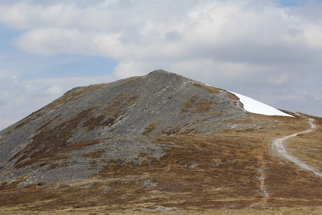
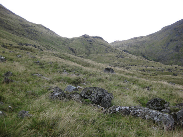
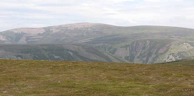
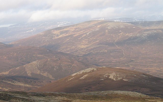
Aonach na Cloiche Mòire, located in Perthshire, Scotland, is a prominent hill/mountain that stands at an elevation of 1,220 meters (4,003 feet) above sea level. It is part of the Grampian Mountains, which form a stunning backdrop to the surrounding landscape. Aonach na Cloiche Mòire is known for its distinctive shape and rugged beauty.

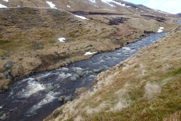
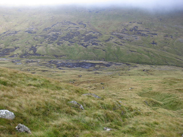
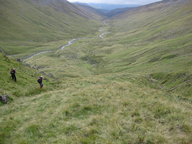
The hill/mountain is a popular destination for hikers, mountaineers, and nature enthusiasts due to its challenging terrain and breathtaking views. The ascent to the summit requires a degree of fitness and experience, as the trail can be steep and rocky in some sections. However, the effort is rewarded with panoramic vistas of the surrounding countryside, including the nearby Loch Tummel and Loch Rannoch.

Aonach na Cloiche Mòire is home to a diverse range of flora and fauna, with heather moorland covering its slopes and rocky outcrops. The hill/mountain attracts a variety of bird species, including golden eagles, peregrine falcons, and red kites, making it a haven for birdwatchers.

In addition to its natural beauty, Aonach na Cloiche Mòire holds historical significance. The area is dotted with ancient cairns and stone circles, hinting at its past as a place of ritual and ceremony for early inhabitants of the region.

Overall, Aonach na Cloiche Mòire offers visitors a chance to immerse themselves in the raw beauty of the Scottish Highlands, with its rugged terrain, stunning vistas, and rich history. It stands as a testament to the enduring allure of Scotland's natural landscapes.

If you have any feedback on the listing, please let us know in the comments section below.

Aonach na Cloiche Mòire Images

Images are sourced within 2km of 56.867817/-3.8028593 or Grid Reference NN9076. Thanks to Geograph Open Source API. All images are credited.

Very small shelter on NW slopes of Aonach na Cloiche Mòire About the right size to fit a solitary sheep, but I don't think that is the purpose of this wee shelter.  Possibly a grouse butt?  But no others in sight nearby, and still too small to duck behind and surprise a startled bird.
Very small shelter on NW slopes of Aonach na Cloiche Mòire
About the right size to fit a solitary sheep, but I don't think that is the purpose of this wee shelter. Possibly a grouse butt? But no others in sight nearby, and still too small to duck behind and surprise a startled bird.
Carn a' Chlamain View across Glen Tilt from Beinn a' Ghlo
Carn a' Chlamain
View across Glen Tilt from Beinn a' Ghlo
Carn a' Chlamain
Carn a' Chlamain
Carn a' Chlamain summit cairn
Snow covered moorland east of Braigh Sron Ghorm
Allt Mhairc The steep banking of the Allt Mhairc in Gleann Mhairc on the route taken from Carn a' Chlamain to Beinn Mheadhonach.
My camera & phone thankfully in a dry bag bounced down the banking into the river and headed downstream.  Thankfully one of the group rescued it a bit further downstream before the waterfall.
Allt Mhairc
The steep banking of the Allt Mhairc in Gleann Mhairc on the route taken from Carn a' Chlamain to Beinn Mheadhonach. My camera & phone thankfully in a dry bag bounced down the banking into the river and headed downstream. Thankfully one of the group rescued it a bit further downstream before the waterfall.
Carn a'Chlamain from the South
Summit of Carn a' Chlamain The hills behind the summit are part of the Beinn a' Ghlo complex on the southeast side of Glen Tilt.
Summit of Carn a' Chlamain
The hills behind the summit are part of the Beinn a' Ghlo complex on the southeast side of Glen Tilt.
Northern slopes of Carn a' Chlamain Looking over Meall Tionail towards Tarf Water. Cairngorms on the horizon.
Northern slopes of Carn a' Chlamain
Looking over Meall Tionail towards Tarf Water. Cairngorms on the horizon.
The summit of Carn a' Chlamain View taken from on the south east ridge, close to where the path up the Faire Clach-ghlais rejoins the landrover track.
The summit of Carn a' Chlamain
View taken from on the south east ridge, close to where the path up the Faire Clach-ghlais rejoins the landrover track.
Glen Mhairc
Glen Mhairc
Glen Mhairc
Glen Mhairc
Glen Mhairc
Glen Mhairc
Bràigh Clais Daimh Snow patch on the plateau of Bràigh Clais Daimh. A broad ridge runs north from here towards the Tarff. Distances are big, but the walking is very easy.
Bràigh Clais Daimh
Snow patch on the plateau of Bràigh Clais Daimh. A broad ridge runs north from here towards the Tarff. Distances are big, but the walking is very easy.
Bràigh nan Creagan Breac Looking northward over the minor top of Bràigh nan Creagan Breac. The parallel ridges could be caused by cattle being driven along the ridge. Away from the cairned ridgeline, frost heave has produced a pattern of small humps, not ridges. This is a logical route to travel between the Tarf, a grassy basin high in the Atholl hills and the outside world, the glens (other than Tilt) being very boggy and the going up here as easy as on a road.
Bràigh nan Creagan Breac
Looking northward over the minor top of Bràigh nan Creagan Breac. The parallel ridges could be caused by cattle being driven along the ridge. Away from the cairned ridgeline, frost heave has produced a pattern of small humps, not ridges. This is a logical route to travel between the Tarf, a grassy basin high in the Atholl hills and the outside world, the glens (other than Tilt) being very boggy and the going up here as easy as on a road.
Bràigh nan Creagan Breac The summit of Bràigh nan Creagan Breac. Slightly shaken picture due to the very strong wind blowing the whole time I was on the hill.
Bràigh nan Creagan Breac
The summit of Bràigh nan Creagan Breac. Slightly shaken picture due to the very strong wind blowing the whole time I was on the hill.
Upper Gleann Craoinidh View from below the summit of Bràigh nan Creagan Breac down the head waters of the Allt Craoinidh. Braigh Coire Chruinn-bhalgain and Carn Liath in the background across the hidden and deep Glen Tilt.
Upper Gleann Craoinidh
View from below the summit of Bràigh nan Creagan Breac down the head waters of the Allt Craoinidh. Braigh Coire Chruinn-bhalgain and Carn Liath in the background across the hidden and deep Glen Tilt.
Allt nan Creagan Breac The top of the Allt nan Creagan Breac which drains part of the Carn a' Chlamhain massif into Gleann Mhairc and eventually the Tilt. The wild peatlands of the Tarf  can be seen through the gap.
Allt nan Creagan Breac
The top of the Allt nan Creagan Breac which drains part of the Carn a' Chlamhain massif into Gleann Mhairc and eventually the Tilt. The wild peatlands of the Tarf can be seen through the gap.
Show me another place!

Aonach na Cloiche Mòire is located at Grid Ref: NN9076 (Lat: 56.867817, Lng: -3.8028593)

Unitary Authority: Perth and Kinross

Police Authority: Tayside

What 3 Words

///slung.lance.obstruct. Near Blair Atholl, Perth & Kinross

Nearby Locations

Aonach na Cloiche Mòire

Related Wikis

Carn a' Chlamain

Càrn a' Chlamain (Gaelic: Càrn a' Chlamhain) is a Scottish mountain situated roughly 12 kilometres north of Blair Atholl in the Forest of Atholl. It is...

Glen Tilt

Glen Tilt (Scottish Gaelic: Gleann Teilt) is a glen in the extreme north of Perthshire, Scotland. Beginning at the confines of Aberdeenshire, it follows...

Beinn Dearg (Blair Atholl)

Beinn Dearg (1,009 m) is a mountain in the Grampian Mountains of Scotland. It lies north of the Perth and Kinross village of Blair Atholl, in the Forest...

Beinn a' Ghlò

Beinn a’ Ghlò is a Scottish mountain situated roughly 10 km (6 mi) north east of Blair Atholl in the Forest of Atholl in between Glen Tilt and Glen Loch...

Càrn Liath (Munro)

Carn Liath (976 m) is a mountain in the Grampian Mountains of Scotland. It lies east of Blair Atholl in Perthshire, Scotland. Although belonging to the...

Carn an Fhidhleir

Carn an Fhidhleir (994 m) is a mountain in the Grampian Mountains of Scotland. It lies on the border of Inverness-shire, Perthshire and Aberdeenshire,...

An Sgarsoch

An Sgarsoch (1,006.5m) is a mountain in the Grampian Mountains of Scotland. It lies north of Blair Atholl in a very remote part of the Highlands, on the...

Forest of Atholl

The Forest of Atholl (also known as Atholl Forest) is a deer forest near the Scottish village of Blair Atholl, Perth and Kinross, first recorded in the...

Have you been to Aonach na Cloiche Mòire?

Leave your review of Aonach na Cloiche Mòire below (or comments, questions and feedback).