Bràigh Clais Daimh

Hill, Mountain in Perthshire

Scotland

Bràigh Clais Daimh

Murky conditions on Beinn Mheadhonach The tundra-like plateau area that forms the higher part of Beinn Mheadhonach ('middle hill') is looking very bare of snow for the time of year, as a persistent cell of high pressure centred around the British Isles has led to dry conditions through much of January.
Murky conditions on Beinn Mheadhonach Credit: Alan O'Dowd

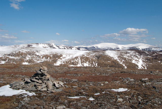
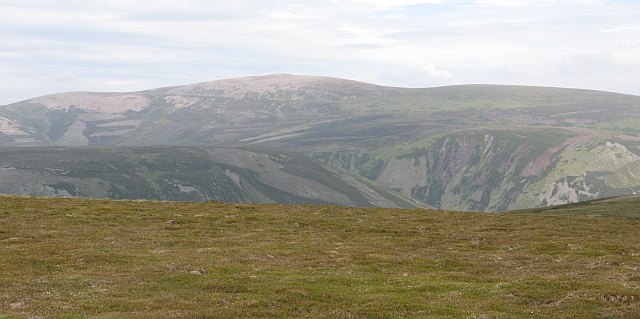
Bràigh Clais Daimh is a prominent hill located in the stunning region of Perthshire, Scotland. Rising to an impressive height of approximately 867 meters (2,844 feet), it offers breathtaking panoramic views of the surrounding landscape. Situated in a remote area, the hill is a popular destination for hikers, mountaineers, and nature enthusiasts seeking an exhilarating outdoor experience.

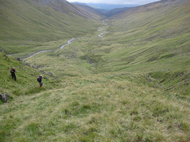
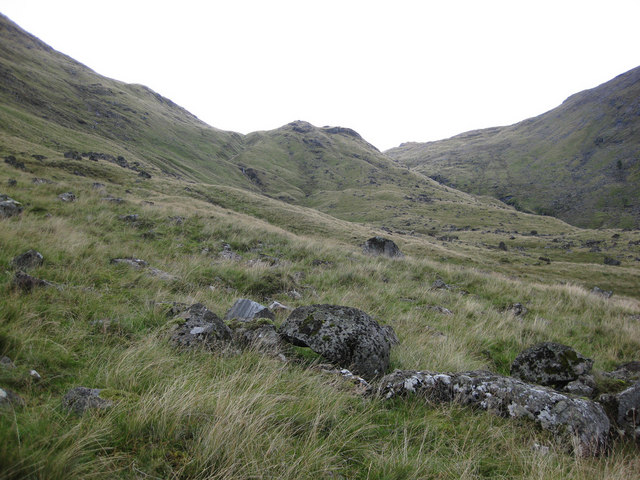
The terrain of Bràigh Clais Daimh is characterized by a mixture of steep slopes, rocky outcrops, and heather-covered moorlands. As climbers ascend the hill, they encounter a diverse range of flora and fauna, including vibrant wildflowers, mosses, and lichens, as well as various bird species such as golden eagles, peregrine falcons, and red grouse.

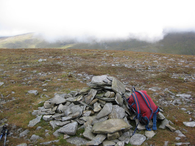
The ascent to the summit of Bràigh Clais Daimh requires a moderate level of fitness and navigation skills, as there is no clearly marked path. However, the challenging hike is rewarded with awe-inspiring views of the surrounding mountains, glens, and lochs. On a clear day, one can even catch a glimpse of the famous Loch Rannoch and Loch Tummel.

Due to its remote location, it is advisable to come prepared with appropriate clothing, sturdy footwear, food, and plenty of water. The weather can be unpredictable, with sudden changes in temperature and visibility, so it is essential to check the forecast before embarking on the journey.

Bràigh Clais Daimh offers a remarkable opportunity to connect with nature and immerse oneself in the rugged beauty of the Scottish Highlands. With its challenging trails, breathtaking vistas, and abundant wildlife, it is an unforgettable destination for outdoor enthusiasts seeking an adventure in Perthshire.

If you have any feedback on the listing, please let us know in the comments section below.

Bràigh Clais Daimh Images

Images are sourced within 2km of 56.850662/-3.8085935 or Grid Reference NN8974. Thanks to Geograph Open Source API. All images are credited.

Murky conditions on Beinn Mheadhonach The tundra-like plateau area that forms the higher part of Beinn Mheadhonach ('middle hill') is looking very bare of snow for the time of year, as a persistent cell of high pressure centred around the British Isles has led to dry conditions through much of January.
Murky conditions on Beinn Mheadhonach
The tundra-like plateau area that forms the higher part of Beinn Mheadhonach ('middle hill') is looking very bare of snow for the time of year, as a persistent cell of high pressure centred around the British Isles has led to dry conditions through much of January.
Cairn on summit ridge of Beinn Mheadhonach Beinn Mheadhonach has a long narrow summit ridge with maps showing two contour rings of 900m. The northern location has a spot height at 901m and seems to be the accepted summit; the cairn seen here however at the other position is larger and may well occupy the highest ground. There's very little in it and hill baggers will surely visit both tops! Carn a’ Chlamain and Beinn a’ Ghlo are the distant mountains with the triple Munro of Beinn a' Ghlo being the hill group to the right.
Cairn on summit ridge of Beinn Mheadhonach
Beinn Mheadhonach has a long narrow summit ridge with maps showing two contour rings of 900m. The northern location has a spot height at 901m and seems to be the accepted summit; the cairn seen here however at the other position is larger and may well occupy the highest ground. There's very little in it and hill baggers will surely visit both tops! Carn a’ Chlamain and Beinn a’ Ghlo are the distant mountains with the triple Munro of Beinn a' Ghlo being the hill group to the right.
Featureless side of Beinn Mheadhonach
Bràigh Clais Daimh Spur of Carn a' Chlamain seen from Glen Tilt.
Bràigh Clais Daimh
Spur of Carn a' Chlamain seen from Glen Tilt.
Old dyke, Beinn Mheadhonach. An old ruined wall across the ridge, high on Beinn Mheadhonach, at 790m. Its ruinous state suggests some antiquity. The ground up here is dry arctic/alpine heath, a mix of slow growing prostrate vegetation and gravels. The flanks of the hill are steep and bouldery falling into Gleann Mhairc and Gleann Diridh.
Old dyke, Beinn Mheadhonach.
An old ruined wall across the ridge, high on Beinn Mheadhonach, at 790m. Its ruinous state suggests some antiquity. The ground up here is dry arctic/alpine heath, a mix of slow growing prostrate vegetation and gravels. The flanks of the hill are steep and bouldery falling into Gleann Mhairc and Gleann Diridh.
Carn a'Chlamain from the South
Upper slopes of Fàire Clach-ghlais The ridge broadens here, continuing moderately steep, before the steeper sides of Carn a' Chlamain's south east ridge are reached. The original path makes a direct line for the latter ridge, the thick heather quickly giving way to patchier bits  mixed with easier grass, while the land rover track takes a more roundabout route to climb onto the ridge..
Upper slopes of Fàire Clach-ghlais
The ridge broadens here, continuing moderately steep, before the steeper sides of Carn a' Chlamain's south east ridge are reached. The original path makes a direct line for the latter ridge, the thick heather quickly giving way to patchier bits mixed with easier grass, while the land rover track takes a more roundabout route to climb onto the ridge..
Beinn Mheadhonach - summit
Glen Mhairc
Glen Mhairc
Glen Mhairc
Glen Mhairc
Allt Mhairc
Allt Mhairc
Moorland above Glen Tilt Three wide heathery ridges - Dùn Seilg, across the Allt Sròn an Duine, Beinn Mheadhonach and Beinn a' Chait.
Moorland above Glen Tilt
Three wide heathery ridges - Dùn Seilg, across the Allt Sròn an Duine, Beinn Mheadhonach and Beinn a' Chait.
Cuirn Mharanaich Cuirn Mharanaich seen across a gentle moorland corrie drained by the Allt Sròn an Duine.
Cuirn Mharanaich
Cuirn Mharanaich seen across a gentle moorland corrie drained by the Allt Sròn an Duine.
Allt Sròn an Duine A moorland stream running off Carn a' Chlamhain.  There is some peat, Carn a' Chlamhain has a smaller area of bogland than would be expected for a Mounth hill.
Allt Sròn an Duine
A moorland stream running off Carn a' Chlamhain. There is some peat, Carn a' Chlamhain has a smaller area of bogland than would be expected for a Mounth hill.
Sròn a' Chrò A steep nose above hidden Glen Tilt eases up to a gravelly ridge. The rock here is granite, a surprise, as I remember Carn a' Chlamhain to be a quartzite hill. Granites outcrop all along the ridge to the east of Gleann Mhairc.

Sròn a' Chrò is not quite as an attractive way up Carn a' Chlamhain as the usual 
Fàire Clach-ghlais ridge on the other side of the Allt Craoinidh. It may lack the hideous landrover track, but does not have the good views of Glen Tilt and Carn a' Chlamhain's steeper side. It is however useful in making a round rather than facing that track again. There is little sign of modern wear along the ridge, suggesting that as usual the munro baggers are in a hurry. Just hoof prints from the stalkers ponies.
Sròn a' Chrò
A steep nose above hidden Glen Tilt eases up to a gravelly ridge. The rock here is granite, a surprise, as I remember Carn a' Chlamhain to be a quartzite hill. Granites outcrop all along the ridge to the east of Gleann Mhairc. Sròn a' Chrò is not quite as an attractive way up Carn a' Chlamhain as the usual Fàire Clach-ghlais ridge on the other side of the Allt Craoinidh. It may lack the hideous landrover track, but does not have the good views of Glen Tilt and Carn a' Chlamhain's steeper side. It is however useful in making a round rather than facing that track again. There is little sign of modern wear along the ridge, suggesting that as usual the munro baggers are in a hurry. Just hoof prints from the stalkers ponies.
Sròn a' Chrò Sròn a' Chrò is a steep nosed ridge between Gleann Mhairc and the hanging valley of the Allt Craoinidh. It is heathery, but the upper reaches are windswept and there is a lot of exposed granite gravel. A good round combined with the better Fàire Clach-ghlais ridge for an ascent of Carn a' Chlamhain but little used.
Sròn a' Chrò
Sròn a' Chrò is a steep nosed ridge between Gleann Mhairc and the hanging valley of the Allt Craoinidh. It is heathery, but the upper reaches are windswept and there is a lot of exposed granite gravel. A good round combined with the better Fàire Clach-ghlais ridge for an ascent of Carn a' Chlamhain but little used.
Marker stone,  Bràigh Clais Daimh The plateau between Sròn a' Chrò and Bràigh Clais Daimh has a series of markers along it. These continue almost to Carn a' Chlamhain. The ground looks as if it has been well used in the past, this may have been a route used to take cattle to and from the Tarff basin. The only recent prints seen were hoof prints from stalker's ponies.
Going is easy here on granite gravels.
Marker stone, Bràigh Clais Daimh
The plateau between Sròn a' Chrò and Bràigh Clais Daimh has a series of markers along it. These continue almost to Carn a' Chlamhain. The ground looks as if it has been well used in the past, this may have been a route used to take cattle to and from the Tarff basin. The only recent prints seen were hoof prints from stalker's ponies. Going is easy here on granite gravels.
Show me another place!

Bràigh Clais Daimh is located at Grid Ref: NN8974 (Lat: 56.850662, Lng: -3.8085935)

Unitary Authority: Perth and Kinross

Police Authority: Tayside

What 3 Words

///allies.panthers.provide. Near Blair Atholl, Perth & Kinross

Nearby Locations

Bràigh Clais Daimh

Related Wikis

Carn a' Chlamain

Càrn a' Chlamain (Gaelic: Càrn a' Chlamhain) is a Scottish mountain situated roughly 12 kilometres north of Blair Atholl in the Forest of Atholl. It is...

Glen Tilt

Glen Tilt (Scottish Gaelic: Gleann Teilt) is a glen in the extreme north of Perthshire, Scotland. Beginning at the confines of Aberdeenshire, it follows...

Beinn a' Ghlò

Beinn a’ Ghlò is a Scottish mountain situated roughly 10 km (6 mi) north east of Blair Atholl in the Forest of Atholl in between Glen Tilt and Glen Loch...

Beinn Dearg (Blair Atholl)

Beinn Dearg (1,009 m) is a mountain in the Grampian Mountains of Scotland. It lies north of the Perth and Kinross village of Blair Atholl, in the Forest...

Càrn Liath (Munro)

Carn Liath (976 m) is a mountain in the Grampian Mountains of Scotland. It lies east of Blair Atholl in Perthshire, Scotland. Although belonging to the...
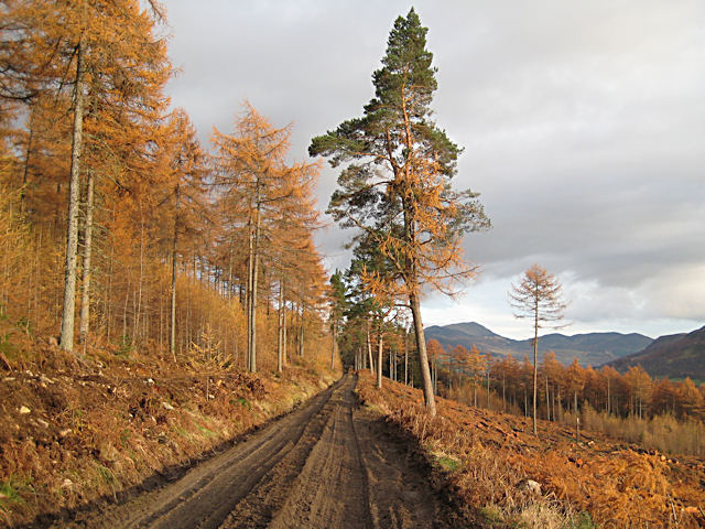
Forest of Atholl

The Forest of Atholl (also known as Atholl Forest) is a deer forest near the Scottish village of Blair Atholl, Perth and Kinross, first recorded in the...

Loch Moraig

Loch Moraig is a freshwater loch, located 2 miles northeast of Blair Atholl. Loch Moraig was an artificial loch, originally a Snipe marsh, that was dammed...
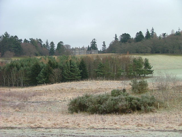
Lude House

Lude House (also known as House of Lude or Lude Estate) is a Category B listed country house and estate in Blair Atholl, Perth and Kinross, Scotland. It...

Nearby Amenities

Located within 500m of 56.850662,-3.8085935
Natural: peak
Source: OS7
Lat/Long: 56.8505982/-3.810258
The data included in this document is from www.openstreetmap.org. The data is made available under ODbL.

Have you been to Bràigh Clais Daimh?

Leave your review of Bràigh Clais Daimh below (or comments, questions and feedback).