Bràigh nan Creagan Breac

Hill, Mountain in Perthshire

Scotland

Bràigh nan Creagan Breac

Featureless plateau near the summit of Beinn Mheadhonach The tundra-like plateau area that forms the higher part of Beinn Mheadhonach ('middle hill') is looking very bare of snow for the time of year, as a persistent cell of high pressure centred around the British Isles has led to dry conditions through much of January.
Featureless plateau near the summit of Beinn Mheadhonach Credit: Alan O'Dowd

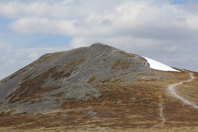
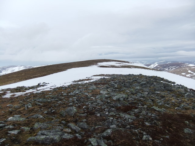
Bràigh nan Creagan Breac is a prominent hill located in Perthshire, Scotland. Standing at an elevation of approximately 762 meters (2,500 feet), it offers breathtaking views of the surrounding landscape. The hill is part of the Grampian Mountains and is situated within the Cairngorms National Park.

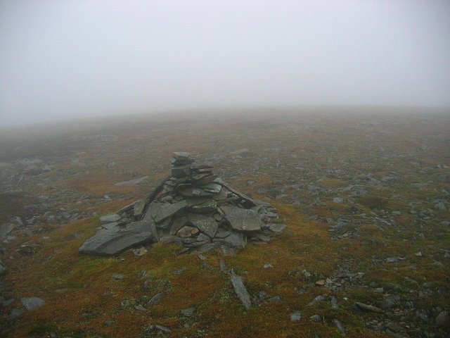
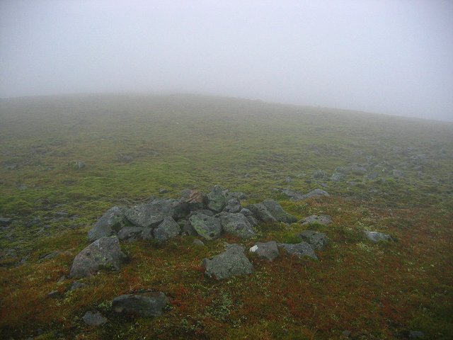
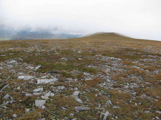
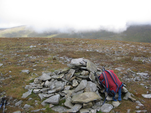
The name Bràigh nan Creagan Breac translates to "hill of the speckled rocks," which is a fitting description of the area's geological features. The hill is characterized by its rugged and rocky terrain, with scattered boulders and outcrops adding to its unique charm. The rocks themselves exhibit a variety of colors and patterns, ranging from earthy browns and grays to vibrant reds and whites.

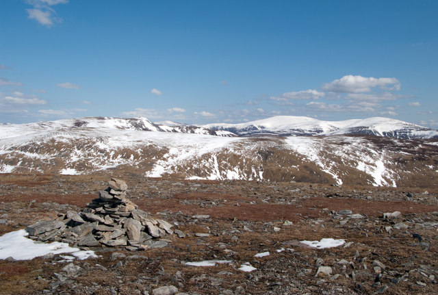
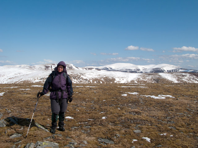
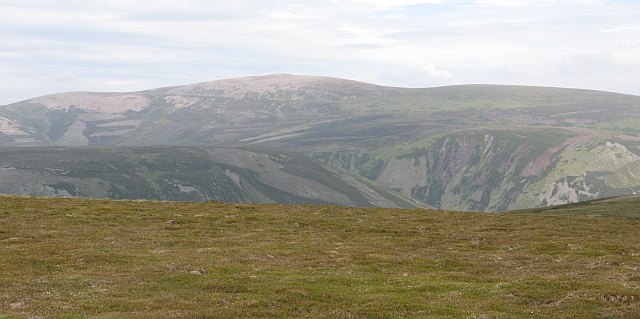
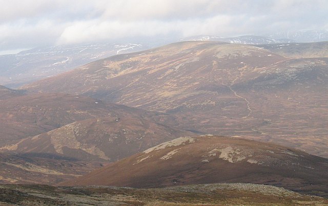
Climbing Bràigh nan Creagan Breac can be a challenging but rewarding experience for outdoor enthusiasts. Several walking and hiking trails traverse the hill, offering different levels of difficulty to cater to various abilities. The summit provides panoramic vistas, allowing visitors to admire the stunning beauty of the Scottish Highlands, with rolling hills, deep valleys, and shimmering lochs as far as the eye can see.

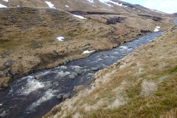
The hill is also home to diverse flora and fauna, with heather, mosses, and grasses covering its slopes. Wildlife such as red deer, mountain hares, and various bird species can often be spotted during the ascent.

Bràigh nan Creagan Breac is a must-visit destination for nature lovers and those seeking solitude and tranquility amidst Scotland's picturesque landscapes. Its rugged beauty and panoramic views make it a popular spot for outdoor activities, photography, and simply immersing oneself in the wonders of the natural world.

If you have any feedback on the listing, please let us know in the comments section below.

Bràigh nan Creagan Breac Images

Images are sourced within 2km of 56.861001/-3.8094206 or Grid Reference NN8975. Thanks to Geograph Open Source API. All images are credited.

Featureless plateau near the summit of Beinn Mheadhonach The tundra-like plateau area that forms the higher part of Beinn Mheadhonach ('middle hill') is looking very bare of snow for the time of year, as a persistent cell of high pressure centred around the British Isles has led to dry conditions through much of January.
Featureless plateau near the summit of Beinn Mheadhonach
The tundra-like plateau area that forms the higher part of Beinn Mheadhonach ('middle hill') is looking very bare of snow for the time of year, as a persistent cell of high pressure centred around the British Isles has led to dry conditions through much of January.
Very small shelter on NW slopes of Aonach na Cloiche Mòire About the right size to fit a solitary sheep, but I don't think that is the purpose of this wee shelter.  Possibly a grouse butt?  But no others in sight nearby, and still too small to duck behind and surprise a startled bird.
Very small shelter on NW slopes of Aonach na Cloiche Mòire
About the right size to fit a solitary sheep, but I don't think that is the purpose of this wee shelter. Possibly a grouse butt? But no others in sight nearby, and still too small to duck behind and surprise a startled bird.
Carn a' Chlamain View across Glen Tilt from Beinn a' Ghlo
Carn a' Chlamain
View across Glen Tilt from Beinn a' Ghlo
Carn a' Chlamain
Carn a' Chlamain
Carn a' Chlamain summit cairn
Cairn on summit ridge of Beinn Mheadhonach Beinn Mheadhonach has a long narrow summit ridge with maps showing two contour rings of 900m. The northern location has a spot height at 901m and seems to be the accepted summit; the cairn seen here however at the other position is larger and may well occupy the highest ground. There's very little in it and hill baggers will surely visit both tops! Carn a’ Chlamain and Beinn a’ Ghlo are the distant mountains with the triple Munro of Beinn a' Ghlo being the hill group to the right.
Cairn on summit ridge of Beinn Mheadhonach
Beinn Mheadhonach has a long narrow summit ridge with maps showing two contour rings of 900m. The northern location has a spot height at 901m and seems to be the accepted summit; the cairn seen here however at the other position is larger and may well occupy the highest ground. There's very little in it and hill baggers will surely visit both tops! Carn a’ Chlamain and Beinn a’ Ghlo are the distant mountains with the triple Munro of Beinn a' Ghlo being the hill group to the right.
Beinn Mheadhonach - the 901m area Beinn Mheadhonach is mapped as having two contour rings at 900m; this is the northern position where a spot height of 901m is recorded on OS maps; it may or may not be the higher of the two locations. Certainly the larger cairn is at the southern, (the other) location which suggests that visitors on the whole may regard that as the actual summit - not that that is conclusive! The surrounding area is stony and very sparsely vegetated. Distantly can be seen Carn a’ Chlamain (behind the climber's head) and Beinn a’ Ghlo, the snowed domes to the right.
Beinn Mheadhonach - the 901m area
Beinn Mheadhonach is mapped as having two contour rings at 900m; this is the northern position where a spot height of 901m is recorded on OS maps; it may or may not be the higher of the two locations. Certainly the larger cairn is at the southern, (the other) location which suggests that visitors on the whole may regard that as the actual summit - not that that is conclusive! The surrounding area is stony and very sparsely vegetated. Distantly can be seen Carn a’ Chlamain (behind the climber's head) and Beinn a’ Ghlo, the snowed domes to the right.
Allt Mhairc The steep banking of the Allt Mhairc in Gleann Mhairc on the route taken from Carn a' Chlamain to Beinn Mheadhonach.
My camera & phone thankfully in a dry bag bounced down the banking into the river and headed downstream.  Thankfully one of the group rescued it a bit further downstream before the waterfall.
Allt Mhairc
The steep banking of the Allt Mhairc in Gleann Mhairc on the route taken from Carn a' Chlamain to Beinn Mheadhonach. My camera & phone thankfully in a dry bag bounced down the banking into the river and headed downstream. Thankfully one of the group rescued it a bit further downstream before the waterfall.
Summit ridge, Beinn Mheadhonach
Bràigh Clais Daimh Spur of Carn a' Chlamain seen from Glen Tilt.
Bràigh Clais Daimh
Spur of Carn a' Chlamain seen from Glen Tilt.
Summit of Beinn Mheadhonach Despite the thick cloud, the nature of nearly all this square can be seen clearly. It's just tundra, a flat expanse of gravels with mosses and hardy grasses. Just to the north of here, the rock turns from schist to granite. This is almost certainly the summit at 902m. , although the books state it's further north. 
If this hill were 13m higher, there would no longer be vegetation surrounding the cairn.
Summit of Beinn Mheadhonach
Despite the thick cloud, the nature of nearly all this square can be seen clearly. It's just tundra, a flat expanse of gravels with mosses and hardy grasses. Just to the north of here, the rock turns from schist to granite. This is almost certainly the summit at 902m. , although the books state it's further north. If this hill were 13m higher, there would no longer be vegetation surrounding the cairn.
Beinn Mheadhonach, the book summit. A small pile of granite boulders marks a candidate for summit of Beinn Mheadhonach, although I am sure it's the other 900m ring contour just to the south.

This is the reality of Scottish hill walking. It's not all sunshine and blue skies.  Even with the cloud, the nature of this tundra square is clear.
Beinn Mheadhonach, the book summit.
A small pile of granite boulders marks a candidate for summit of Beinn Mheadhonach, although I am sure it's the other 900m ring contour just to the south. This is the reality of Scottish hill walking. It's not all sunshine and blue skies. Even with the cloud, the nature of this tundra square is clear.
Carn a'Chlamain from the South
Summit of Carn a' Chlamain The hills behind the summit are part of the Beinn a' Ghlo complex on the southeast side of Glen Tilt.
Summit of Carn a' Chlamain
The hills behind the summit are part of the Beinn a' Ghlo complex on the southeast side of Glen Tilt.
The summit of Carn a' Chlamain View taken from on the south east ridge, close to where the path up the Faire Clach-ghlais rejoins the landrover track.
The summit of Carn a' Chlamain
View taken from on the south east ridge, close to where the path up the Faire Clach-ghlais rejoins the landrover track.
Beinn Mheadhonach - summit
Show me another place!

Bràigh nan Creagan Breac is located at Grid Ref: NN8975 (Lat: 56.861001, Lng: -3.8094206)

Unitary Authority: Perth and Kinross

Police Authority: Tayside

What 3 Words

///rewarded.joyously.prepare. Near Blair Atholl, Perth & Kinross

Nearby Locations

Bràigh nan Creagan Breac

Related Wikis

Carn a' Chlamain

Càrn a' Chlamain (Gaelic: Càrn a' Chlamhain) is a Scottish mountain situated roughly 12 kilometres north of Blair Atholl in the Forest of Atholl. It is...

Glen Tilt

Glen Tilt (Scottish Gaelic: Gleann Teilt) is a glen in the extreme north of Perthshire, Scotland. Beginning at the confines of Aberdeenshire, it follows...

Beinn Dearg (Blair Atholl)

Beinn Dearg (1,009 m) is a mountain in the Grampian Mountains of Scotland. It lies north of the Perth and Kinross village of Blair Atholl, in the Forest...

Beinn a' Ghlò

Beinn a’ Ghlò is a Scottish mountain situated roughly 10 km (6 mi) north east of Blair Atholl in the Forest of Atholl in between Glen Tilt and Glen Loch...

Càrn Liath (Munro)

Carn Liath (976 m) is a mountain in the Grampian Mountains of Scotland. It lies east of Blair Atholl in Perthshire, Scotland. Although belonging to the...

Forest of Atholl

The Forest of Atholl (also known as Atholl Forest) is a deer forest near the Scottish village of Blair Atholl, Perth and Kinross, first recorded in the...

Carn an Fhidhleir

Carn an Fhidhleir (994 m) is a mountain in the Grampian Mountains of Scotland. It lies on the border of Inverness-shire, Perthshire and Aberdeenshire,...

An Sgarsoch

An Sgarsoch (1,006.5m) is a mountain in the Grampian Mountains of Scotland. It lies north of Blair Atholl in a very remote part of the Highlands, on the...

Nearby Amenities

Located within 500m of 56.861001,-3.8094206
Bràigh nan Creagan Breac'
Ele: 887
Natural: peak
Source: OS7
Lat/Long: 56.8606242/-3.808938
The data included in this document is from www.openstreetmap.org. The data is made available under ODbL.

Have you been to Bràigh nan Creagan Breac?

Leave your review of Bràigh nan Creagan Breac below (or comments, questions and feedback).