Beinn Liath

Hill, Mountain in Perthshire

Scotland

Beinn Liath

Sheep on heather moorland, Wester Kinloch Ben Lawers and surrounding mountains are visible in the distance.
Sheep on heather moorland, Wester Kinloch Credit: Alan O'Dowd

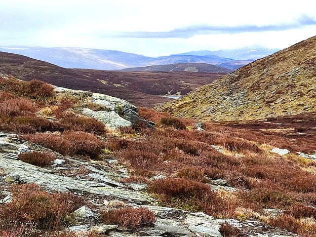
Beinn Liath is a prominent hill located in Perthshire, Scotland. It is part of the wider Grampian Mountains range and stands at an impressive elevation of 879 meters (2,884 feet). The name Beinn Liath translates to "grey mountain" in Gaelic, which aptly describes its appearance, especially during misty or overcast weather conditions.

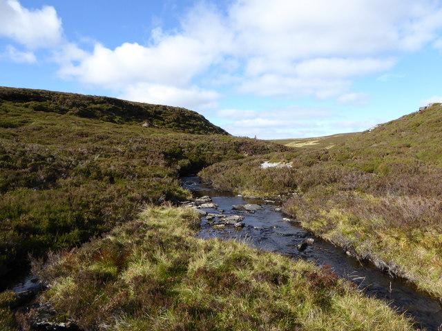
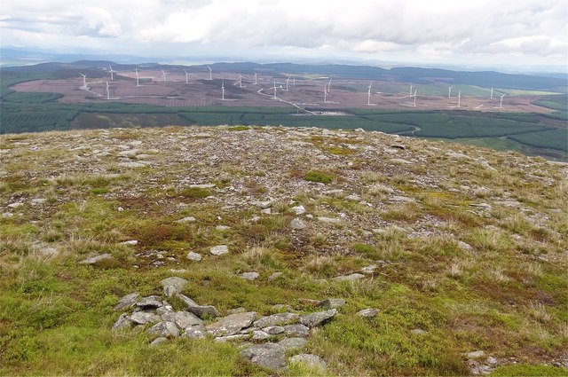
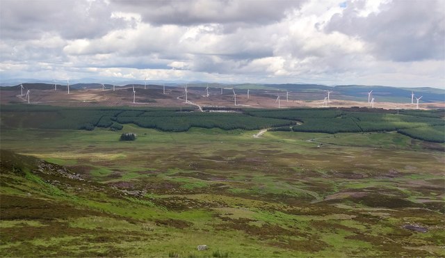
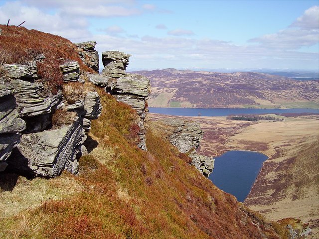
The hill is easily accessible from various starting points, making it a popular destination for hikers, mountaineers, and nature enthusiasts. Its location within the beautiful Perthshire countryside offers breathtaking panoramic views of the surrounding landscapes, including nearby Loch Tay and the Trossachs National Park.

Beinn Liath's terrain is characterized by a mixture of grassy slopes, rocky outcrops, and heather-covered moorland. The hill's summit provides an excellent vantage point to observe the diverse flora and fauna that inhabit the area. Visitors may spot various bird species, such as golden eagles and peregrine falcons, as well as red deer and other wildlife.

Depending on the chosen route, ascending Beinn Liath can be a challenging endeavor, especially during inclement weather or in winter conditions when the hill is often covered in snow and ice. Proper equipment, navigation skills, and caution are advised for those attempting to conquer its slopes.

Overall, Beinn Liath is a captivating destination for outdoor enthusiasts seeking stunning views, a diverse ecosystem, and a rewarding hiking experience in the heart of Perthshire's natural beauty.

If you have any feedback on the listing, please let us know in the comments section below.

Beinn Liath Images

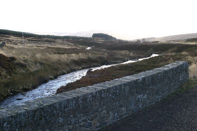
Images are sourced within 2km of 56.539459/-3.7981499 or Grid Reference NN8940. Thanks to Geograph Open Source API. All images are credited.

Sheep on heather moorland, Wester Kinloch Ben Lawers and surrounding mountains are visible in the distance.
Sheep on heather moorland, Wester Kinloch
Ben Lawers and surrounding mountains are visible in the distance.
View down Glen Fender Taken from moorland above Creag nan Gabhar ('crag of the goats').
View down Glen Fender
Taken from moorland above Creag nan Gabhar ('crag of the goats').
Heading north on the old military road through Glen Cochill Road, scrub, forest...and windmills.
Heading north on the old military road through Glen Cochill
Road, scrub, forest...and windmills.
Road heading north
Road heading north
Meall Dearg from the Southeast The trig point on Meall Dearg is just visible a short distance off the hill road when looking up the southeast side of the slope.
Meall Dearg from the Southeast
The trig point on Meall Dearg is just visible a short distance off the hill road when looking up the southeast side of the slope.
Glimpse of Loch Fender A slight dip in the rocky heathery terrain on the southeast approach to Meall Dearg offers a brief glimpse of Loch Fender lying to the west.
Glimpse of Loch Fender
A slight dip in the rocky heathery terrain on the southeast approach to Meall Dearg offers a brief glimpse of Loch Fender lying to the west.
Cut Coniferous Branches This cut branch was one of many scattered around in this area of open moorland.  With the exception of a few small self seeded trees there were no other coniferous trees of any size.  There was no sign they had been cut locally to inhibit the establishment of self seeded trees.  Thus, it would seem that these branches had been brought here and placed on the hillside for some form of habitat management.
Cut Coniferous Branches
This cut branch was one of many scattered around in this area of open moorland. With the exception of a few small self seeded trees there were no other coniferous trees of any size. There was no sign they had been cut locally to inhibit the establishment of self seeded trees. Thus, it would seem that these branches had been brought here and placed on the hillside for some form of habitat management.
Peat Erosion Close to the summit of Meal Dearg is an area of eroded peatland where the mineral soil is exposed.  This image is looking northwest towards Calliacher Wind Farm with Loch Hoil to its right.  Above Loch Hoil on the horizon is Schiehallion.
Peat Erosion
Close to the summit of Meal Dearg is an area of eroded peatland where the mineral soil is exposed. This image is looking northwest towards Calliacher Wind Farm with Loch Hoil to its right. Above Loch Hoil on the horizon is Schiehallion.
Heathland and forestry in Glen Cochill
Old gate below Creag an Loch An old gate remains standing long after its surrounding fence has disappeared - not an uncommon sight in the weather-beaten Scottish hills!
Old gate below Creag an Loch
An old gate remains standing long after its surrounding fence has disappeared - not an uncommon sight in the weather-beaten Scottish hills!
Grouse grit, wind turbines and Schiehallion Some of the turbines of the Calliachar Wind Farm intrude upon the view towards Schiehallion as a box of medicated grit for consumption by grouse lies in the foreground.

There are quite a lot of wind turbines in this area now, with the vast Griffin Wind Farm also nearby.
Grouse grit, wind turbines and Schiehallion
Some of the turbines of the Calliachar Wind Farm intrude upon the view towards Schiehallion as a box of medicated grit for consumption by grouse lies in the foreground. There are quite a lot of wind turbines in this area now, with the vast Griffin Wind Farm also nearby.
Glenfender Burn Beginning its journey from Loch Fender to eventually join the River Braan.
Glenfender Burn
Beginning its journey from Loch Fender to eventually join the River Braan.
Peat on Meall Dearg An area of wet, exposed peat on the hillside just below the summit of Meall Dearg.
Peat on Meall Dearg
An area of wet, exposed peat on the hillside just below the summit of Meall Dearg.
Trig pillar on Meall Dearg Meall Dearg ('rounded, red hill') has a plaque on its trig pillar stating that it is part of the Ordnance Survey's GPS network.
Trig pillar on Meall Dearg
Meall Dearg ('rounded, red hill') has a plaque on its trig pillar stating that it is part of the Ordnance Survey's GPS network.
New road between Beinn Liath and Meall Dearg A new bulldozed road has appeared on this hillside, presumably to serve grouse shooting.

The name of the corrie down to the left is Coire na h-Airighe Gruamaich ('corrie of the gloomy shieling') and the site of some shielings is still marked on the map today.
New road between Beinn Liath and Meall Dearg
A new bulldozed road has appeared on this hillside, presumably to serve grouse shooting. The name of the corrie down to the left is Coire na h-Airighe Gruamaich ('corrie of the gloomy shieling') and the site of some shielings is still marked on the map today.
Griffin Wind Farm from Meall Dearg Looking east from the summit of Meall Dearg and the new windfarm of Scottish and Southern Energys starts to take shape in felled woodland east of Glen Cochill.
Griffin Wind Farm from Meall Dearg
Looking east from the summit of Meall Dearg and the new windfarm of Scottish and Southern Energys starts to take shape in felled woodland east of Glen Cochill.
Griffin Wind Farm Seen from the lower slopes of Meall Dearg 22 turbines are already in place at Griffin Wind Farm - there will be 68, generating 156 MW on completion.

Info here:-<span class="nowrap"><a title="http://www.sse.com/Griffin/" rel="nofollow ugc noopener" href="http://www.sse.com/Griffin/">Link</a><img style="margin-left:2px;" alt="External link" title="External link - shift click to open in new window" src="https://s1.geograph.org.uk/img/external.png" width="10" height="10"/></span>
<span class="nowrap"><a title="http://www.aswag.org.uk/wind%20farms.html" rel="nofollow ugc noopener" href="http://www.aswag.org.uk/wind%20farms.html">Link</a><img style="margin-left:2px;" alt="External link" title="External link - shift click to open in new window" src="https://s1.geograph.org.uk/img/external.png" width="10" height="10"/></span>

General Wade's military road can just be seen in the middle of the photo.
Griffin Wind Farm
Seen from the lower slopes of Meall Dearg 22 turbines are already in place at Griffin Wind Farm - there will be 68, generating 156 MW on completion. Info here:-LinkExternal link LinkExternal link General Wade's military road can just be seen in the middle of the photo.
Glen Cochill Looking S from position
Glen Cochill
Looking S from position
Show me another place!

Beinn Liath is located at Grid Ref: NN8940 (Lat: 56.539459, Lng: -3.7981499)

Unitary Authority: Perth and Kinross

Police Authority: Tayside

What 3 Words

///perfumed.powers.congratulations. Near Aberfeldy, Perth & Kinross

Nearby Locations

Beinn Liath

Related Wikis

Loch Fender

Loch Fender is a small irregular shaped freshwater loch that lies to the north of Loch Freuchie and three miles south-south-east of Amulree and 2+1⁄2 miles...

Amulree

Amulree (Scottish Gaelic: Àth Maol Ruibhe, 'Ford of [St.] Maelrubha') is a small hamlet in Perth and Kinross, Scotland. It lies in hilly country on the...

Loch Freuchie

Loch Freuchie, also known as Fraoch, the heatherly loch, is a large freshwater loch on a north-west to south-east orientation, within Glen Quaich in Perth...

Achnafauld

Achnafauld (, Scottish Gaelic: Achadh na Follt) is a settlement in the Scottish Highlands, about 15 miles (24 km) northwest of Perth. It is located in...

Nearby Amenities

Located within 500m of 56.539459,-3.7981499
Beinn Liath
Ele: 607
Natural: peak
Lat/Long: 56.5390467/-3.7974098
The data included in this document is from www.openstreetmap.org. The data is made available under ODbL.

Have you been to Beinn Liath?

Leave your review of Beinn Liath below (or comments, questions and feedback).