Bainloch Hill

Hill, Mountain in Kirkcudbrightshire

Scotland

Bainloch Hill

Rocks by Southwick Water The principal outfall of Southwick Water hugs the steep coastal rocks to form a channel which is intermittently quite deep for the unwary.
Rocks by Southwick Water Credit: Jonathan Wilkins

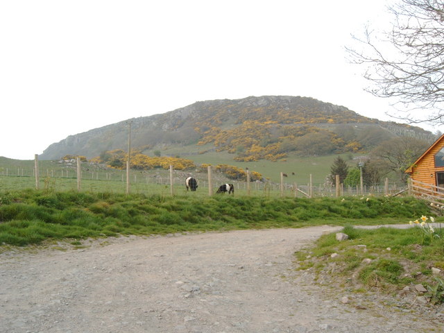
Bainloch Hill is a prominent hill located in Kirkcudbrightshire, a historic county in southwest Scotland. Situated near the town of Gatehouse of Fleet, this hill offers stunning panoramic views of the surrounding area, making it a popular destination for hikers and nature enthusiasts.

Reaching an elevation of approximately 275 meters (902 feet), Bainloch Hill is not exceptionally high compared to other mountains in the region. However, its location and unique topography make it an attractive destination for outdoor activities. The hill is characterized by its gentle slopes and lush green vegetation, which provide a picturesque backdrop for visitors.

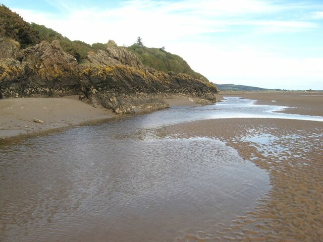
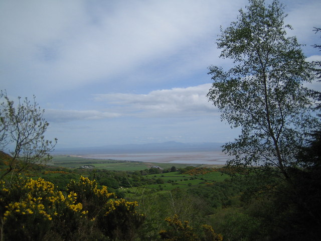
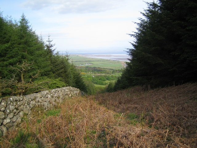
The summit of Bainloch Hill provides breathtaking views of the Galloway Hills to the north, the Solway Firth to the south, and the rolling Scottish countryside in between. On clear days, it is even possible to catch a glimpse of the Isle of Man in the distance.

The hill is easily accessible via well-maintained footpaths, making it suitable for hikers of all abilities. The surrounding area is abundant in wildlife, including various bird species, red deer, and rabbits, adding to the natural beauty and tranquility of the hill.

Overall, Bainloch Hill in Kirkcudbrightshire offers a delightful and accessible outdoor experience for those looking to immerse themselves in the scenic Scottish countryside while enjoying breathtaking views of the surrounding landscape.

If you have any feedback on the listing, please let us know in the comments section below.

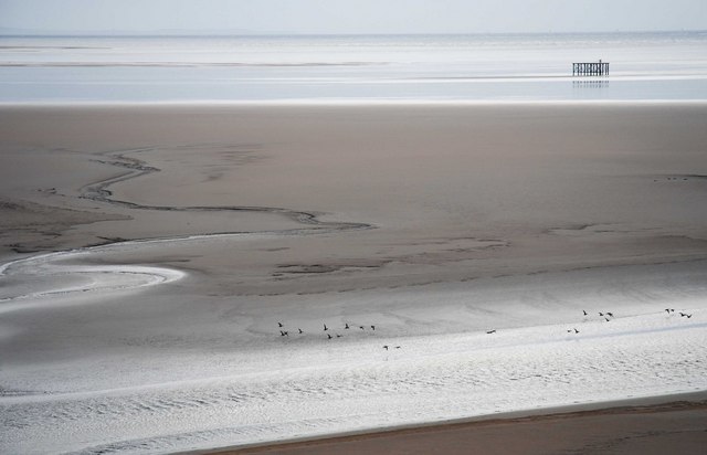
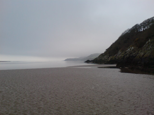
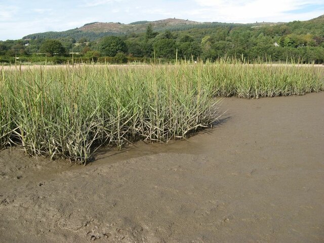
Bainloch Hill Images

Images are sourced within 2km of 54.89626/-3.7267645 or Grid Reference NX8957. Thanks to Geograph Open Source API. All images are credited.

Rocks by Southwick Water The principal outfall of Southwick Water hugs the steep coastal rocks to form a channel which is intermittently quite deep for the unwary.
Rocks by Southwick Water
The principal outfall of Southwick Water hugs the steep coastal rocks to form a channel which is intermittently quite deep for the unwary.
View towards Mersehead Sands, Solway Firth The picture of Mersehead Sands was taken whilst ascending Bainloch Hill.
View towards Mersehead Sands, Solway Firth
The picture of Mersehead Sands was taken whilst ascending Bainloch Hill.
View down the firebreak to the Solway Firth
Cemetery near Sandyhills (former church)
Clifton Craig Info from a climbing website:  Clifton is one of Southern Scotland's best kept secrets. South facing, quick drying, close to the road and in a beautiful location: its only weak point is the diminutive stature of the climbs. However, these pack such a punch into their short length that they are guaranteed to leave you just as drained as a 50m pitch would on most other crags.  Please keep dogs on a lead when in the fields. In spring, peregrines often nest near The Main Area or Red Slab and these buttresses should be avoided at this time.
Clifton Craig
Info from a climbing website: Clifton is one of Southern Scotland's best kept secrets. South facing, quick drying, close to the road and in a beautiful location: its only weak point is the diminutive stature of the climbs. However, these pack such a punch into their short length that they are guaranteed to leave you just as drained as a 50m pitch would on most other crags. Please keep dogs on a lead when in the fields. In spring, peregrines often nest near The Main Area or Red Slab and these buttresses should be avoided at this time.
Clifton Craig From a climbing website: "Clifton is one of Southern Scotland's best kept secrets. South facing, quick drying, close to the road and in a beautiful location: its only weak point is the diminutive stature of the climbs. However, these pack such a punch into their short length that they are guaranteed to leave you just as drained as a 50m pitch would on most other crags.  Please keep dogs on a lead when in the fields. In spring, peregrines often nest near The Main Area or Red Slab and these buttresses should be avoided at this time."
Clifton Craig
From a climbing website: "Clifton is one of Southern Scotland's best kept secrets. South facing, quick drying, close to the road and in a beautiful location: its only weak point is the diminutive stature of the climbs. However, these pack such a punch into their short length that they are guaranteed to leave you just as drained as a 50m pitch would on most other crags. Please keep dogs on a lead when in the fields. In spring, peregrines often nest near The Main Area or Red Slab and these buttresses should be avoided at this time."
Entrance to Southwick Cemetery
Southwick Cemetery The neat little wall surrounding Southwick cemetery - and the old Yew trees within.
Southwick Cemetery
The neat little wall surrounding Southwick cemetery - and the old Yew trees within.
Weathered Gravestones at Southwick Cemetery.
The "Beltie" Belted Galloway Bull - licking his lips or picking his nose?
The "Beltie"
Belted Galloway Bull - licking his lips or picking his nose?
Looking over the Solway Sands
Southwick cemetery Geographers in this square obviously have a thing about mortality.
Southwick cemetery
Geographers in this square obviously have a thing about mortality.
The Solway Coast The Solway coast looking towards Sandyhills Bay.
The Solway Coast
The Solway coast looking towards Sandyhills Bay.
Clonyard Farm Isolated hill farm enclosed by Hawthorn Hill and Clonyard Wood.  The farm retains some old farm buildings including a horse engine shed (right of photograph).
Clonyard Farm
Isolated hill farm enclosed by Hawthorn Hill and Clonyard Wood. The farm retains some old farm buildings including a horse engine shed (right of photograph).
Clifton Craig Clifton Craig.
Clifton Craig
Clifton Craig.
Reed bed Not the most popular part of this wonderful bay, by virtue of the sticky, muddy substrate which is sufficiently rarely covered by the tide to support a significant bed of reeds which are just coming into flower.
Reed bed
Not the most popular part of this wonderful bay, by virtue of the sticky, muddy substrate which is sufficiently rarely covered by the tide to support a significant bed of reeds which are just coming into flower.
Sandyhills east end The eastern end of the shore at Sandyhills is showing distinct signs of erosive action, with granite boulders and tree roots in the sand - but still a fabulous place to be on the hottest September day in Scotland since 1906. Eventually we were forced to find shade!
Sandyhills east end
The eastern end of the shore at Sandyhills is showing distinct signs of erosive action, with granite boulders and tree roots in the sand - but still a fabulous place to be on the hottest September day in Scotland since 1906. Eventually we were forced to find shade!
Erosion above the beach Signs of significant erosion above the beach at Sandyhills, with toppled trees showing their root-plates and abundant, dead roots sticking out of the sand.
Erosion above the beach
Signs of significant erosion above the beach at Sandyhills, with toppled trees showing their root-plates and abundant, dead roots sticking out of the sand.
Show me another place!

Bainloch Hill is located at Grid Ref: NX8957 (Lat: 54.89626, Lng: -3.7267645)

Unitary Authority: Dumfries and Galloway

Police Authority: Dumfries and Galloway

What 3 Words

///snowballs.dogs.balloons. Near Dalbeattie, Dumfries & Galloway

Nearby Locations

Bainloch Hill

Related Wikis

Colvend and Southwick

Colvend and Southwick is a community council area and civil parish within the Stewartry area of Dumfries and Galloway, Scotland. It is also part of the...

Rockcliffe, Dumfries and Galloway

Rockcliffe is a small, coastal village in Kirkcudbrightshire, Dumfries and Galloway in Scotland, with a view of Rough Island, Hestan Island, the Solway...

Kippford

Kippford (/ˈkɪpfəd/; otherwise Scaur) is a small village along the Solway coast, in the historic county of Kirkcudbrightshire in Dumfries and Galloway...

Rough Island, Scotland

"Rough Island" is also used as a translation of "Garbh Eilean", a common Scottish name for islandsRough Island is a 20-acre (8 ha) uninhabited tidal island...

Rough Firth

Rough Firth is an inlet on the northern coast of the Solway Firth in the Stewartry area of Dumfries and Galloway, Scotland. The firth lies between Almorness...

Dalbeattie Star F.C.

Dalbeattie Star Football Club is a Scottish association football club based in Dalbeattie, Dumfries and Galloway. It currently competes in the South of...

Dalbeattie

Dalbeattie (, Scots: Dawbeattie, Scottish Gaelic: Dail Bheithe meaning 'haugh of the birch' or Dail bhàite 'drowned (i.e. liable to flood) haugh') is a...

Palnackie

Palnackie is a village in the parish of Buittle in the historical county of Kirkcudbrightshire in Dumfries and Galloway, Scotland. It has a population...

Nearby Amenities

Located within 500m of 54.89626,-3.7267645
Bainloch Hill
Natural: peak
Source: os7
Lat/Long: 54.8960837/-3.7267583
The data included in this document is from www.openstreetmap.org. The data is made available under ODbL.

Have you been to Bainloch Hill?

Leave your review of Bainloch Hill below (or comments, questions and feedback).