Cefn Cwm-coel

Hill, Mountain in Radnorshire

Wales

Cefn Cwm-coel

View from path overlooking Ciloerwynt Farm The large nearer barn is in square.  Looking on down the Claerwen valley.
View from path overlooking Ciloerwynt Farm Credit: Andrew Hill

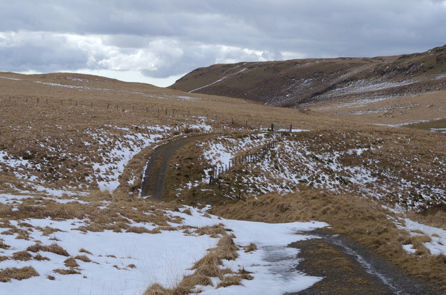
Cefn Cwm-coel is a prominent hill located in the county of Radnorshire, Wales. It is part of the wider Cambrian Mountains range, which stretches across central Wales. Standing at an elevation of approximately 495 meters (1,624 feet), Cefn Cwm-coel offers stunning panoramic views of the surrounding countryside.

The hill is characterized by its gentle slopes covered in grass and heather, making it a popular destination for walking and hiking enthusiasts. Its location within the Cambrian Mountains provides ample opportunities for exploring the diverse flora and fauna of the area.

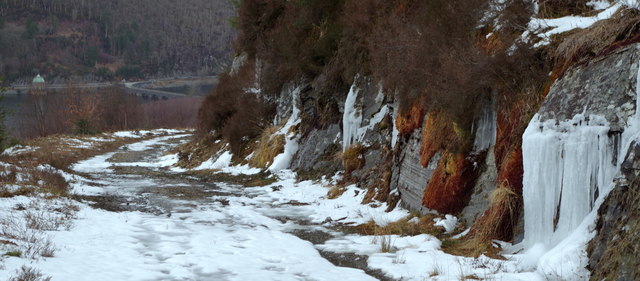
At the summit of Cefn Cwm-coel, visitors can enjoy breathtaking vistas of the Radnorshire landscape. On clear days, one can see for miles, with rolling hills, valleys, and forests stretching into the distance. The hill is also known for its tranquil atmosphere, offering a peaceful retreat for those seeking solace in nature.

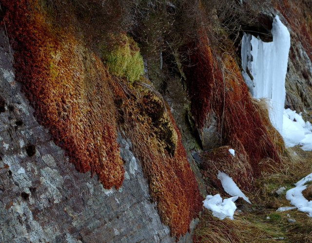
Cefn Cwm-coel is situated within the Radnor Forest, an area of protected landscape renowned for its natural beauty and wildlife. The forest is home to a variety of species, including red kites, peregrine falcons, and otters, providing ample opportunities for wildlife spotting.

Access to Cefn Cwm-coel is facilitated by well-maintained footpaths and trails that lead to the summit. The hill is a popular destination for both experienced hikers and casual walkers, offering a range of routes suitable for all levels of fitness.

Overall, Cefn Cwm-coel stands as an idyllic hill in Radnorshire, offering visitors a chance to experience the beauty and tranquility of the Welsh countryside.

If you have any feedback on the listing, please let us know in the comments section below.

Cefn Cwm-coel Images

Images are sourced within 2km of 52.269777/-3.6265697 or Grid Reference SN8964. Thanks to Geograph Open Source API. All images are credited.

View from path overlooking Ciloerwynt Farm The large nearer barn is in square.  Looking on down the Claerwen valley.
View from path overlooking Ciloerwynt Farm
The large nearer barn is in square. Looking on down the Claerwen valley.
Ciloerwynt Farm, Claerwen valley The large nearer barn is in square.  Looking across the Claerwen valley.
Ciloerwynt Farm, Claerwen valley
The large nearer barn is in square. Looking across the Claerwen valley.
Lichen on rock Below Craig Fawr in the Claerwen valley.  Location approximate.
Lichen on rock
Below Craig Fawr in the Claerwen valley. Location approximate.
Track across hill country Track at about 440m.  Craig Fawr ahead and right skyline rises to 519m.  Track descends in front of Craig Fawr to the Claerwen valley.  The dip carries the stream draining Gors Coch, an extensive boggy area.
Track across hill country
Track at about 440m. Craig Fawr ahead and right skyline rises to 519m. Track descends in front of Craig Fawr to the Claerwen valley. The dip carries the stream draining Gors Coch, an extensive boggy area.
Forest path in snow A signed path with small gate links the top edge of the forest with the track above Cwm Coel.  Larch trees bare of needles, snow on the ground, and afternoon light penetrating from the edge of the forest.
Forest path in snow
A signed path with small gate links the top edge of the forest with the track above Cwm Coel. Larch trees bare of needles, snow on the ground, and afternoon light penetrating from the edge of the forest.
Cwm Coel forest track Looking down to the reservoirs.  The low rock face to the right was covered with colourful mosses and also icicles as the cold weather was lifting.
Cwm Coel forest track
Looking down to the reservoirs. The low rock face to the right was covered with colourful mosses and also icicles as the cold weather was lifting.
Low rock face with colourful moss and icicles By the Llanerchi Wood forest track to Cwm Coel.  Many overhanging mossy or rocky corners had icicles which were melting in the thaw.
Low rock face with colourful moss and icicles
By the Llanerchi Wood forest track to Cwm Coel. Many overhanging mossy or rocky corners had icicles which were melting in the thaw.
Claerwen Reservoir
Claerwen Reservoir
The inlet of Dyfnant on Claerwen reservoir
The Dyfnant stream heading towards Claerwen reservoir
Built to last The reservoir engineers' bridge is unlikely to crumble or be washed away in floods.
Built to last
The reservoir engineers' bridge is unlikely to crumble or be washed away in floods.
Grass and flowers in a Ciloerwynt meadow
Dewey bagging Meg by the small cairn near the summit of Craig Dyfnant
Dewey bagging
Meg by the small cairn near the summit of Craig Dyfnant
Sheep dip Disused sheep dip built by the Elan Estate close to the site of Cae Blaenmethan
Sheep dip
Disused sheep dip built by the Elan Estate close to the site of Cae Blaenmethan
Sheep dip Closer view of the former sheep dipping station,nice flat grassy pitches for a wild camp one day
Sheep dip
Closer view of the former sheep dipping station,nice flat grassy pitches for a wild camp one day
Enclosed farmland in the Clearwen valley Enclosed farmland near Ciloerwynt in the Clearwen valley.
Enclosed farmland in the Clearwen valley
Enclosed farmland near Ciloerwynt in the Clearwen valley.
The easternmost arm of Claerwen Reservoir The arms of the reservoir divert the track far up the sides of the various deep side valleys coming from the north.  This is the Dyfnant.
The easternmost arm of Claerwen Reservoir
The arms of the reservoir divert the track far up the sides of the various deep side valleys coming from the north. This is the Dyfnant.
The Dyfnant arm of the Claerwen Reservoir The large reservoir is in an open upland setting, with arms on the northern side where deep side valleys come in.  A good track follows every curve.
The Dyfnant arm of the Claerwen Reservoir
The large reservoir is in an open upland setting, with arms on the northern side where deep side valleys come in. A good track follows every curve.
Show me another place!

Cefn Cwm-coel is located at Grid Ref: SN8964 (Lat: 52.269777, Lng: -3.6265697)

Unitary Authority: Powys

Police Authority: Dyfed Powys

What 3 Words

///dwarves.waged.lawyer. Near Rhayader, Powys

Nearby Locations

Disgwylfa Cefn Cwm-coel

Related Wikis

Claerwen Fault

The Claerwen Fault is a major SW-NE trending fault in central Wales. It was active as a normal fault during deposition of Late Ordovician to mid-Silurian...

Elan Valley

The Elan Valley (Welsh: Cwm Elan) is a river valley situated to the west of Rhayader, in Powys, Wales, sometimes known as the "Welsh Lake District". It...

Principality of Wales

The Principality of Wales (Welsh: Tywysogaeth Cymru) was originally the territory of the native Welsh princes of the House of Aberffraw from 1216 to 1283...

Craig Goch Dam

The Craig Goch Dam, often called the Top dam, is a masonry dam in the Elan Valley of Wales and creates the upper-most of the Elan Valley Reservoirs. Construction...

Have you been to Cefn Cwm-coel?

Leave your review of Cefn Cwm-coel below (or comments, questions and feedback).