Banff

Settlement in Banffshire

Scotland

Banff

Stagecoach Bluebird Macduff Bus Depot
Stagecoach Bluebird Macduff Bus Depot Credit: Jay T

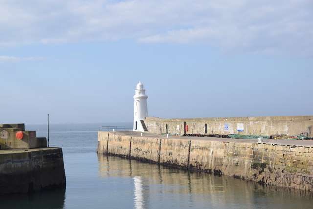
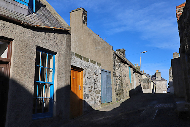
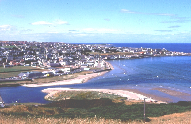
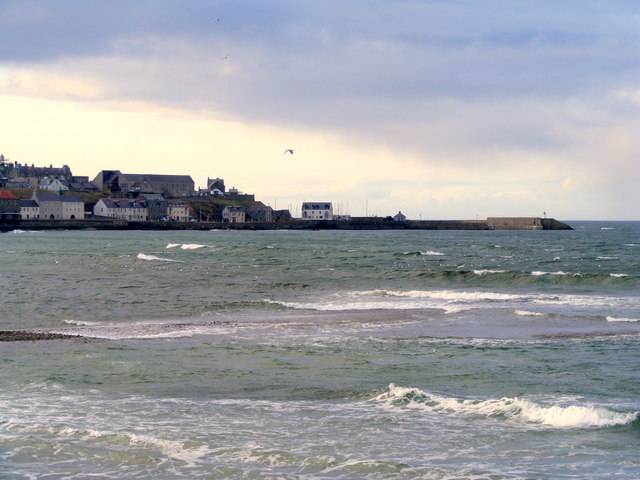
Banff is a historic town located in the county of Banffshire, Scotland. Situated on the northeastern coast of the country, it lies at the mouth of the River Deveron and is surrounded by breathtaking natural beauty. The town is known for its picturesque setting, with the rugged coastline meeting rolling hills and stunning countryside.

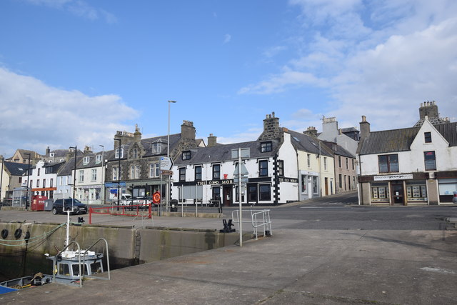
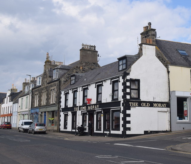
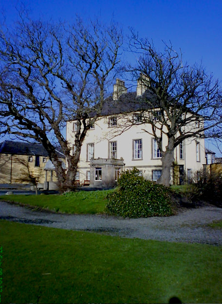
Banff boasts a rich history that dates back to the 12th century, and evidence of its past can be seen in the town's architecture and landmarks. One of the most prominent attractions is Banff Castle, a magnificent 17th-century building that offers visitors a glimpse into the town's past. The Georgian architecture found throughout the town is also a testament to its historical significance.

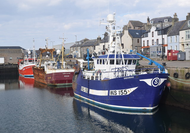
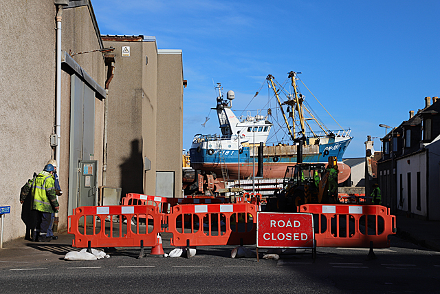
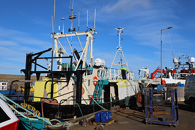
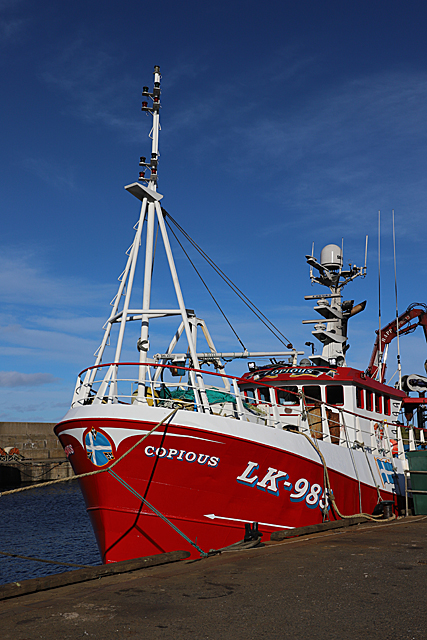
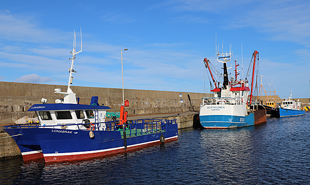
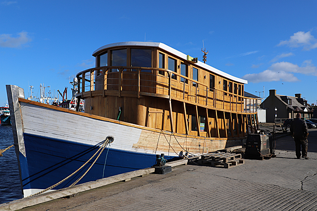
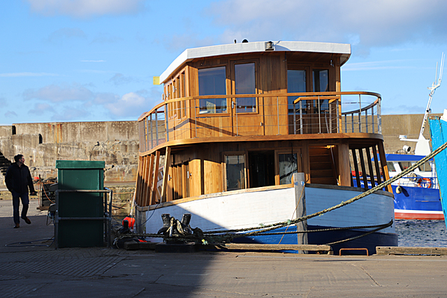
In addition to its cultural heritage, Banff offers a variety of activities for visitors to enjoy. The town's coastal location makes it a popular destination for beachgoers and water sports enthusiasts. The nearby Banff Links Beach provides a beautiful stretch of sand, while the Deveron River offers opportunities for fishing and boating.

For those interested in exploring the natural wonders of the area, the nearby Cairngorms National Park is a must-visit. With its rugged mountains, vast forests, and diverse wildlife, the park offers endless opportunities for hiking, wildlife spotting, and outdoor adventures.

Banff is also home to a range of amenities, including shops, restaurants, and accommodations that cater to both locals and tourists. The town's friendly atmosphere and welcoming community make it a delightful place to visit and explore.

If you have any feedback on the listing, please let us know in the comments section below.

Banff Images

Images are sourced within 2km of 57.665033/-2.523393 or Grid Reference NJ6864. Thanks to Geograph Open Source API. All images are credited.

Stagecoach Bluebird Macduff Bus Depot
Macduff: a view over the harbour Looking over the harbour from the grassy hilltop to the south, where an anchor is ... anchored, by the <a href="https://www.geograph.org.uk/photo/451242">NJ7064 : Macduff: parish church</a>.
Macduff: a view over the harbour
Looking over the harbour from the grassy hilltop to the south, where an anchor is ... anchored, by the NJ7064 : Macduff: parish church.
View towards Macduff from Banff beach Macduff parish kirk is prominent on the hill with the unusual war memorial tower to the right.
View towards Macduff from Banff beach
Macduff parish kirk is prominent on the hill with the unusual war memorial tower to the right.
Macduff parish kirk Built 1805 (remodelled 1865) on a dramatic hilltop site overlooking Macduff harbour.  B-listed (LB37616): <span class="nowrap"><a title="http://portal.historicenvironment.scot/designation/LB37616" rel="nofollow ugc noopener" href="http://portal.historicenvironment.scot/designation/LB37616">Link</a><img style="margin-left:2px;" alt="External link" title="External link - shift click to open in new window" src="https://s1.geograph.org.uk/img/external.png" width="10" height="10"/></span> .
Macduff parish kirk
Built 1805 (remodelled 1865) on a dramatic hilltop site overlooking Macduff harbour. B-listed (LB37616): LinkExternal link .
Macduff war memorial An unusual and striking war memorial tower erected in 1920 and B-listed (LB37681):  <span class="nowrap"><a title="http://portal.historicenvironment.scot/designation/LB37631" rel="nofollow ugc noopener" href="http://portal.historicenvironment.scot/designation/LB37631">Link</a><img style="margin-left:2px;" alt="External link" title="External link - shift click to open in new window" src="https://s1.geograph.org.uk/img/external.png" width="10" height="10"/></span> .
Macduff war memorial
An unusual and striking war memorial tower erected in 1920 and B-listed (LB37681): LinkExternal link .
View of Macduff harbour from Church Street
Macduff town hall, 17 Shore Street The Scottish baronial town hall facing the harbour was designed by Aberdeen architects Pirie and Clyne in 1884 and is B-listed (LB37634): <span class="nowrap"><a title="http://portal.historicenvironment.scot/designation/LB37634" rel="nofollow ugc noopener" href="http://portal.historicenvironment.scot/designation/LB37634">Link</a><img style="margin-left:2px;" alt="External link" title="External link - shift click to open in new window" src="https://s1.geograph.org.uk/img/external.png" width="10" height="10"/></span> . Next door is the former Clydesdale Bank and agent's house, also B-listed (LB37635): <span class="nowrap"><a title="http://portal.historicenvironment.scot/designation/LB37635" rel="nofollow ugc noopener" href="http://portal.historicenvironment.scot/designation/LB37635">Link</a><img style="margin-left:2px;" alt="External link" title="External link - shift click to open in new window" src="https://s1.geograph.org.uk/img/external.png" width="10" height="10"/></span> .
Macduff town hall, 17 Shore Street
The Scottish baronial town hall facing the harbour was designed by Aberdeen architects Pirie and Clyne in 1884 and is B-listed (LB37634): LinkExternal link . Next door is the former Clydesdale Bank and agent's house, also B-listed (LB37635): LinkExternal link .
Macduff harbour entrance and lighthouse The lighthouse dates from 1903 (Canmore record 81477: <span class="nowrap"><a title="https://canmore.org.uk/site/81447/macduff-harbour-entrance-lighthouse" rel="nofollow ugc noopener" href="https://canmore.org.uk/site/81447/macduff-harbour-entrance-lighthouse">Link</a><img style="margin-left:2px;" alt="External link" title="External link - shift click to open in new window" src="https://s1.geograph.org.uk/img/external.png" width="10" height="10"/></span> ).
Macduff harbour entrance and lighthouse
The lighthouse dates from 1903 (Canmore record 81477: LinkExternal link ).
Macduff harbour The harbour at Macduff, with its ocean-going trawlers, has a totally different feel to the gentrified Banff marina on the other side of the River Deveron estuary.  Here we see the smartly turned out Shekinah (registered to INV = Inverness) and the Reliance II (BF = Banff) sandwiching a rather rusty visitor from afar; the Glen Alvah from BM = Brixham (Devon).
Macduff harbour
The harbour at Macduff, with its ocean-going trawlers, has a totally different feel to the gentrified Banff marina on the other side of the River Deveron estuary. Here we see the smartly turned out Shekinah (registered to INV = Inverness) and the Reliance II (BF = Banff) sandwiching a rather rusty visitor from afar; the Glen Alvah from BM = Brixham (Devon).
Harbourside buildings, Macduff Most prominent is the Old Moray Inn.
Harbourside buildings, Macduff
Most prominent is the Old Moray Inn.
The Old Moray Inn, Macduff Next door is a chandler and the harbour master's office.
The Old Moray Inn, Macduff
Next door is a chandler and the harbour master's office.
School Lane School Lane climbs in both direction from its intersection with Duff Street. This is looking up the eastern part of it from near the corner of Duff Street.
School Lane
School Lane climbs in both direction from its intersection with Duff Street. This is looking up the eastern part of it from near the corner of Duff Street.
Road Closed As this is the signposted route to the Macduff Marine Aquarium, and no diversion is signposted, I have to hope that there have not been too many baffled visitors recently.
Road Closed
As this is the signposted route to the Macduff Marine Aquarium, and no diversion is signposted, I have to hope that there have not been too many baffled visitors recently.
Nova Spero 'Nova Spero', registered in Stornoway, is in Macduff for maintenance and a fresh coat of paint.
Nova Spero
'Nova Spero', registered in Stornoway, is in Macduff for maintenance and a fresh coat of paint.
Copious This Lerwick boat is looking very smart. Note the blue and white Shetland flag on the bow.
Copious
This Lerwick boat is looking very smart. Note the blue and white Shetland flag on the bow.
Boats in Macduff Harbour The grapevine tells me that 'Vertrouwen' is on the market, her licence and quota having been transferred to a new larger boat.
Boats in Macduff Harbour
The grapevine tells me that 'Vertrouwen' is on the market, her licence and quota having been transferred to a new larger boat.
'Highland Lassie' This is the former 'Frigate Bird' with only the hull and engine left from her days as a fishing boat. The new superstructure is of oak felled by a gale near Inverness, and was built in Inverness. She will have cabins on the top deck and in the fish hold, and will be moored at Dochgarroch on the Caledonian Canal at the north end of Loch Ness as additional accommodation for the hotel there. She will also be available for charter. 

See <span class="nowrap"><a title="https://www.pressandjournal.co.uk/fp/news/highlands/1651723/floating-hotel-takes-first-voyage-in-preparation-for-opening/" rel="nofollow ugc noopener" href="https://www.pressandjournal.co.uk/fp/news/highlands/1651723/floating-hotel-takes-first-voyage-in-preparation-for-opening/">Link</a><img style="margin-left:2px;" alt="External link" title="External link - shift click to open in new window" src="https://s1.geograph.org.uk/img/external.png" width="10" height="10"/></span>
'Highland Lassie'
This is the former 'Frigate Bird' with only the hull and engine left from her days as a fishing boat. The new superstructure is of oak felled by a gale near Inverness, and was built in Inverness. She will have cabins on the top deck and in the fish hold, and will be moored at Dochgarroch on the Caledonian Canal at the north end of Loch Ness as additional accommodation for the hotel there. She will also be available for charter. See LinkExternal link
'Highland Lassie' Someone commented that from this angle, she looks like Noah's Ark! See <a href="https://www.geograph.org.uk/photo/6063761">NJ7064 : 'Highland Lassie'</a>.
'Highland Lassie'
Someone commented that from this angle, she looks like Noah's Ark! See NJ7064 : 'Highland Lassie'.
Show me another place!

Banff is located at Grid Ref: NJ6864 (Lat: 57.665033, Lng: -2.523393)

Unitary Authority: Aberdeenshire

Police Authority: North East

What 3 Words

///blotting.rainfall.spruced. Near Banff, Aberdeenshire

Related Wikis

Banff Town House

Banff Town House is a municipal building in Low Street, Banff, Aberdeenshire, Scotland. The building, which is used as a customer service point and job...

Banff Castle

Banff Castle is a ruined former royal castle near Banff, Aberdeenshire, Scotland. == History == Built as a motte and bailey castle in the 12th century...

Banff, Aberdeenshire

Banff (Scottish Gaelic: Banbh) is a town in the Banff and Buchan area of Aberdeenshire, Scotland. It is situated on Banff Bay and faces the town of Macduff...

Banff Sheriff Court

Banff Sheriff Court is a judicial structure in Low Street, Banff, Aberdeenshire, Scotland. The structure, which was the headquarters of Banffshire County...

Princess Royal Park

Princess Royal Park is a football ground in the town of Banff in the north-east of Scotland, which is the home ground of Highland Football League side...

Duff House Royal Golf Club

Duff House Royal Golf Club is a Championship Course and one of the best golf courses in Aberdeenshire. Located in Banff, Scotland it was founded in 1910...

Banff Bay

Banff Bay (Scottish Gaelic: Bàgh Bhanbh) is a coastal embayment in Scotland situated between the towns of Banff, Aberdeenshire and Macduff, Aberdeenshire...

River Deveron

The River Deveron (Scottish Gaelic: Uisge Dubh Èireann) is a river in the north east of Scotland. The river has a length of 60 miles (97 km), and has a...

Nearby Amenities

Located within 500m of 57.665033,-2.523393
Banff
Is In: Scotland, United Kingdom
Name Gd: Banbh
Name Sco: Bamff
Place: town
Population: 4000
Source: npe
Wikidata: Q54809
Wikipedia: en:Banff, Aberdeenshire
Lat/Long: 57.6647037/-2.5232971
Mini Roundabout
Direction: clockwise
Source: survey
Lat/Long: 57.6609974/-2.5252408
Pub
Railway Inn
Brewery: McEwan's
Lat/Long: 57.6694319/-2.5237766
Post Box
Brand: Royal Mail
Brand Wikidata: Q638098
Brand Wikipedia: en:Royal Mail
Collection Times: Mo-Fr 09:00; Sa 07:00
Operator: Royal Mail
Operator Wikidata: Q638098
Post Box Type: pillar
Postal Code: AB45
Ref: AB45 1D
Royal Cypher: GR
Royal Cypher Wikidata: Q33102273
Lat/Long: 57.6675994/-2.5236054
Historic: memorial
Memorial: war_memorial
Lat/Long: 57.666863/-2.5235271
Bicycle Parking
Bicycle Parking: stands
Capacity: 4
Check Date Capacity: 2021-10-20
Covered: no
Source: survey
Lat/Long: 57.6655555/-2.5236985
Bicycle Parking
Bicycle Parking: stands
Capacity: 4
Check Date Capacity: 2021-10-20
Covered: no
Lat/Long: 57.6649921/-2.5208215
Pub
The Market Arms
Addr City: Banff
Addr Housenumber: 5
Addr Postcode: AB45 1DB
Addr Street: High Shore
Fhrs Id: 679162
Source Addr: FHRS Open Data
Lat/Long: 57.6650747/-2.5210431
Toilets
Fee: no
Operator: Aberdeenshire Council
Wheelchair: yes
Lat/Long: 57.6629346/-2.5224316
Traffic Calming: cushion
Lat/Long: 57.6632537/-2.5304484
Turning Circle
Lat/Long: 57.6655394/-2.5302188
Traffic Calming: table
Lat/Long: 57.6648065/-2.528958
Turning Circle
Lat/Long: 57.6654211/-2.5293281
Atm
RBS
Brand: RBS
Brand Wikidata: Q160126
Brand Wikipedia: en:Royal Bank of Scotland
Check Date: 2021-10-20
Official Name: Royal Bank of Scotland
Operator: RBS
Operator Wikidata: Q160126
Lat/Long: 57.6649314/-2.5198791
Bus Stop
Seafield Street
Bus: yes
Naptan AtcoCode: 630021412
Naptan Bearing: W
Naptan CommonName: Seafield Street
Naptan Indicator: W bound
Naptan Landmark: Seafield Street
Naptan NaptanCode: 23624365
Naptan Street: Seafield Street
Naptan Verified: no
Public Transport: platform
Ref: 23624365
Lat/Long: 57.6666916/-2.5268302
Bus Stop
Seafield Street
Bench: yes
Bin: no
Bus: yes
Naptan AtcoCode: 630021411
Naptan Bearing: E
Naptan CommonName: Seafield Street
Naptan Indicator: E bound
Naptan Landmark: Seafield Street
Naptan NaptanCode: 23624357
Naptan Street: Seafield Street
Naptan Verified: no
Public Transport: platform
Ref: 23624357
Shelter: yes
Tactile Paving: no
Lat/Long: 57.6667616/-2.5288443
Bus Stop
Duncan Street
Bus: yes
Naptan AtcoCode: 630021402
Naptan Bearing: NW
Naptan CommonName: Duncan Street
Naptan Indicator: at
Naptan Landmark: Duncan Street
Naptan NaptanCode: 23624346
Naptan Street: Boyndie Street West
Naptan Verified: no
Public Transport: platform
Ref: 23624346
Lat/Long: 57.6666989/-2.5307769
Stone of Um
Natural: stone
Lat/Long: 57.6661434/-2.522297
Entrance: yes
Lat/Long: 57.6649472/-2.5197307
Bus Stop
Water Lane
Bench: no
Bus: yes
Naptan AtcoCode: 630026002
Naptan Bearing: SE
Naptan CommonName: Water Lane
Naptan Indicator: at
Naptan Landmark: Water Lane
Naptan NaptanCode: 23624389
Naptan Street: Carmelite Street
Naptan Verified: no
Public Transport: platform
Ref: 23624389
Shelter: no
Lat/Long: 57.665021/-2.5188904
Entrance: yes
Lat/Long: 57.6649711/-2.5198012
Entrance: yes
Lat/Long: 57.6665378/-2.5223562
Bus Stop
Castle Street
Bench: no
Bin: yes
Bus: yes
Naptan AtcoCode: 630021351
Naptan Bearing: N
Naptan CommonName: Castle Street
Naptan Indicator: N bound
Naptan Landmark: Castle Street
Naptan NaptanCode: 23627867
Naptan Street: Castle Street
Naptan Verified: no
Public Transport: platform
Ref: 23627867
Shelter: no
Tactile Paving: no
Lat/Long: 57.6663348/-2.5237206
Power: transformer
Lat/Long: 57.6626014/-2.5219038
Bank
Bank of Scotland
Addr Country: GB
Brand: Bank of Scotland
Brand Wikidata: Q627381
Brand Wikipedia: en:Bank of Scotland
Contact Website: https://branches.bankofscotland.co.uk/banff/29-low-street
Lat/Long: 57.6639728/-2.5218931
Fast Food
Happy Palace
Addr City: Banff
Addr Housenumber: 19
Addr Postcode: AB45 1AU
Addr Street: Low Street
Cuisine: chinese
Fhrs Id: 679212
Source Addr: FHRS Open Data
Lat/Long: 57.6636874/-2.5217376
Bus Stop
Airlie Gardens
Bus: yes
Naptan AtcoCode: 630045562
Naptan Bearing: N
Naptan CommonName: Airlie Gardens
Naptan Indicator: opp
Naptan NaptanCode: 23629245
Naptan Street: Low Street
Naptan Verified: no
Public Transport: platform
Source: naptan;bing;naptan_compare_tool
Lat/Long: 57.6624888/-2.5217832
Cafe
The Coffee Pot
Addr City: Banff
Addr Housenumber: 13
Addr Postcode: AB45 1AN
Addr Street: High Street
Fhrs Id: 679163
Source Addr: FHRS Open Data
Lat/Long: 57.6632054/-2.523489
Entrance: yes
Lat/Long: 57.664335/-2.523505
Bus Stop
High Street
Bus: yes
Naptan AtcoCode: 630021341
Naptan Bearing: N
Naptan CommonName: High Street
Naptan Indicator: at 43
Naptan Landmark: High Street
Naptan NaptanCode: 23627864
Naptan Street: High Street
Naptan Verified: no
Public Transport: platform
Ref: 23627864
Lat/Long: 57.6641248/-2.5233833
Drinking Water
Biggar Memorial Drinking Fountain
Historic: drinking_fountain
Lat/Long: 57.6646522/-2.5218461
Bus Stop
Fife Street
Bus: yes
Naptan AtcoCode: 630021771
Naptan Bearing: E
Naptan CommonName: Fife Street
Naptan Indicator: at
Naptan Landmark: Fife Street
Naptan NaptanCode: 23627893
Naptan Street: St Catherine Street
Naptan Verified: no
Public Transport: platform
Ref: 23627893
Lat/Long: 57.6678043/-2.5260626
Fast Food
Real Tandoori
Opening Hours: Su-Th 16:00-23:00, Fr,Sa 16:00-02:00
Lat/Long: 57.665835/-2.5233456
Telephone
Booth: KX100
Covered: booth
Phone: +44 1261 815347
Lat/Long: 57.6653409/-2.523644
Defibrillator
Defibrillator Location: In a box to the left of the entrance of the Lighthouse Fish Bar. The code to open the defibrillator box is in an alarmed box next to it.
Emergency: defibrillator
Indoor: no
Lat/Long: 57.6643209/-2.5235033
Seafield Bakery
Shop: bakery
Lat/Long: 57.6667287/-2.5245324
Banff Mercat Cross
Historic: memorial
Memorial: mercat_cross
Lat/Long: 57.664551/-2.5216812
J.G. Ross
Addr City: Banff
Addr Housenumber: 75
Addr Postcode: AB45 1AN
Addr Street: High Street
Fhrs Id: 679204
Shop: bakery
Source Addr: FHRS Open Data
Lat/Long: 57.6647532/-2.5235561
B.A.R.R.K.
Shop: charity
Lat/Long: 57.6643501/-2.5219763
Post Box
Brand: Royal Mail
Brand Wikidata: Q638098
Brand Wikipedia: en:Royal Mail
Collection Times: Mo-Fr 17:15; Sa 12:00
Operator: Royal Mail
Operator Wikidata: Q638098
Post Box Type: pillar
Ref: AB45 363
Royal Cypher: no
Lat/Long: 57.6653679/-2.5236322
Post Depot
Banff Delivery Office
Operator: Royal Mail
Operator Type: private
Operator Wikidata: Q638098
Lat/Long: 57.6646184/-2.5208336
Castlegate Convenience Store
Addr City: Banff
Addr Housename: Castlegate Newsagent
Addr Housenumber: 1
Addr Postcode: AB45 1DH
Addr Street: Castle Street
Brand: Premier
Brand Wikidata: Q7240340
Fhrs Id: 679252
Shop: convenience
Source Addr: FHRS Open Data
Website: https://www.premier-stores.co.uk/our-stores/castlegate-convenience-store
Lat/Long: 57.6650301/-2.5236956
Post Box
Operator: Royal Mail
Post Box Mounting: stone_wall
Post Box Type: wall
Ref: AB45 9D
Royal Cypher: GVIR
Royal Cypher Wikidata: Q33102169
Lat/Long: 57.6665112/-2.530285
Pharmacy
Strachan Pharmacy
Addr City: Banff
Addr Street: High Street
Healthcare: pharmacy
Lat/Long: 57.6646241/-2.5235427
Crossing
Crossing Island: yes
Lat/Long: 57.661985/-2.5226793
Atm
Brand: Bank of Scotland
Brand Wikidata: Q627381
Brand Wikipedia: en:Bank of Scotland
Check Date: 2021-10-20
Operator: Bank of Scotland
Operator Wikidata: Q627381
Lat/Long: 57.6639097/-2.5217885
Recycling
Recycling Clothes: yes
Recycling Glass Bottles Colour Separated: yes
Lat/Long: 57.662425/-2.5219226
Pub
The Aul Fife
Lat/Long: 57.6634894/-2.5214157
Post Box
Brand: Royal Mail
Brand Wikidata: Q638098
Brand Wikipedia: en:Royal Mail
Collection Times: Mo-Fr 17:30; Sa 12:30
Operator: Royal Mail
Operator Wikidata: Q638098
Post Box Apertures: 2
Post Box Type: pillar
Ref: AB45 45
Royal Cypher: scottish_crown
Lat/Long: 57.6640267/-2.5217465
Entrance: yes
Lat/Long: 57.6642487/-2.5234835
Bus Stop
Fife Street
Bus: yes
Naptan AtcoCode: 630021772
Naptan Bearing: W
Naptan CommonName: Fife Street
Naptan Indicator: opp
Naptan Landmark: St Catherine Street
Naptan NaptanCode: 23627892
Naptan Street: St Catherine Street
Naptan Verified: no
Public Transport: platform
Ref: 23627892
Lat/Long: 57.6678429/-2.5273664
Bicycle Parking
Bicycle Parking: stands
Capacity: 4
Covered: no
Lat/Long: 57.6640718/-2.5234327
Information: office
Tourism: information
Lat/Long: 57.6628152/-2.522386
Crossing
Crossing: traffic_signals
Crossing Ref: pelican
Lat/Long: 57.6648559/-2.5233861
Post Box
Post Box Type: wall
Ref: AB45 2D
Royal Cypher: GVIR
Royal Cypher Wikidata: Q33102169
Lat/Long: 57.66143/-2.5244995
Post Box
Post Box Type: lamp
Ref: AB45 18D
Royal Cypher: scottish_crown
Lat/Long: 57.6649513/-2.5257877
Traffic Calming: hump
Lat/Long: 57.6628796/-2.5273356
Bicycle Parking
Bicycle Parking: stands
Capacity: 4
Covered: no
Lat/Long: 57.6627181/-2.5224494
Post Box
Post Box Type: wall
Ref: AB45 53D
Royal Cypher: GVIR
Royal Cypher Wikidata: Q33102169
Lat/Long: 57.6633187/-2.5296498
Bus Stop
Lat/Long: 57.662229/-2.526079
Defibrillator
Defibrillator Location: outside Tesco entrance
Emergency: defibrillator
Opening Hours: 24/7
Lat/Long: 57.6649327/-2.5197224
Bench
Lat/Long: 57.6686683/-2.5225371
Banff Tourist Hub
Addr City: Banff
Addr Housename: Banff Tourist Hub
Addr Housenumber: 57
Addr Street: Low Street
Contact Facebook: https://www.facebook.com/BanffshireTouristHub/
Information: office
Internet Access: yes
Internet Access Fee: no
Tourism: information
Lat/Long: 57.6647949/-2.5217925
Cafe
Delight
Addr City: Banff
Addr Housename: Delight Enterprises
Addr Housenumber: 10A
Addr Postcode: AB45 1DY
Addr Street: Boyndie Street
Cuisine: coffee_shop
Fhrs Id: 1080114
Internet Access: yes
Internet Access Fee: no
Source Addr: FHRS Open Data
Lat/Long: 57.6648472/-2.5246115
The Spotty Bag shop
Shop: houseware
Lat/Long: 57.6647179/-2.5175284
Restaurant
Bridgeview Restaurant
Level: 1
Lat/Long: 57.6647492/-2.5173078
Noexit: yes
Lat/Long: 57.6638243/-2.5269871
Charging Station
Capacity: 6
Operator: ChargePlace Scotland
Operator Wikidata: Q105359316
Lat/Long: 57.6646156/-2.5163696
Turning Circle
Lat/Long: 57.6655363/-2.5186271
Cafe
The Broken Fiddle
Addr City: Banff
Addr Housenumber: 9
Addr Postcode: AB45 1AD
Addr Street: Strait Path
Fhrs Authority: Aberdeenshire
Fhrs Id: 679167
Fhrs Local Authority Id: 13863
Source Addr: FHRS Open Data
Lat/Long: 57.6647803/-2.5224135
Fast Food
Pyramids Takeaway
Addr City: Banff
Addr Housenumber: 53
Addr Postcode: AB45 1AU
Addr Street: Low Street
Fhrs Id: 679213
Source Addr: FHRS Open Data
Lat/Long: 57.6646345/-2.5220455
Generator Output Electricity: yes
Generator Source: solar
Generator Type: solar_photovoltaic_panel
Location: roof
Power: generator
Lat/Long: 57.6663963/-2.5261108
Generator Output Electricity: yes
Generator Source: solar
Generator Type: solar_photovoltaic_panel
Location: roof
Power: generator
Lat/Long: 57.662318/-2.5281221
Generator Output Electricity: yes
Generator Source: solar
Generator Type: solar_photovoltaic_panel
Location: roof
Power: generator
Lat/Long: 57.6648274/-2.524228
Generator Output Electricity: yes
Generator Source: solar
Generator Type: solar_photovoltaic_panel
Location: roof
Power: generator
Lat/Long: 57.6683689/-2.5271753
Generator Output Electricity: yes
Generator Source: solar
Generator Type: solar_photovoltaic_panel
Location: roof
Power: generator
Lat/Long: 57.66531/-2.530219
Generator Output Electricity: yes
Generator Source: solar
Generator Type: solar_photovoltaic_panel
Location: roof
Power: generator
Lat/Long: 57.6630956/-2.5308305
The Mercat
Contact Facebook: https://www.facebook.com/themercatbanff/
Shop: gift
Lat/Long: 57.6647943/-2.52188
Atm
Brand: cash zone
Lat/Long: 57.6642372/-2.5234824
Cafe
Baobab
Diet Vegan: only
Takeaway: yes
Lat/Long: 57.6639012/-2.5215184
Veterinary
Seafield Veterinary Group
Lat/Long: 57.6673696/-2.5238888
Defibrillator
Access: yes
Defibrillator Location: outside wall of Castle Bar
Emergency: defibrillator
Indoor: no
Level: 0
Opening Hours: 24/7
Lat/Long: 57.6674313/-2.5238724
Pub
Castle Bar
Outdoor Seating: yes
Lat/Long: 57.667473/-2.5239501
Give Way
Direction: backward
Lat/Long: 57.6654521/-2.5228778
Give Way
Direction: forward
Lat/Long: 57.6650211/-2.5195893
Give Way
Direction: backward
Lat/Long: 57.6675902/-2.523746
Waste Basket
Lat/Long: 57.662814/-2.522222
Bus Stop
Water Lane
Bus: yes
Naptan AtcoCode: 630026001
Naptan Bearing: NW
Naptan CommonName: Water Lane
Naptan Indicator: opp
Naptan Landmark: Water Lane
Naptan NaptanCode: 23624393
Naptan Street: Carmelite Street
Naptan Verified: no
Public Transport: platform
Ref: 23624393
Lat/Long: 57.6647546/-2.5183652
Bus Stop
Addison Crescent
Bus: yes
Naptan AtcoCode: 630021422
Naptan Bearing: W
Naptan CommonName: Addison Crescent
Naptan Indicator: at
Naptan Landmark: Addison Crescent
Naptan NaptanCode: 23624354
Naptan Street: Whinhill Terrace
Naptan Verified: no
Public Transport: platform
Ref: 23624354
Lat/Long: 57.6647126/-2.5303798
Bus Stop
Addison Crescent
Bus: yes
Naptan AtcoCode: 630021421
Naptan Bearing: E
Naptan CommonName: Addison Crescent
Naptan Indicator: opp
Naptan Landmark: Addison Crescent
Naptan NaptanCode: 23627876
Naptan Street: Whinhill Terrace
Naptan Verified: no
Public Transport: platform
Ref: 23627876
Lat/Long: 57.6647885/-2.5297929
Bus Stop
Chalmers Hospital
Bus: yes
Naptan AtcoCode: 630021363
Naptan Bearing: W
Naptan CommonName: Chalmers Hospital
Naptan Indicator: W-bound
Naptan Landmark: Chalmers Hospital
Naptan NaptanCode: 23629897
Naptan Street: Clunie Street
Naptan Verified: no
Public Transport: platform
Ref: 23629897
Lat/Long: 57.66866/-2.5255084
Bus Stop
Chalmers Hospital
Bench: no
Bin: no
Bus: yes
Lit: yes
Naptan AtcoCode: 630021362
Naptan Bearing: N
Naptan CommonName: Chalmers Hospital
Naptan Indicator: N bound
Naptan Landmark: Chalmers Hospital
Naptan NaptanCode: 23624374
Naptan Street: North Castle Street
Naptan Verified: no
Passenger Information Display: no
Public Transport: platform
Ref: 23624374
Shelter: no
Tactile Paving: no
Lat/Long: 57.6684263/-2.5238327
Bus Stop
Chalmers Hospital
Bus: yes
Naptan AtcoCode: 630021361
Naptan Bearing: E
Naptan CommonName: Chalmers Hospital
Naptan Indicator: E bound
Naptan Landmark: Chalmers Hospital
Naptan NaptanCode: 23624369
Naptan Street: Clunie Street
Naptan Verified: no
Public Transport: platform
Ref: 23624369
Lat/Long: 57.668758/-2.5251194
Bus Stop
Castle Street
Bus: yes
Naptan AtcoCode: 630021352
Naptan Bearing: S
Naptan CommonName: Castle Street
Naptan Indicator: S bound
Naptan Landmark: Castle Street
Naptan NaptanCode: 23624375
Naptan Street: Castle Street
Naptan Verified: no
Public Transport: platform
Ref: 23624375
Lat/Long: 57.666535/-2.523527
Bus Stop
High Street
Bus: yes
Naptan AtcoCode: 630021342
Naptan Bearing: S
Naptan CommonName: High Street
Naptan Indicator: opp 35
Naptan Landmark: High Street
Naptan NaptanCode: 23624376
Naptan Street: High Street
Naptan Verified: no
Public Transport: platform
Ref: 23624376
Lat/Long: 57.663753/-2.5232016
Bus Stop
Low Street
Bus: yes
Naptan AtcoCode: 630021332
Naptan Bearing: S
Naptan CommonName: Low Street
Naptan Indicator: S bound
Naptan Landmark: Low Street
Naptan NaptanCode: 23624382
Naptan Street: Low Street
Naptan Verified: no
Public Transport: platform
Ref: 23624382
Lat/Long: 57.6643247/-2.5216261
Bus Stop
Low Street
Bus: yes
Naptan AtcoCode: 630021331
Naptan Bearing: N
Naptan CommonName: Low Street
Naptan Indicator: N bound
Naptan Landmark: Town Hall
Naptan NaptanCode: 23624383
Naptan Street: Low Street
Naptan Verified: no
Public Transport: platform
Ref: 23624383
Lat/Long: 57.6644923/-2.5219017
Bus Stop
Bayview Crescent
Bus: yes
Naptan AtcoCode: 630021272
Naptan Bearing: NW
Naptan CommonName: Bayview Crescent
Naptan Indicator: opp
Naptan Landmark: Bayview Crescent
Naptan NaptanCode: 23632397
Naptan Street: Boyndie Road West
Naptan Verified: no
Public Transport: platform
Ref: 23632397
Lat/Long: 57.6661852/-2.5293965
Bus Stop
Bayview Crescent
Bus: yes
Naptan AtcoCode: 630021271
Naptan Bearing: SE
Naptan CommonName: Bayview Crescent
Naptan Indicator: at
Naptan Landmark: Bayview Crescent
Naptan NaptanCode: 23632396
Naptan Street: Boyndie Street West
Naptan Verified: no
Public Transport: platform
Ref: 23632396
Lat/Long: 57.6661913/-2.5290601
Bus Stop
Airlie Gardens
Bus: yes
Naptan AtcoCode: 630045561
Naptan Bearing: S
Naptan CommonName: Airlie Gardens
Naptan Indicator: at
Naptan NaptanCode: 23629232
Naptan Street: Low Street
Naptan Verified: no
Public Transport: platform
Source: naptan;bing;naptan_compare_tool
Lat/Long: 57.6626769/-2.5214671
The Good Sleep Company
Addr City: Banff
Addr Street: High Street
Shop: bed
Lat/Long: 57.6638223/-2.523099
Addr City: Banff
Addr Street: High Street
Disused Shop: yes
Lat/Long: 57.6645819/-2.5232023
M&Co
Addr City: Banff
Addr Street: High Street
Brand: M&Co
Brand Wikidata: Q6711808
Shop: clothes
Lat/Long: 57.6646809/-2.5231956
Stewart & Watson
Addr City: Banff
Addr Street: High Street
Office: lawyer
Lat/Long: 57.664574/-2.5235389
Addr City: Banff
Addr Street: High Street
Shop: optician
Lat/Long: 57.664706/-2.523555
West Carpets
Addr City: Banff
Addr Street: High Street
Shop: carpet
Lat/Long: 57.6648387/-2.5235684
The Barber Shop
Addr City: Banff
Addr Street: High Street
Shop: hairdresser
Lat/Long: 57.6648918/-2.5235805
Fixme: What is this?
Note: Name is "____ Scott"
Shop: yes
Lat/Long: 57.6656794/-2.5233257
Cafe
Baird's Bistro
Addr City: Banff
Addr Street: Castle Street
Lat/Long: 57.6652548/-2.5237039
Bank
TSB
Brand: TSB
Brand Wikidata: Q7671560
Website: https://branches.tsb.co.uk/banff/banff.html
Lat/Long: 57.6655962/-2.5233217
Baird's Pharmacy
Addr City: Banff
Addr Street: Castle Street
Shop: chemist
Lat/Long: 57.6651873/-2.5236945
Post Office
Banff Post Office
Addr City: Banff
Addr Postcode: AB45 1DH
Addr Street: Castle Street
Brand: Post Office
Brand Wikidata: Q1783168
Ref Pol Id: 12450
Lat/Long: 57.6652806/-2.5237602
Trend DIY
Addr City: Banff
Addr Street: Castle Street
Shop: doityourself
Lat/Long: 57.6652254/-2.5233056
Bodies of Banff
Addr City: Banff
Addr Street: Castle Street
Shop: photo
Lat/Long: 57.6650618/-2.5232948
Traffic Calming: cushion
Lat/Long: 57.6663299/-2.5295874
Traffic Calming: cushion
Lat/Long: 57.6659871/-2.5286619
Traffic Calming: hump
Lat/Long: 57.6620504/-2.5274476
Man Made: tower
Tower Type: firefighter_training
Lat/Long: 57.6673306/-2.5264364
Traffic Calming: cushion
Lat/Long: 57.6632543/-2.5289204
Traffic Calming: hump
Lat/Long: 57.6636524/-2.5272422
Traffic Calming: hump
Lat/Long: 57.6644404/-2.5271912
Traffic Calming: cushion
Lat/Long: 57.6647453/-2.5300651
Traffic Calming: cushion
Lat/Long: 57.6635855/-2.5313195
Traffic Calming: cushion
Lat/Long: 57.6640794/-2.5313055
Stop
Direction: forward
Lat/Long: 57.6615173/-2.5245597
Traffic Calming: cushion
Lat/Long: 57.6617124/-2.5255639
Entrance: main
Lat/Long: 57.6607908/-2.5258855
Natural: shrub
Lat/Long: 57.6608239/-2.5262931
The data included in this document is from www.openstreetmap.org. The data is made available under ODbL.

Have you been to Banff?

Leave your review of Banff below (or comments, questions and feedback).